


SOLD: Wilderness Oasis: A Sprawling 480.4-Acre Ranch in Lander County, NV
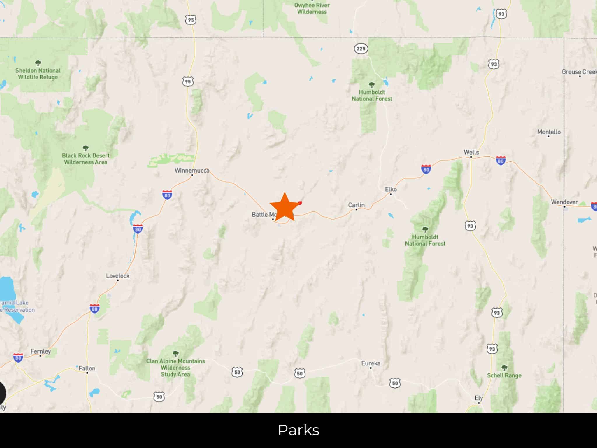
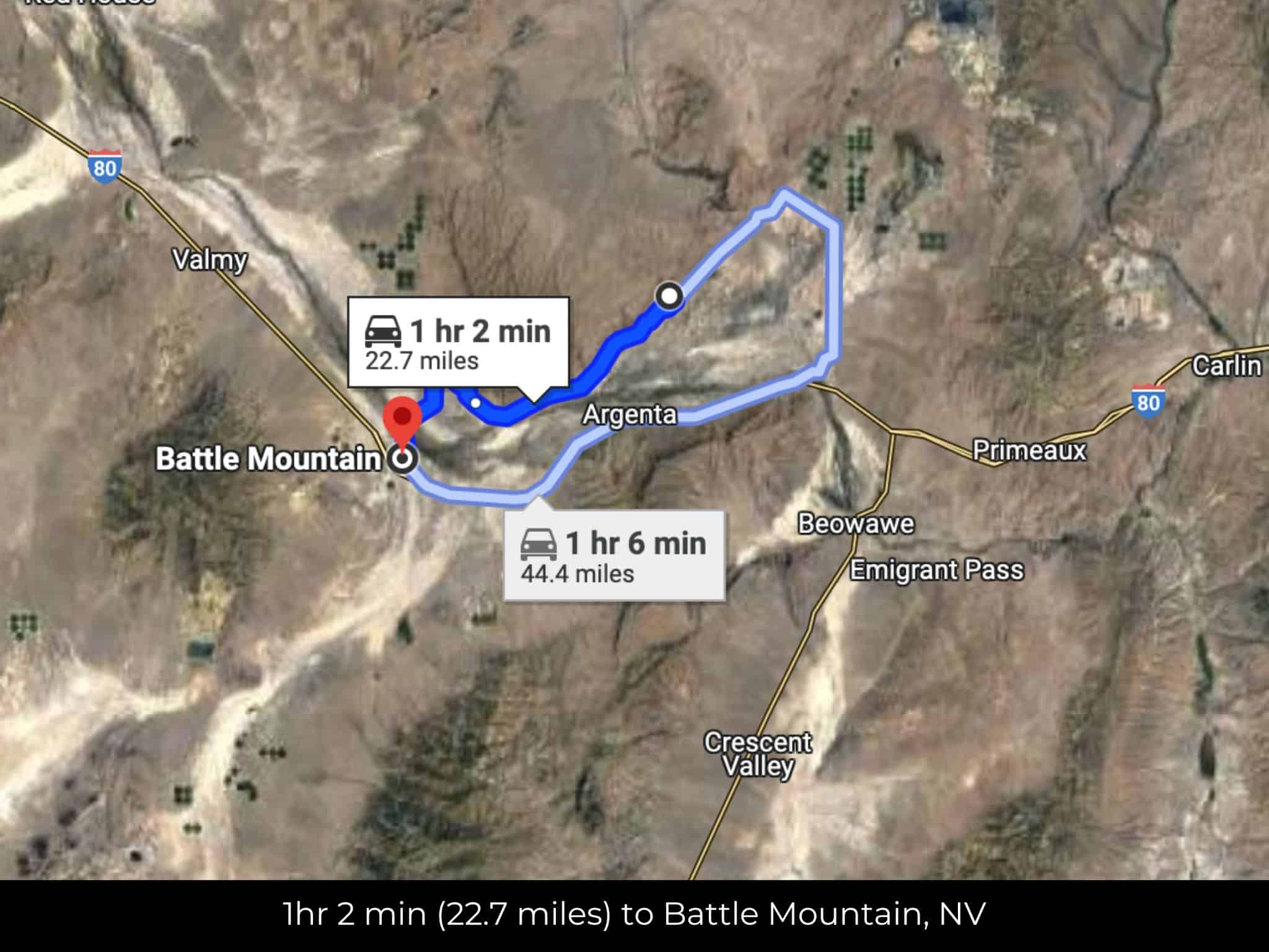
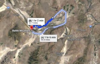
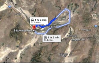
1 hr 3 min (22.7 miles) to Battle Mountain, NV
APN# 010-190-05
Payment
Payment Notes:
Warranty of Title: The property will be conveyed via a general warranty deed, guaranteeing you free and clear title to the property.
We accept Cash or 3rd party financing with a pre-approval letter.
We do not offer owner financing. No payment options are available for this property.
Paying a 3% Buyer's Agent Commission!
Property Description
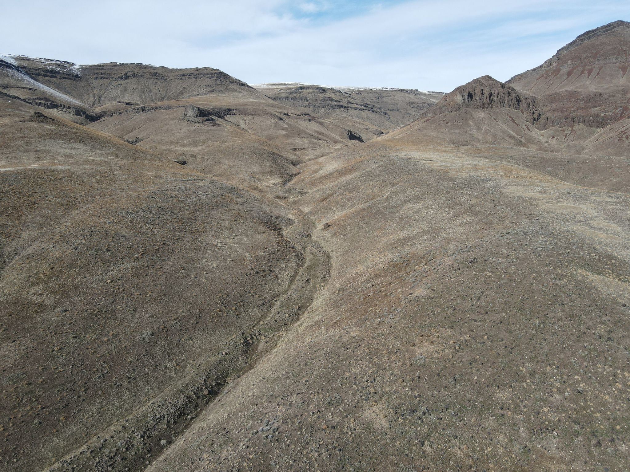
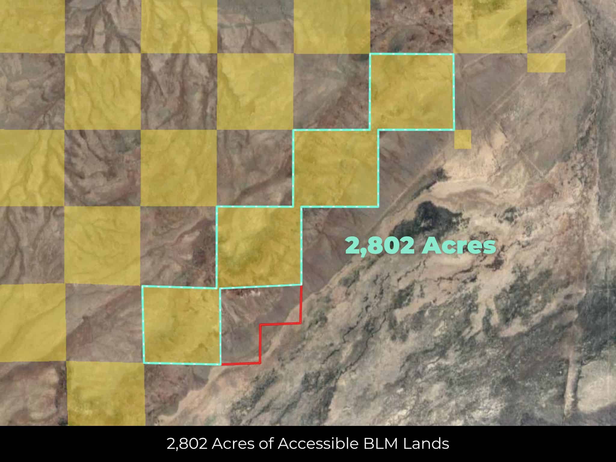
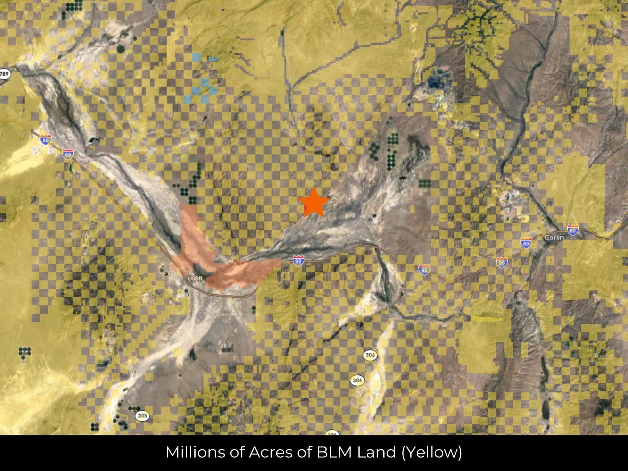
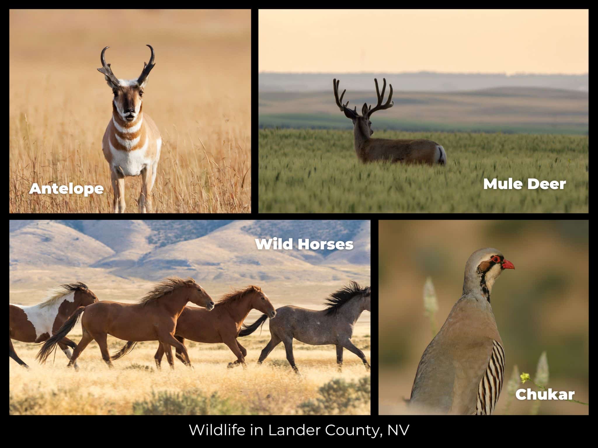
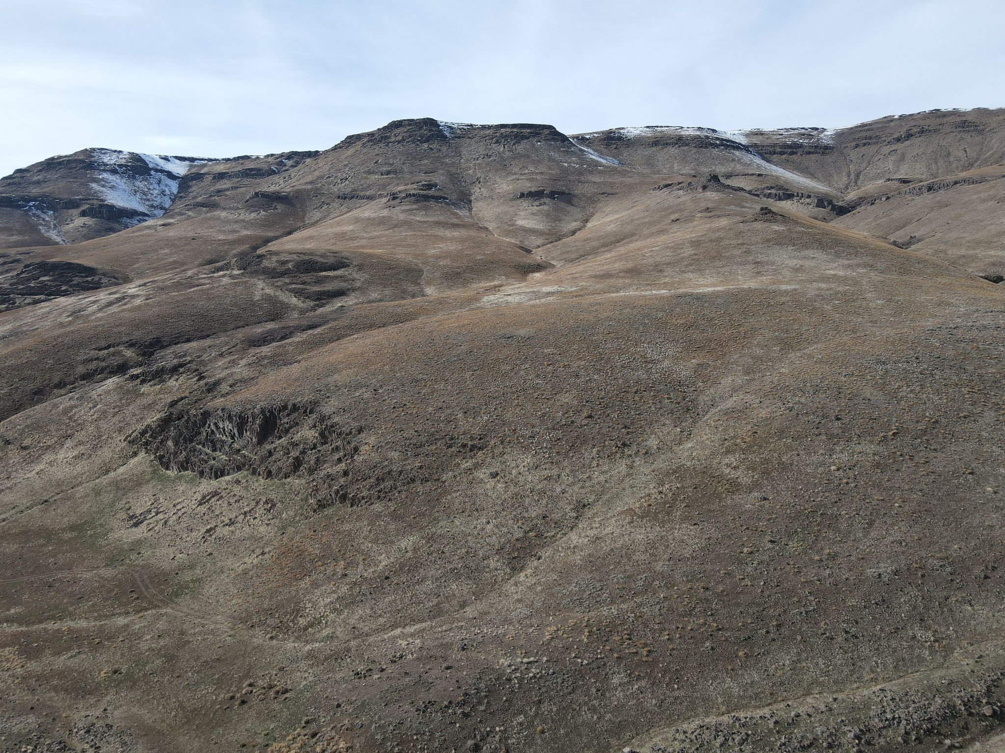
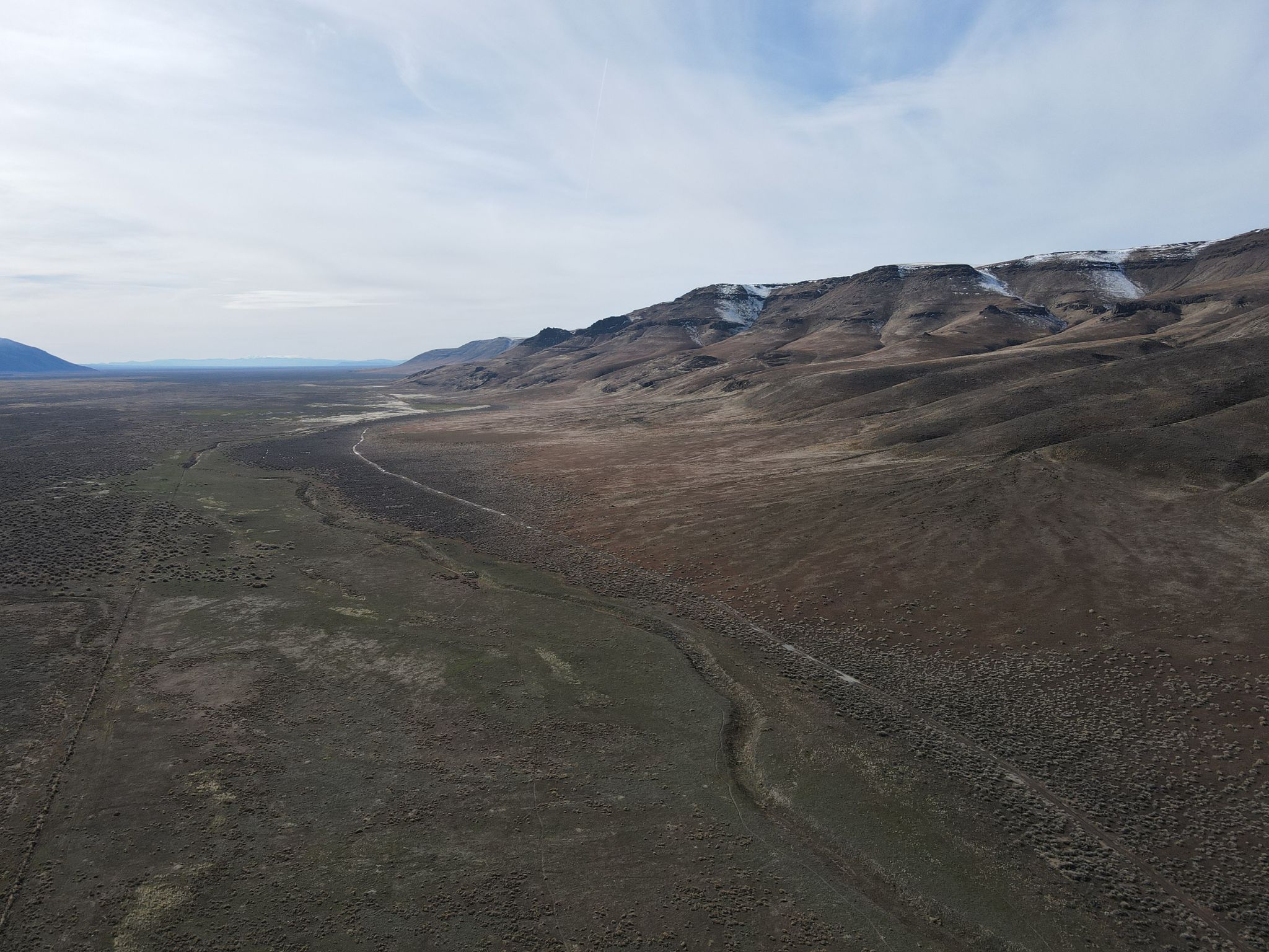
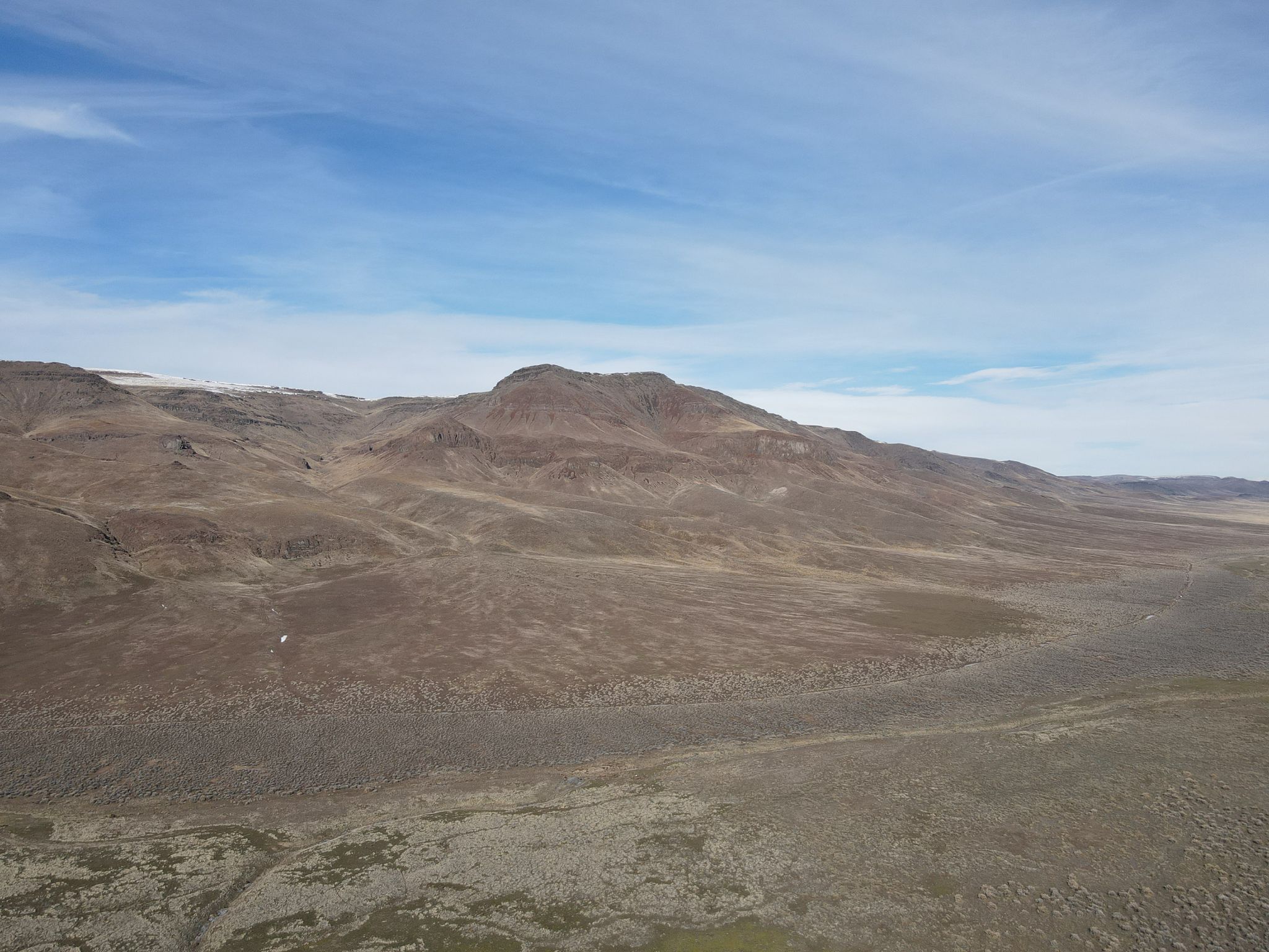
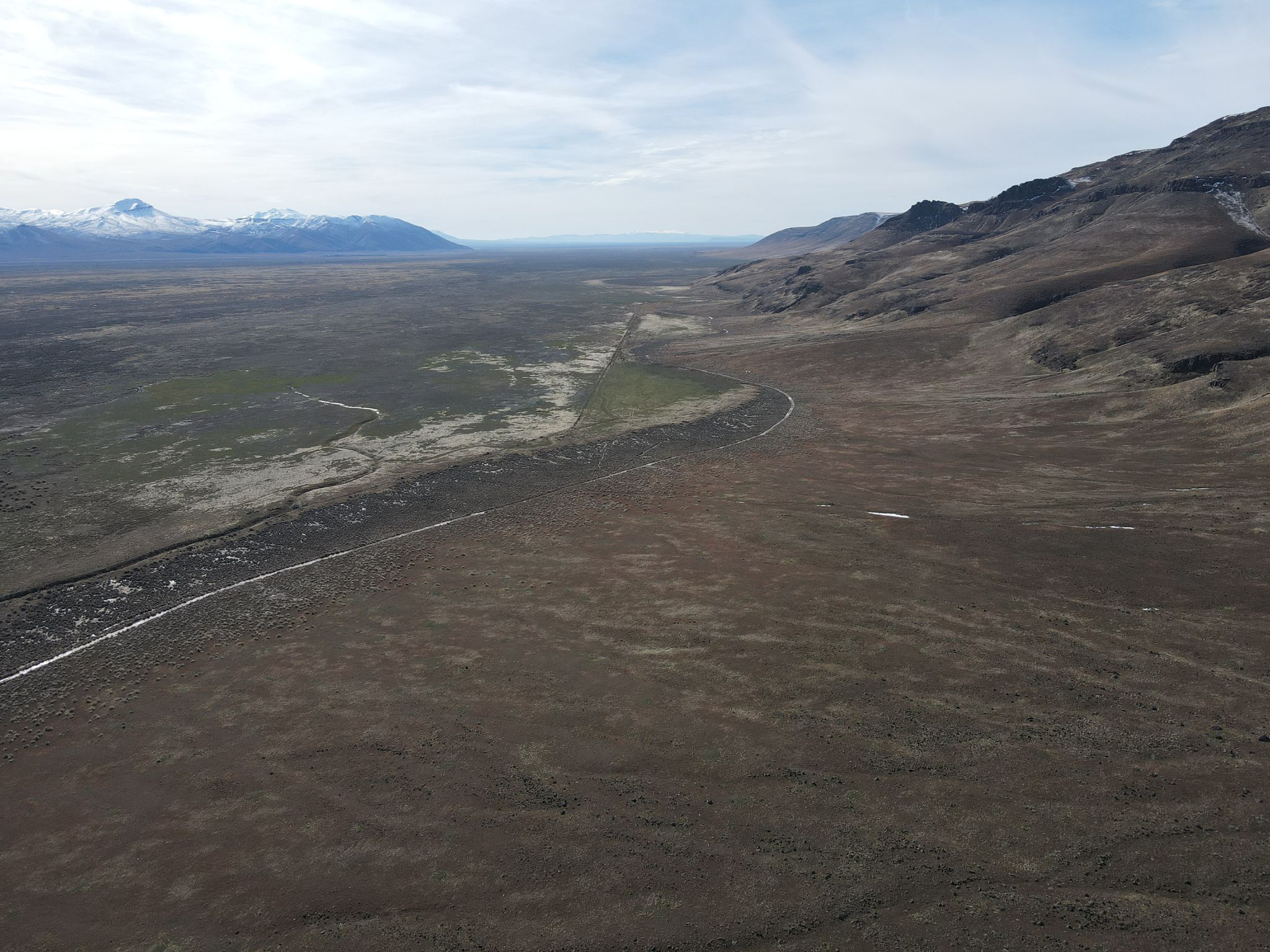
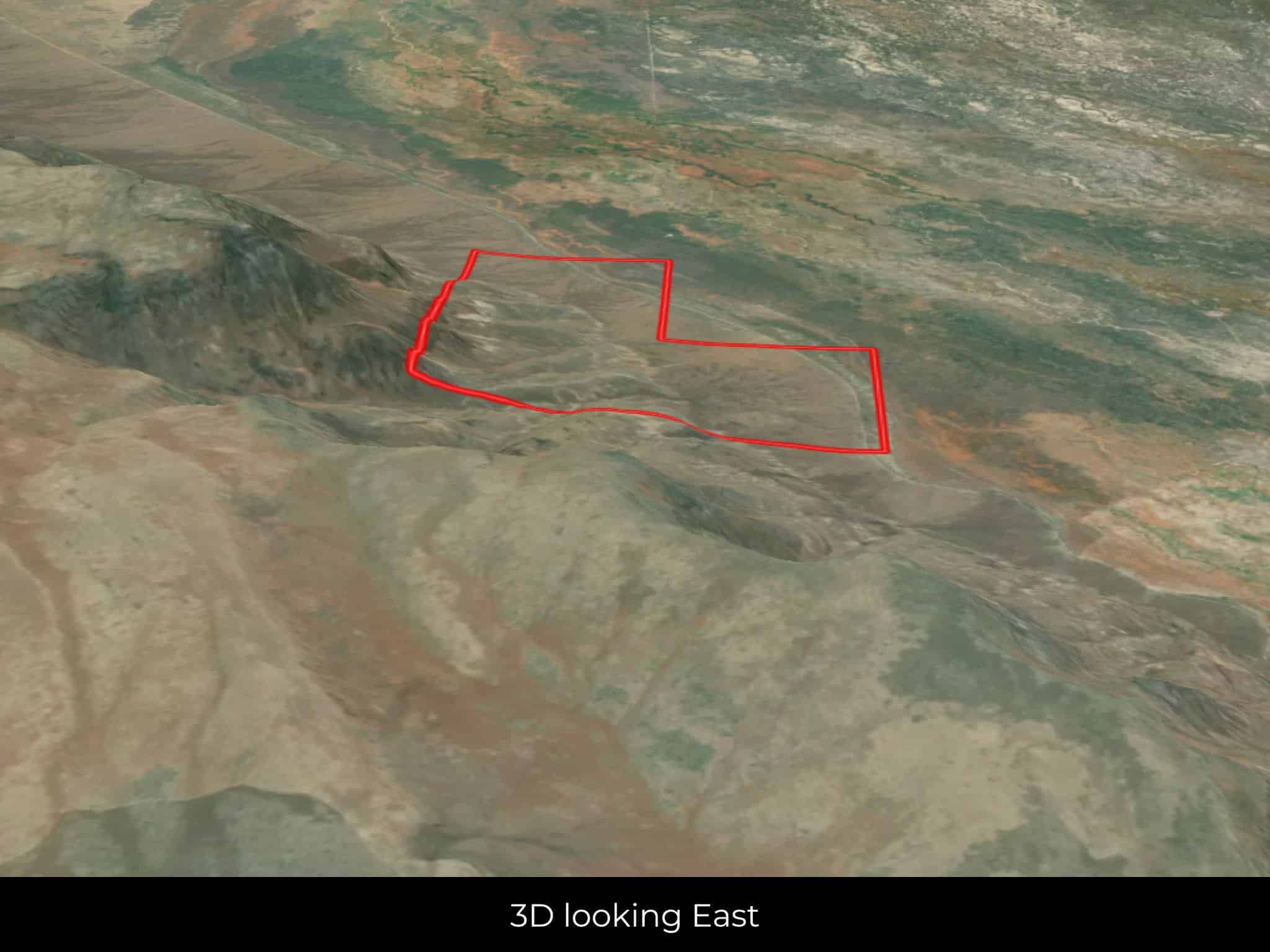
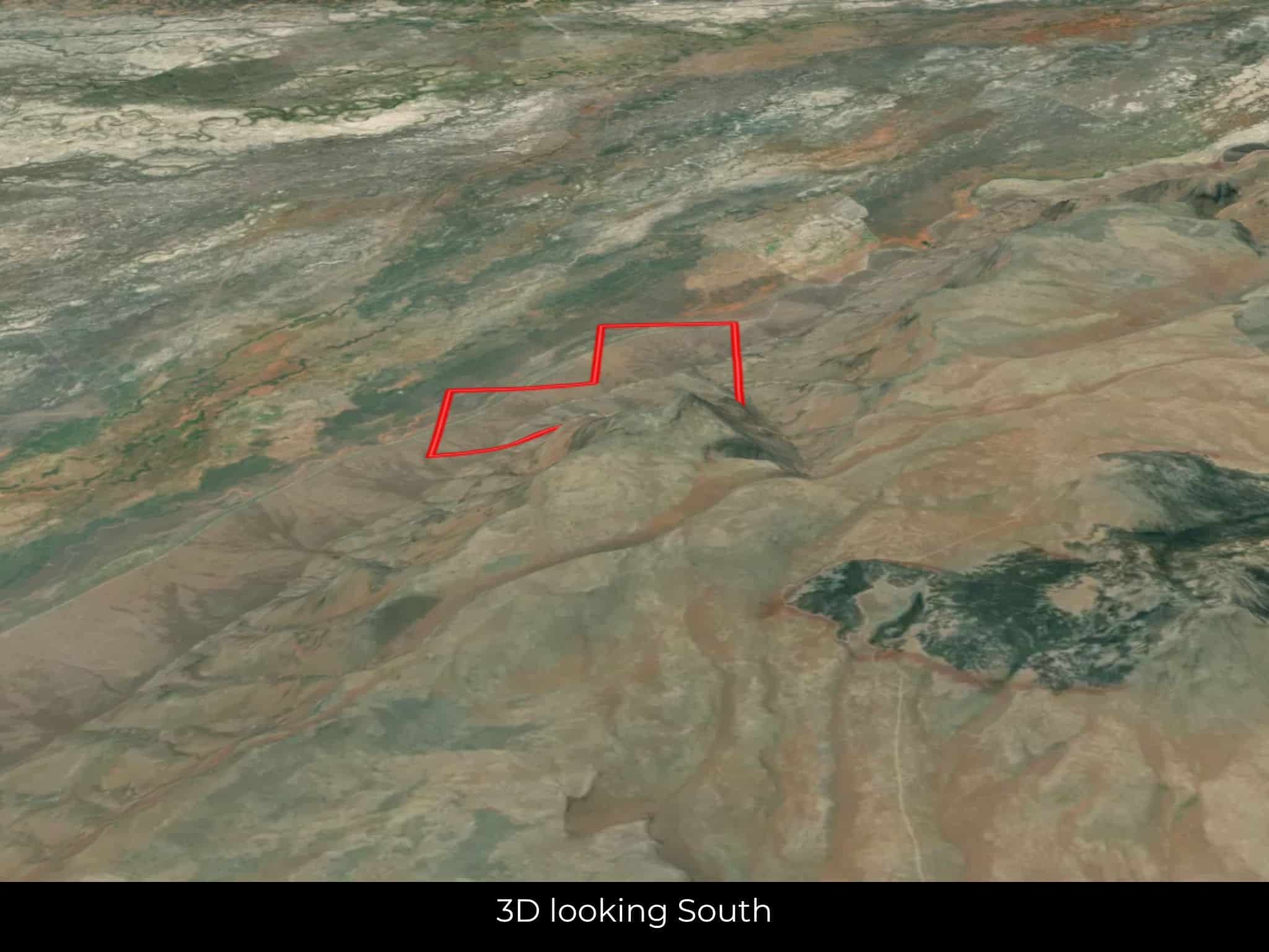
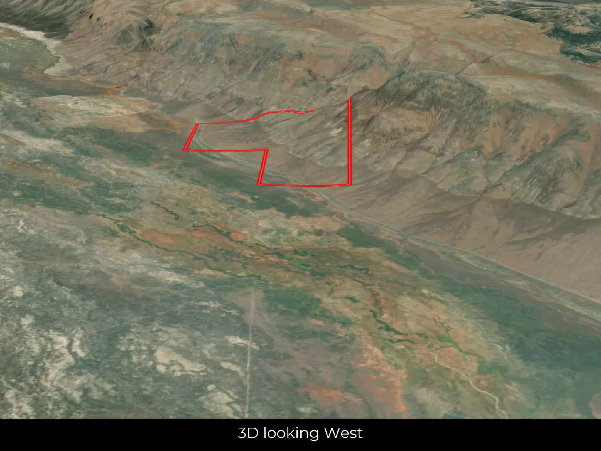
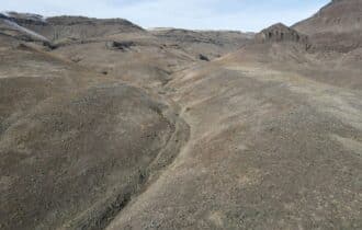
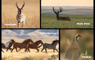
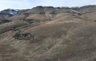
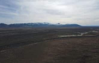
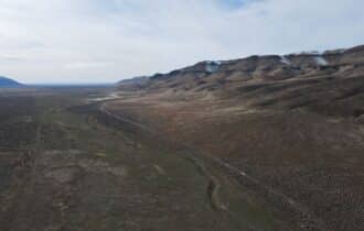
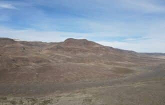
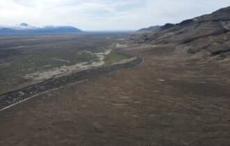
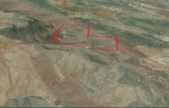
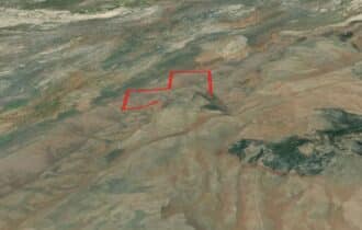
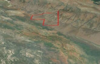
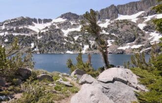
Nestled in the heart of Lander County, Nevada, is a rare and expansive 480.4-acre ranch that presents a unique opportunity for those seeking a harmonious blend of natural beauty and outdoor adventure. Surrounded by millions of acres of Bureau of Land Management (BLM) land and bordered by the pristine landscapes of national parks, this vast parcel offers an unparalleled sense of seclusion and tranquility. The property boasts a diverse and thriving ecosystem, home to a rich variety of wildlife, including antelope, mule deer, wild horses, chukar, and more. Nature enthusiasts and outdoor lovers will be captivated by the abundance of flora and fauna that graces the land, creating an idyllic setting for exploration and appreciation of the natural world.
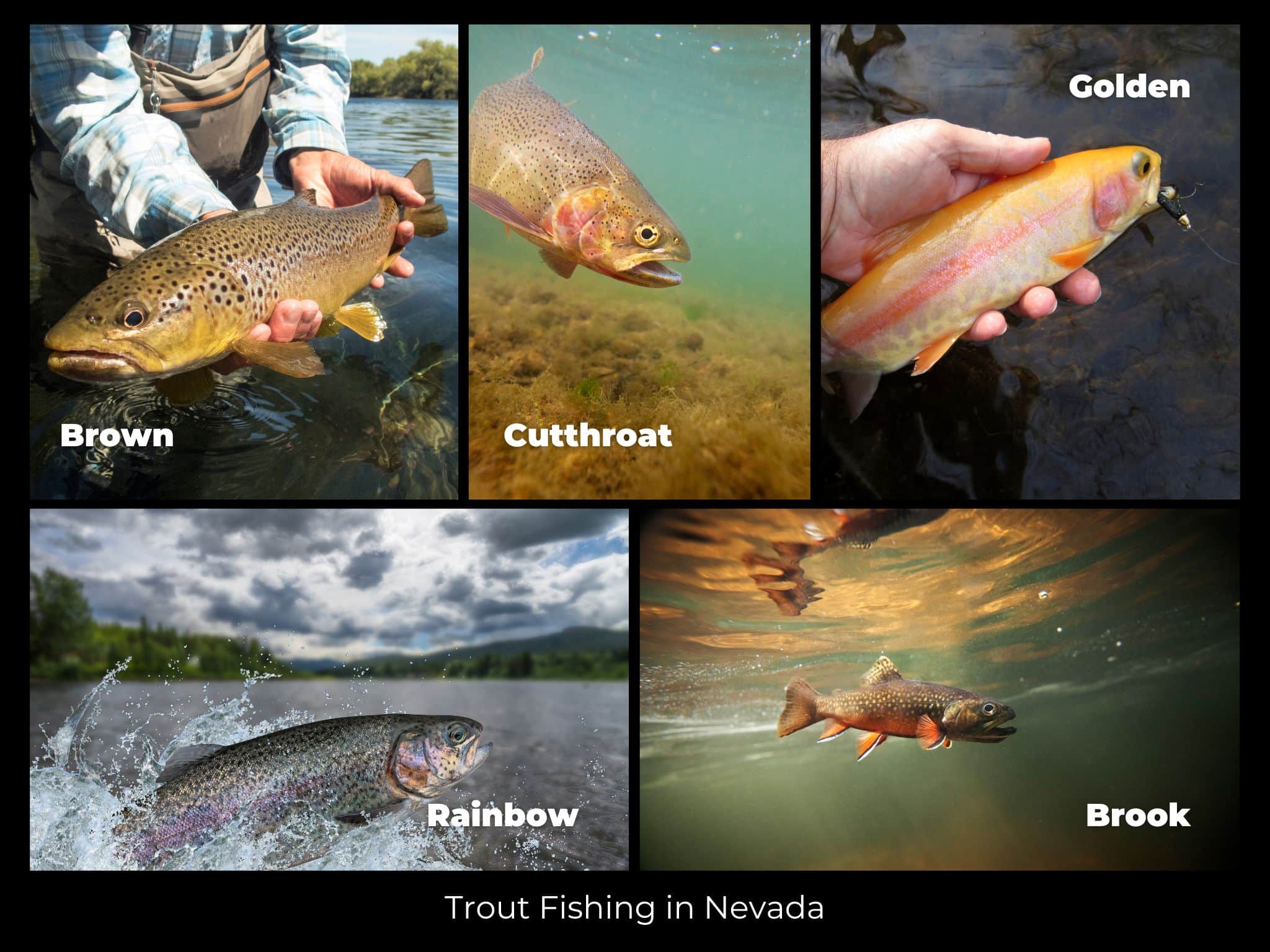
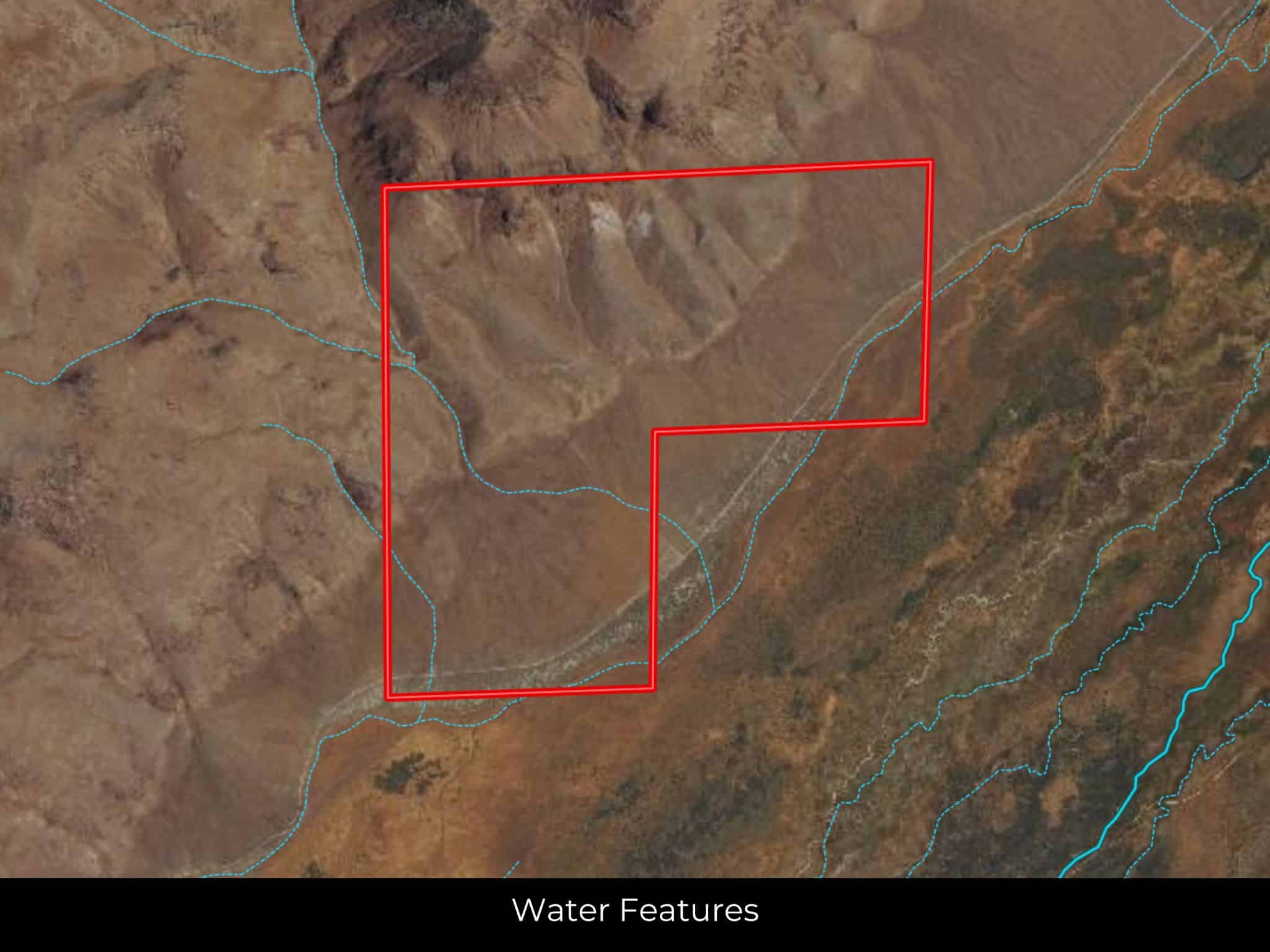
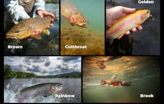
In addition to its remarkable surroundings, this property is a haven for fishing enthusiasts, with access to some of the best trout fishing spots in Nevada. The nearby waterways provide an opportunity to reel in a variety of trout species, including Brown, Cutthroat, Golden, Rainbow, and Brook trout. Whether casting a line from the shore or navigating the pristine waters, the trout fishing experience here is nothing short of exceptional. With its vast acreage, breathtaking scenery, and proximity to abundant wildlife and fishing opportunities, this vacant lot in Lander County is a haven for those seeking a connection with nature and the ultimate outdoor lifestyle.
Visiting the Property
You are welcome to visit the property at your convenience and anytime while it's still available. However, we HIGHLY recommend checking-in with us prior to visiting the property in case the property has gone under contract or already sold.
The interactive map above is generated with MapRight. MapRight has free apps for Apple IOS and Android that can be used to track your location and route throughout a property and provide driving directions.
MapRight for Apple –> Download App.
MapRight for Android –> Download App.
To launch the interactive map on your device, 1) install the free MapRight app using one of the two links above for Apple or Android, and 2) click the “View Full Screen” link (see above) in the embedded map on the property listing page.
Property Information
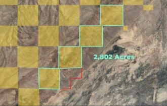
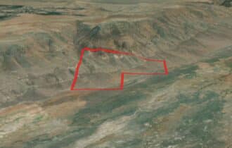
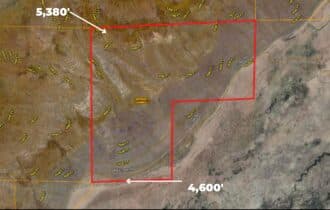
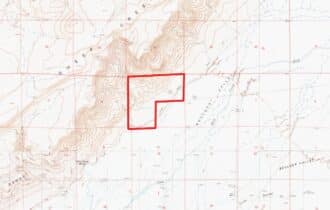
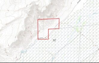
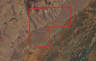
Parcel Size
480.4 Acre
State
Nevada
County
Lander
Nearest Cities
Battle Mountain, NV
Parcel #
010-190-05
Address
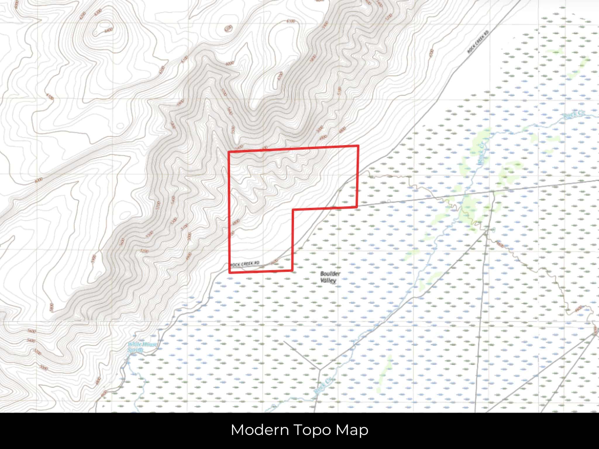
000 Rock Creek Road, Battle Mountain, NV, 89820
Legal Description
N/2 & SW/4 of Section 3, Township 33 North, Range 47 East
Zip Code
89820
Annual Property Taxes
$462.58
Ag Exemption
No
HOA
None!
HOA per Year
None
Survey Available
None
School District
Lander County School District
Liens and Back Taxes
None!
Source Deed
Sent for Filing.
Title Status
Free & Clear!
Outgoing Conveyance
Warranty Deed
Property Features
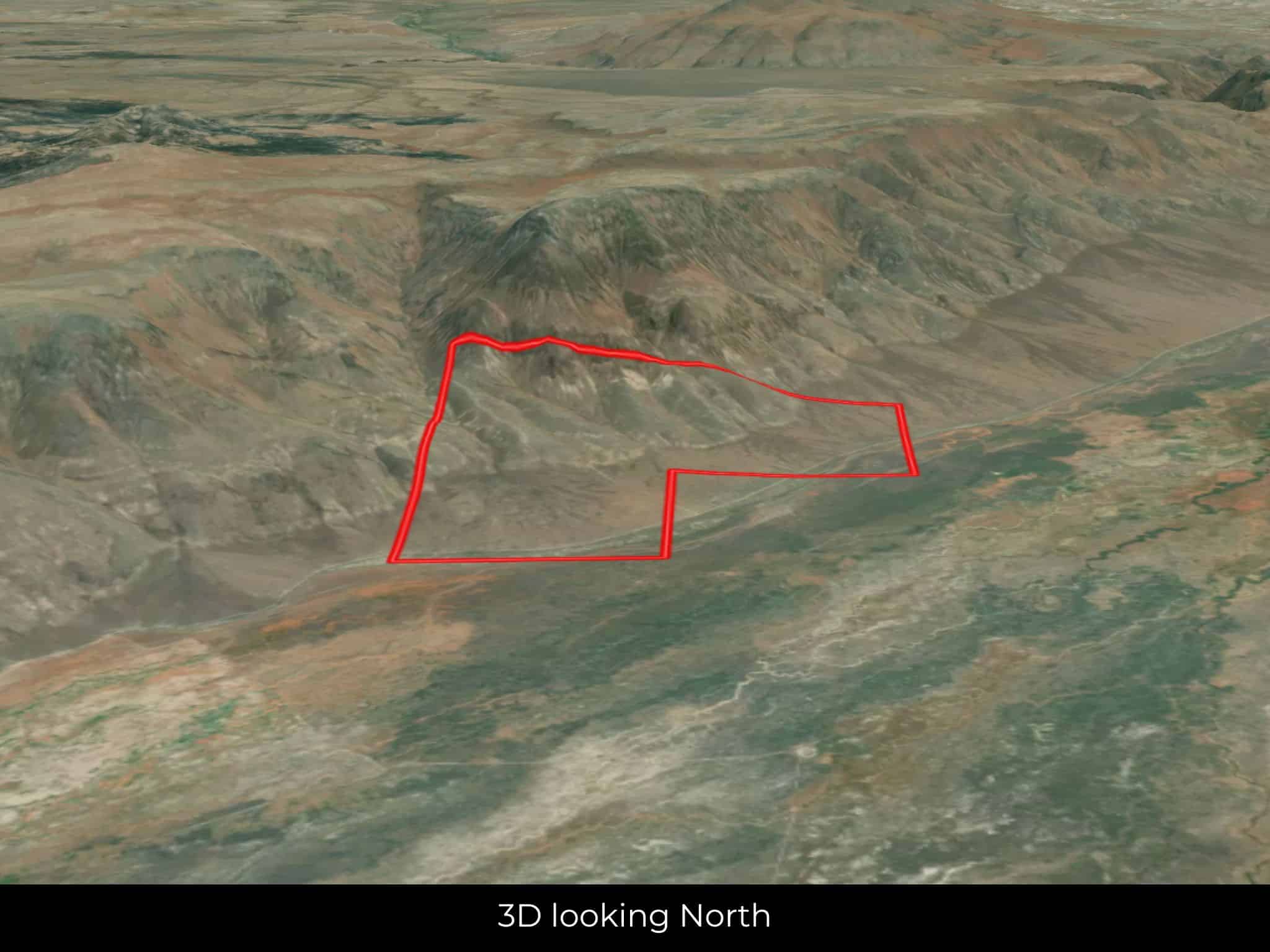
Acres
480.4
Dimension
5,546′ x 5,277′
County
Lander
Access
Dirt Road
Power
Alternative
Water
Alternative
Coordinates
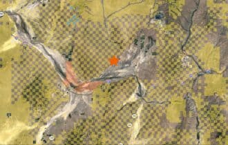
40.7657, -116.6659
Zoning
Vacant Lot (General)
Elevation
4,600′ – 5380′
Terrain
Rugged
Floodplain
No
Duplexes
Yes
Mobiles
Yes
Tiny Homes
Yes
Barndominiums
Yes
RV's
Yes
Camping
Yes
Utilities
🔌 Power: Solar, wind, propane, or alternative energy source.
💧 Water: Water well, collection, hauling/delivery, or alternative.
🚽 Sewer: Septic or alternative sewer system.
☎️ Phone: Cellular, VOIP (see internet below), and satellite phone through Iridium, Globalstar, or Inmarsat.
🌐 Internet: Satellite internet through Starlink, HughesNet, or ViaSat.
📺 Cable: Satellite cable through Dish or DirectTV.
Nearby Cities, Conveniences, and Attractions
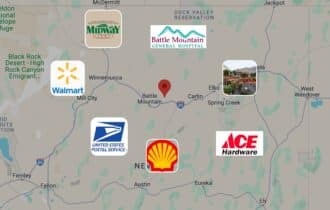
- 1 hr 2 min (22.7 miles) to Battle Mountain. NV (about)
- 1 hr 3 min (22.9 miles) to Ace Hardware, Battle Mountain, NV (about)
- 1 hr 3 min (23.2 miles) to Battle Mountain General Hospital (about)
- 1 hr 4 min (23.3 miles) to Midway Market, Batlle Mountain, NV (about)
- 1 hr 4 min (23.3 miles) to USPS, Battle Mountain, NV (about)
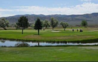
- 1 hr 6 min (25.2 miles) to Mountain View Golf Course (about)
- 1 hr 6 min (23.9 miles) to Shell, Battle Mountain, NV (about)
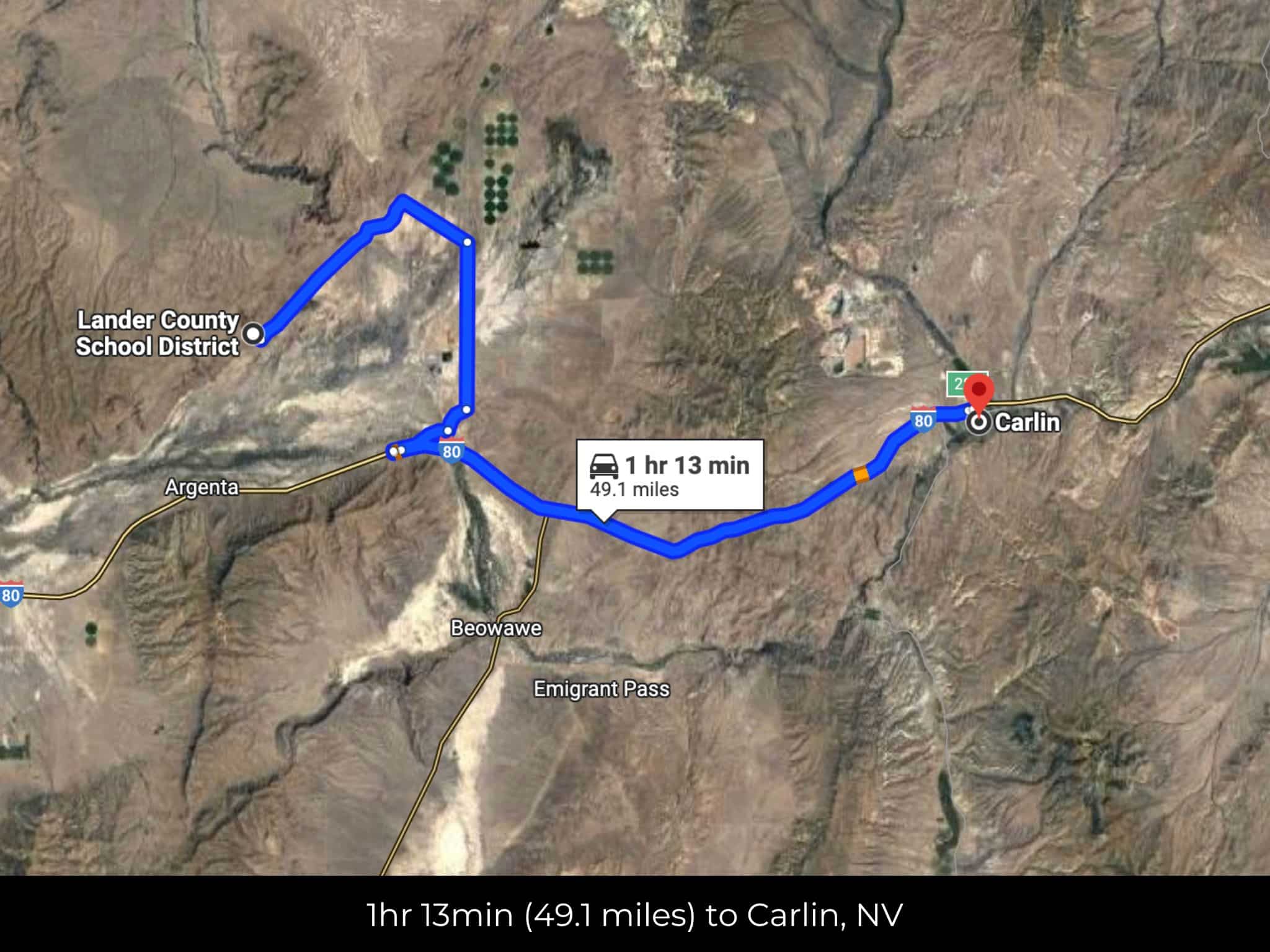
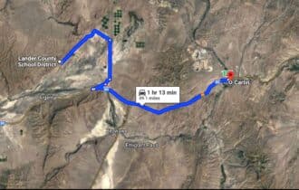
- 1 hr 10 min (49.1 miles) to Carlin, NV (about)
- 1 hr 25 min (69.2 miles) to Cal Ranch Hardware Store, Elko, NV (about)
- 1 hr 26 min (44.8 miles) to Willow Creek Pond (about)
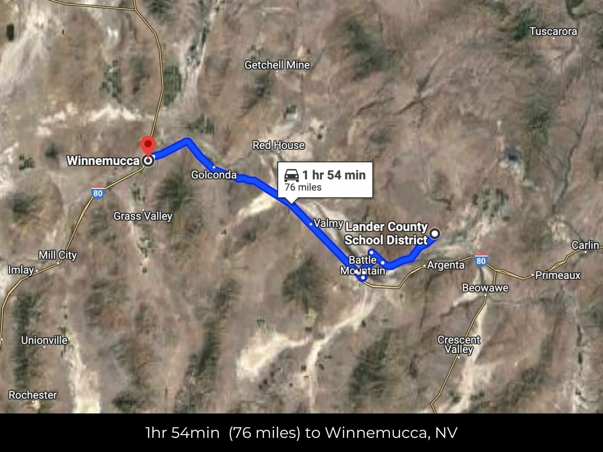
- 1 hr 52 min (76.0 miles) to Winnemucca, NV (about)
- 1 hr 57 min (78.8 miles) to Walmart, Winnemucca, NV (about)
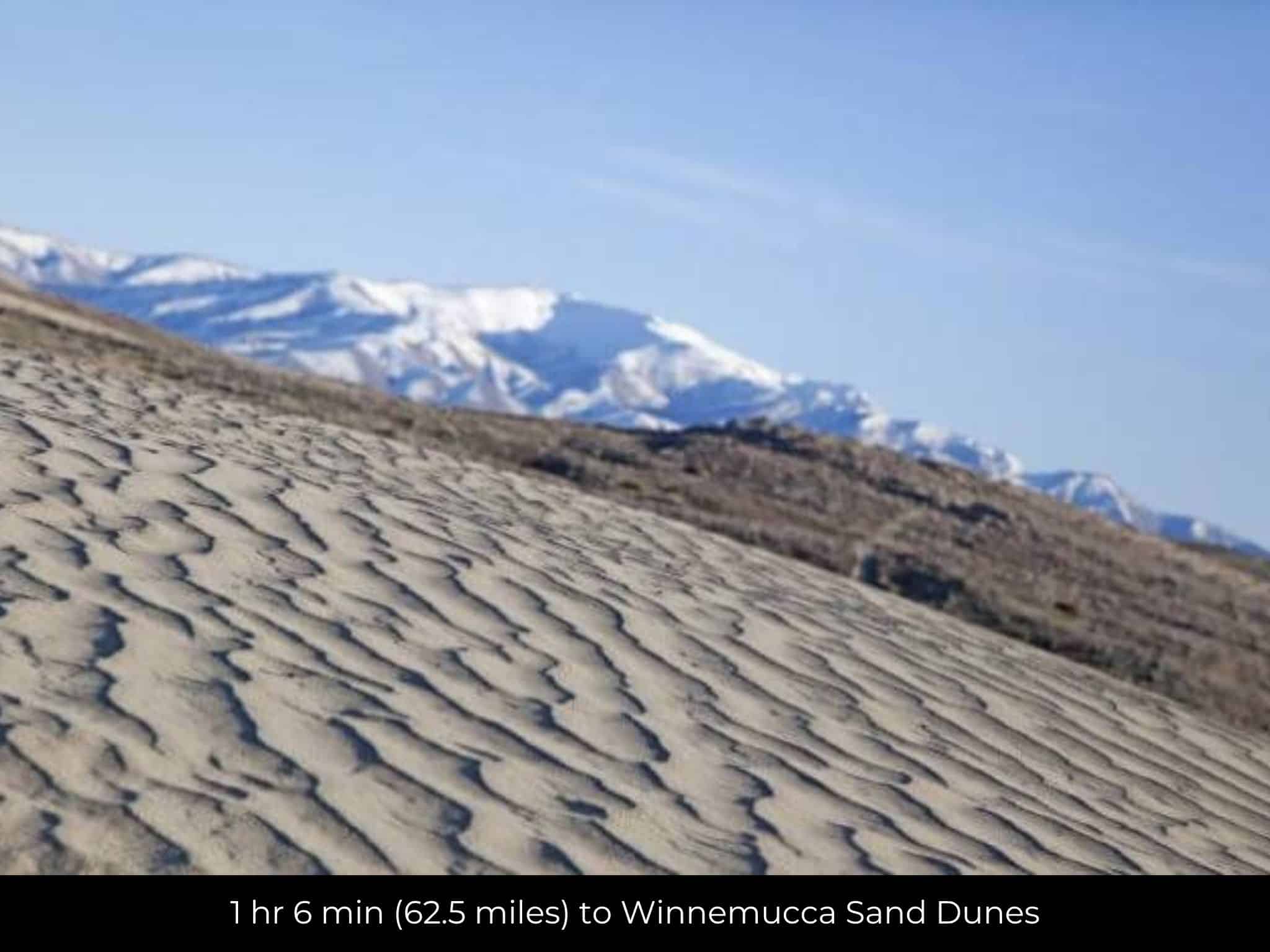
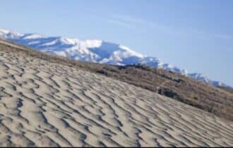
- 1 hr 59 min (83.1 miles) to Winnemucca Sand Dunes (about)
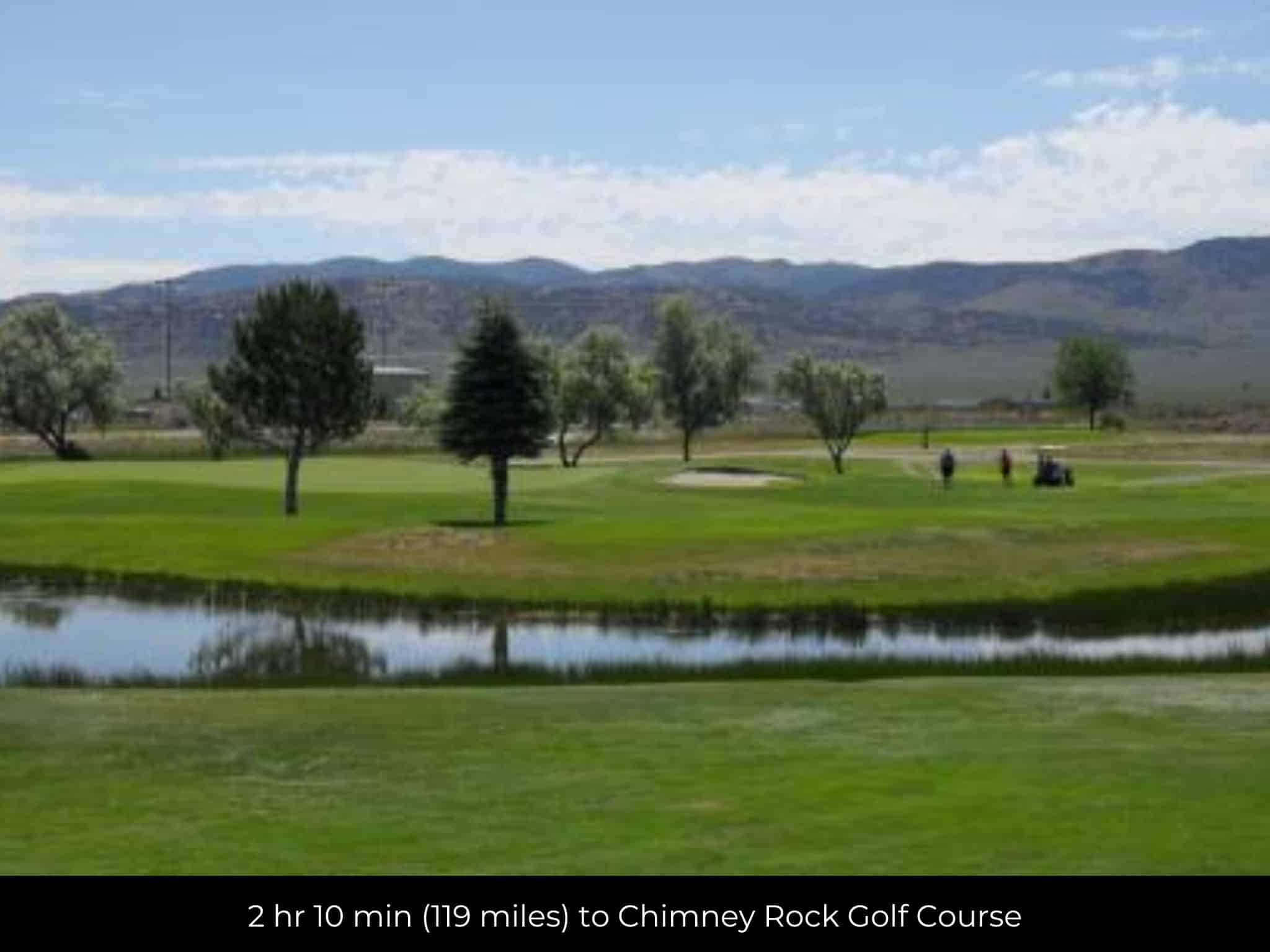
- 2 hr 10 min (119 miles) to Chimney Rock Golf Course (about)
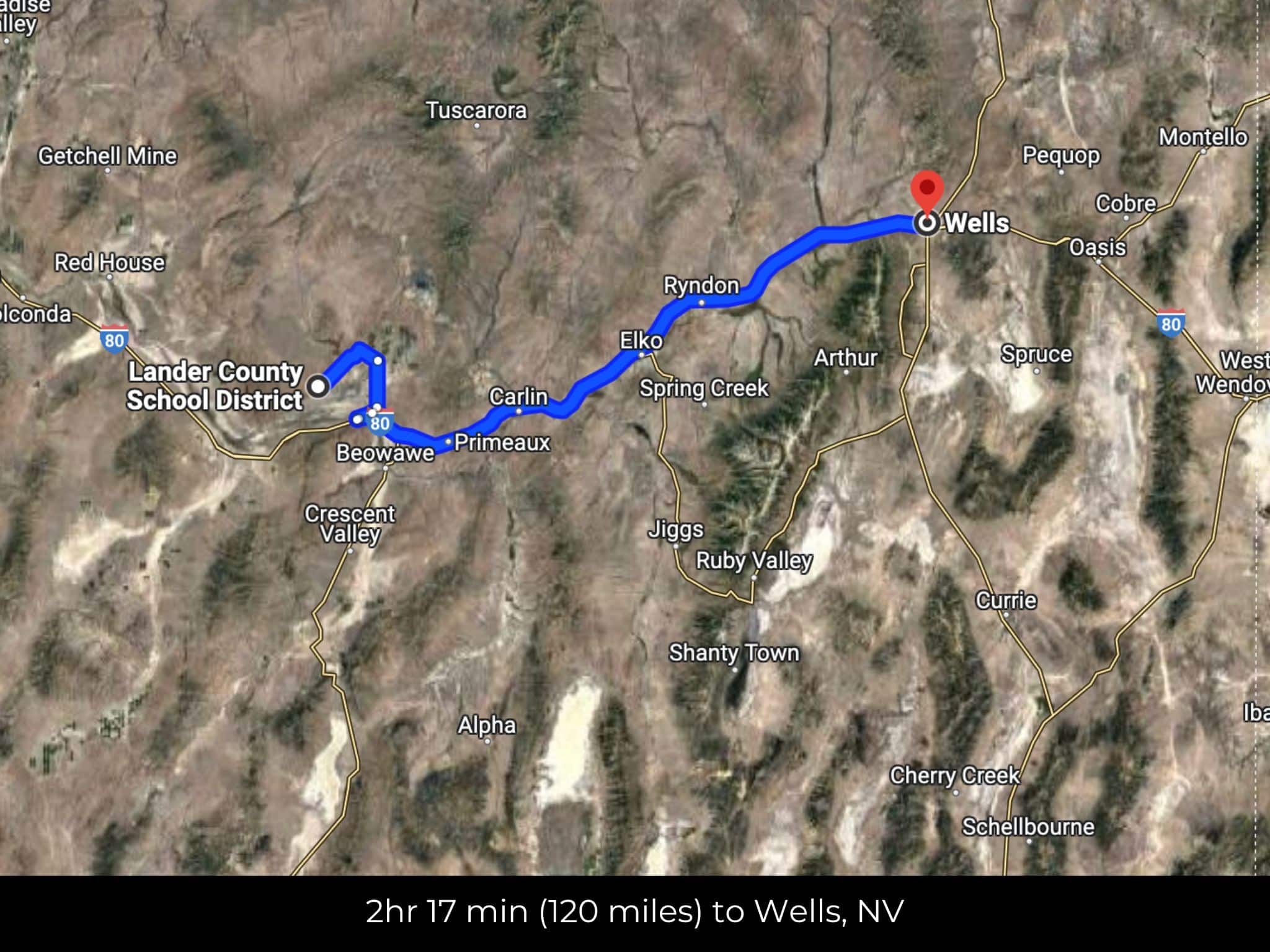
- 2 hr 12 min (120 miles) to Wells, NV (about)
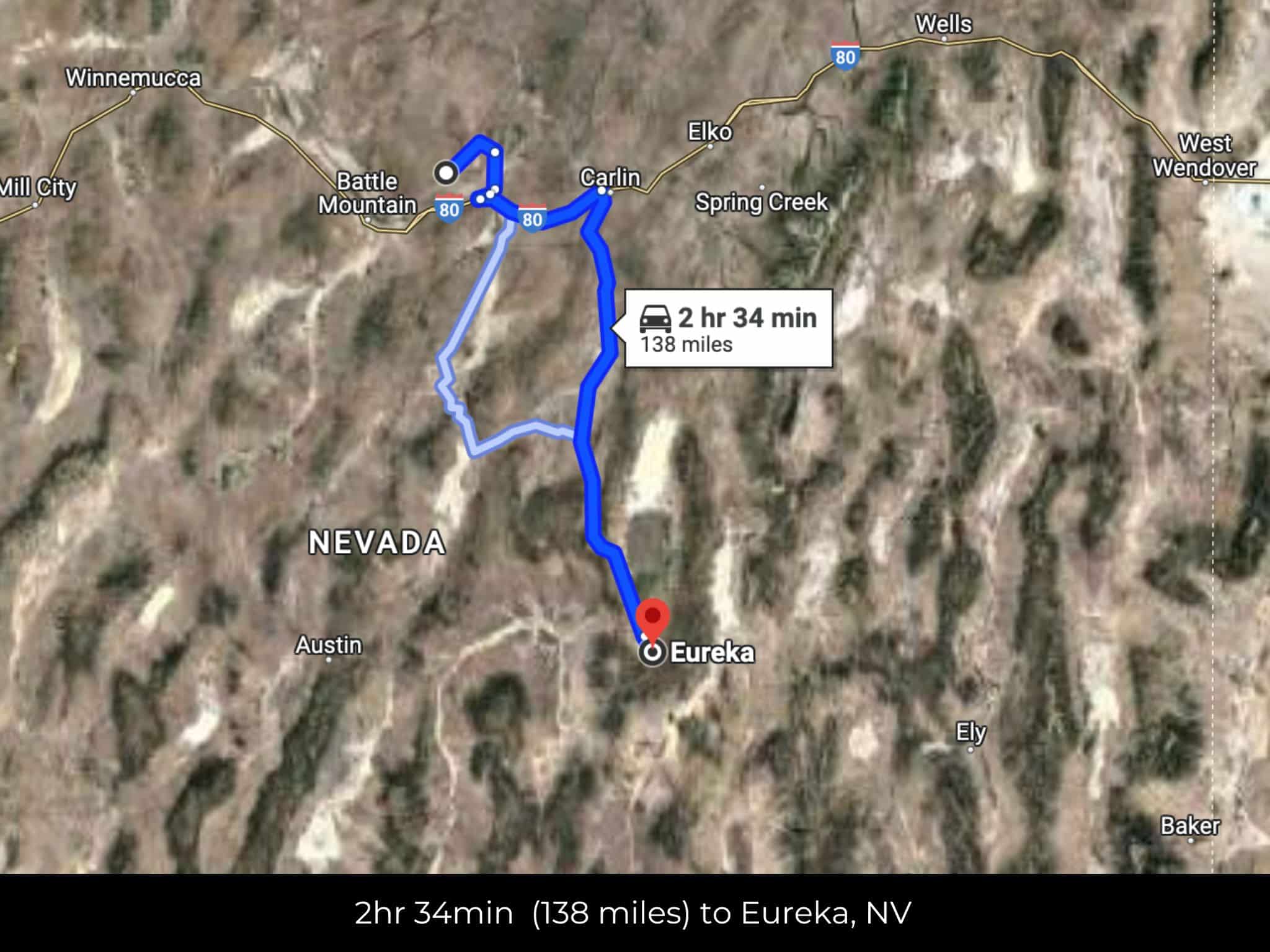
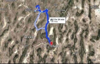
- 2 hr 33 min (138 miles) to Eureka, NV (about)
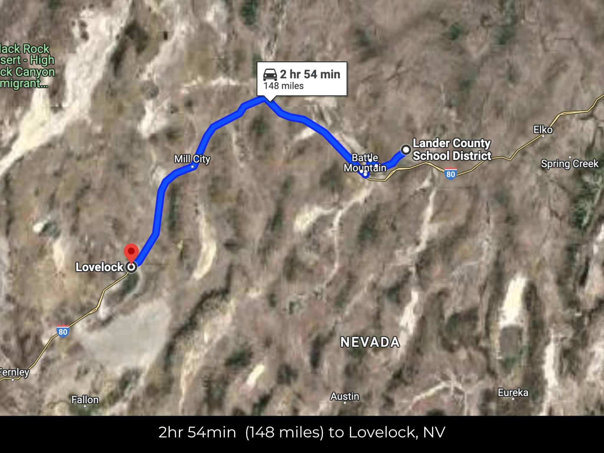
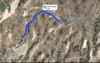
- 2 hr 50 min (148 miles) to Lovelock, NV (about)
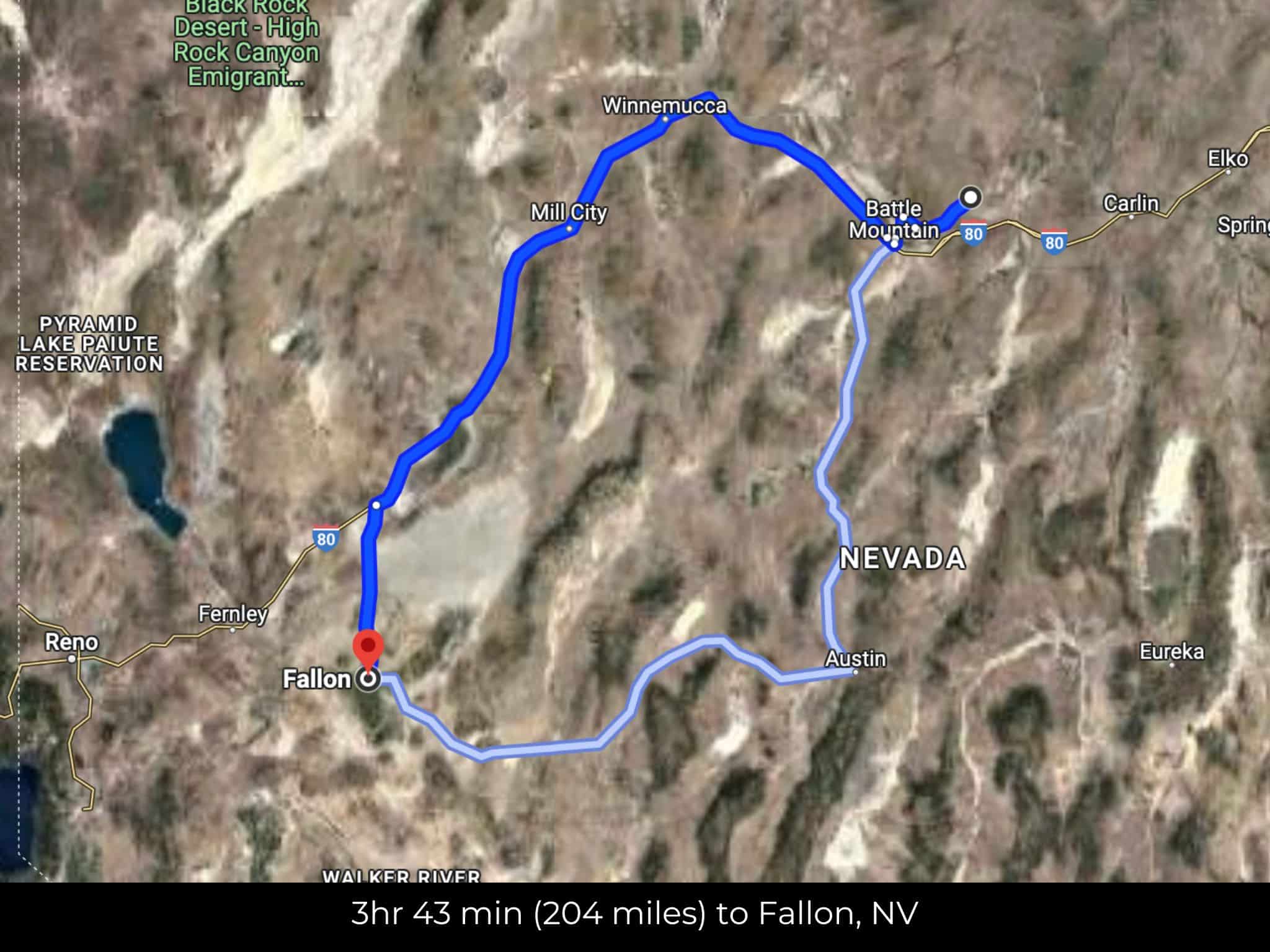
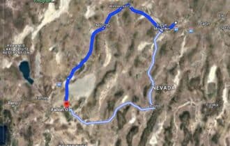
- 3 hr 39 min (204 miles) to Fallon, NV (about)
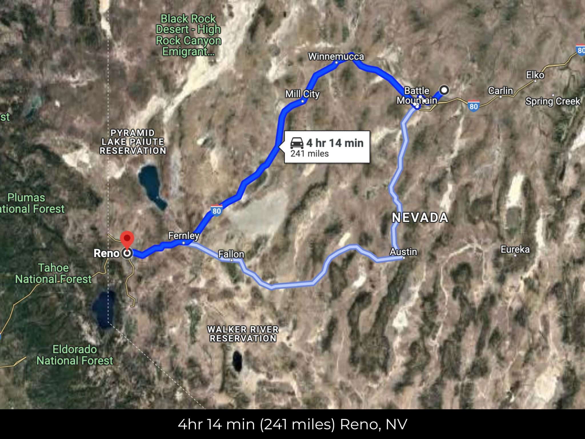
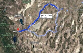
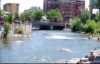
- 4 hr 12 min (241 miles) to Downtown Reno (about)
- 4 hr 18 min (243 miles) to Fishing, Virginia Lake (about)
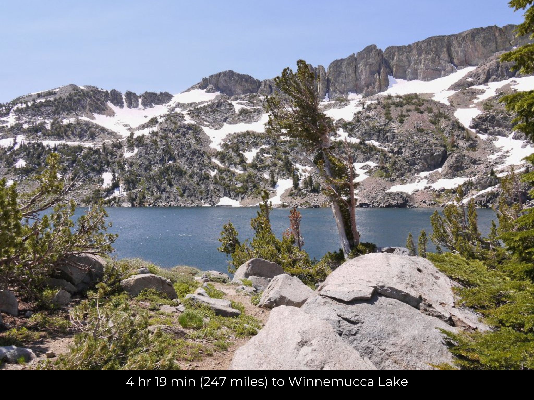
- 4 hr 19 min (247 miles) to Winnemucca Lake (about)
- 4 hr 11 min (241 miles) to Reno, NV (about)
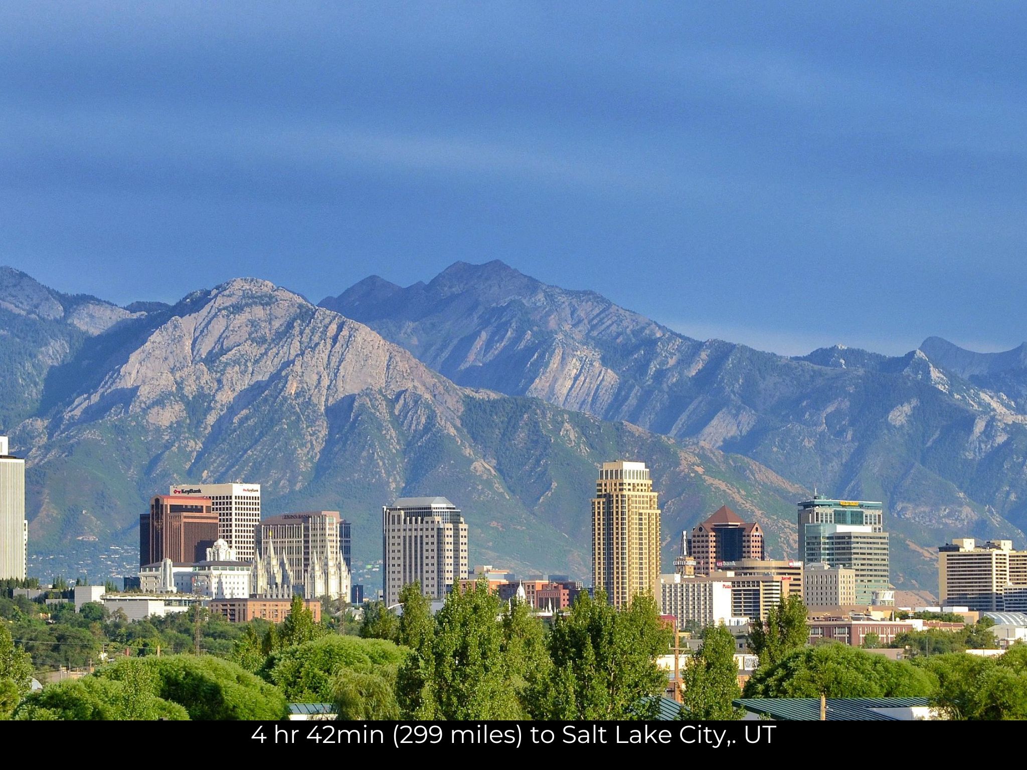
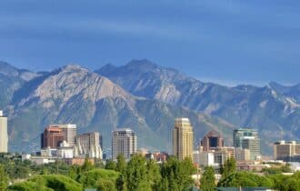
- 4 hr 42 min (299 miles) to Salt Lake City, UT (about)
County Contacts
Lander County Assessor Lura Duvall (775) 635-2610. (website)
Lander County Treasurer Jusdivia Johnson (775) 635-5127. (website)
Lander County Clerk Molly Gonzalez (775) 635-5738. (website)
Lander County Zoning (775) 635-2860. (website)
Lander County Health (website)
Lander County CAD (website)
Lander County GIS (website)
Closing Costs and Fees
$299
Document Prep Fee
Buyer will pay a $299 document preparation fee, which includes all postage and county recording fees. Seller will warrant title to the property.
$0
In-House Closing Fee
There will be no additional fees or expenses for an in-house closing. We will close in 14 days or less. This is the fastest, easiest, and cheapest way to close.
$1,500+
Title Company Fees*
Title Company costs are typically 2-5% of the purchase price with a minimum fee of around $1,500. Many states have legislated, standard insurance rates and other fees vary by the title company.
* If Buyer elects to close through a third-party title company, Buyer will bear all closing costs and expenses, including Seller’s title policy and Seller's escrow fees. Closing through a title company typically takes 30-45 days, depending on the county, title company, and transaction activity in the area.
Driving Directions and GPS Coordinates
🚗 Driving Directions: Head southwest on Rock Creek Rd 13.6 mi, Continue onto Rock Creek Rd 3.2 mi, Turn left onto Hwy 35 4.8 mi, Continue onto NV-806 1.0 mi,Continue onto N Reese St 0.2 mi, Turn right onto E Front St
📍 Northwest Corner: 40.7696, -116.6728 (Google Map)
📍 Northeast Corner: 40.7702, -116.6541 (Google Map)
📍 Southeast Corner: 40.7571, -116.6642 (Google Map)
📍 Southwest Corner: 40.7567, -116.6727 (Google Map)
📍 Center Point: 40.7657, -116.6659 (See embedded Google Map below 👇.)
Google Map
If you click the blue Directions link below, 👇 you can get Google turn-by-turn directions to the property on any device. The map coordinates for the Google Map below are for the approximate center of the property and not the entrance, gate, or primary access point for the property. Google Maps may provide driving directions that require the use of private or abandoned roads or may require you to go through gates located on private property. Do not trespass on private property! Some properties will require a 4-wheel drive vehicle or may be inaccessible in certain weather conditions. Please don't get stuck or lost.
Additional Notes
As-Is and As-Available: This property is being sold property “as-is” and “as-available.” No representations as to fitness for a particular purpose have been made. No verbal claims or promises have been made. Please see our Terms of Service for more information.
Contract: After making your initial deposit, we will email you the purchase and sale agreement, which includes a warranty deed. Agreements are prepared manually and will be sent out Monday through Friday between 9 AM and 5 PM CST. Thank you for your patience.
No Monthly Payments: We are not offering seller financing on this property. This is an all-cash transaction. We are not offering a payment plan. If you would like to finance your purchase of the property, please contact a third-party lender prior to making your deposit. We will not sign a purchase and sale agreement that is contingent upon third-party financing without a pre-approval letter.
3% Buyer's Agent Commission: You are not required to have an agent or broker assist you with purchasing this property. However, if the Buyer does use an agent, and the Seller is made aware of this prior to an agreement on price or signed contract, the Seller will pay a 3% commission to the Buyer's licensed agent or broker.
Maps and GPS Coordinates: Maps and GPS coordinates are believed to be accurate, but accuracy is not guaranteed. The information contained in the maps should not be considered a “legal description,” and the maps and GPS coordinates are not a replacement for a survey. We have taken reasonable steps to ensure that parcel lines, maps, and coordinates are in fact accurate, but third-party geographical information system (GIS) providers, including information from the county, often contain errors and inaccuracies.