


SOLD:Top of the World Views on 6.686 Acres
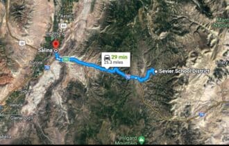
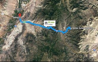
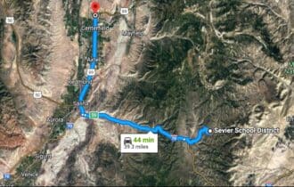
31 min (25.3 miles) to Salina, UT
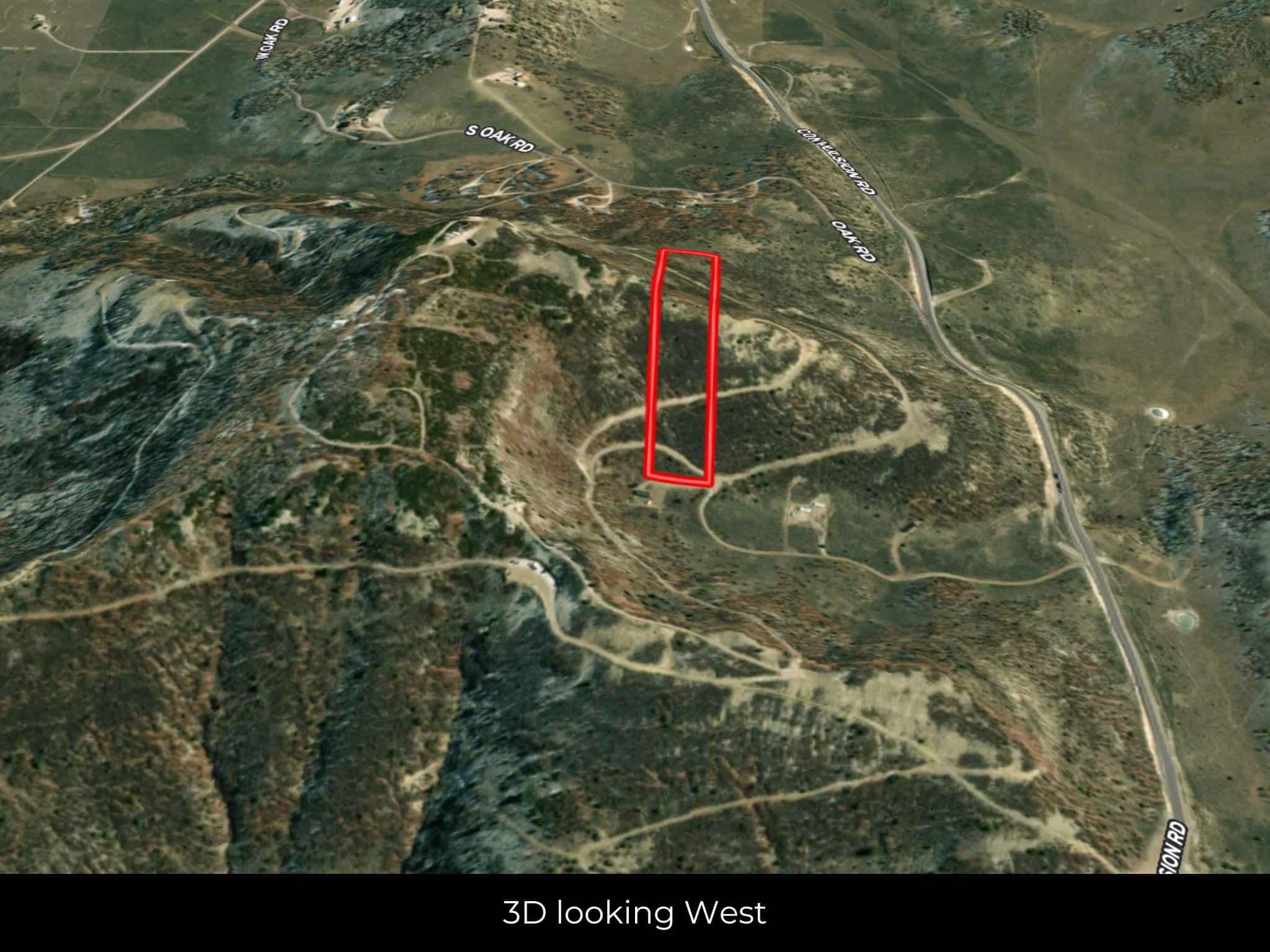
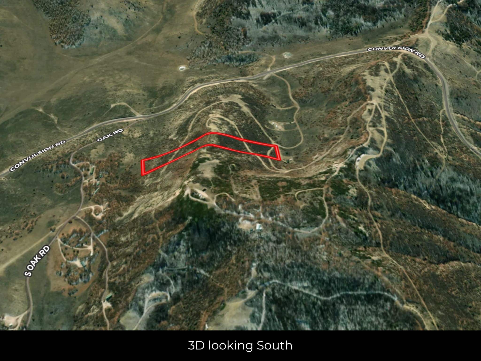
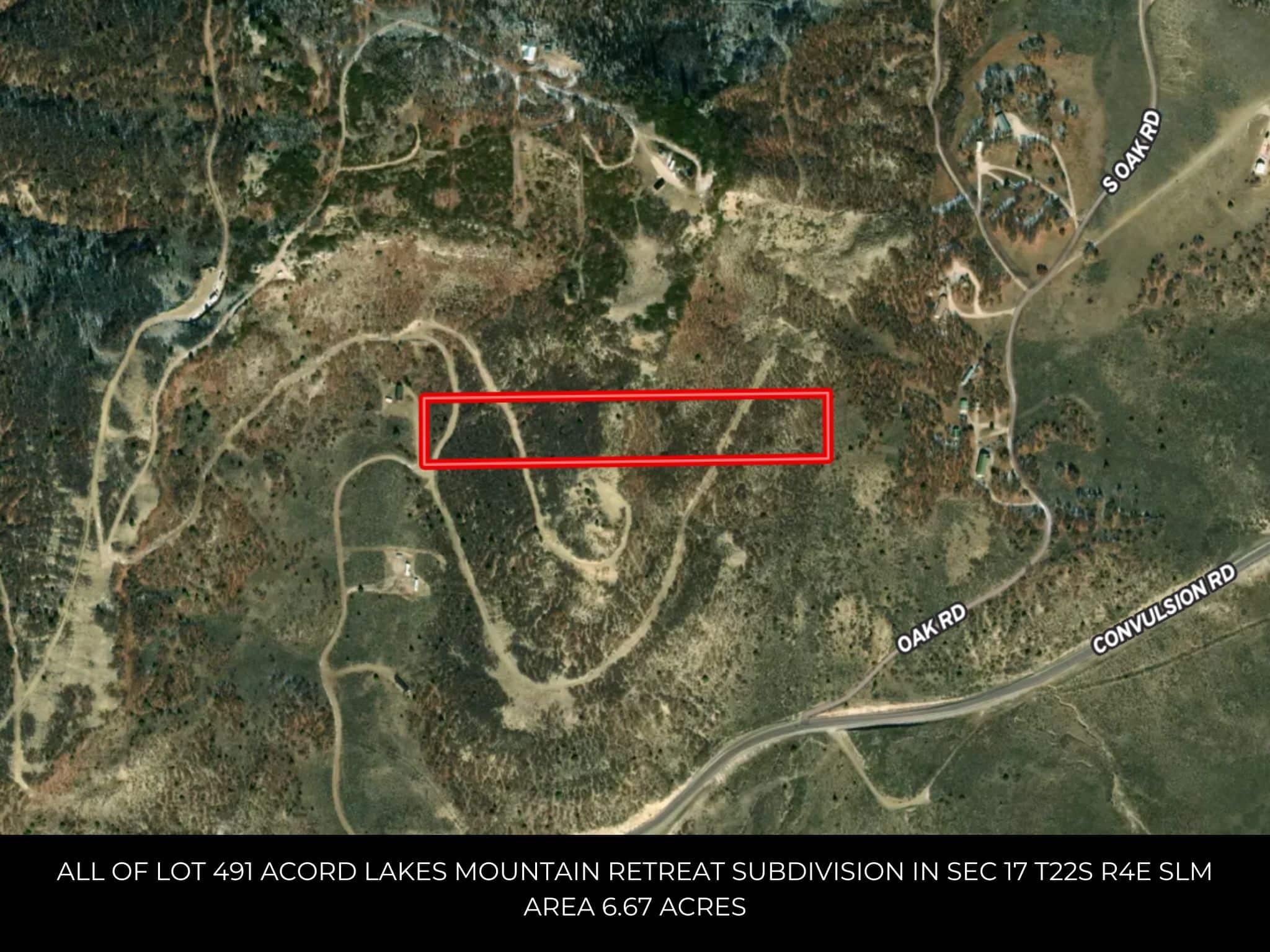
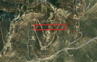
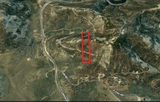
APN# 3-215-491
Payment
Payment Notes:
Warranty of Title: The property will be conveyed via a general warranty deed, guaranteeing you free and clear title to the property.
We accept Cash or 3rd party financing with a pre-approval letter.
We do not offer owner financing. No payment options are available for this property.
Paying a 3% Buyer's Agent Commission!
Property Description
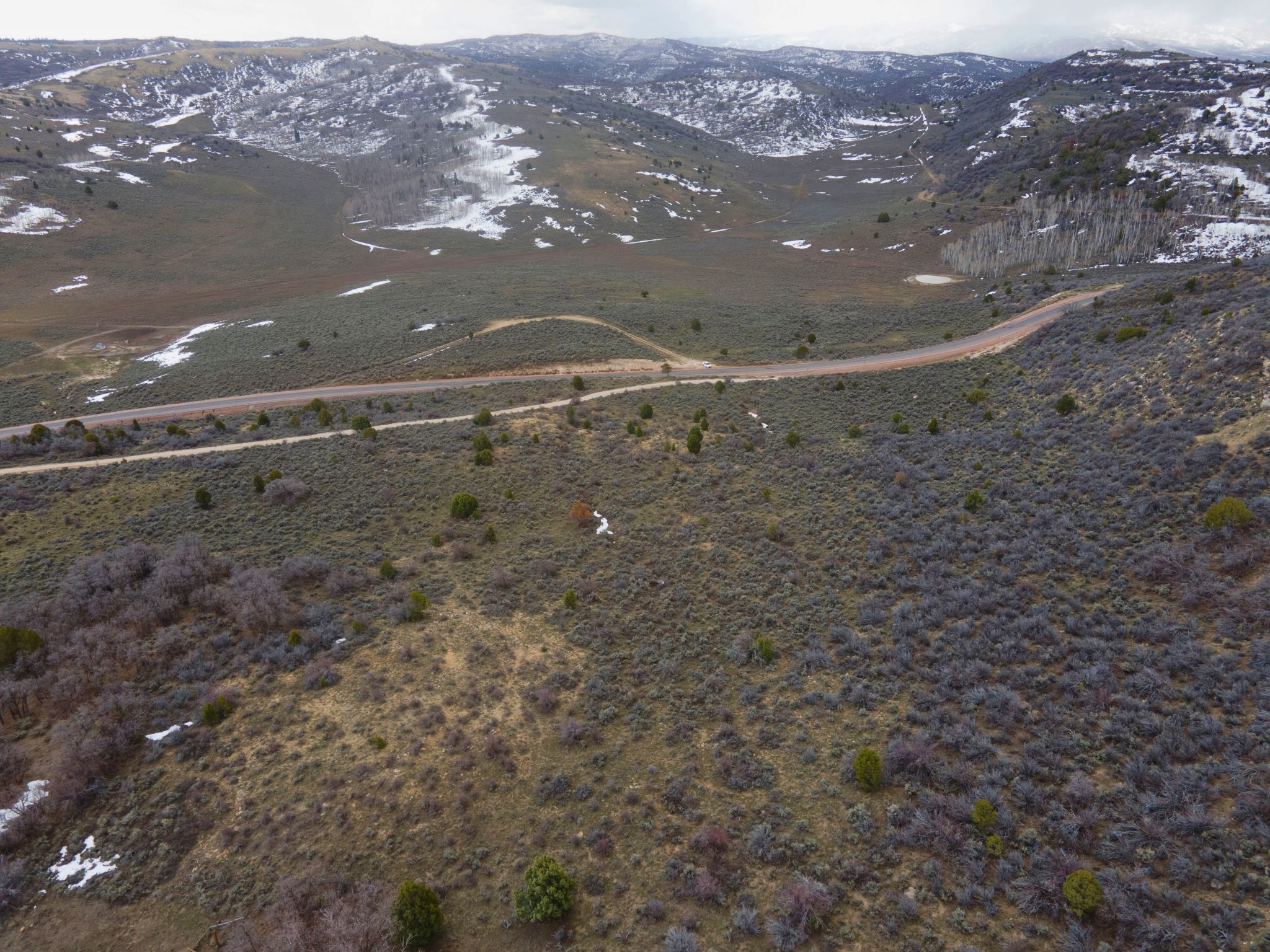
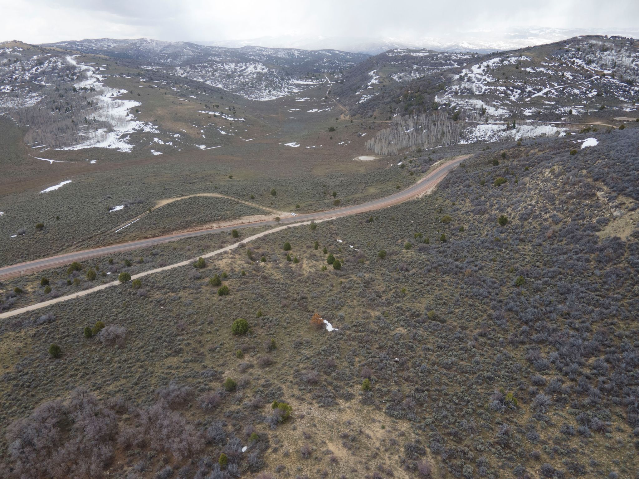
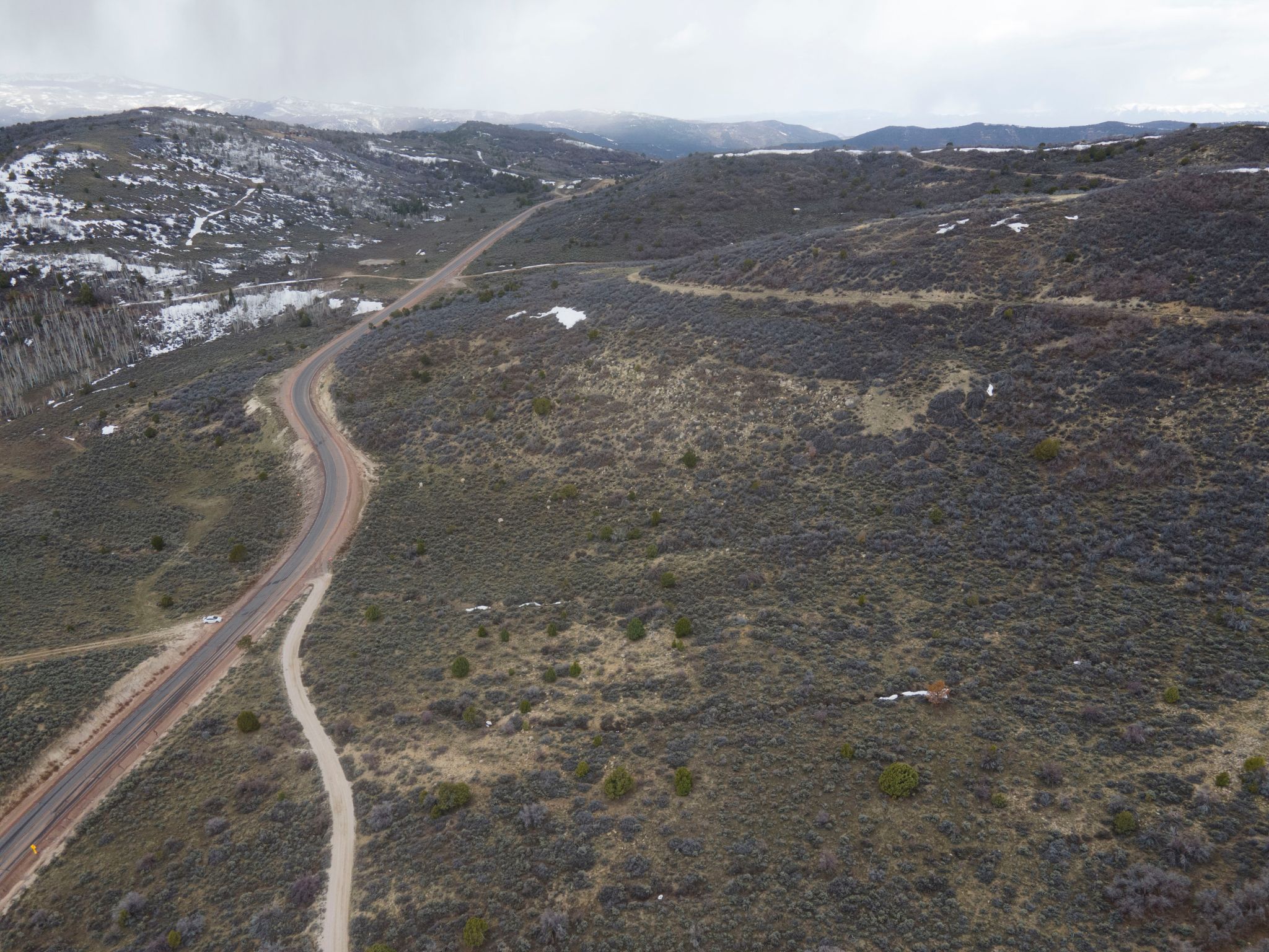
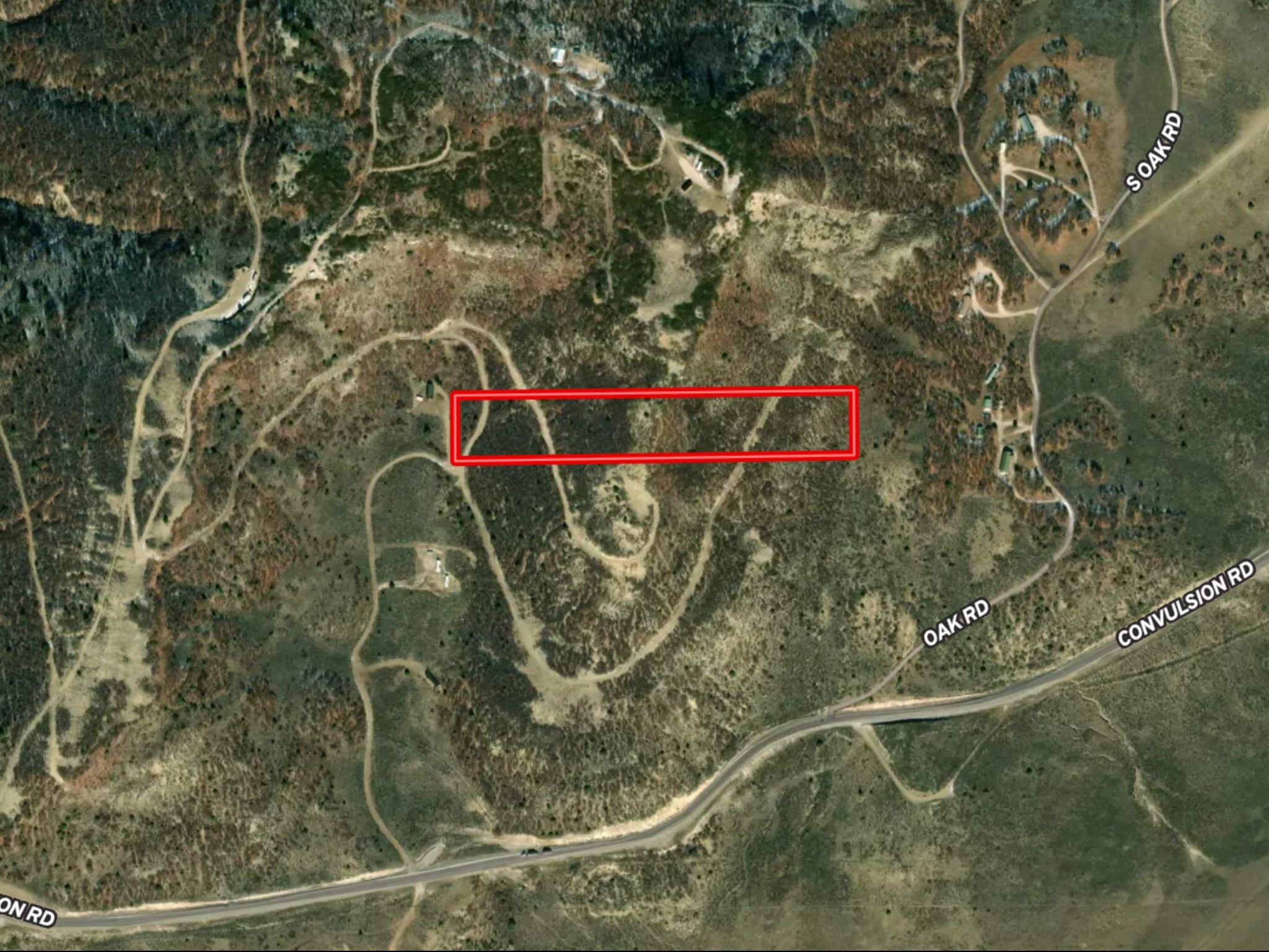
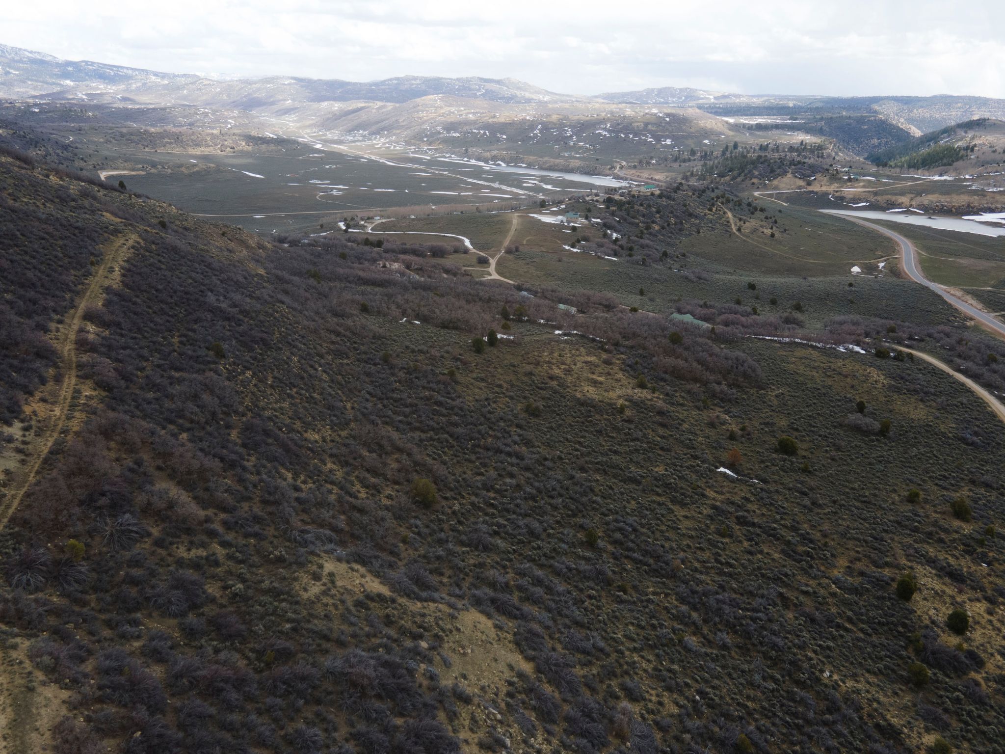
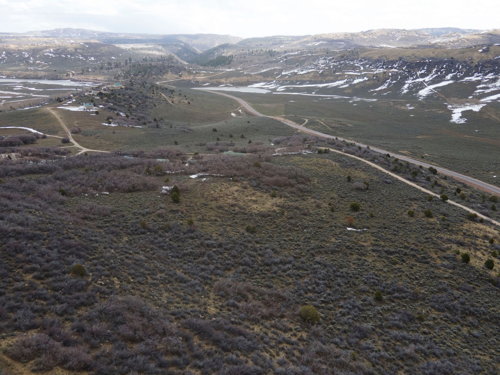
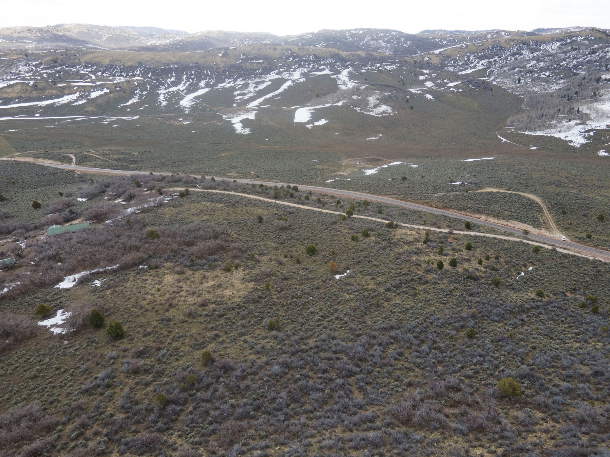
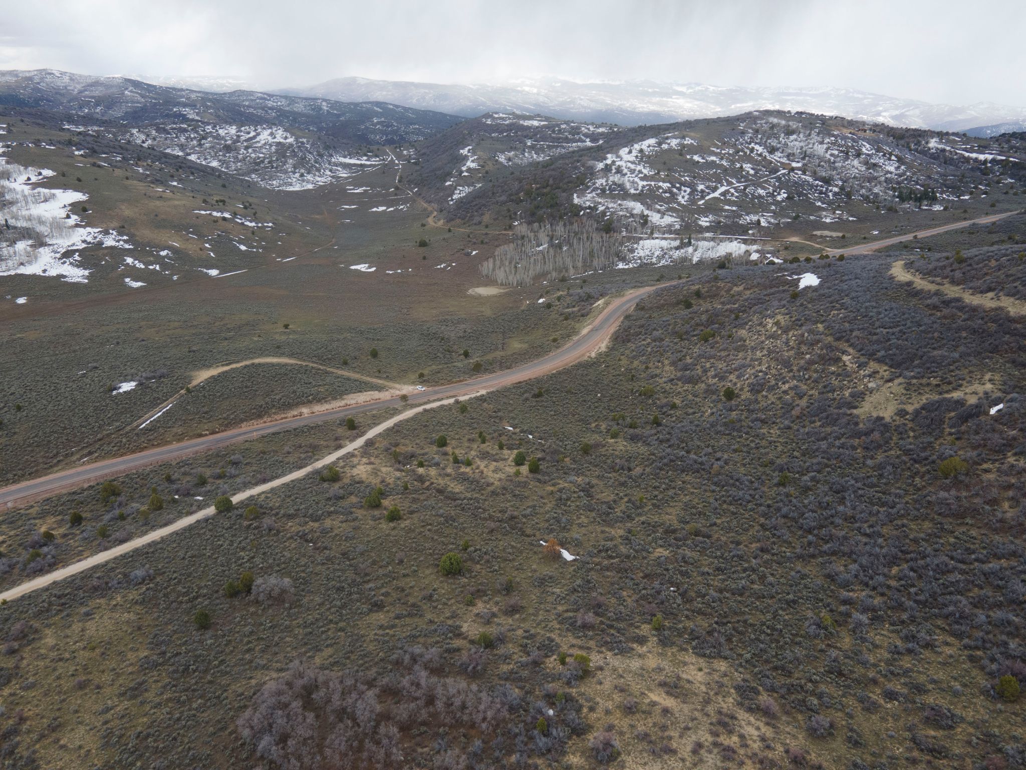
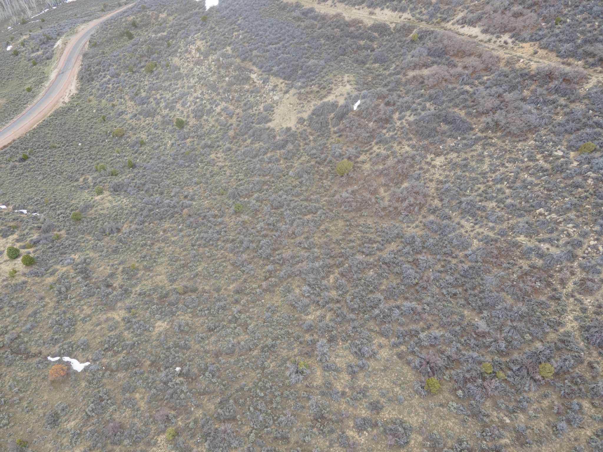
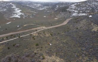
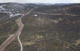
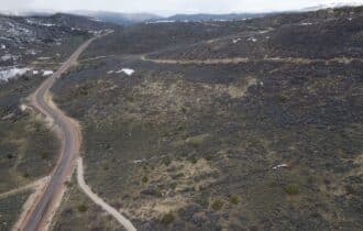
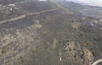
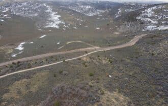
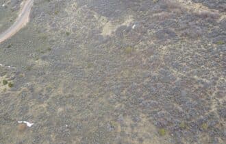
Be the king of your own hill on this 6.686-acre lot in central Utah! This property is 25 miles east
of Salina in a quiet neighborhood of mountain homes. Access is easy just ¾ mile off a paved
road, and with a driveway already in place, all you need to do is build your dream home and start
enjoying the quiet mountain lifestyle. Power is available within half a mile, and you will need a
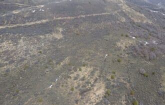
well or cistern for water. The terrain is sloped on both sides with a flat area for building at the top
of the hill, giving you million-dollar views in every direction.
Sevier County is quiet and remote – Salt Lake City is 165 miles away – but it has several unique
attractions for the perfect day trip. GG’s Marketplace is a general store in the small town of
Monroe, and it is worth the drive to get their daily fresh donuts and tamales. Take your kids or
your friends to Big Rock Adventure on the Sevier River for some classic team-building
challenges, or bring your inner tube and spend a lazy afternoon floating in the quiet water. Your
water activities do not have to end in the winter since Sevier County has two hot springs open to
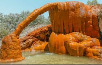
the public – Mystic Hot Springs and Red Hills Hot Springs – both near Monroe. Mystic Hot
Springs is well-developed and has a nominal entry fee, while Red Hills Hot Springs is primitive,
but is free.
You can own the best views in Central Utah and live right in the heart of some of the best
outdoor recreation in the state, but this 6.686-acre lot is competitively priced and will not last
long. Contact me today for more information.
Visiting the Property
You are welcome to visit the property at your convenience and anytime while it's still available. However, we HIGHLY recommend checking-in with us prior to visiting the property in case the property has gone under contract or already sold.
The interactive map above is generated with MapRight. MapRight has free apps for Apple IOS and Android that can be used to track your location and route throughout a property and provide driving directions.
MapRight for Apple –> Download App.
MapRight for Android –> Download App.
To launch the interactive map on your device, 1) install the free MapRight app using one of the two links above for Apple or Android, and 2) click the “View Full Screen” link (see above) in the embedded map on the property listing page.
Property Information
Parcel Size
6.686 Acre
State
Utah
County
Sevier
Nearest Cities
Salina, UT
Parcel #
3-215-491
Address
00 CONVULSION, SALINA, UT, 84654
Legal Description
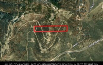
ALL OF LOT 491 ACORD LAKES MOUNTAIN RETREAT SUBDIVISION IN SEC 17 T22S R4E SLM AREA 6.67 ACRES
Zip Code
84654
Annual Property Taxes
$137.68
Ag Exemption
No
HOA
Yes
HOA per Year
None!
Survey Available
Yes
School District
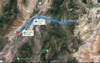
Sevier School District
Liens and Back Taxes
None!
Source Deed
Sent for Filing.
Title Status
Free & Clear!
Outgoing Conveyance
Warranty Deed
Property Features
Acres
6.686
Dimension
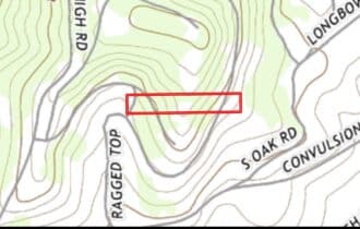
1313.91 feet X 217.78 feet
County
Sevier
Subdivision
Exists
Access
Easement
Power
Available
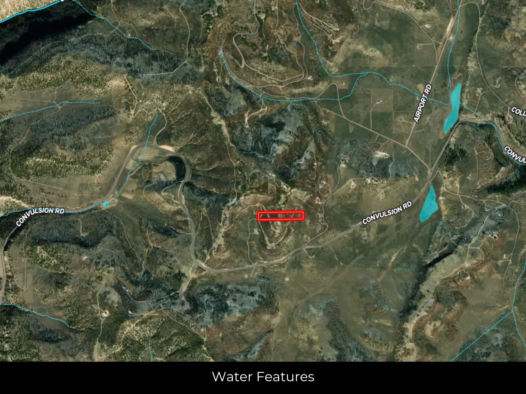
Water
Available
Coordinates
38.8978, -111.4902
Zoning
Residential Acreage
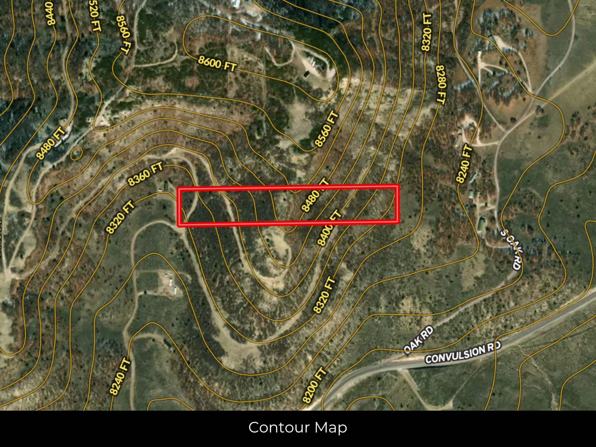
Elevation
8480 ft
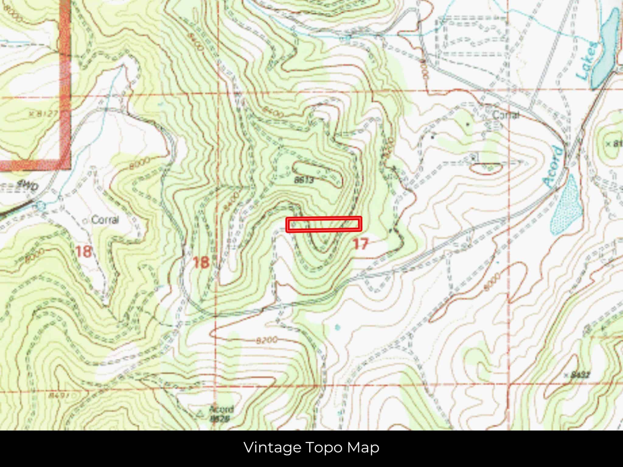
Terrain
Sloping
Floodplain
No
Duplexes
Yes – Permit
Mobiles
Yes – Permit
Tiny Homes
Yes – Permit
Barndominiums
Yes – Permit
RV's
Yes- Permit
Camping
Yes – Permit
Property Survey, HOA, & Additional Documents
Utilities
🔌 PowerRocky Mountain Power or Solar, wind, propane, or alternative energy source.
💧 Water: Utah Division of Water Rights or Water well, collection, hauling/delivery, or alternative.
🚽 Sewer: Central Utah Public Health or Septic or alternative sewer system.
☎️ Phone: cellular, VOIP (see internet below), and satellite phone through Iridium, Globalstar, or Inmarsat.
🌐 Internet: satellite internet through Starlink, HughesNet, or ViaSat.
📺 Cable: satellite cable through Dish or DirectTV.
Nearby Cities, Conveniences, and Attractions
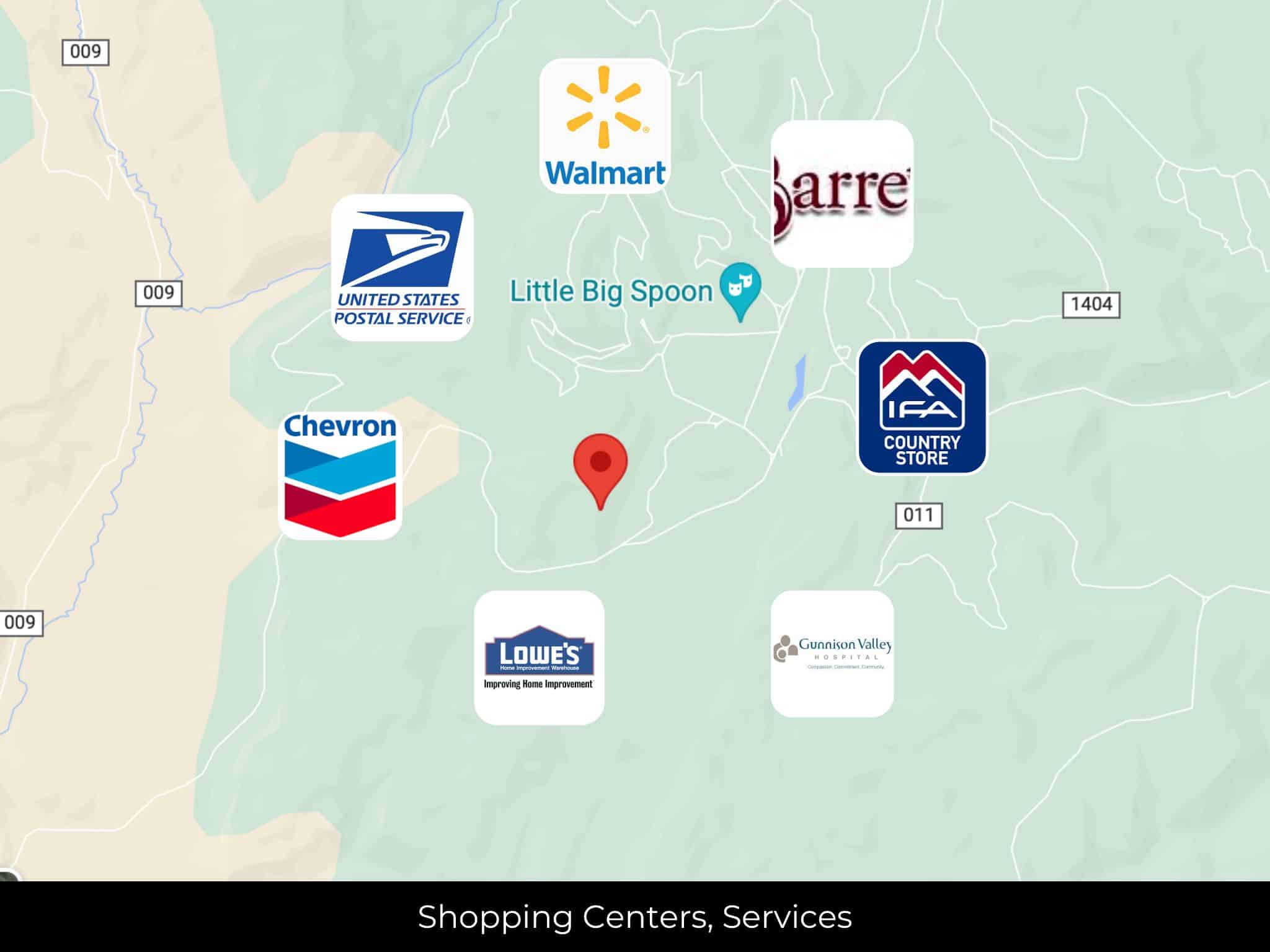
29 min (25.2 miles) to Miss Mary's Pioneer Museum (about)
29 min (25.3 miles) to Salina (about)
29 min (25.3 miles) to Barrett's Foodtown, Salina, UT (about)
30 min (25.9 miles) to Chevron, Salina, UT (about)
31 min (26.4 miles) to IFA Country Stores, Salina, UT (about)
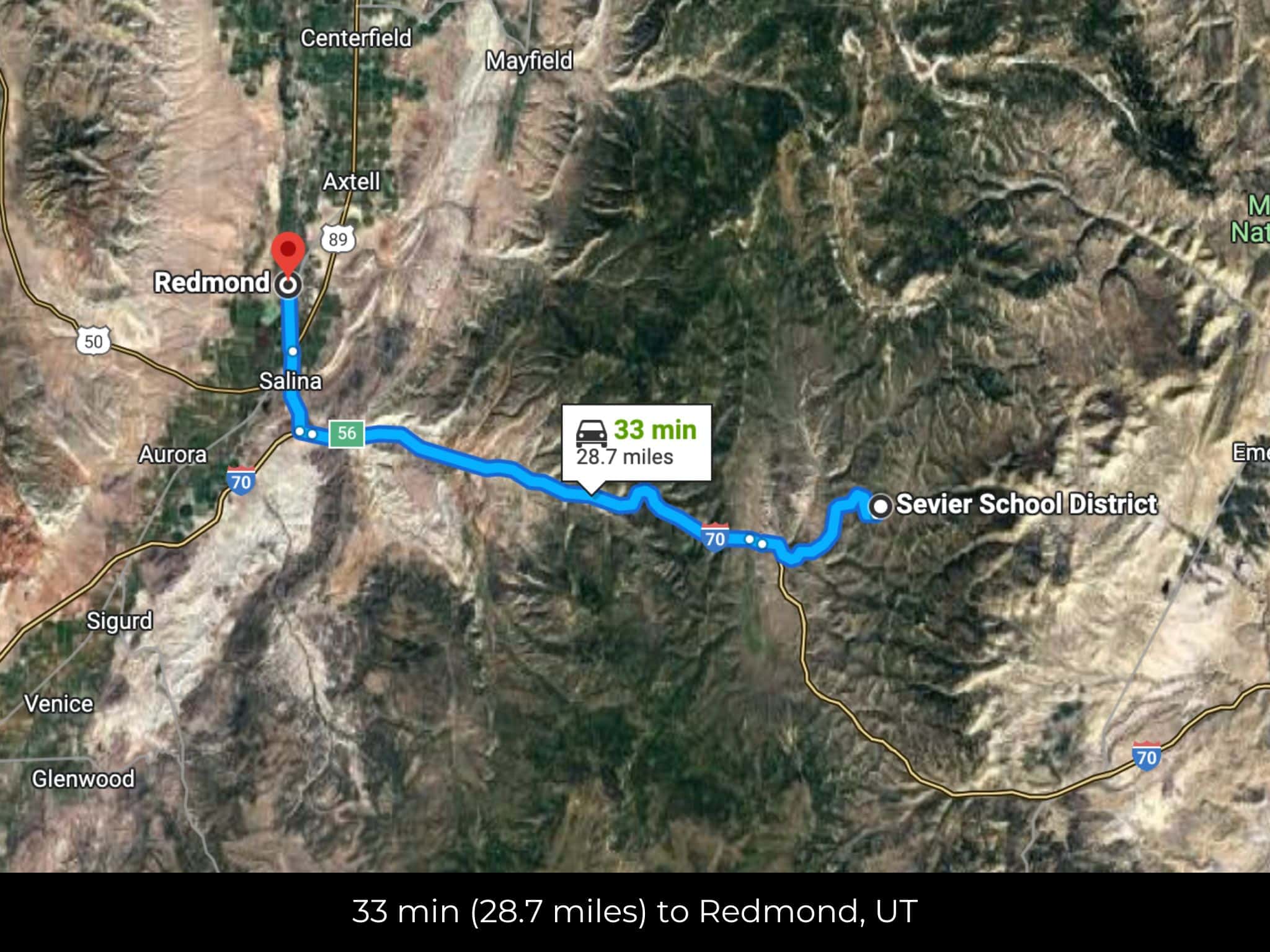
34 min (28.7 miles) to Redmond (about)
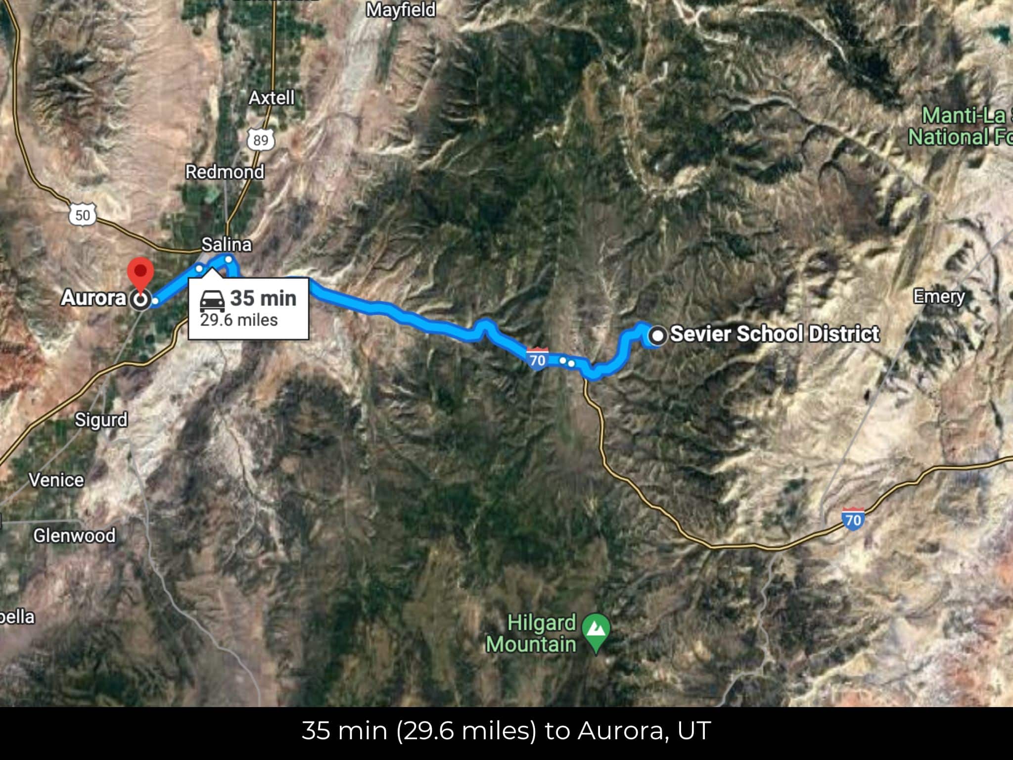
35 min (29.6 miles) to Aurora (about)
35 min (29.7 miles)to USPS, Aurora, UT (about)
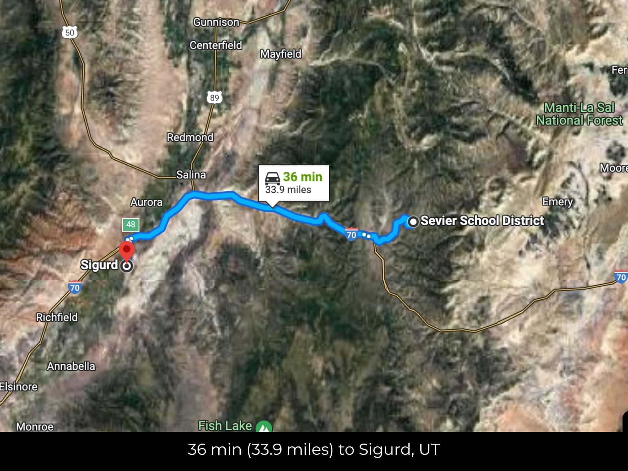
36 min (33.9 miles) to Sigurd (about)
39 min (22.3 miles) to Salina Canyon (about)
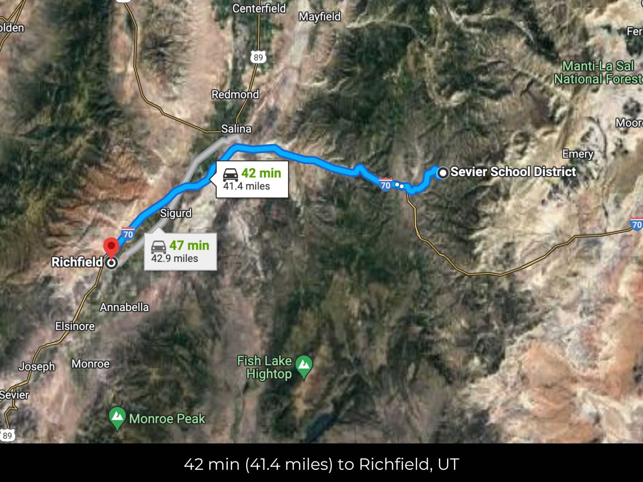
42 min (41.4 miles) to Richfield (about)
43 min (43.7 miles) to Home Depot, Richfield, UT (about)
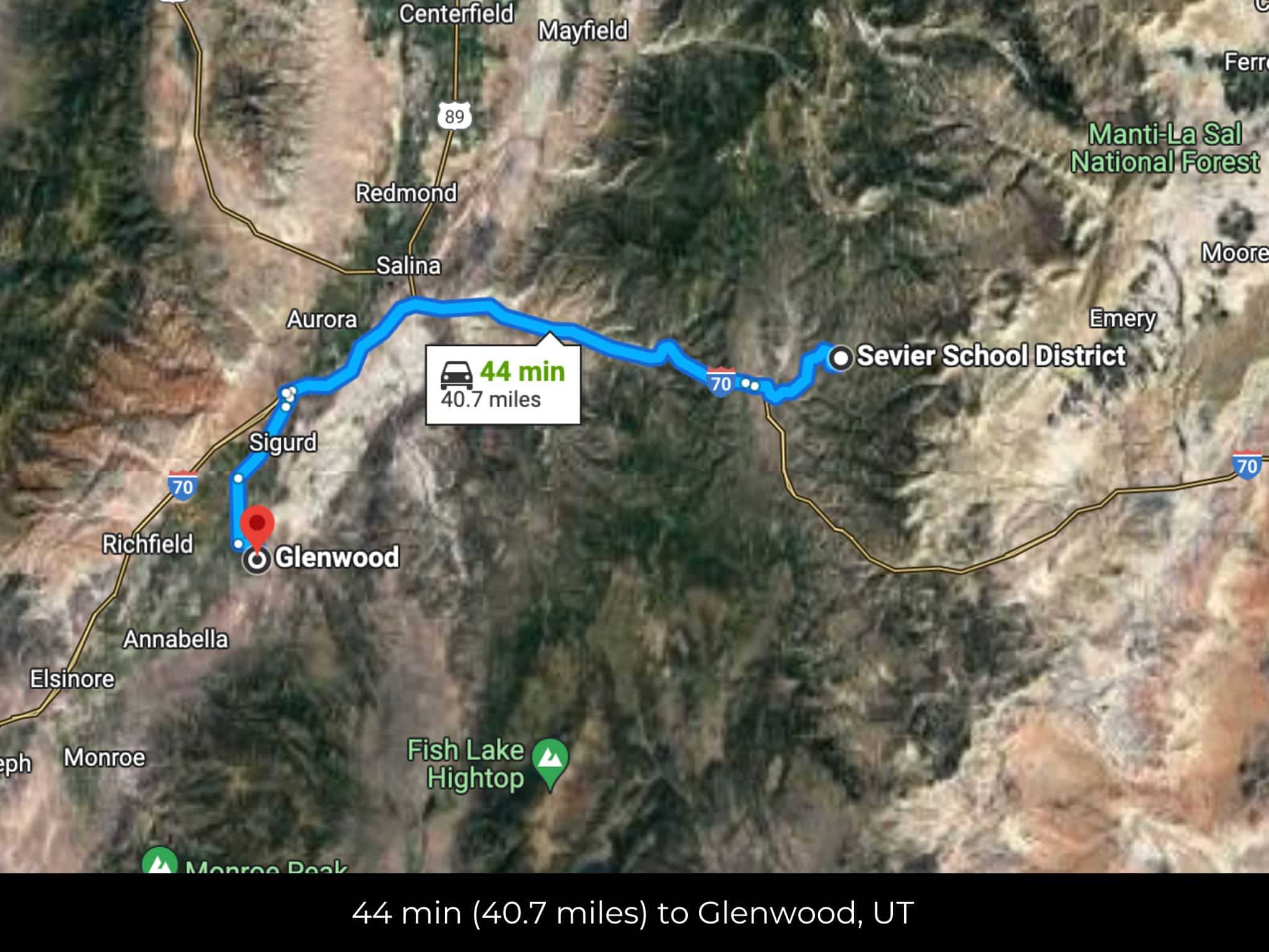
44 min (40.7 miles) to Glenwood (about)
44 min (39.3 miles) to Gunnison (about)
44 min (39.5 miles) to Gunnison Valley Hospital, Gunnison, UT (about)
45 min (44.4 miles) to Cove View Golf Course (about)
46 min (44.5 miles) to Walmart, Richfield, UT (about)
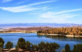
54 min (48.1 miles) to Palisade State Park (about)
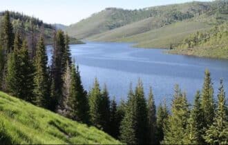
1 hr 10 min (67.2 miles) to Fish Lake (about)
2 hr 42 min (169 miles) to University of Utah (about)
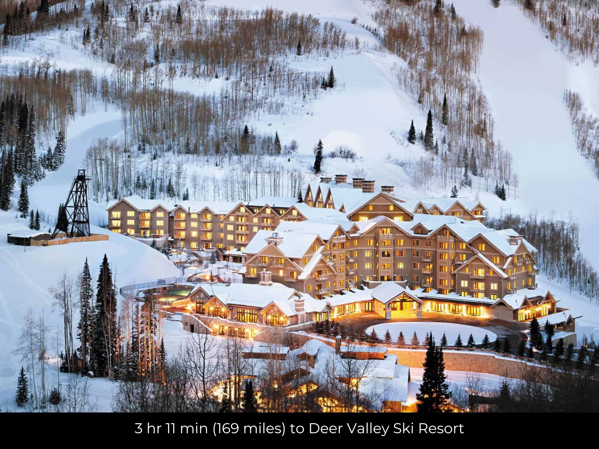
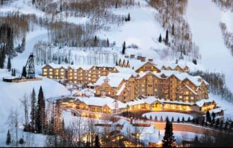
3 hr 11 min (169 miles) to Deer Valley Ski Resort (about)
56 min (53.3 miles) to Mystic Hot Springs (about)
County Contacts
Sevier County Assessor Amy Garren-Clark (435) 893-0434 (website)
Sevier County Treasurer Lindsey L. Hansen (435) 893-0441 (website)
Sevier County Clerk Steven C. Wall (435) 893-0401 (website)
Sevier County Zoning Jason Mackelprang (435) 893-0420 (website)
Sevier County Health Mike Willits (435) 893-9166 (website)
Sevier County CAD (website)
Sevier County GIS (website)
Closing Costs and Fees
$299
Document Prep Fee
Buyer will pay a $299 document preparation fee, which includes all postage and county recording fees. Seller will warrant title to the property.
$0
In-House Closing Fee
There will be no additional fees or expenses for an in-house closing. We will close in 14 days or less. This is the fastest, easiest, and cheapest way to close.
$1,500+
Title Company Fees*
Title Company costs are typically 2-5% of the purchase price with a minimum fee of around $1,500. Many states have legislated, standard insurance rates and other fees vary by the title company.
* If Buyer elects to close through a third-party title company, Buyer will bear all closing costs and expenses, including Seller’s title policy and Seller's escrow fees. Closing through a title company typically takes 30-45 days, depending on the county, title company, and transaction activity in the area.
Driving Directions and GPS Coordinates
🚗 Driving Directions: Head southwest on W Ragged Top toward Convulsion Rd 0.3 mi, Turn right onto Convulsion Rd 6.1 mi, Turn right to merge onto I-70 W 16.8 mi Take exit 56 for US-50 W/US-89 N toward I-70 BL/Salina 0.4 mi, Turn right onto US-50 W/US-89 N/S State St
📍 Northwest Corner: 38.8979, -111.4926 (Google Map)
📍 Northeast Corner: 38.8979, -111.4882 (Google Map)
📍 Southeast Corner:38.8975, -111.4882 (Google Map)
📍 Southwest Corner:38.8975, -111.4926 (Google Map)
📍 Center Point:38.8978, -111.4902 (See embedded Google Map below 👇.)
Google Map
If you click the blue Directions link below, 👇 you can get Google turn-by-turn directions to the property on any device. The map coordinates for the Google Map below are for the approximate center of the property and not the entrance, gate, or primary access point for the property. Google Maps may provide driving directions that require the use of private or abandoned roads or may require you to go through gates located on private property. Do not trespass on private property! Some properties will require a 4-wheel drive vehicle or may be inaccessible in certain weather conditions. Please don't get stuck or lost.
Additional Notes
As-Is and As-Available: This property is being sold property “as-is” and “as-available.” No representations as to fitness for a particular purpose have been made. No verbal claims or promises have been made. Please see our Terms of Service for more information.
Contract: After making your initial deposit, we will email you the purchase and sale agreement, which includes a warranty deed. Agreements are prepared manually and will be sent out Monday through Friday between 9 AM and 5 PM CST. Thank you for your patience.
No Monthly Payments: We are not offering seller financing on this property. This is an all-cash transaction. We are not offering a payment plan. If you would like to finance your purchase of the property, please contact a third-party lender prior to making your deposit. We will not sign a purchase and sale agreement that is contingent upon third-party financing without a pre-approval letter.
3% Buyer's Agent Commission: You are not required to have an agent or broker assist you with purchasing this property. However, if the Buyer does use an agent, and the Seller is made aware of this prior to an agreement on price or signed contract, the Seller will pay a 3% commission to the Buyer's licensed agent or broker.
Maps and GPS Coordinates: Maps and GPS coordinates are believed to be accurate, but accuracy is not guaranteed. The information contained in the maps should not be considered a “legal description,” and the maps and GPS coordinates are not a replacement for a survey. We have taken reasonable steps to ensure that parcel lines, maps, and coordinates are in fact accurate, but third-party geographical information system (GIS) providers, including information from the county, often contain errors and inaccuracies.