


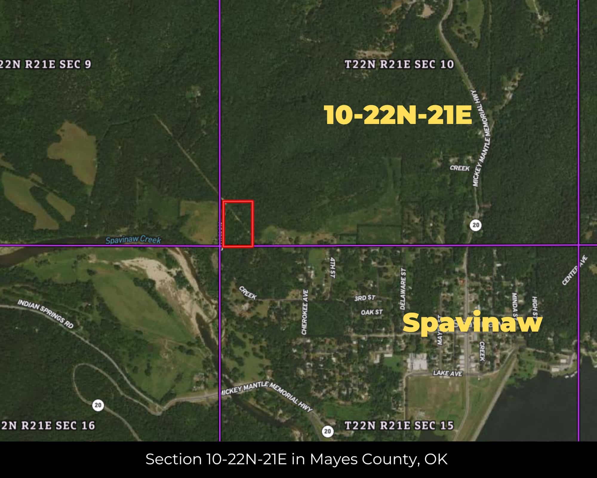


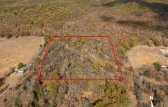


7 Unrestricted Acres on Spavinaw Creek – Rolling Ozark Terrain, Power Available, Mayes County OK
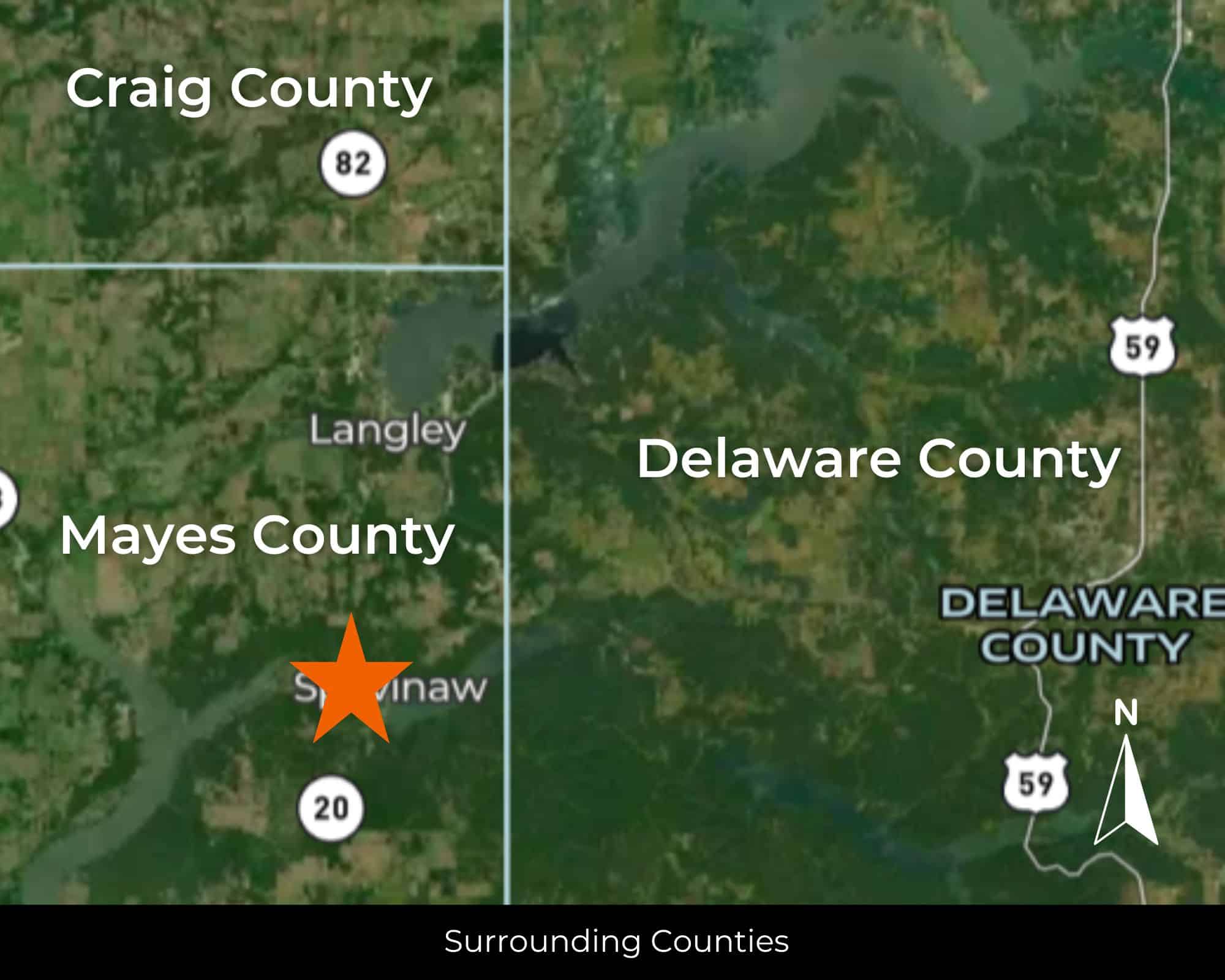
5 Miles from Spavinaw, OK
APN# 0000-10-22N-21E-3-004-00
Payment
Payment Notes:
Warranty of Title: The property will be conveyed via a general warranty deed, guaranteeing you free and clear title to the property.
We accept Cash or 3rd party financing with a pre-approval letter.
We do not offer owner financing. No payment options are available for this property.
Paying a 3% Buyer's Agent Commission!
Property Description
Where the Ozarks Meet the Prairie
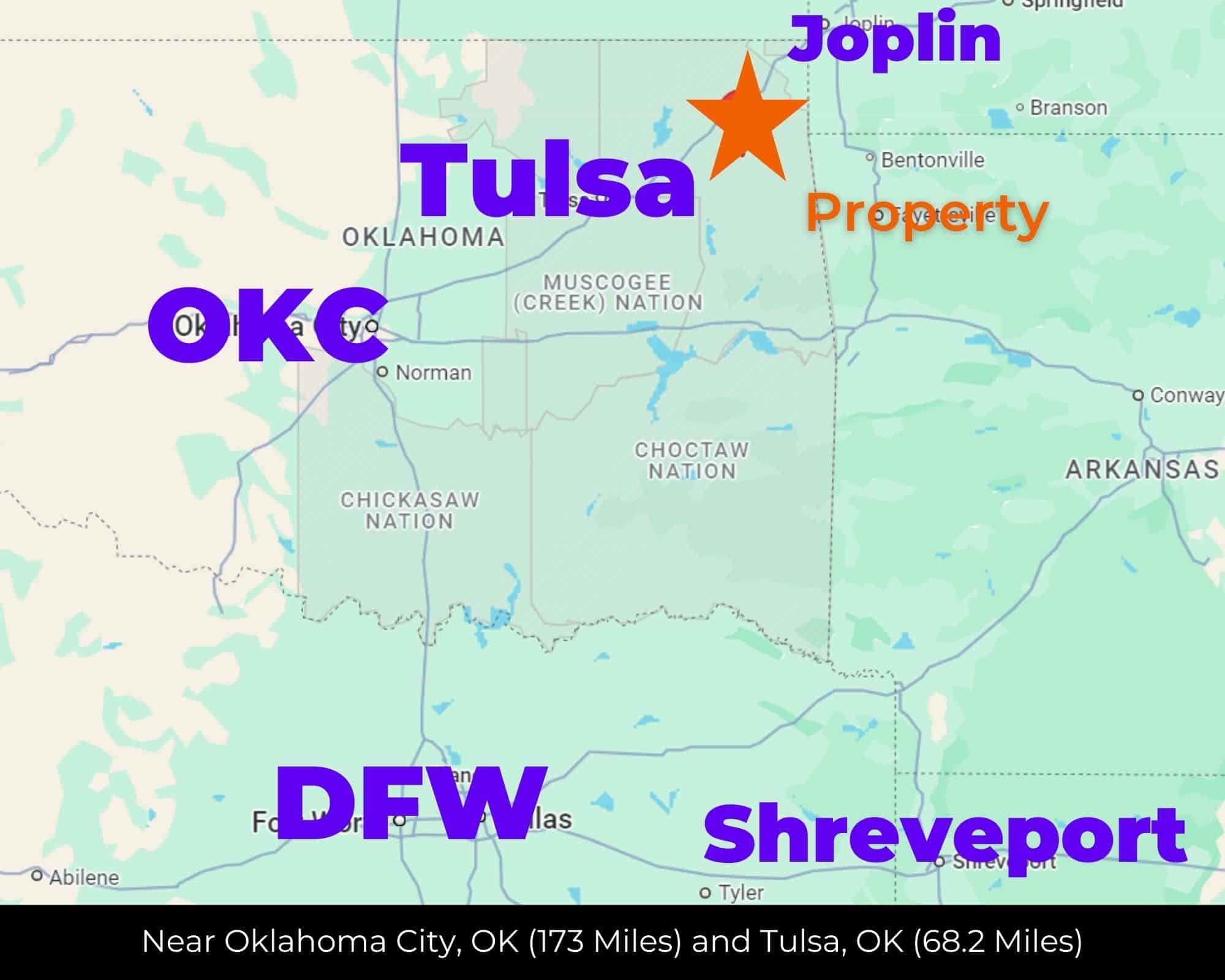
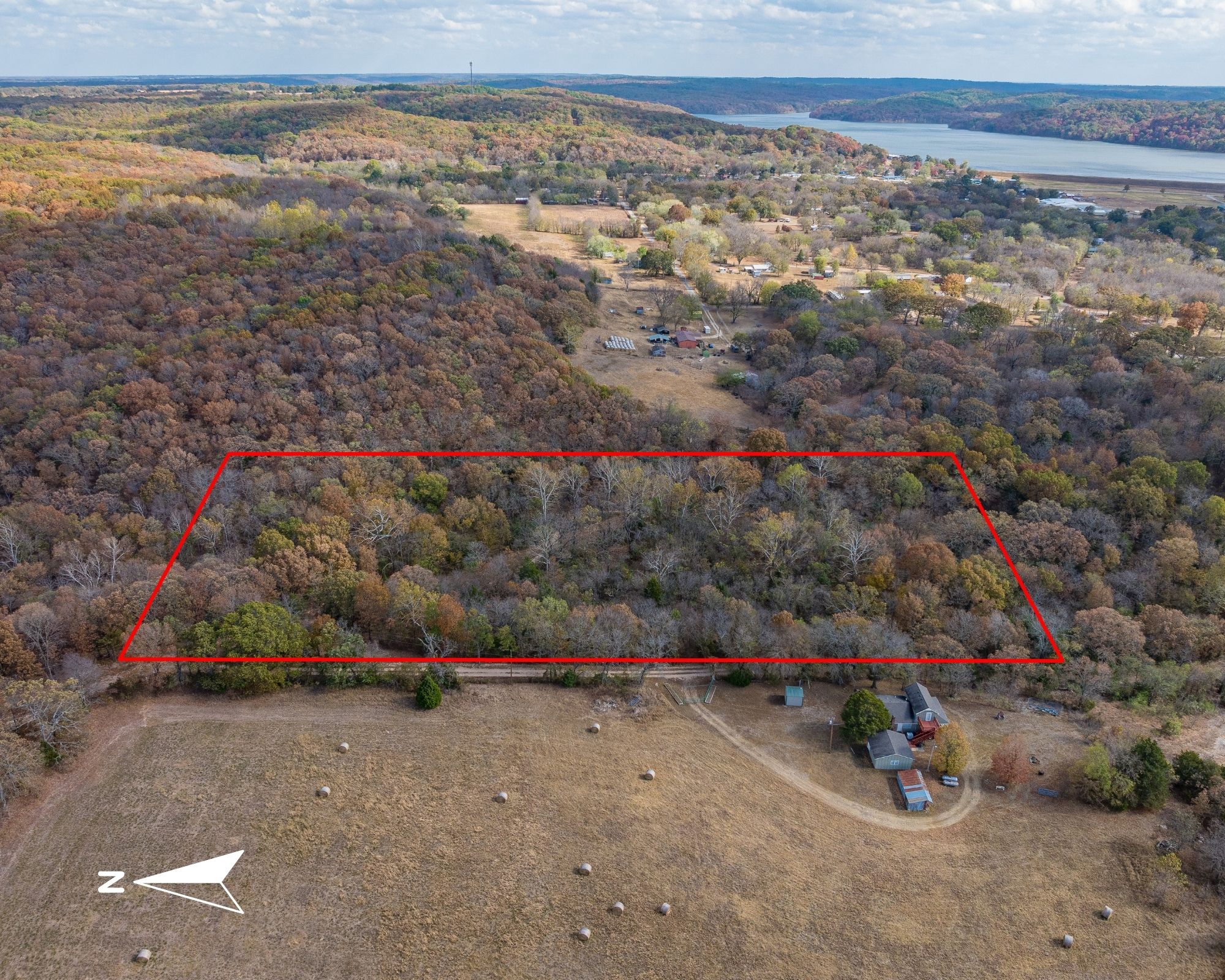
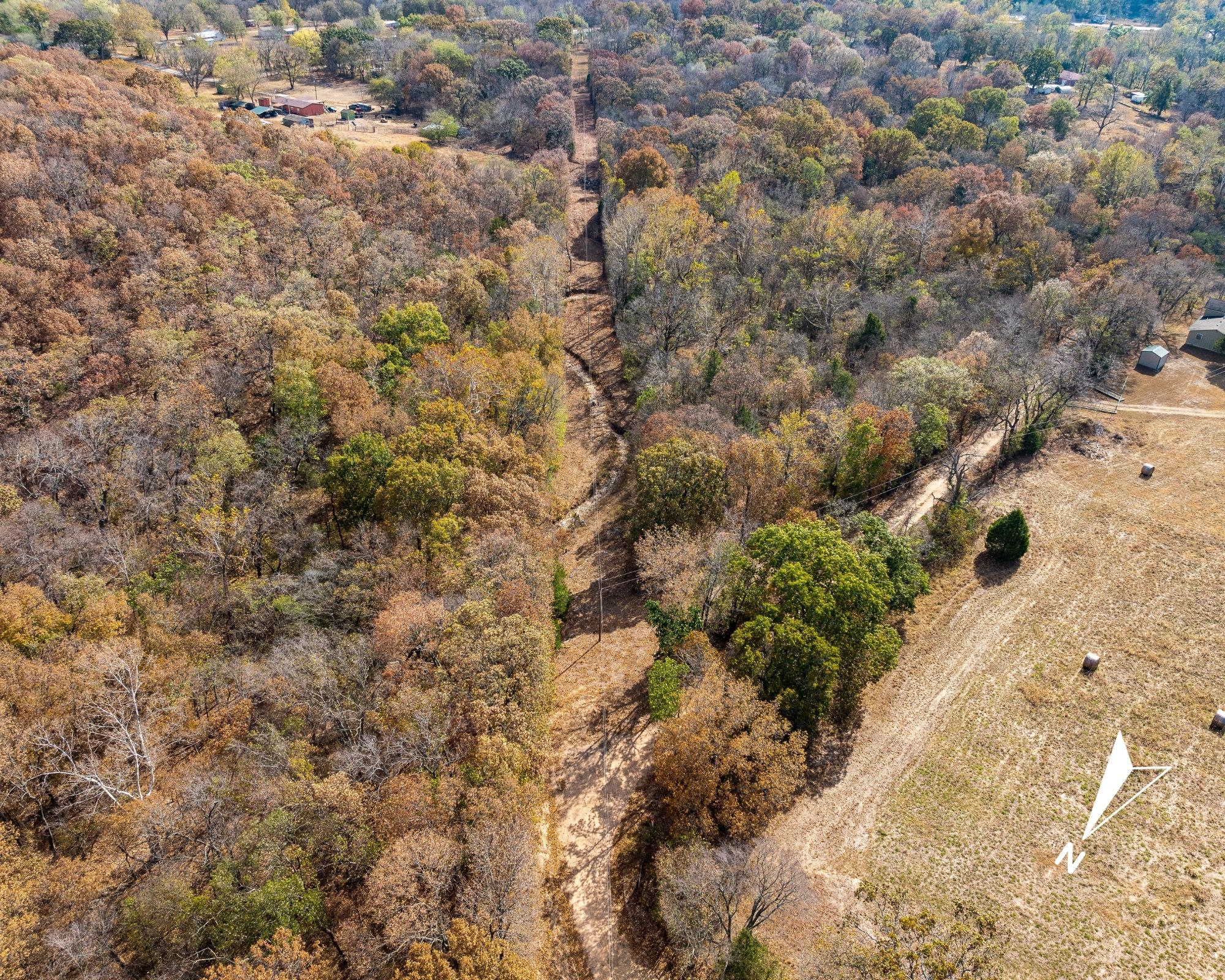
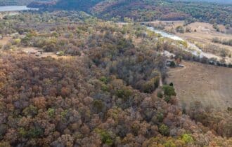
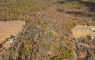
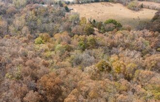
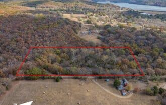
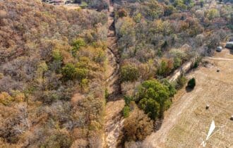
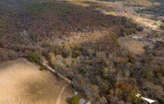
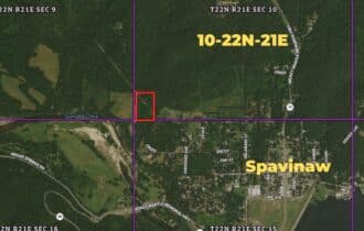
This is the kind of ground that feels like it's been waiting for someone. Seven acres of rolling Ozark foothills in northeastern Mayes County, just five miles from Spavinaw—Mickey Mantle's hometown—with a seasonal creek winding through the property and power already at the road.
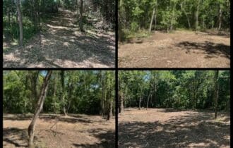
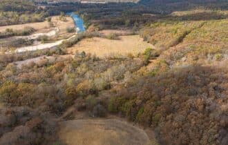
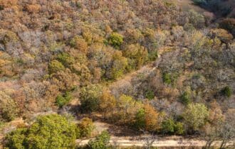
The terrain rolls and drops the way the Ozark fringe does in this part of Oklahoma, where the Cherokee Plains give way to the dissected plateau. Oak and hickory dominate the higher ground, with the bottomland vegetation thickening along the creek corridor. At 654 feet of elevation, you're sitting on the western edge of the Ozark Highlands—the same rough, timbered country that makes up the nearby 14,000-acre Spavinaw Wildlife Management Area, known for whitetail, turkey, squirrel, and rabbit.
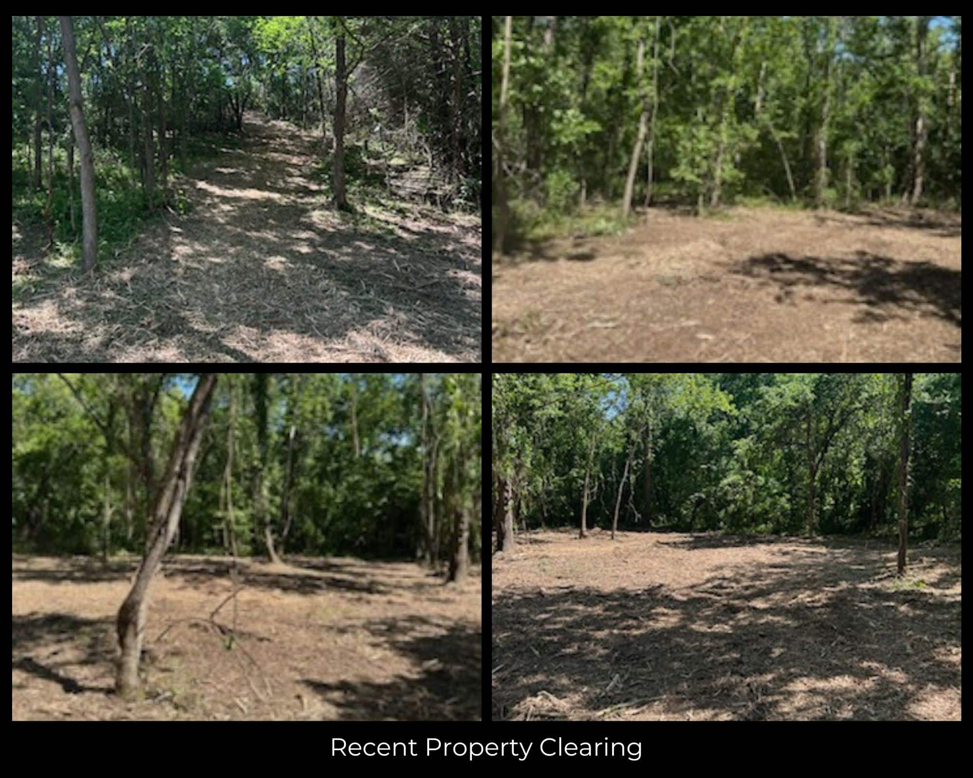
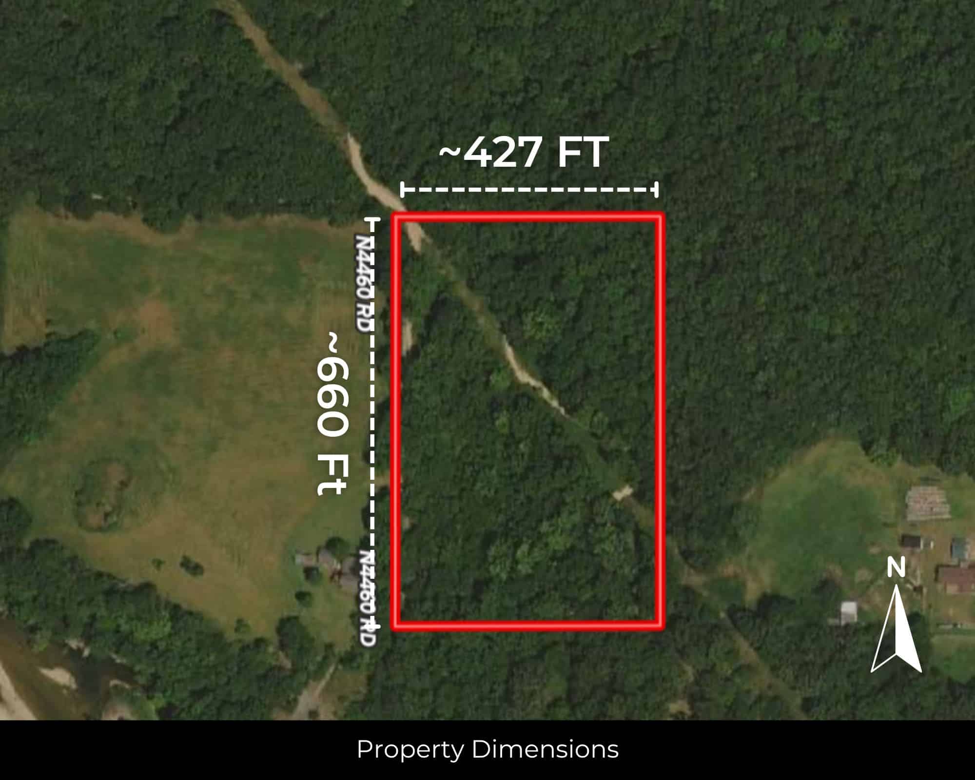
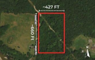
The property is completely unrestricted. Cabin, barndominium, mobile, tiny home, RV—whatever you want to build, you can build. The dimensions are roughly 660 by 427 feet, giving you room to site a structure on the high ground while keeping the creek bottom wild. No HOA. No floodplain. Annual taxes run about $90.
Grand Lake o' the Cherokees—46,500 surface acres of bass, crappie, and catfish water—is about 15 miles northeast. Lake Spavinaw and Lake Eucha are even closer, both known for exceptional bluegill fishing and quiet shorelines. Spavinaw State Park is just down the road. Tulsa is an hour west. You're close enough to get what you need, far enough to forget about it when you don't.
This is where the Ozarks begin and the prairie ends. The oaks turn wine-colored in spring—that's where the town got its name, from the French traders who came through in the 1700s. Cherokee families settled this creek after the Trail of Tears. The ground has been walked a long time.
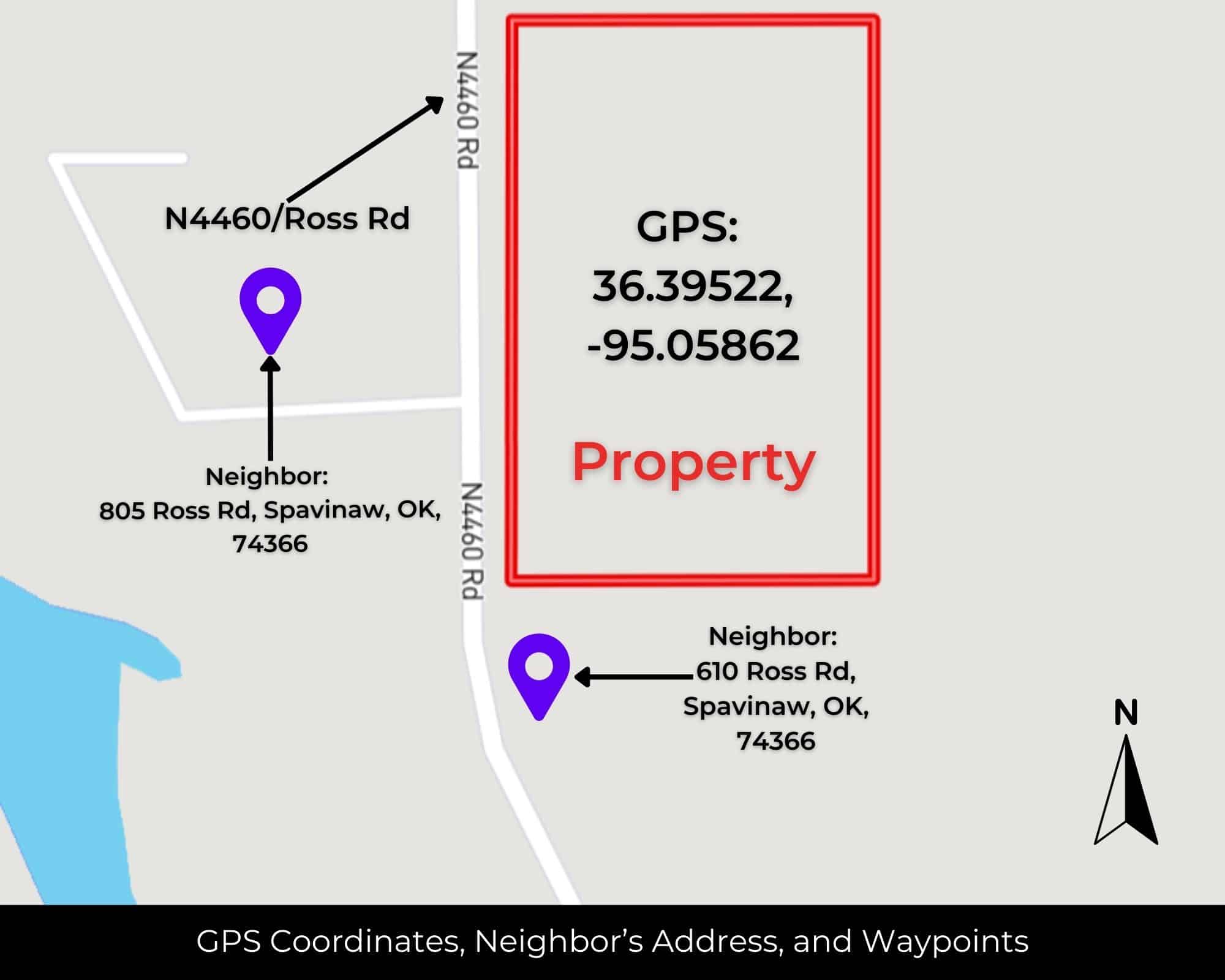
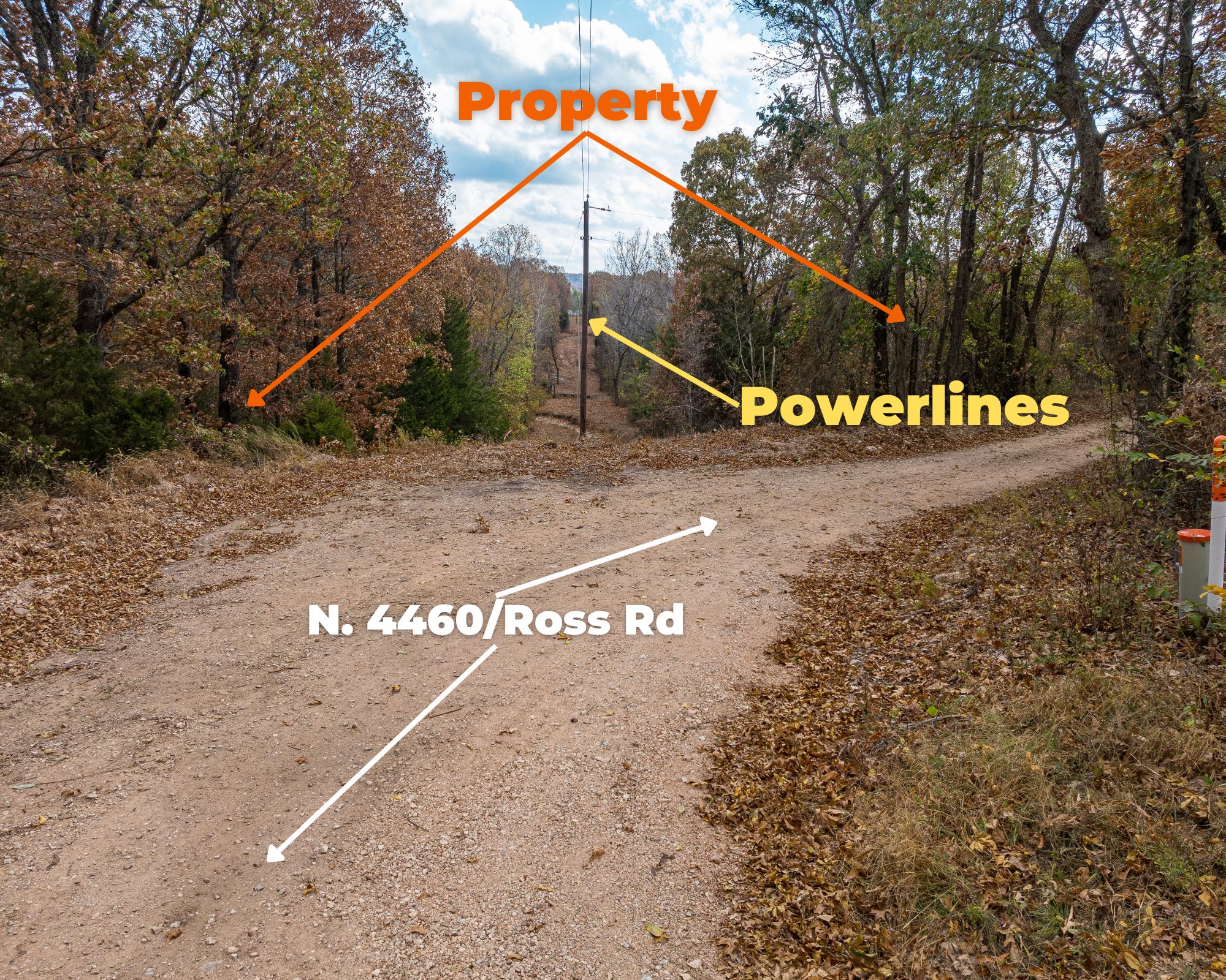
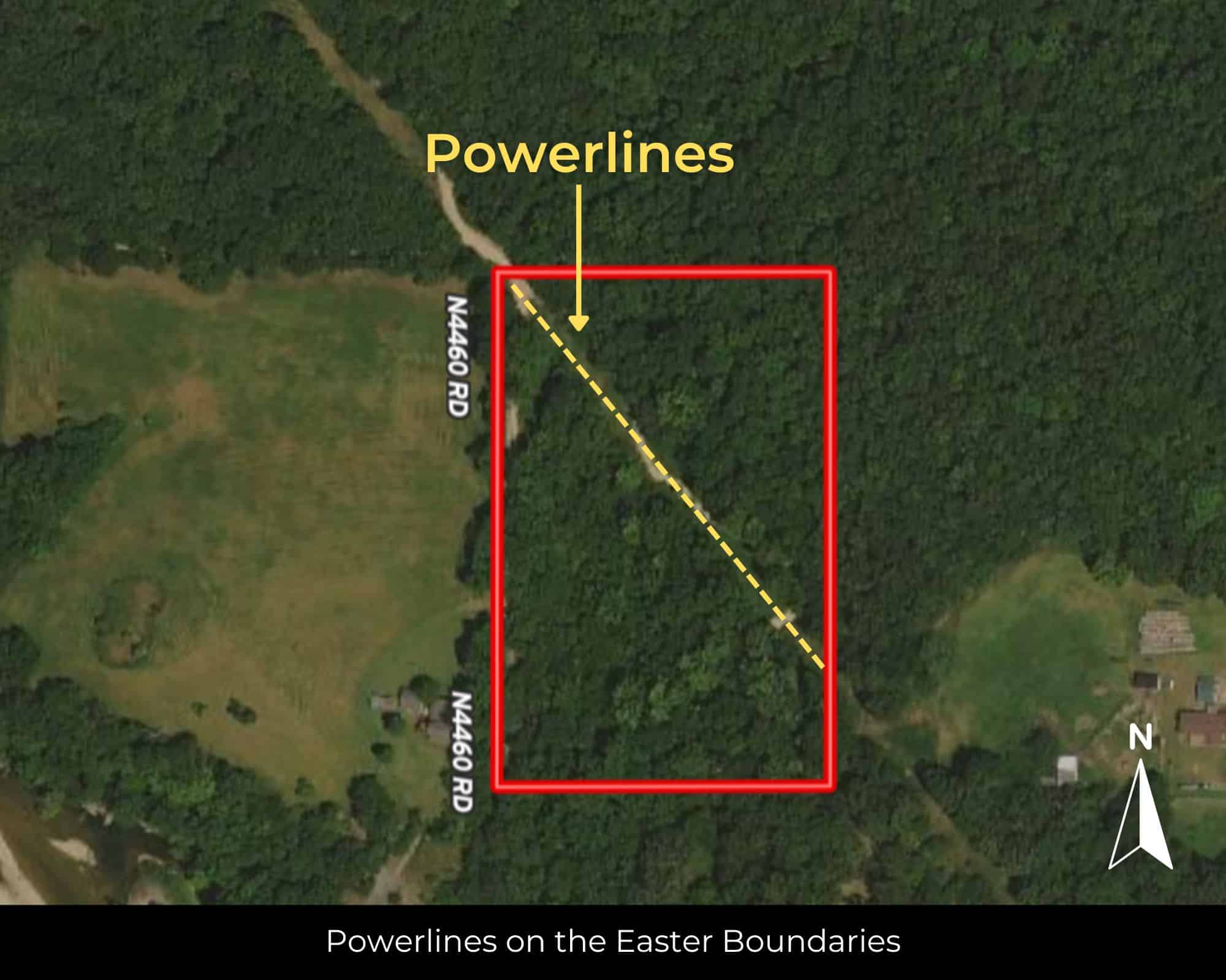
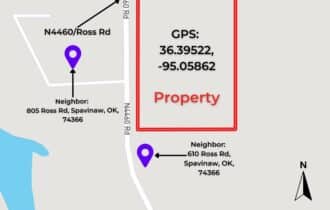
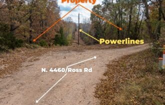
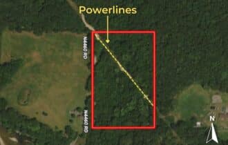
Dirt road access off N4460 Road. Power available through Grand River Dam Authority. Well required for water; septic for sewer. Starlink covers the area if you need to stay connected. Warranty deed. Survey not included.
Weekend deer camp, off-grid cabin, place to park the camper and disappear for a while—this is the kind of small acreage that lets you do what you want without asking permission. Call or text 855-833-5263 to get the details or schedule a walkthrough.
Quick Facts
7 Acres, Creek, No Restrictions, Power at the Road
7 unrestricted acres in northeastern Mayes County, OK—5 miles from Spavinaw. Dimensions approximately 660′ x 427′. Rolling Ozark foothills terrain with seasonal creek on property. Elevation 654 ft; no floodplain. Oak-hickory timber typical of the Ozark Plateau fringe. Power available at the road through GRDA; well and septic required. Mobiles, tiny homes, RVs, barndominiums, and camping all permitted—no HOA, no restrictions. Annual taxes $90. Dirt road access via N4460 Rd. Grand Lake o' the Cherokees 15 miles NE; Spavinaw State Park and Lakes Spavinaw/Eucha nearby. Spavinaw WMA (14,000+ acres, whitetail, turkey, squirrel) within 10 miles. Tulsa 55 miles SW. Warranty deed; survey not included. GPS: 36.39522, -95.05862. APN: 0000-10-22N-21E-3-004-00. Call or text 855-833-5263.
Visiting the Property
You are welcome to visit the property at your convenience and anytime while it's still available. However, we HIGHLY recommend checking-in with us prior to visiting the property in case the property has gone under contract or already sold.
The interactive map above is generated with MapRight. MapRight has free apps for Apple IOS and Android that can be used to track your location and route throughout a property and provide driving directions.
MapRight for Apple –> Download App.
MapRight for Android –> Download App.
To launch the interactive map on your device, 1) install the free MapRight app using one of the two links above for Apple or Android, and 2) click the “View Full Screen” link (see above) in the embedded map on the property listing page.
Property Information
Parcel Size
7 Acres
State
Oklahoma
County
Mayes County
Nearest Cities
Spavinaw, OK
Parcel #
0000-10-22N-21E-3-004-00
Address
00 N4460 Rd, Spavinaw, OK 74366
Legal Description
10-22N-21E 1283/1003 W429'SWSWSW
Zip Code
74366
Annual Property Taxes
$90
Agricultural Tax Exemption
No
HOA
No
HOA per Year
None!
Survey Available
No
School District
Spavinaw Public School District
Liens and Back Taxes
None!
Source Deed
Sent for Filing.
Title Status
Free & Clear!
Outgoing Conveyance
Warranty Deed
Property Features
Acres
7
Dimension
660 FT x 427 FT
County
Mayes County
Access
Dirt Road
Power
Available
Water
Well Required, Rain Harvesting, or Alternative
Coordinates
36.39522, -95.05862
Zoning
Rural
Elevation
654 FT
Terrain
Rolling
Floodplain
None
Duplexes
Yes
Mobiles
Yes
Tiny Homes
Yes
Barndominiums
Yes
RV's
Yes
Camping
Yes
Utilities
🔌 Power: Grand River Damn Authority
💧 Water: Water well, collection, hauling/delivery, or alternative.
🚽 Sewer: Septic or alternative sewer system.
☎️ Phone: Landline, Cellular, VOIP (see internet below), and satellite phone through Iridium, Globalstar, or Inmarsat.
🌐 Internet: Satellite internet through Starlink, HughesNet, or ViaSat.
📺 Cable: Satellite cable through Dish or DirectTV.
County Contacts
County Assessor: (918) 825-0625
County Treasurer: (918) 825-0160
County Recorder: (918) 825-2426
County Health: (918) 825-4224
Closing Costs and Fees
$299
Document Prep Fee
Buyer will pay a $299 document preparation fee, which includes all postage and county recording fees. Seller will warrant title to the property.
$0
In-House Closing Fee
There will be no additional fees or expenses for an in-house closing. We will close in 14 days or less. This is the fastest, easiest, and cheapest way to close.
$1,500+
Title Company Fees*
Title Company costs are typically 2-5% of the purchase price with a minimum fee of around $1,500. Many states have legislated, standard insurance rates and other fees vary by the title company.
* If Buyer elects to close through a third-party title company, Buyer will bear all closing costs and expenses, including Seller’s title policy and Seller's escrow fees. Closing through a title company typically takes 30-45 days, depending on the county, title company, and transaction activity in the area.
Driving Directions and GPS Coordinates
🚗 Driving Directions: Take Tulsa Ave to OK-20 W/State Hwy 82 S/N Main St, Head south toward Tulsa Ave, Turn right at the 1st cross street onto Tulsa Ave, Turn left at the 1st cross street onto OK-20 W/State Hwy 82 S/N Main St, Take Cherokee Ave and Cr to N4460 Rd
📍 Center Point: 36.39522, -95.05862 (See embedded Google Map below 👇.)
Google Map
If you click the blue Directions link below, 👇 you can get Google turn-by-turn directions to the property on any device. The map coordinates for the Google Map below are for the approximate center of the property and not the entrance, gate, or primary access point for the property. Google Maps may provide driving directions that require the use of private or abandoned roads or may require you to go through gates located on private property. Do not trespass on private property! Some properties will require a 4-wheel drive vehicle or may be inaccessible in certain weather conditions. Please don't get stuck or lost.
Additional Notes
As-Is and As-Available: This property is being sold property “as-is” and “as-available.” No representations as to fitness for a particular purpose have been made. No verbal claims or promises have been made. Please see our Terms of Service for more information.
Contract: After making your initial deposit, we will email you the purchase and sale agreement, which includes a warranty deed. Agreements are prepared manually and will be sent out Monday through Friday between 9 AM and 5 PM CST. Thank you for your patience.
No Monthly Payments: We are not offering seller financing on this property. This is an all-cash transaction. We are not offering a payment plan. If you would like to finance your purchase of the property, please contact a third-party lender prior to making your deposit. We will not sign a purchase and sale agreement that is contingent upon third-party financing without a pre-approval letter.
3% Buyer's Agent Commission: You are not required to have an agent or broker assist you with purchasing this property. However, if the Buyer does use an agent, and the Seller is made aware of this prior to an agreement on price or signed contract, the Seller will pay a 3% commission to the Buyer's licensed agent or broker.
Maps and GPS Coordinates: Maps and GPS coordinates are believed to be accurate, but accuracy is not guaranteed. The information contained in the maps should not be considered a “legal description,” and the maps and GPS coordinates are not a replacement for a survey. We have taken reasonable steps to ensure that parcel lines, maps, and coordinates are in fact accurate, but third-party geographical information system (GIS) providers, including information from the county, often contain errors and inaccuracies.