

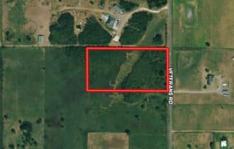


SOLD: Perfect 4.974 Acre Ranchette Just Outside an Idyllic Small Town
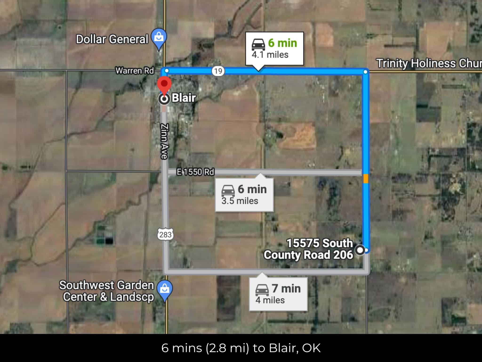
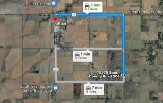
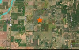
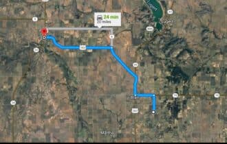
6 min (4.1 miles) to Blair, OK
APN# 0945-00-000-020-0-000-00
Payment
Payment Notes:
Warranty of Title: The property will be conveyed via a general warranty deed, guaranteeing you free and clear title to the property.
We accept Cash or 3rd party financing with a pre-approval letter.
We do not offer owner financing. No payment options are available for this property.
Paying a 3% Buyer's Agent Commission!
Property Description
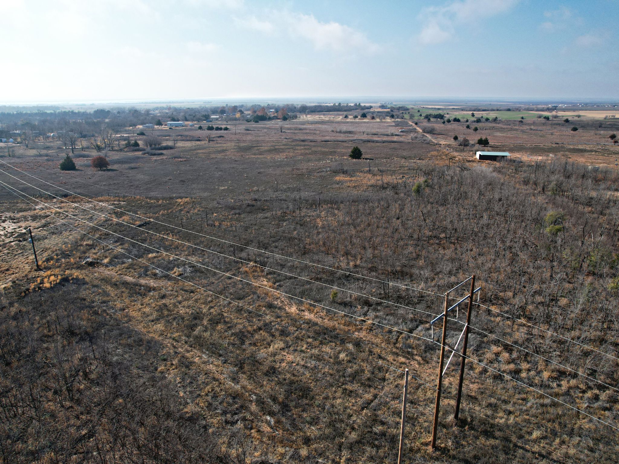
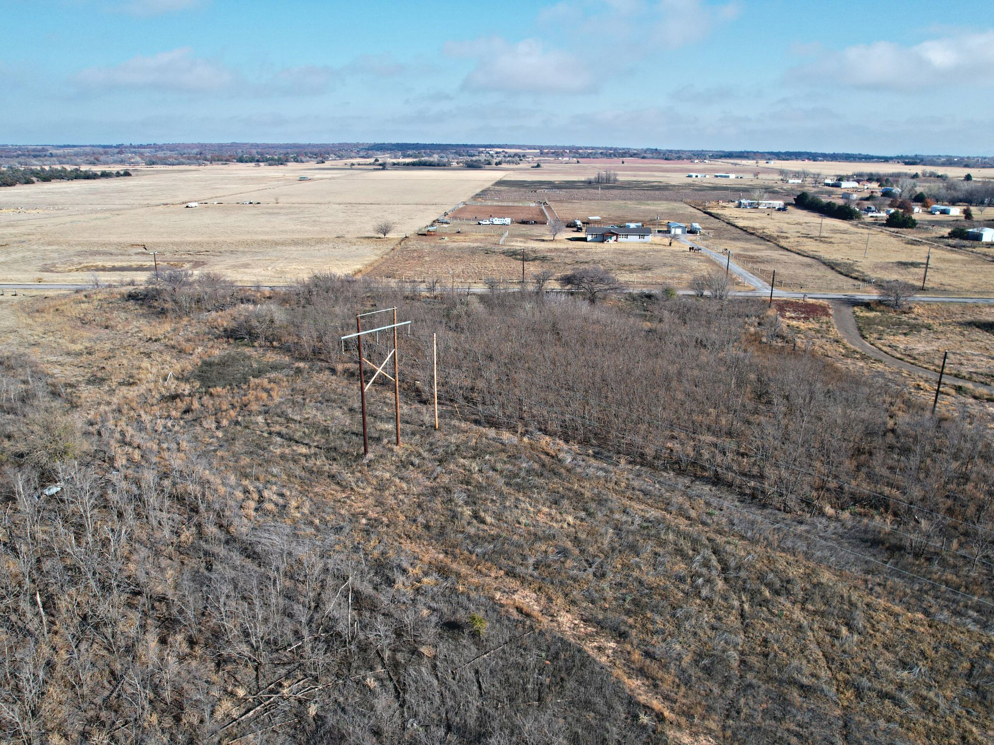
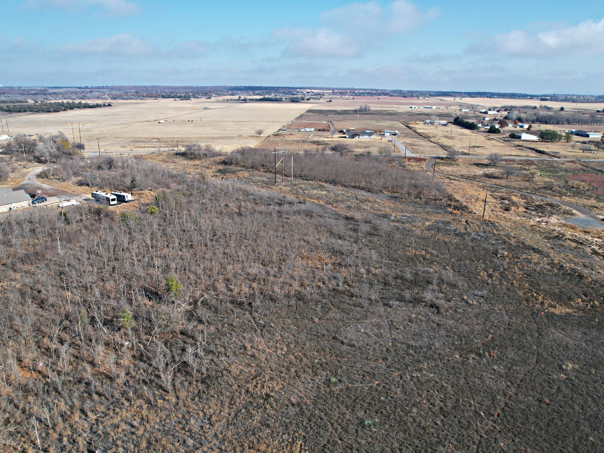
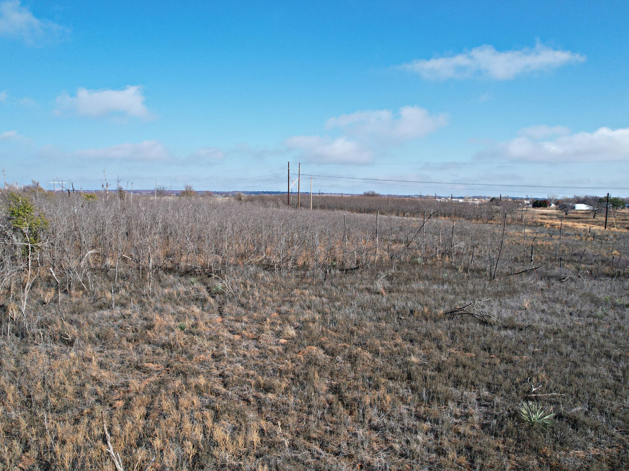
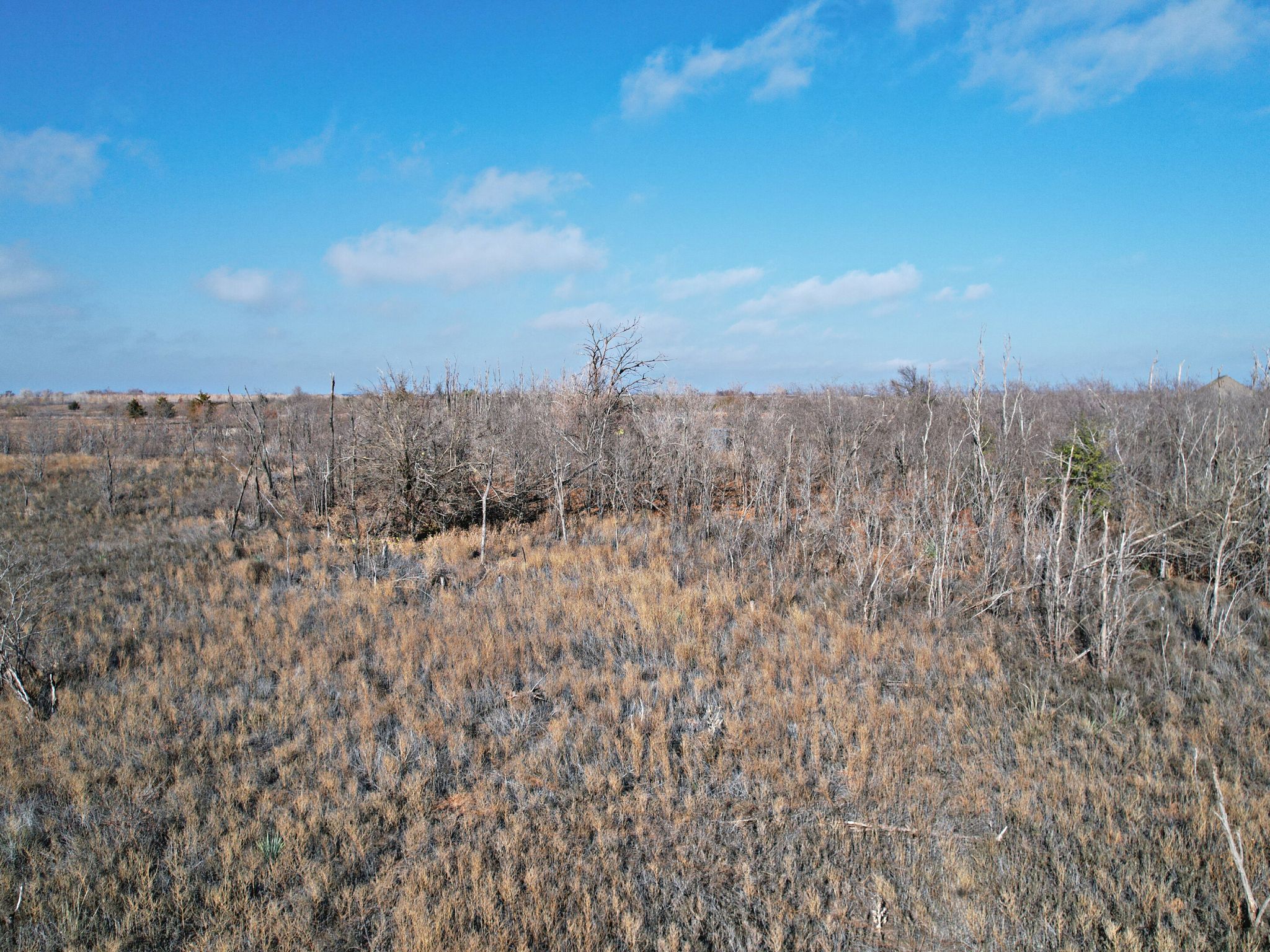
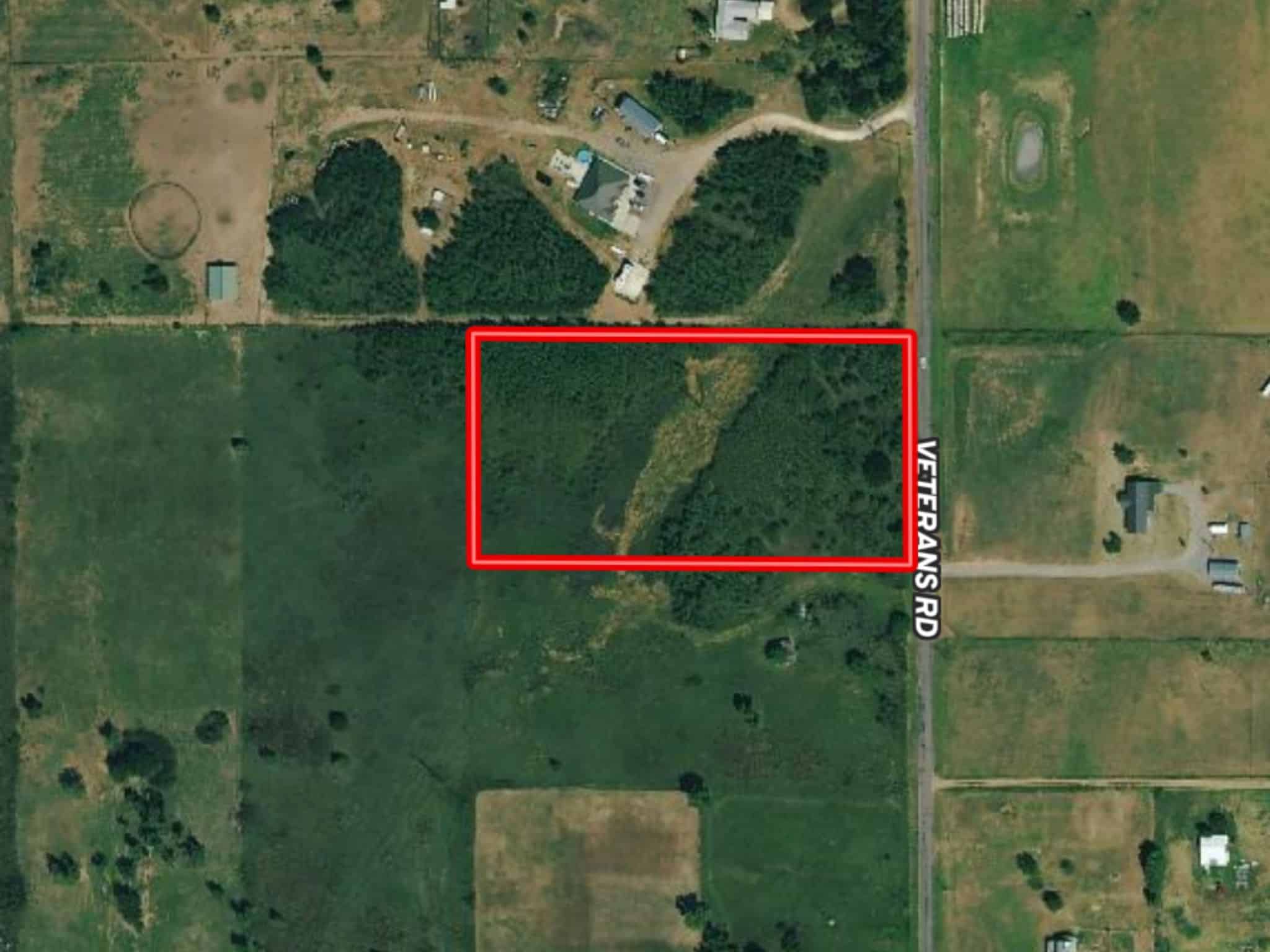
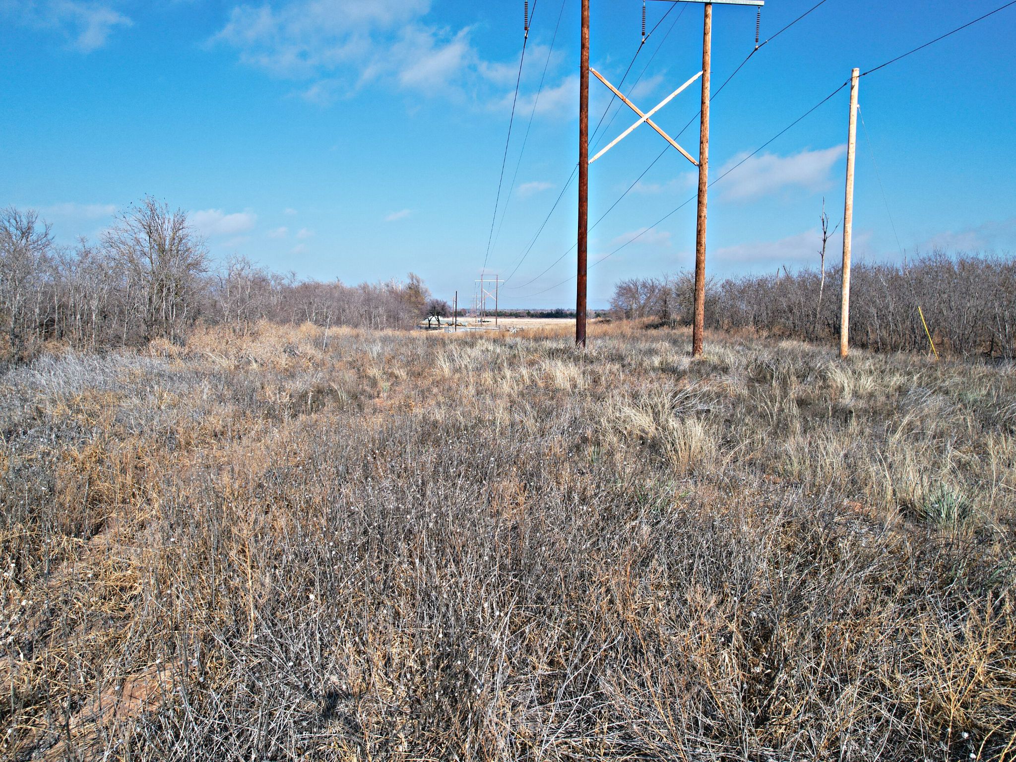
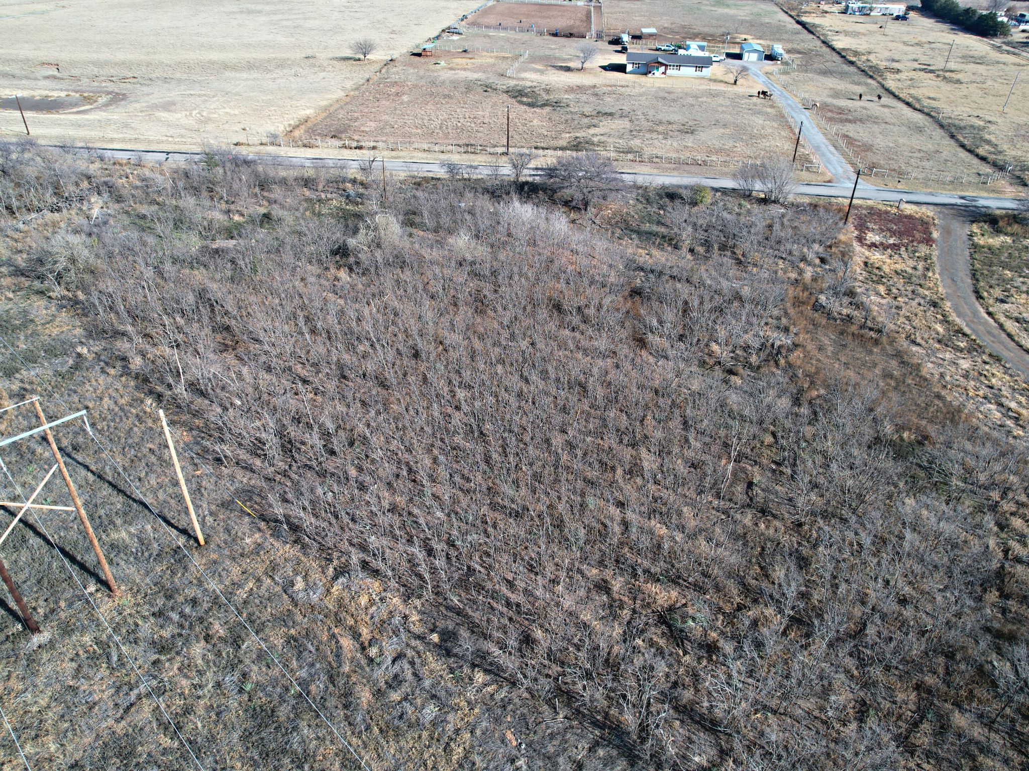
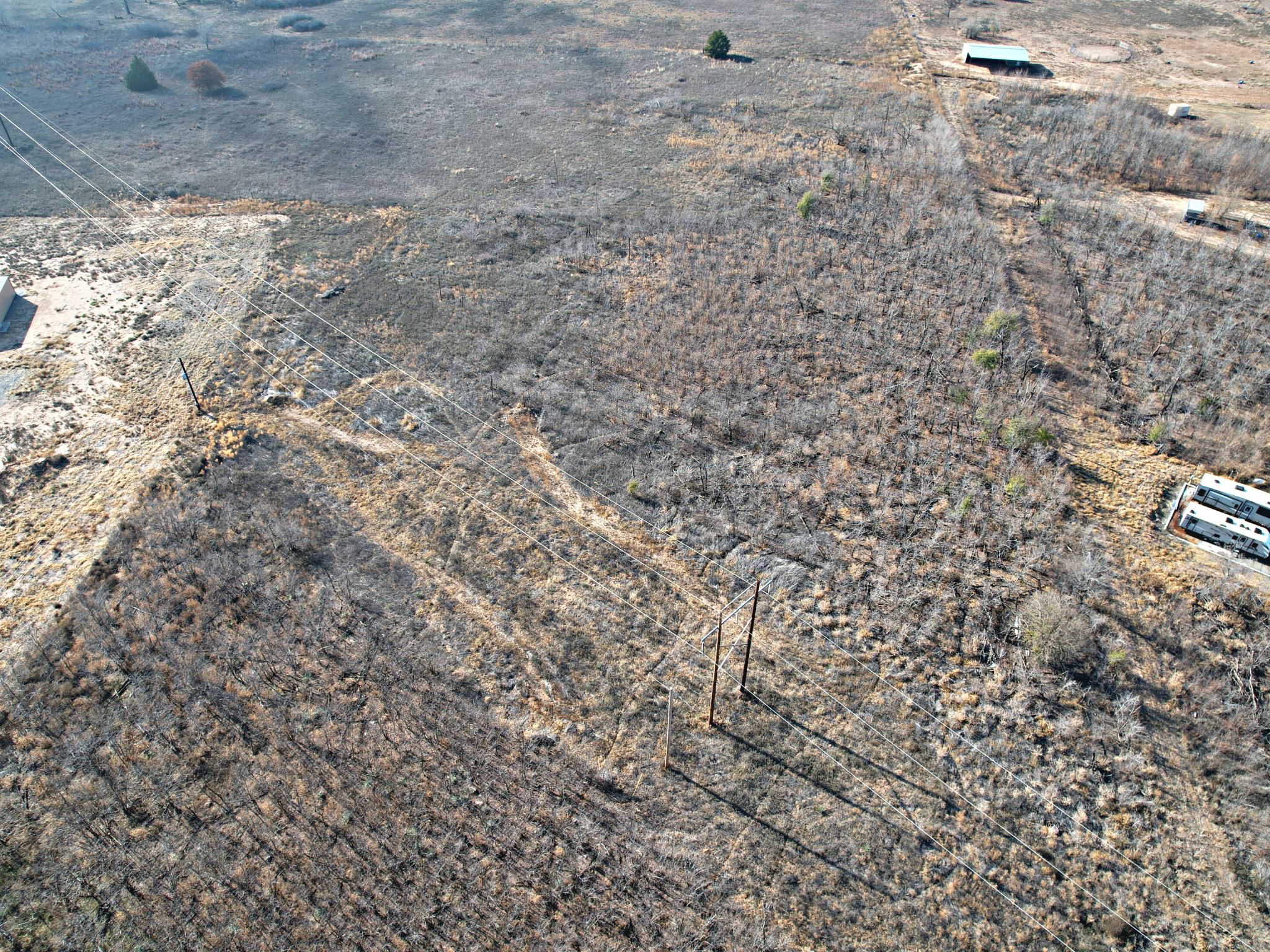
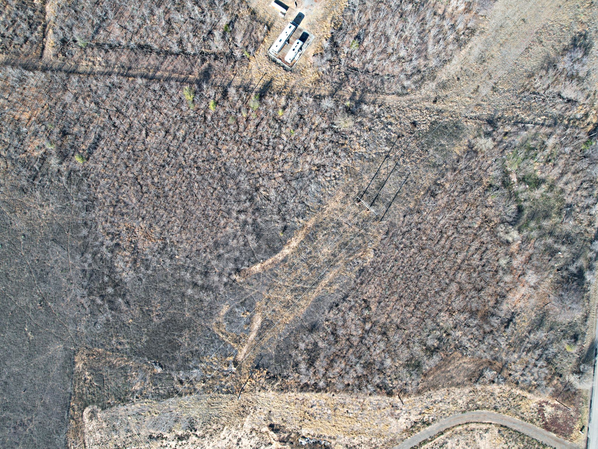
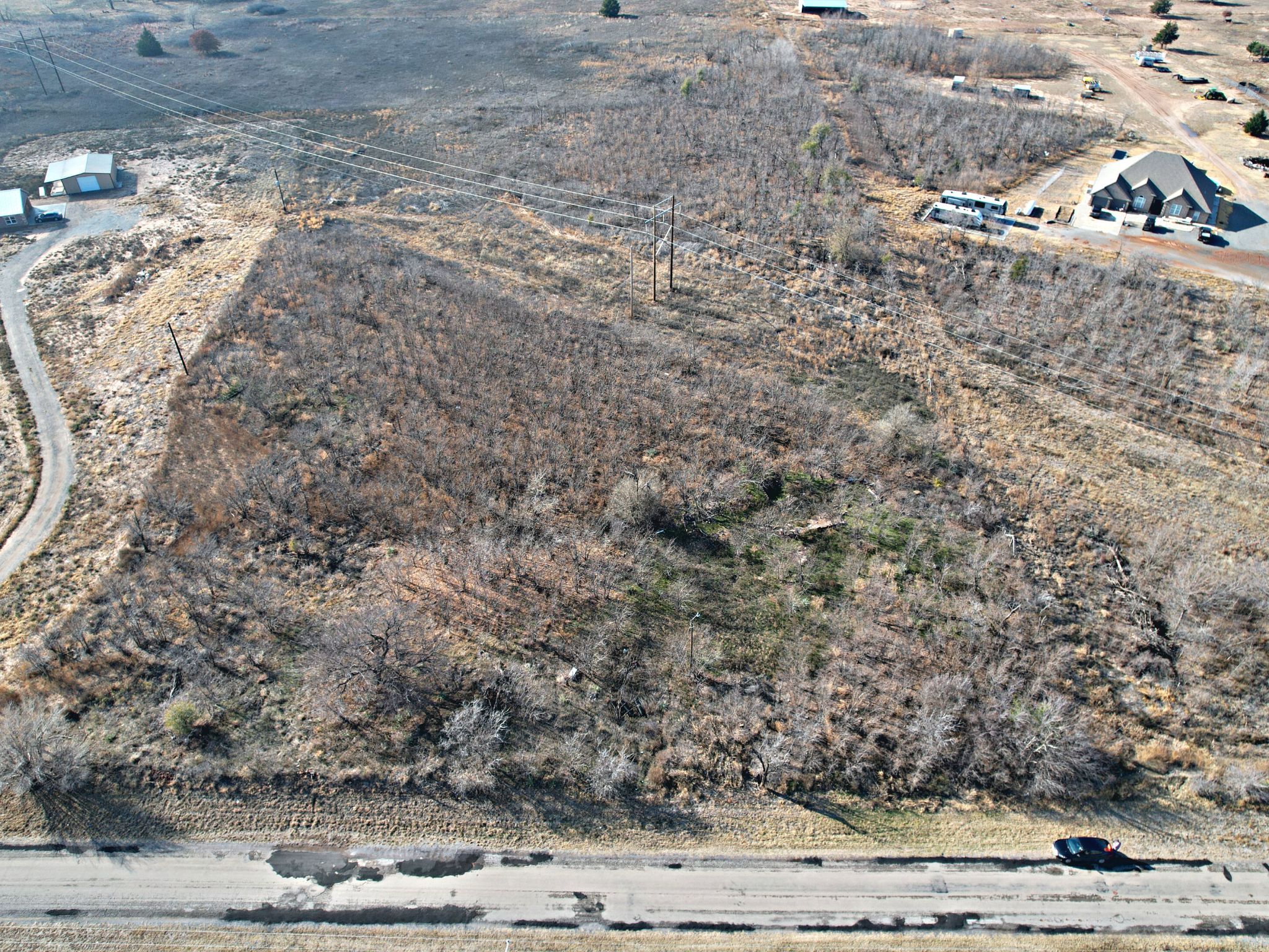
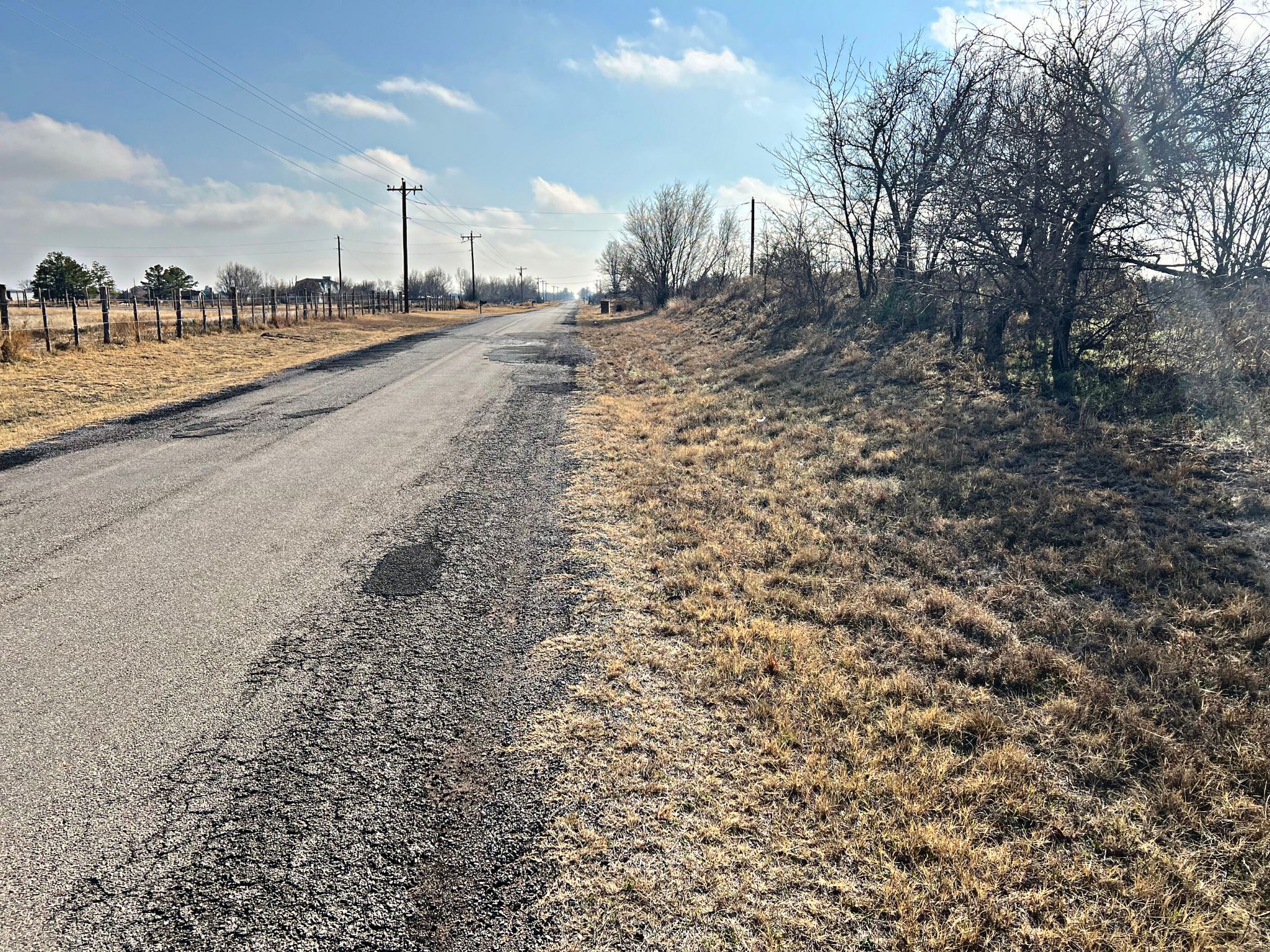
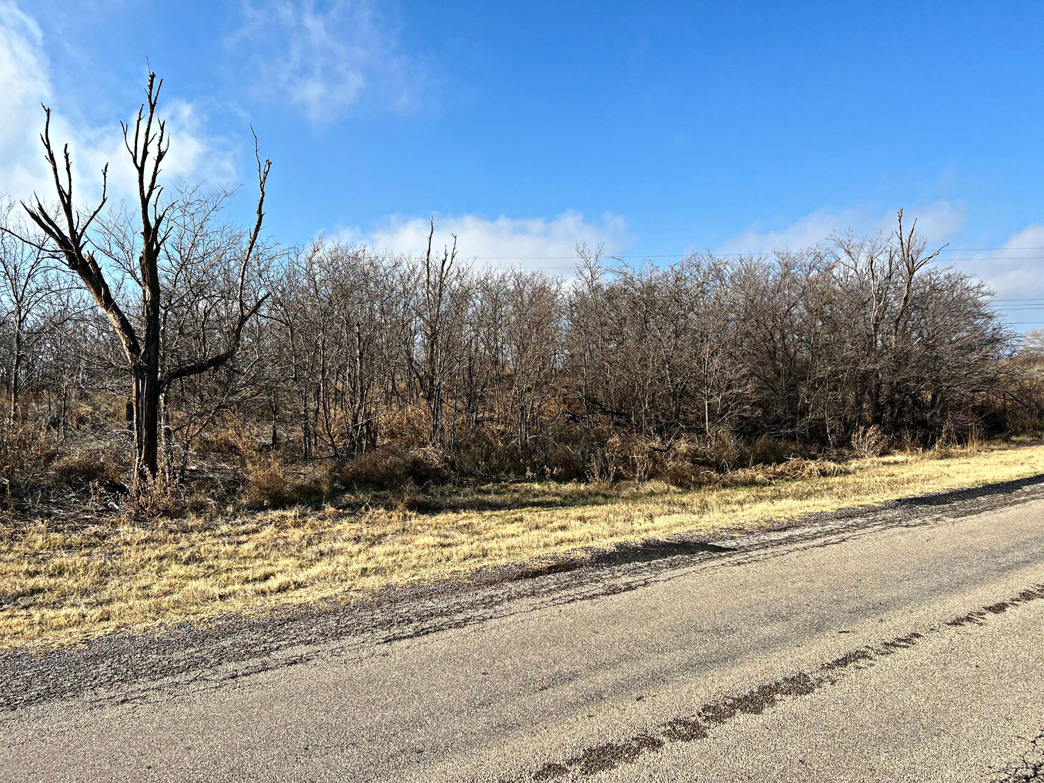
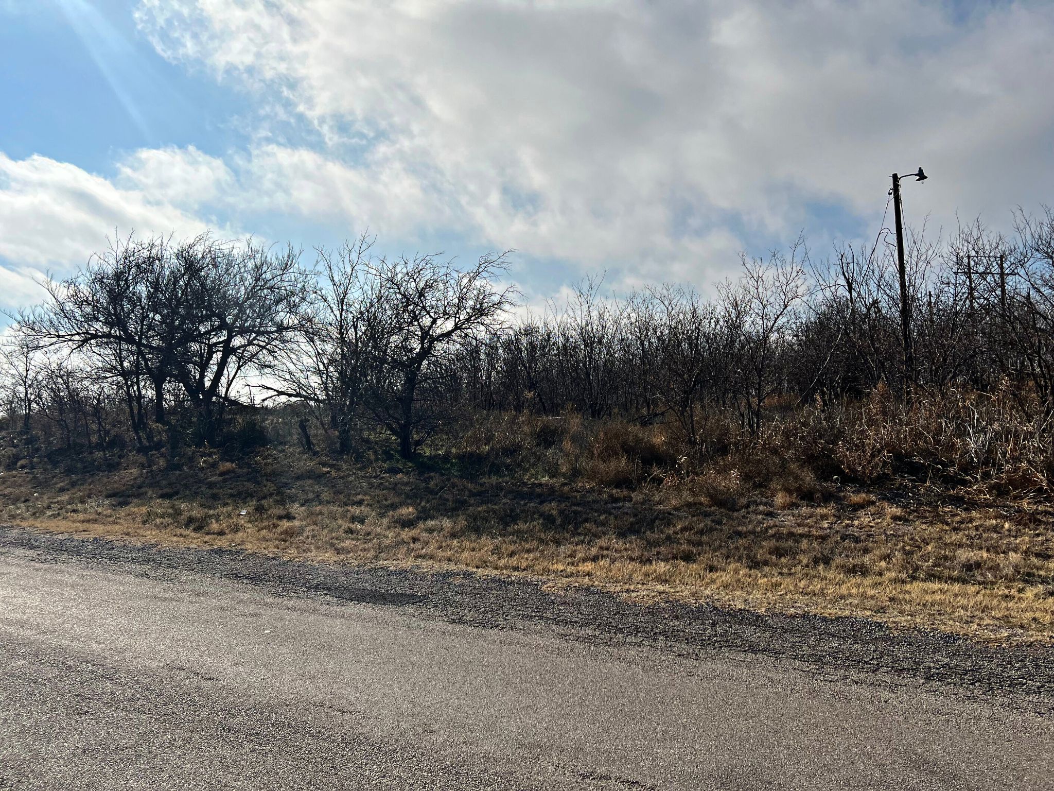
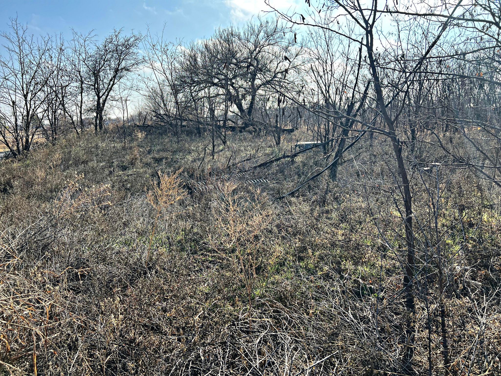
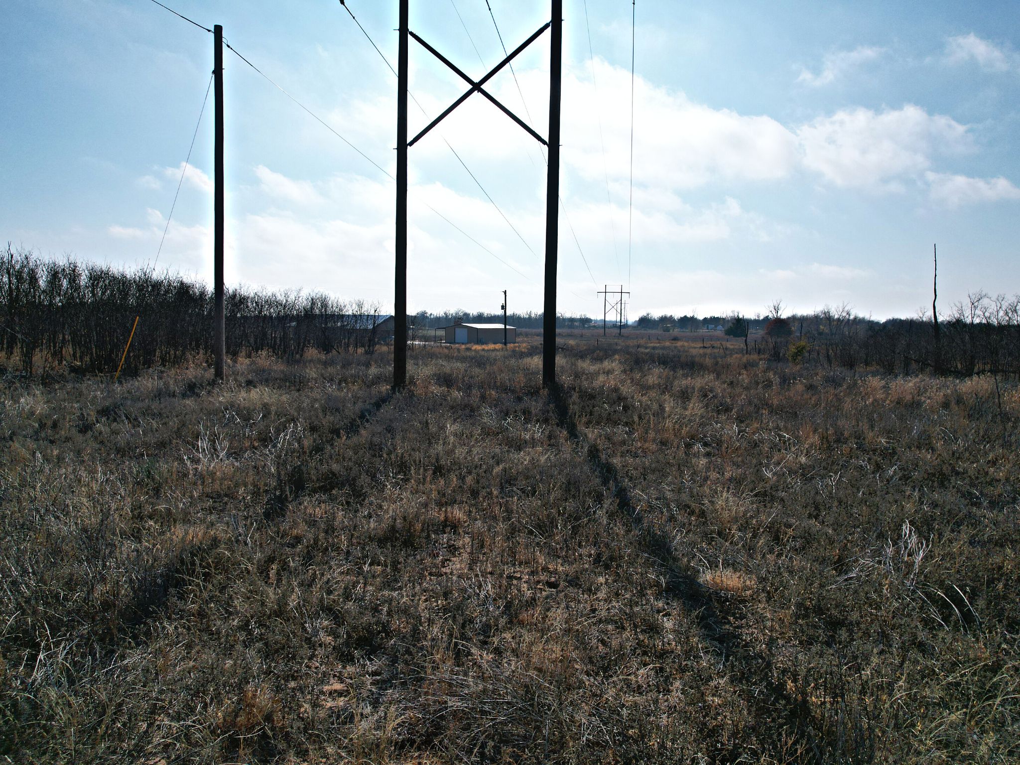
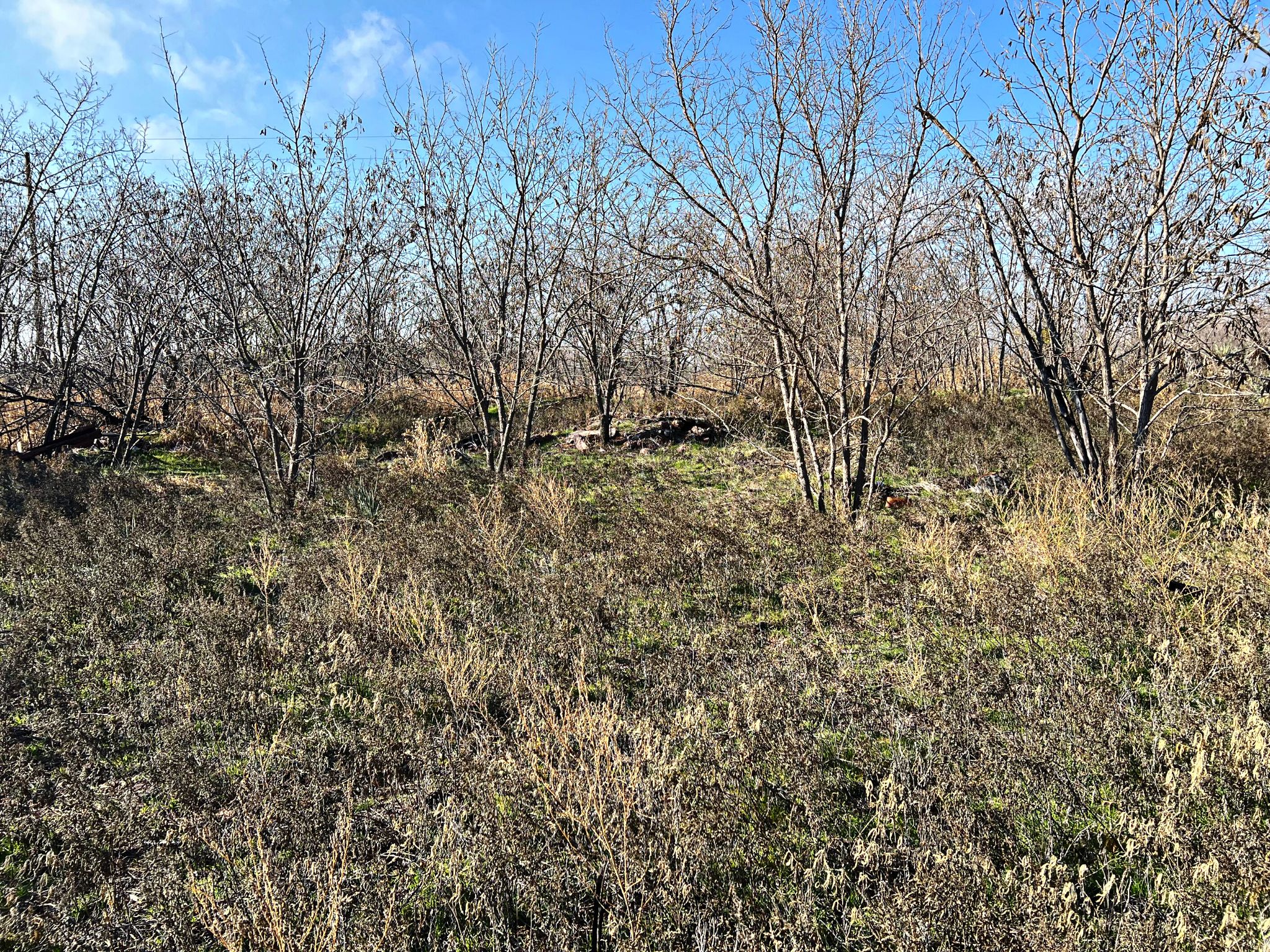
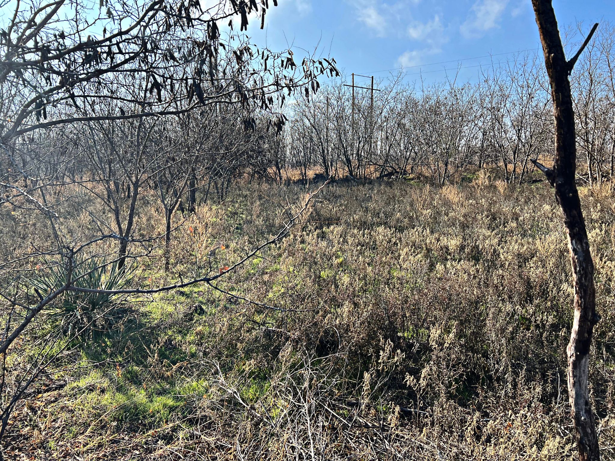
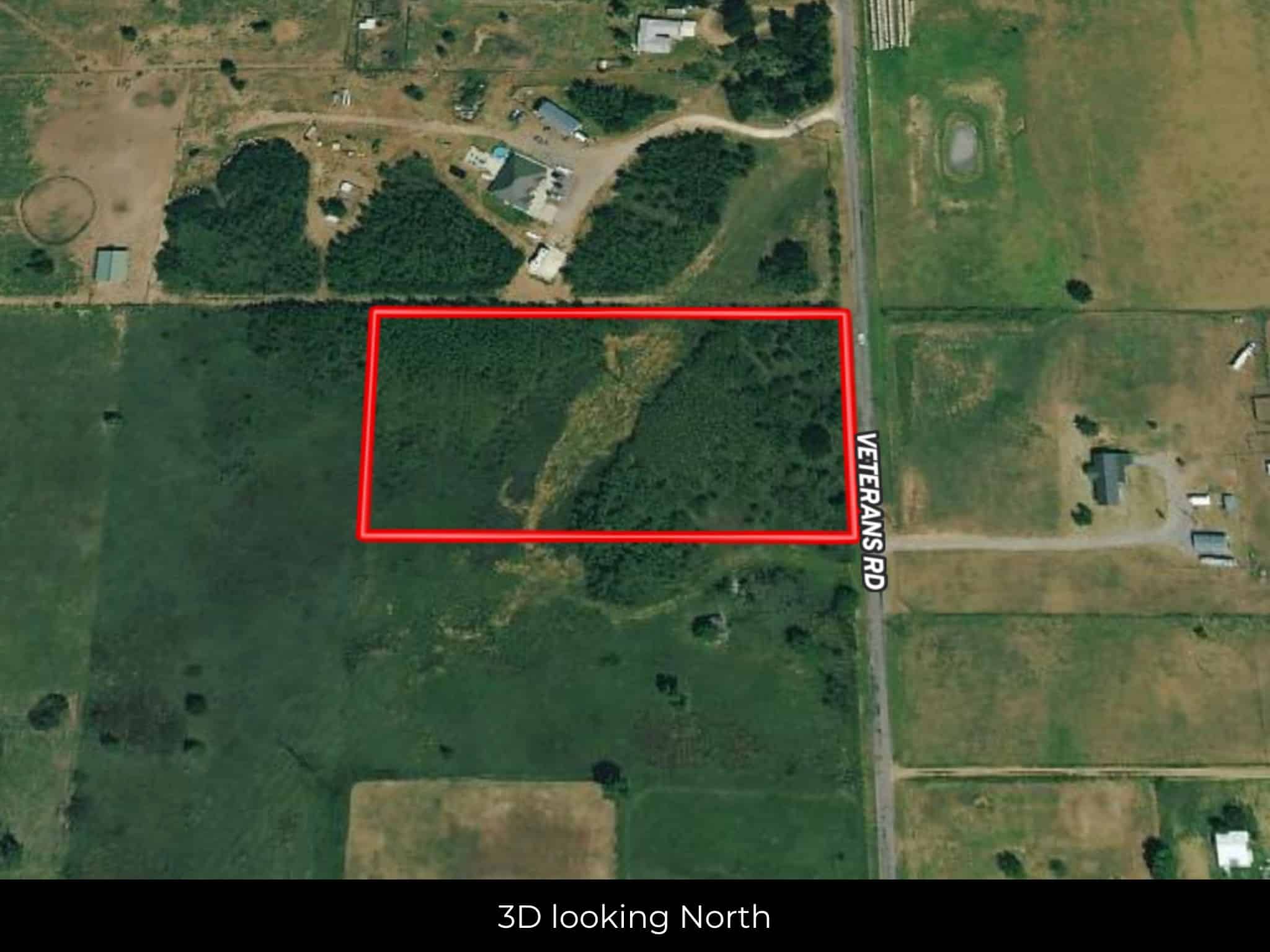
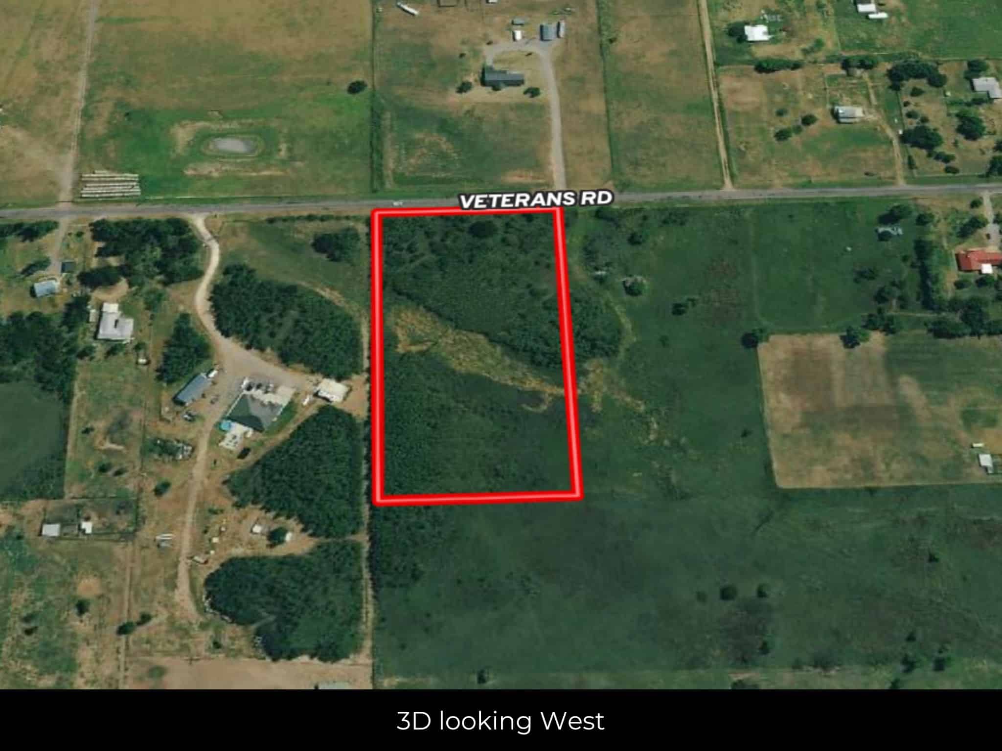
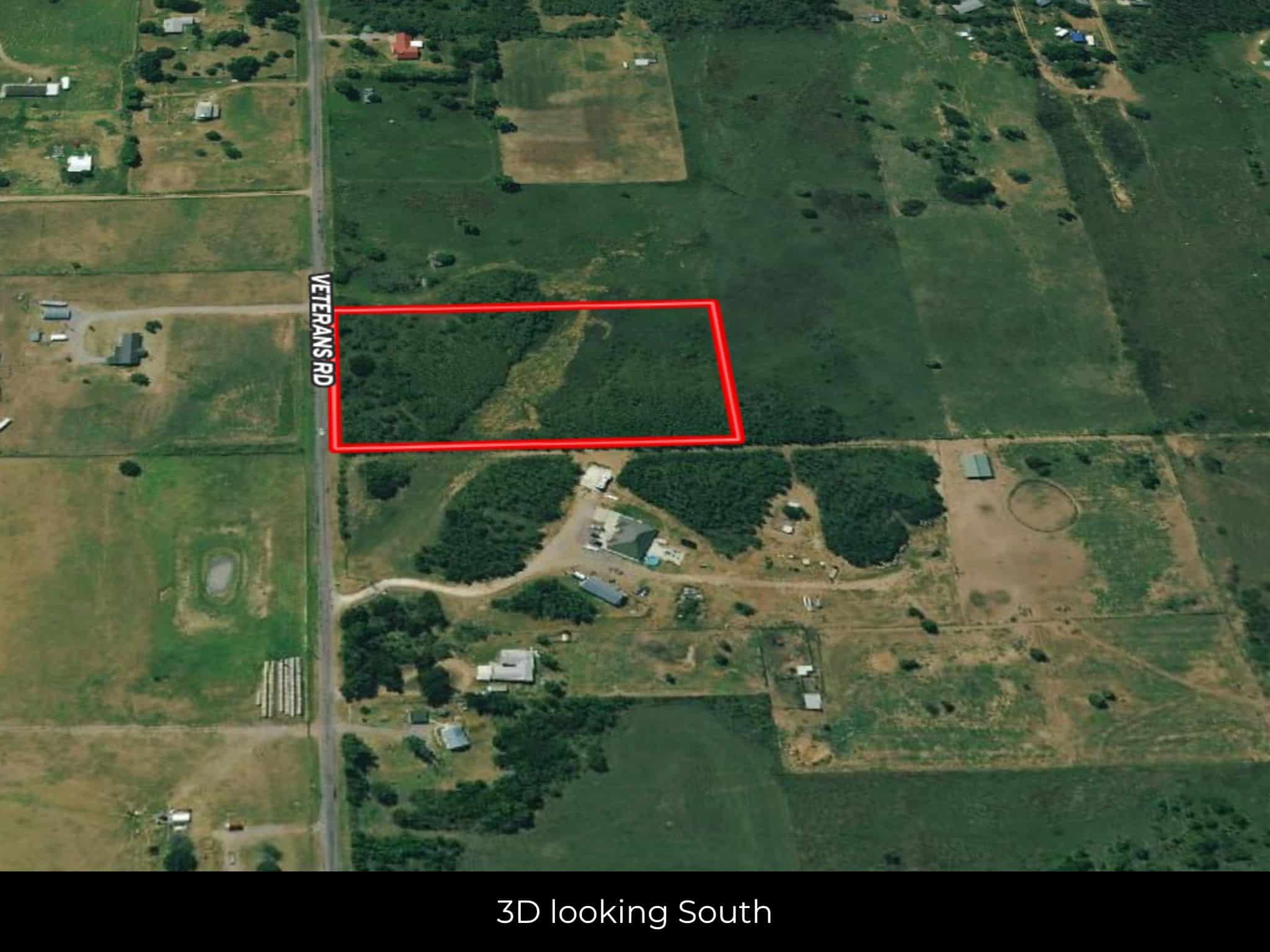
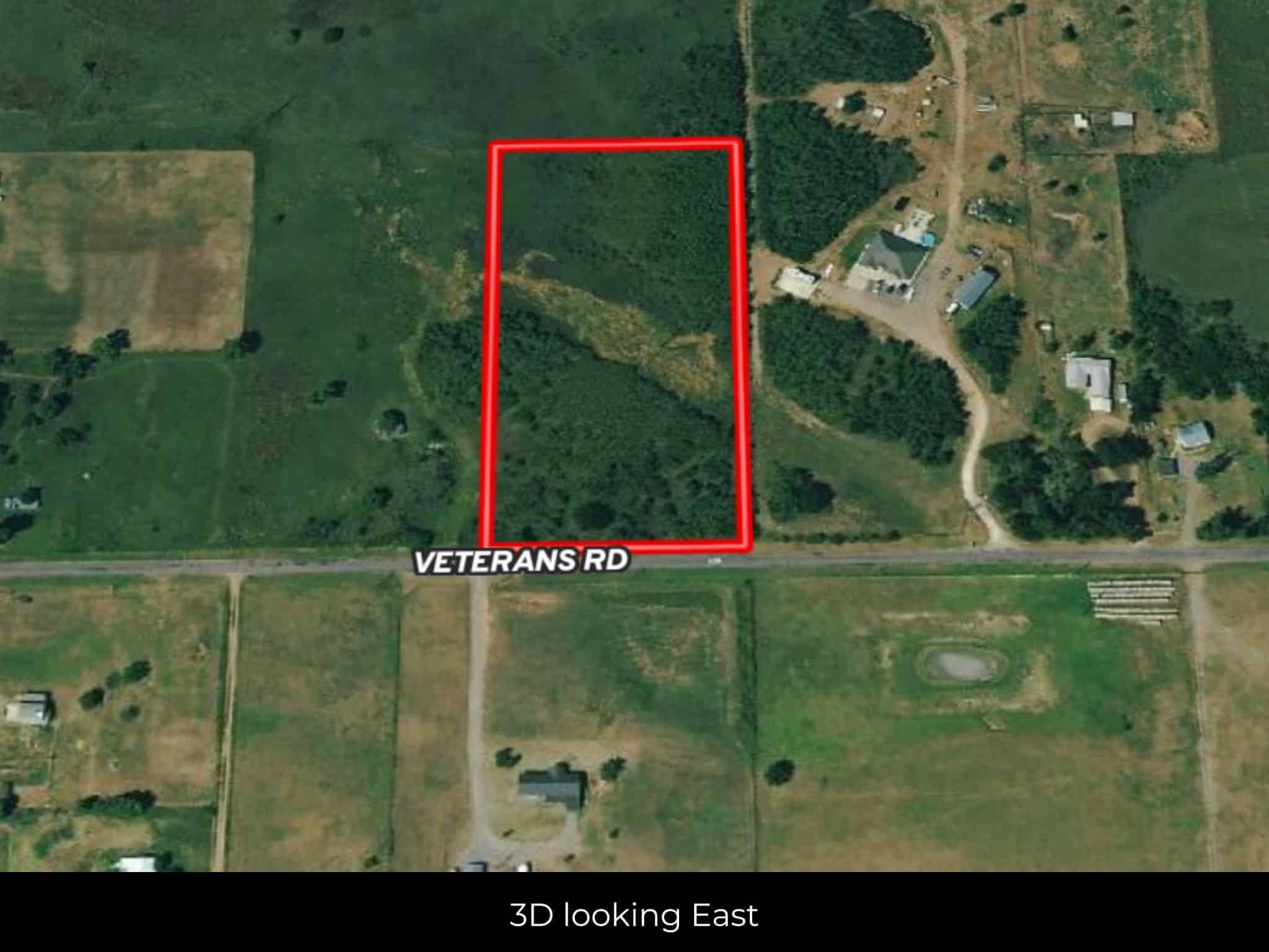
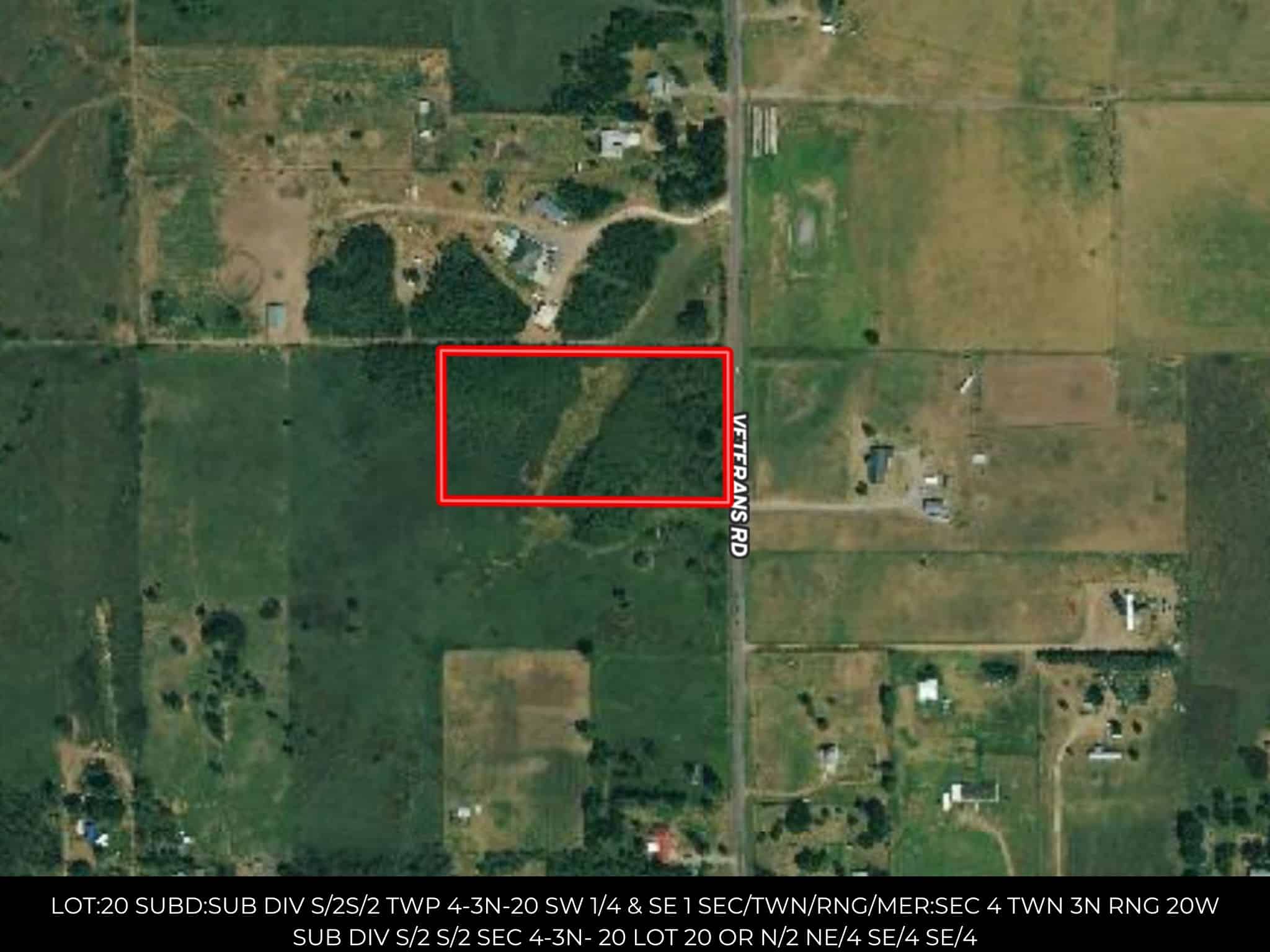
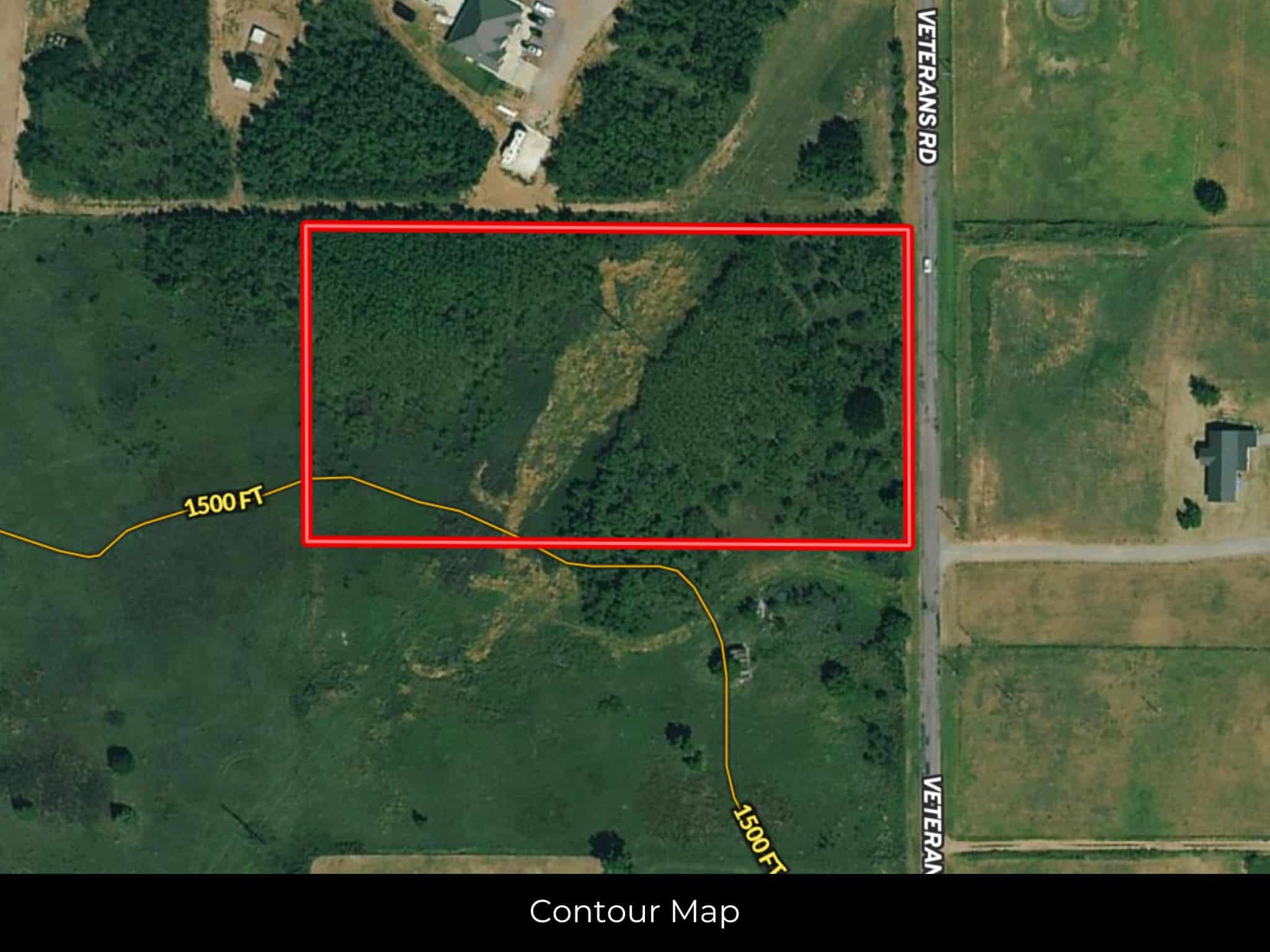
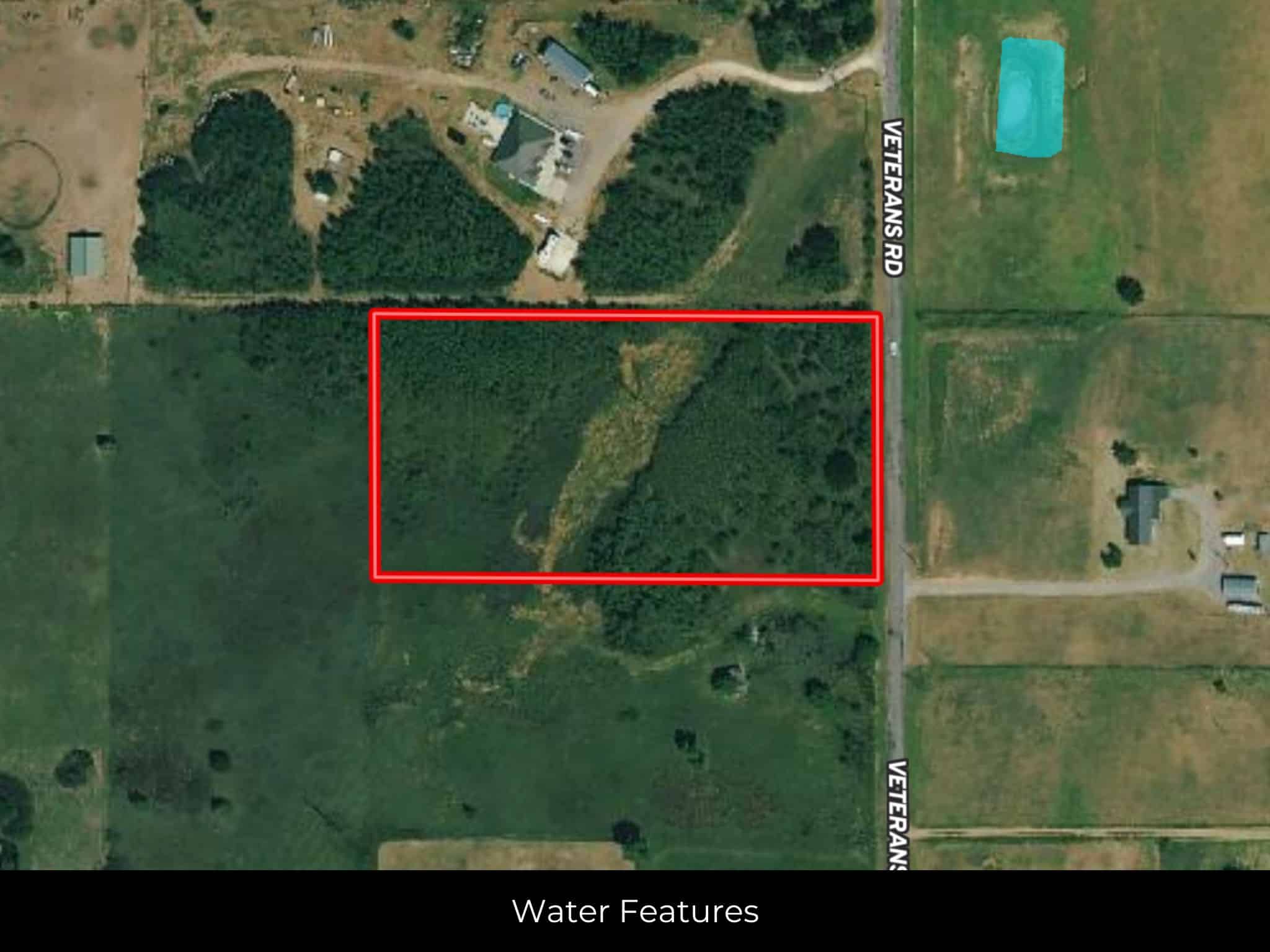
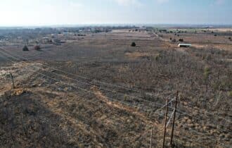
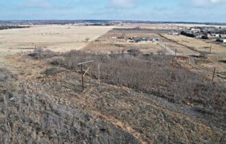
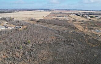
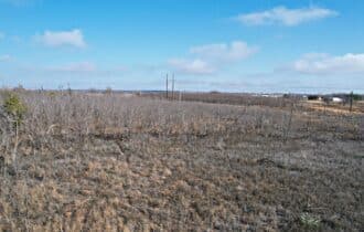
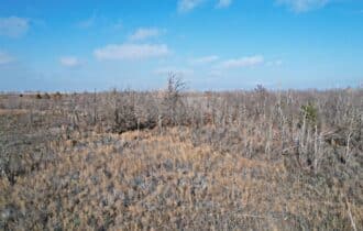
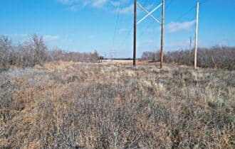
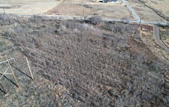
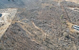
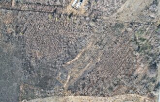
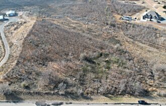
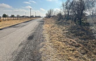
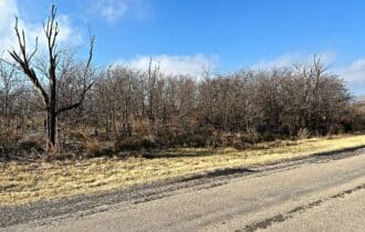
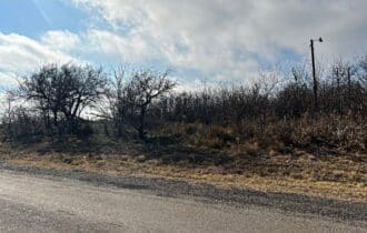
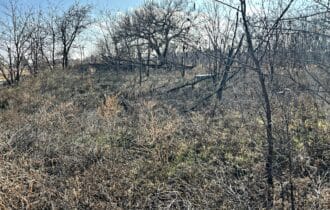
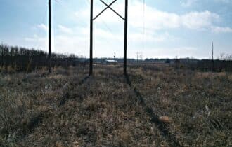
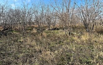
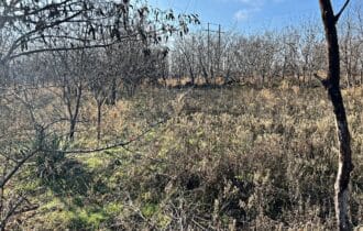
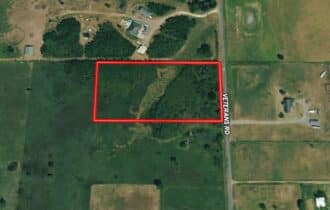
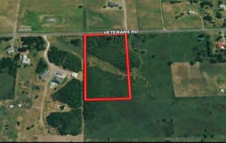
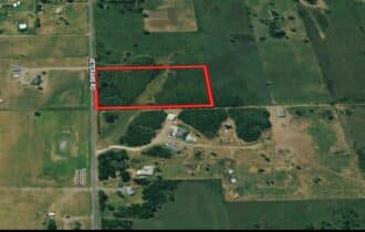
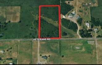
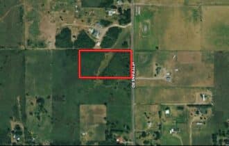
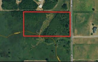
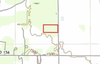
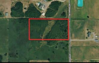
Bring all your ideas to this 4.974-acre lot just outside Blair in rural southwest Oklahoma. This property is ready for you to transform it into the ranchette you have always imagined. The terrain is level, and it is not in a flood zone. Access is from a paved county road and power is available. Neighboring houses are well-maintained, newer model manufactured homes. This property is mostly covered with trees and brush, but has a clear section near the middle. Keep the flora for a natural privacy fence or clear the land for pasture. This lot has endless possibilities.
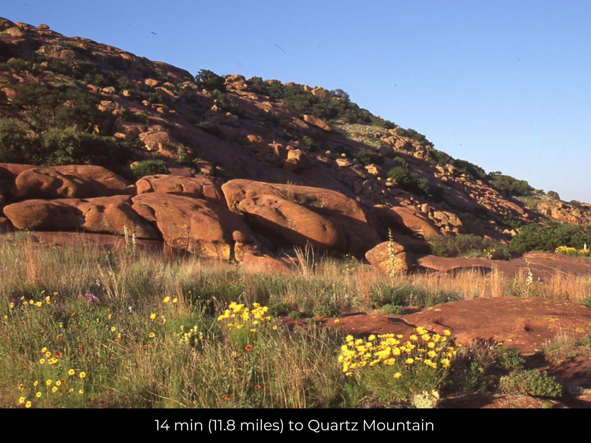
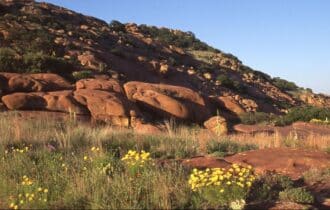
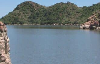
Blair is a tiny town with just 800 residents, and Jackson County has just 24,000 residents, so most local activities focus on outdoor exploration. Quartz Mountain Nature Park is 20 minutes north of Altus. Hike the trail to the top of the mountain for stunning views of the surrounding landscape, but be sure to wear your best hiking boots because the trail is quite steep and rocky. After you hike, take a dip in Lake Altus, located at the base of Quartz Mountain, or find a quiet, sandy spot to lounge on the beach. The Wichita Mountains Wildlife Refuge is an hour east of Altus, and it is a beautiful place to watch the prairie dogs and bison in their natural habitat.
This 4.974-acre lot just outside Blair is a rare find with paved road access and power available, and at this price it will not last long. Contact me today for more information.
Visiting the Property
You are welcome to visit the property at your convenience and anytime while it's still available. However, we HIGHLY recommend checking-in with us prior to visiting the property in case the property has gone under contract or already sold.
The interactive map above is generated with MapRight. MapRight has free apps for Apple IOS and Android that can be used to track your location and route throughout a property and provide driving directions.
MapRight for Apple –> Download App.
MapRight for Android –> Download App.
To launch the interactive map on your device, 1) install the free MapRight app using one of the two links above for Apple or Android, and 2) click the “View Full Screen” link (see above) in the embedded map on the property listing page.
Property Information
Parcel Size
4.974 Acre
State
Oklahoma
County
Jackson
Nearest Cities
Blair OK
Parcel #
0945-00-000-020-0-000-00
Address
15575 S County RD 206, Blair, OK, 73526
Legal Description
LOT:20 SUBD:SUB DIV S/2S/2 TWP 4-3N-20 SW 1/4 & SE 1 SEC/TWN/RNG/MER:SEC 4 TWN 3N RNG 20W SUB DIV S/2 S/2 SEC 4-3N- 20 LOT 20 OR N/2 NE/4 SE/4 SE/4
Zip Code
73526
Annual Property Taxes
$5
Ag Exemption
No
HOA
None
HOA per Year
None
Survey Available
Yes
School District
Blair Public Schools
Liens and Back Taxes
None!
Source Deed
Sent for Filing.
Title Status
Free & Clear!
Outgoing Conveyance
Warranty Deed
Property Features
Acres
4.974
Dimension
635.68 feet X 334.09 feet
County
Jackson
Subdivision
Exists
Access
Yes
Power
Yes
Water
Yes
Heating
Yes
Coordinates
34.7576, -99.3008
Zoning
RURAL/AGRICULTURAL-VACANT LAND
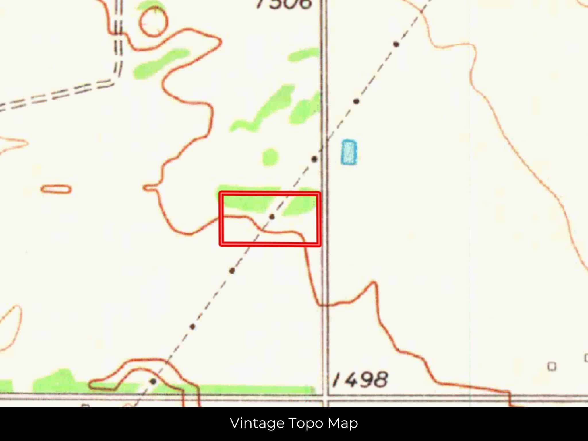
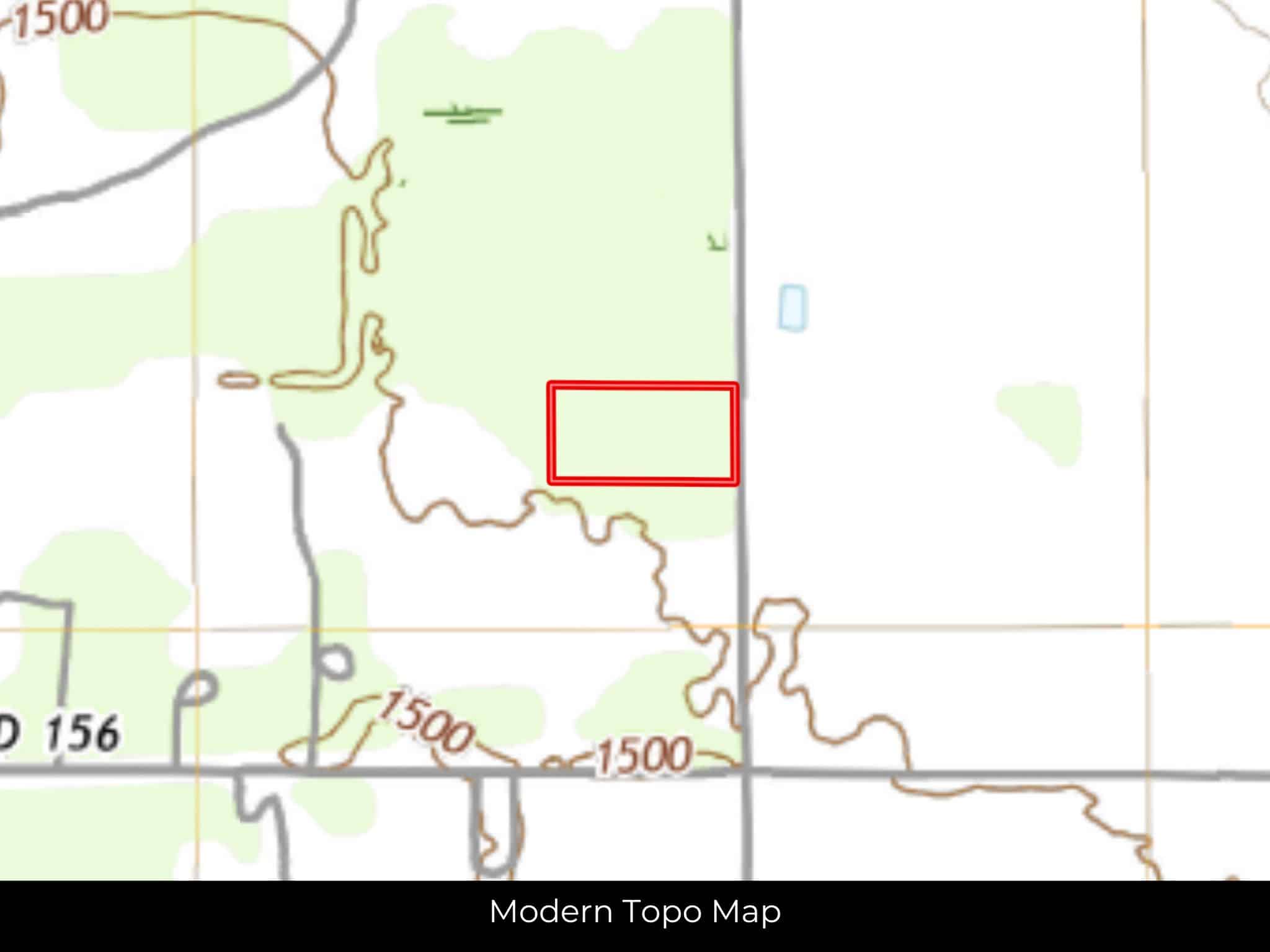
Elevation
1500ft
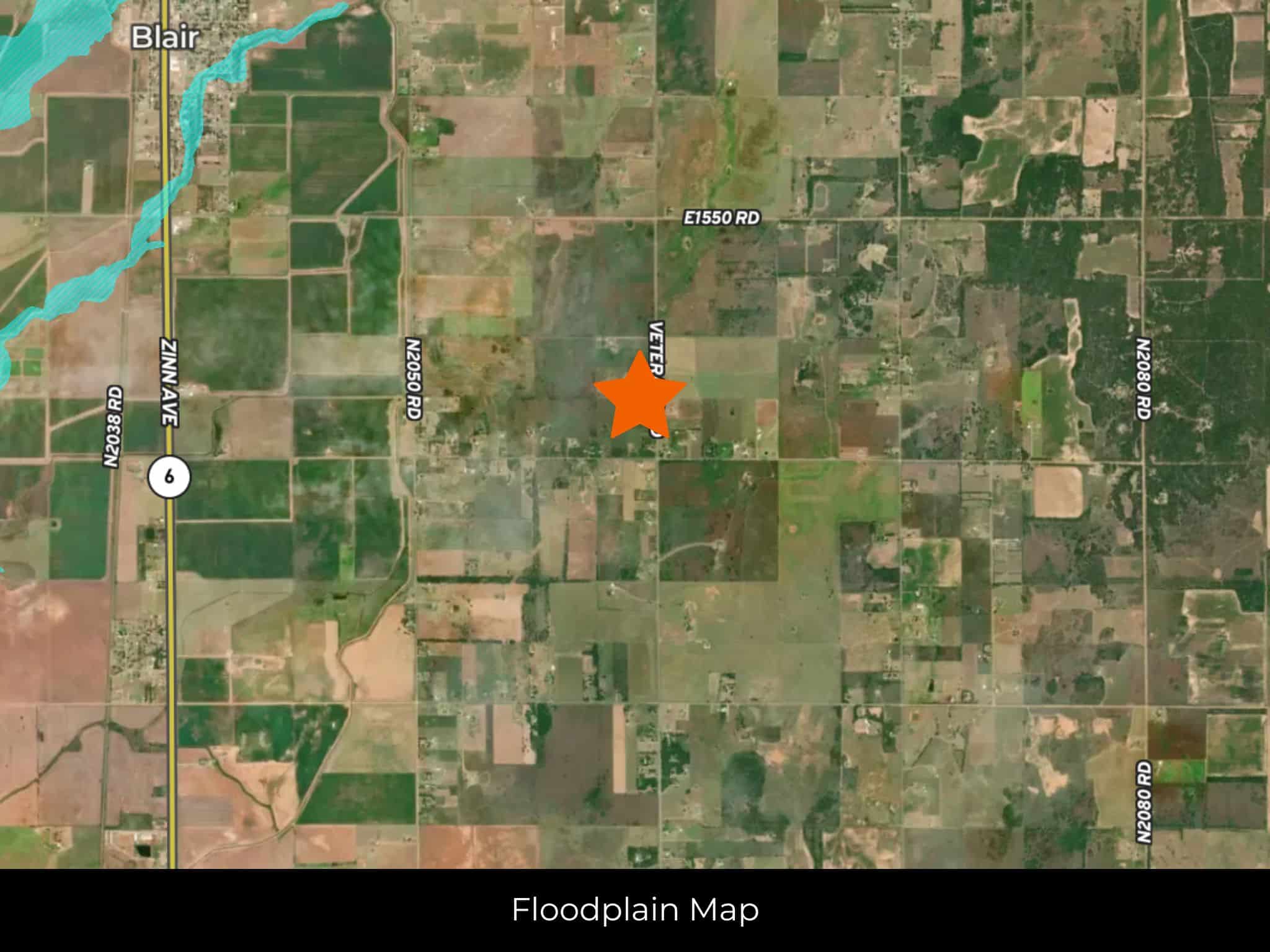
Terrain
Flat
Floodplain
No
Duplexes
Yes
Mobiles
Yes
Tiny Homes
Yes
Barndominiums
Yes
RV's
Yes
Camping
Yes
Property Survey, HOA, & Additional Documents
Utilities
🔌 Power: Southwest Rural Electric Association or Solar, wind, propane, or alternative energy source.
💧 Water: Jackson County Water
🚽 Sewer: Septic or alternative sewer system.
☎️ Phone: cellular, VOIP (see internet below), and satellite phone through Iridium, Globalstar, or Inmarsat.
🌐 Internet: satellite internet through Starlink, HughesNet, or ViaSat.
📺 Cable: satellite cable through Dish or DirectTV.
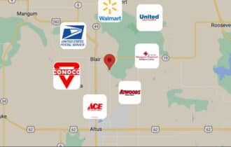
Nearby Cities, Conveniences, and Attractions
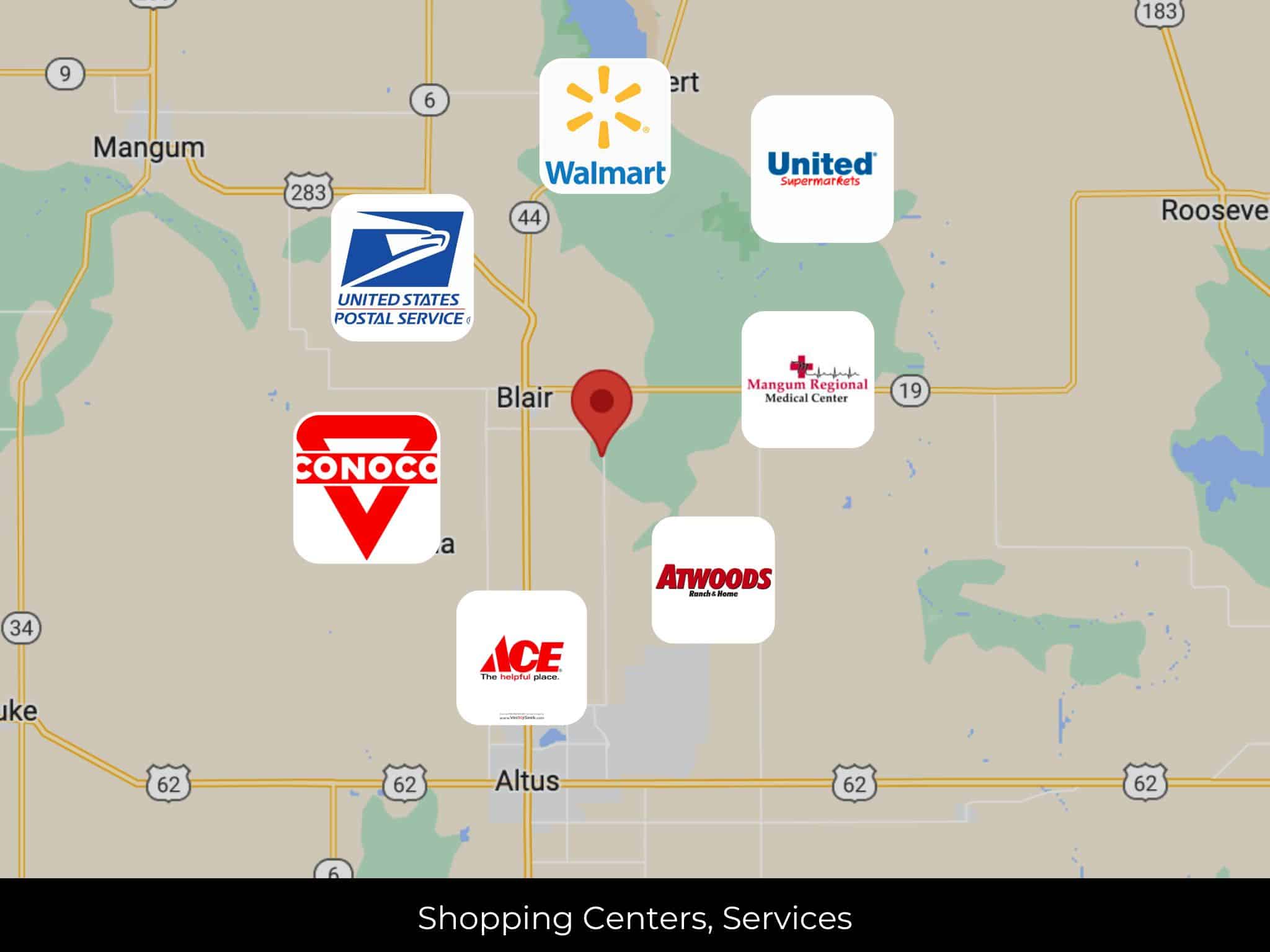
6 min (4.0 miles) to Conoco, Blair, OK (about)
6 min (4.1 miles) to Blair, Oklahoma (about)
10 min (7.2 miles) to United States Postal Service, Martha, OK (about)
11 min (8.2 miles) to Friendship, Oklahoma (about)
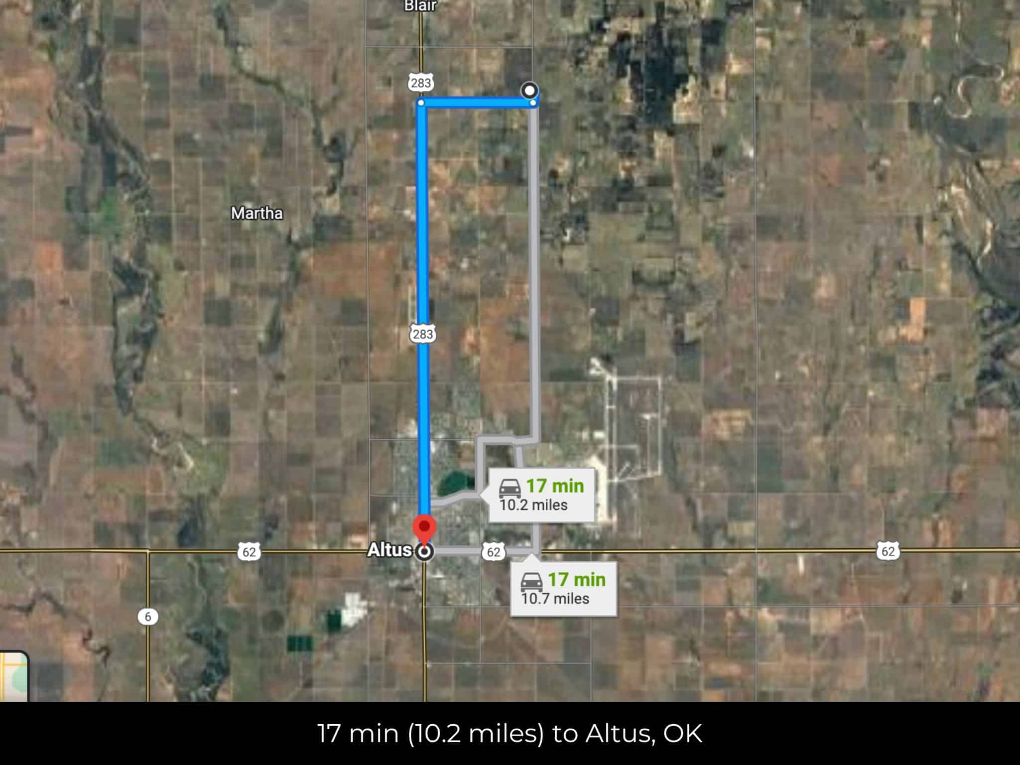
12 min (8.7 miles) to Atwoods, Altus, OK (about)
12 min (8.6 miles) to Walmart Supercenter, Altus, OK (about)
13 min (9.2 miles) to Altus Ace Hardware, Altus, OK (about)
14 min (11.8 miles) to Quartz Mountain (about)
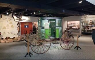
15 min (9.9 miles) to Museum of the Western Prairie (about)
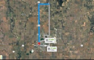
16 min (10.3 miles) to Altus, Oklahoma (about)
17 min (10.3 miles) to United Supermarkets, Altus, OK (about)
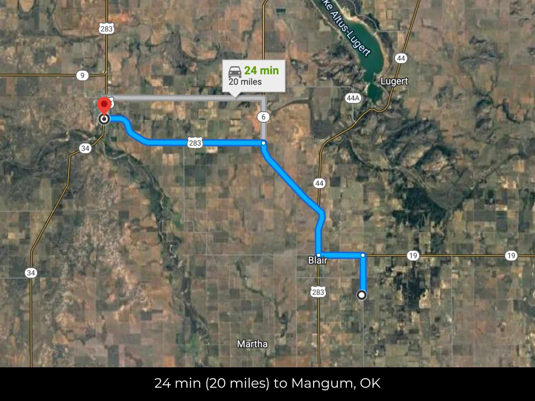
19 min (17.6 miles) to Mangum, Oklahoma (about)
22 min (17.6 miles) to Lake Altus (about)
23 min (18.9 miles) to Mangum Regional Medical Center, Magnum, OK (about)
23 min (19.5 miles) to Mangum Golf Course (about)
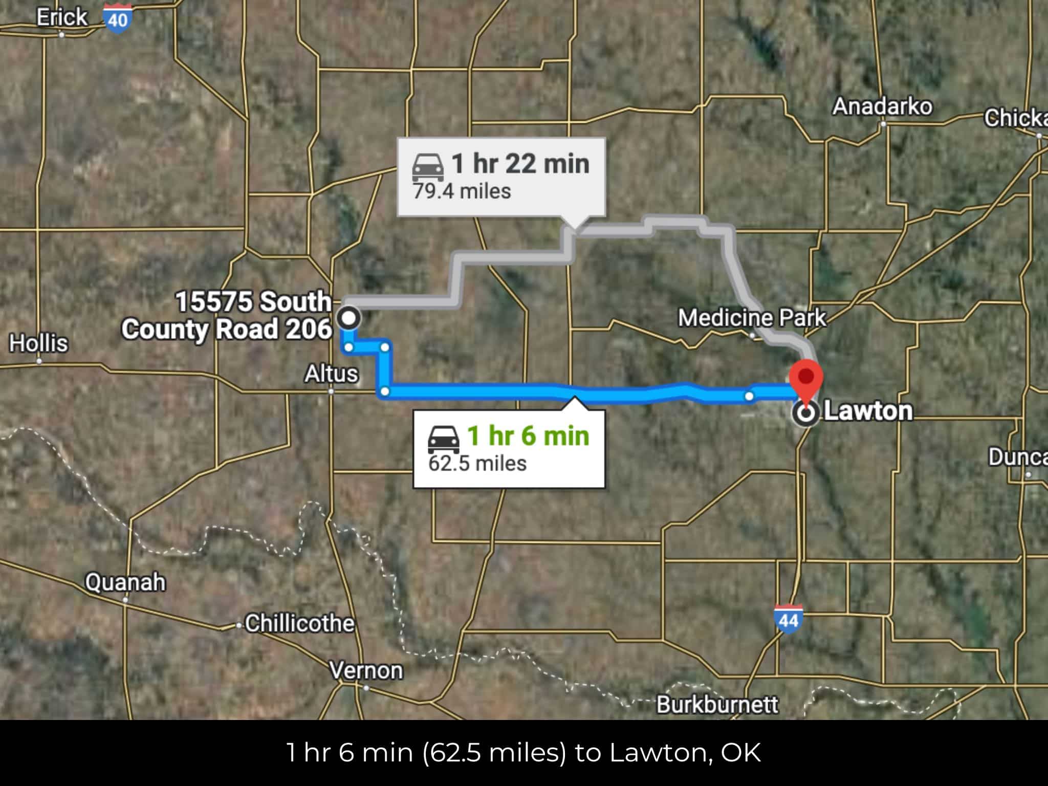
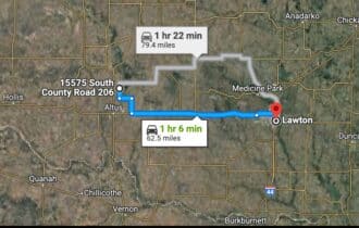
1 hr 6 min (62.5 miles) to Lawton, Oklahoma (about)
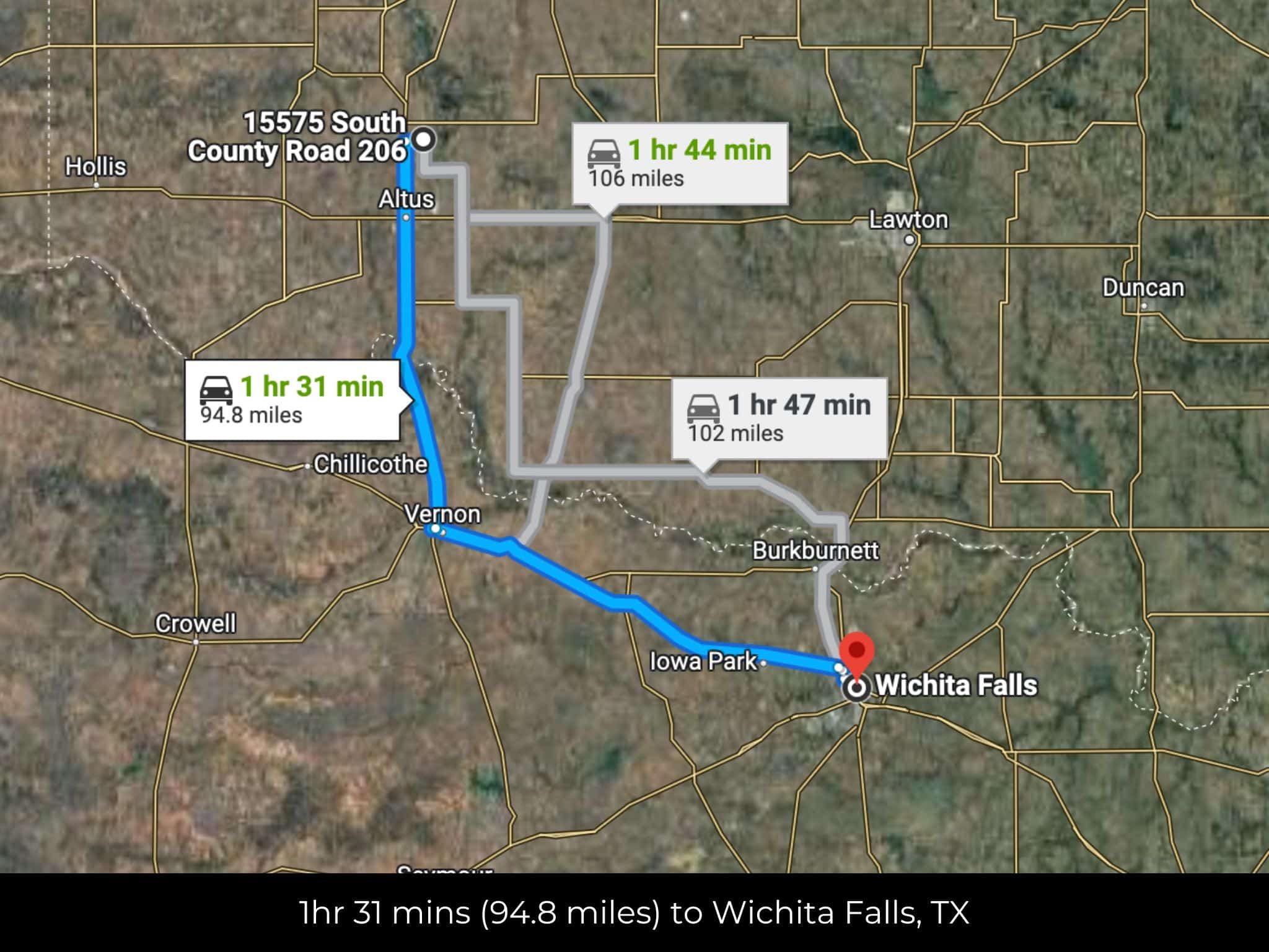
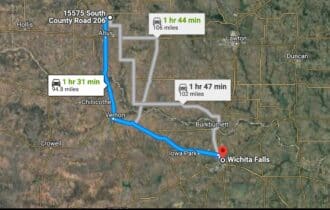
1 hr 31 min (94.8 miles) to Wichita Falls, Texas (about)
2 hr 11 min (137 miles) to The University of Oklahoma (about)
2 hr 12 min (138 miles) to Jacobson House Native Art Center (about)
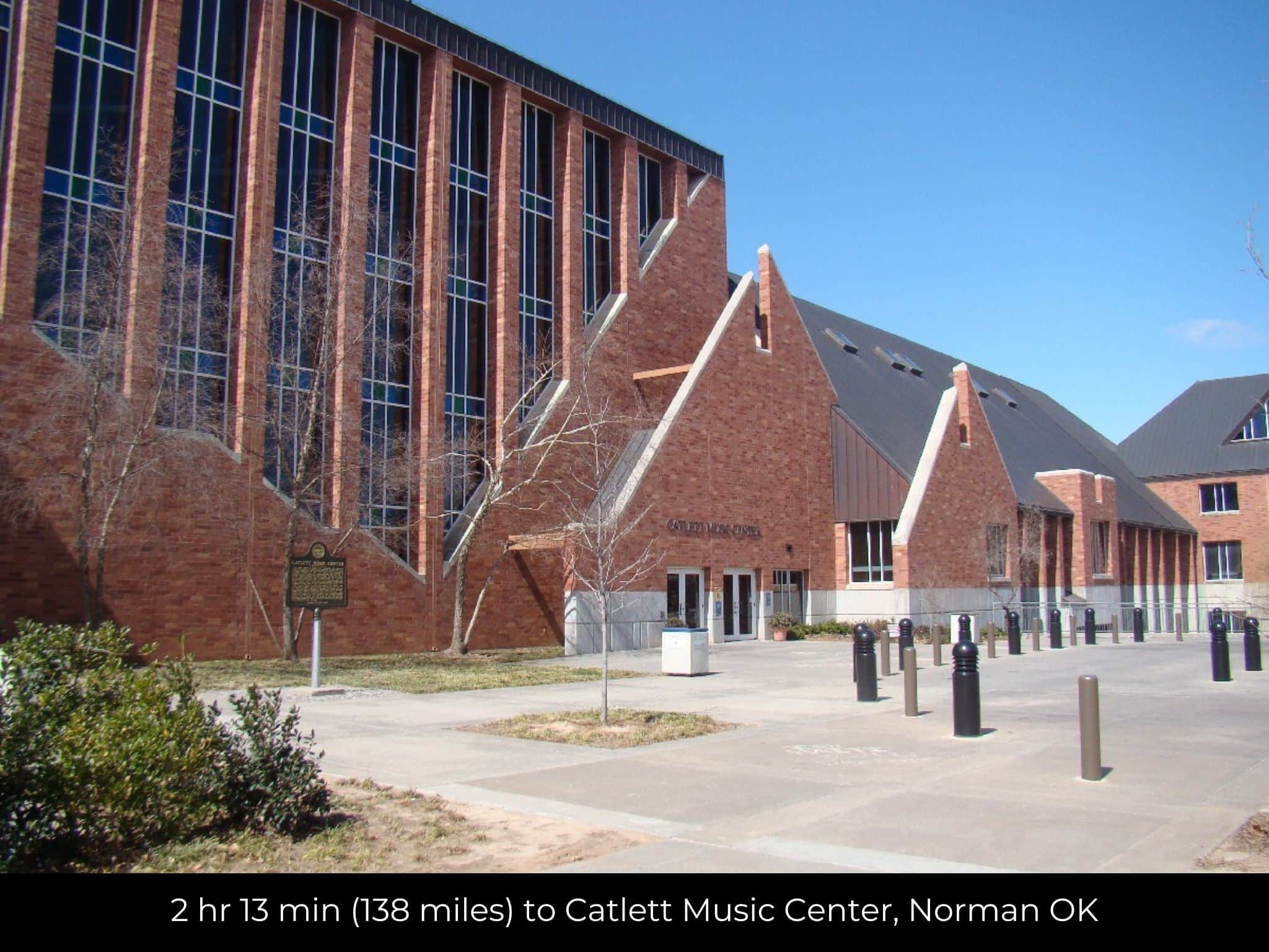
2 hr 13 min (138 miles) to Catlett Music Center, Norman OK (about)
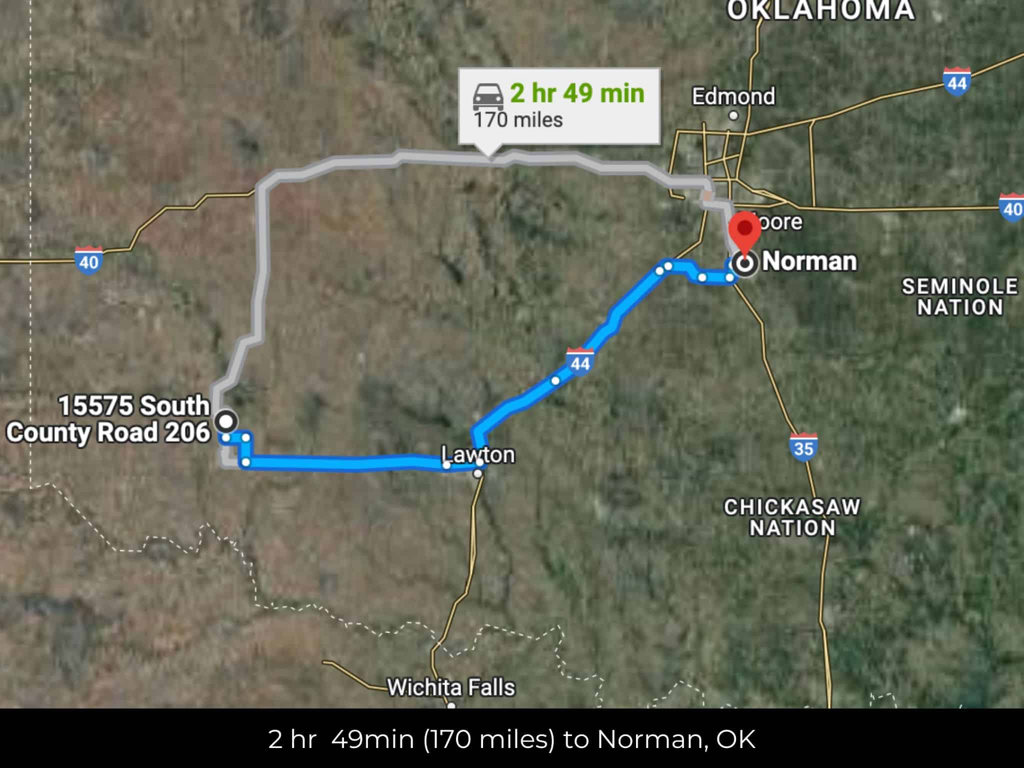
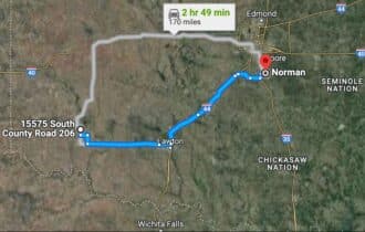
2 hr 15 min (139 miles) to Norman, Oklahoma (about)
2 hr 21 min (143 miles) to Canadian River Vineyard and Winery (about)
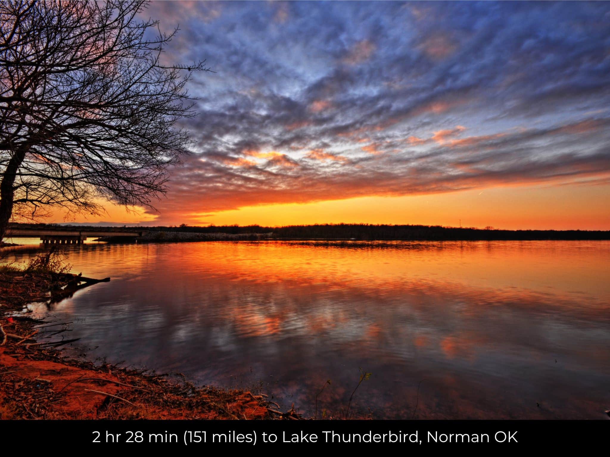
2 hr 28 min (151 miles) to Lake Thunderbird, Norman OK (about)
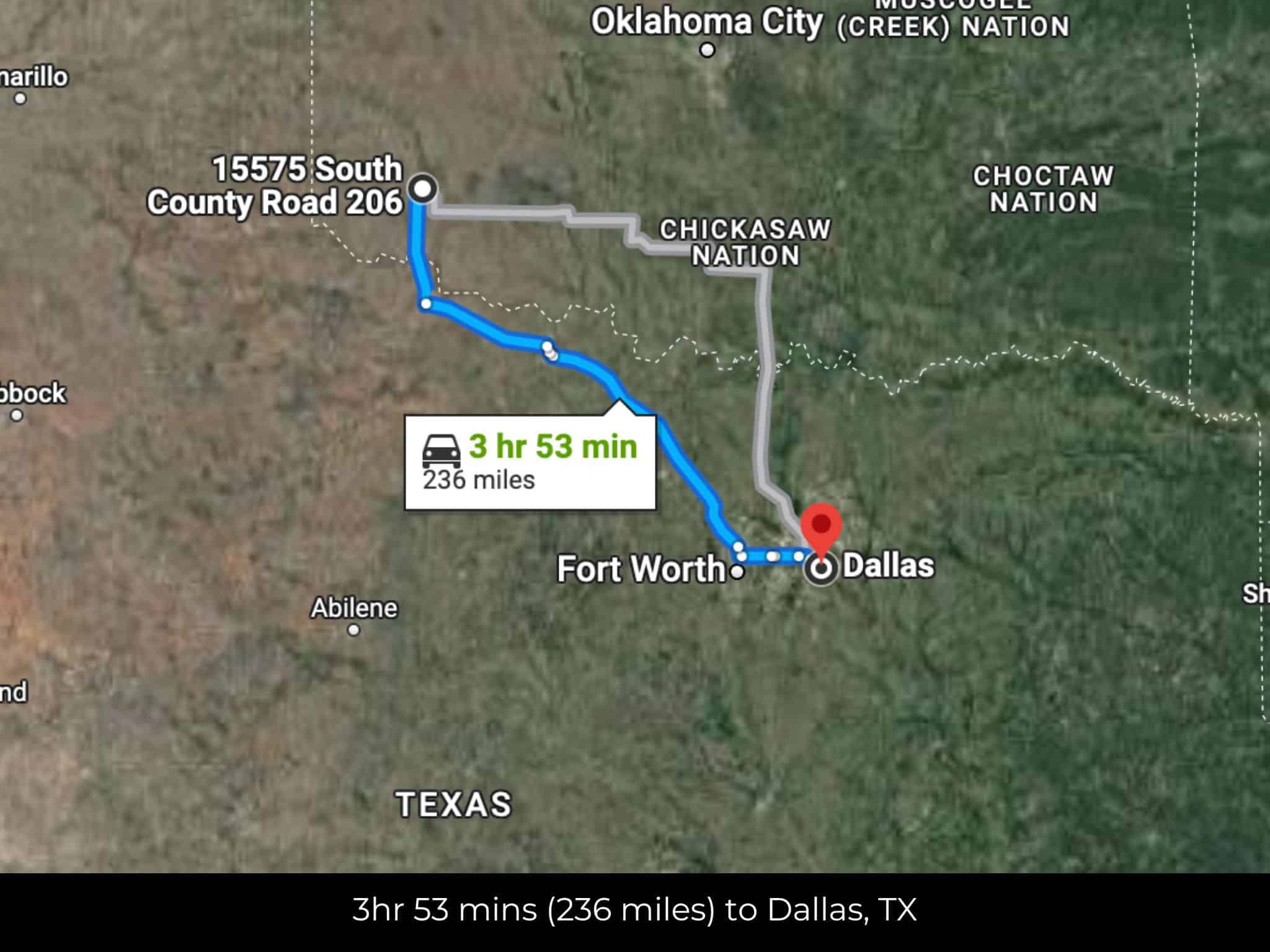
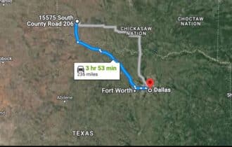
3 hr 48 min (236 miles) to Dallas, Texas (about)
County Contacts
Jackson County Assessor Lisa Roberson (580) 482-0787 (website)
Jackson County Treasurer Renee Howard (580) 482-4371 (website)
Jackson County Clerk Robin Booker (580) 482-4070 (website)
Jackson County Zoning 580-563-2406
Jackson County Health (website)
Jackson County CAD (website)
Jackson County GIS (website)
Closing Costs and Fees
$299
Document Prep Fee
Buyer will pay a $299 document preparation fee, which includes all postage and county recording fees. Seller will warrant title to the property.
$0
In-House Closing Fee
There will be no additional fees or expenses for an in-house closing. We will close in 14 days or less. This is the fastest, easiest, and cheapest way to close.
$1,500+
Title Company Fees*
Title Company costs are typically 2-5% of the purchase price with a minimum fee of around $1,500. Many states have legislated, standard insurance rates and other fees vary by the title company.
* If Buyer elects to close through a third-party title company, Buyer will bear all closing costs and expenses, including Seller’s title policy and Seller's escrow fees. Closing through a title company typically takes 30-45 days, depending on the county, title company, and transaction activity in the area.
Driving Directions and GPS Coordinates
🚗 Driving Directions: Head east on W South St toward S Florence Ave
0.3 mi, Turn left onto S Walnut St 1.0 mi, Turn right
📍 Northwest Corner: 34.758, -99.3018 (Google Map)
📍 Northeast Corner: 34.758, -99.2998 (Google Map)
📍 Southeast Corner: 34.7572, -99.2998 (Google Map)
📍 Southwest Corner: 34.7572, -99.3018 (Google Map)
📍 Center Point: 34.7576, -99.3008 (See embedded Google Map below 👇.)
Google Map
If you click the blue Directions link below, 👇 you can get Google turn-by-turn directions to the property on any device. The map coordinates for the Google Map below are for the approximate center of the property and not the entrance, gate, or primary access point for the property. Google Maps may provide driving directions that require the use of private or abandoned roads or may require you to go through gates located on private property. Do not trespass on private property! Some properties will require a 4-wheel drive vehicle or may be inaccessible in certain weather conditions. Please don't get stuck or lost.
Additional Notes
As-Is and As-Available: This property is being sold property “as-is” and “as-available.” No representations as to fitness for a particular purpose have been made. No verbal claims or promises have been made. Please see our Terms of Service for more information.
Contract: After making your initial deposit, we will email you the purchase and sale agreement, which includes a warranty deed. Agreements are prepared manually and will be sent out Monday through Friday between 9 AM and 5 PM CST. Thank you for your patience.
No Monthly Payments: We are not offering seller financing on this property. This is an all-cash transaction. We are not offering a payment plan. If you would like to finance your purchase of the property, please contact a third-party lender prior to making your deposit. We will not sign a purchase and sale agreement that is contingent upon third-party financing without a pre-approval letter.
3% Buyer's Agent Commission: You are not required to have an agent or broker assist you with purchasing this property. However, if the Buyer does use an agent, and the Seller is made aware of this prior to an agreement on price or signed contract, the Seller will pay a 3% commission to the Buyer's licensed agent or broker.
Maps and GPS Coordinates: Maps and GPS coordinates are believed to be accurate, but accuracy is not guaranteed. The information contained in the maps should not be considered a “legal description,” and the maps and GPS coordinates are not a replacement for a survey. We have taken reasonable steps to ensure that parcel lines, maps, and coordinates are in fact accurate, but third-party geographical information system (GIS) providers, including information from the county, often contain errors and inaccuracies.