


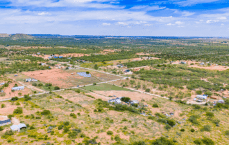


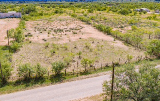
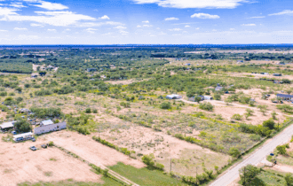
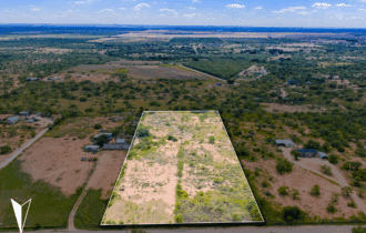


5.48 Unrestricted Acres Near San Angelo – Paved Road, No HOA, Mobiles Allowed
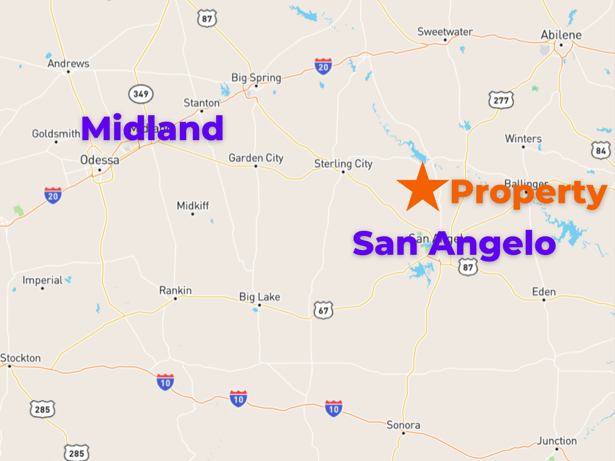
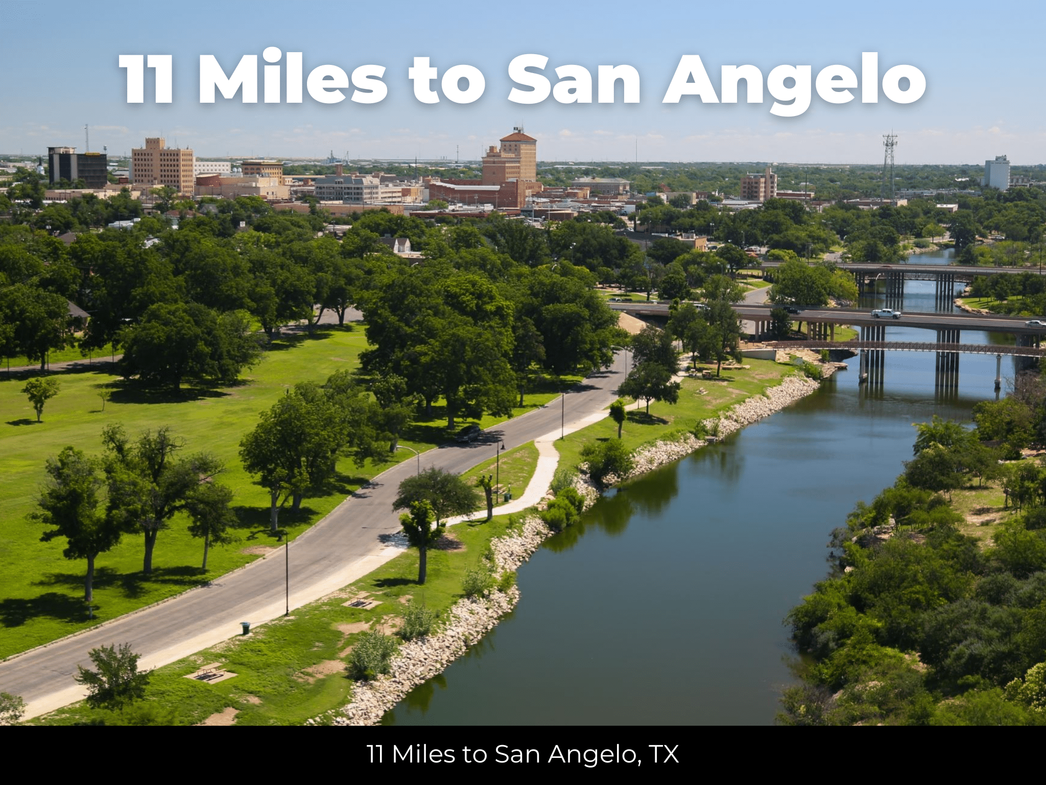
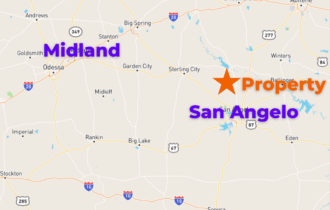
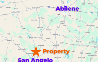
11 miles from San Angelo
APN#55-64125-0248-000-00
Payment
Payment Notes:
Warranty of Title: The property will be conveyed via a general warranty deed, guaranteeing you free and clear title to the property.
We accept Cash or 3rd party financing with a pre-approval letter.
We do offer owner financing with $10,000 cash down.
Paying a 3% Buyer's Agent Commission!
Wide Open Texas Living – 5.48 Acre Lot 11 Miles from San Angelo
Room to Build Just Outside Town
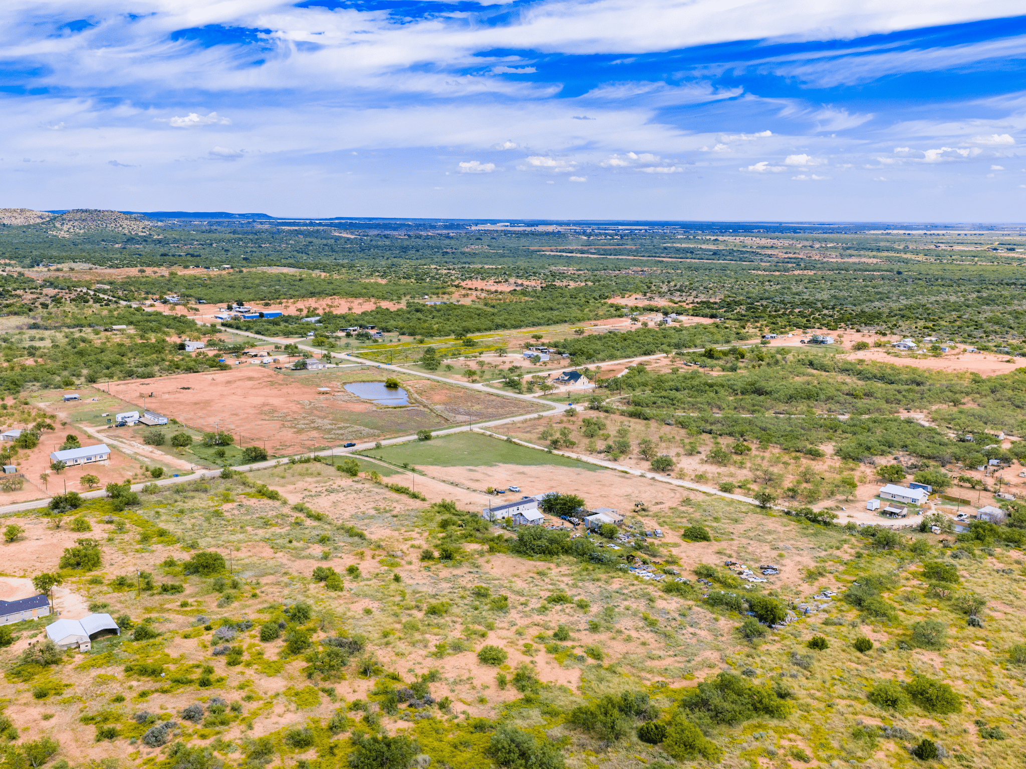
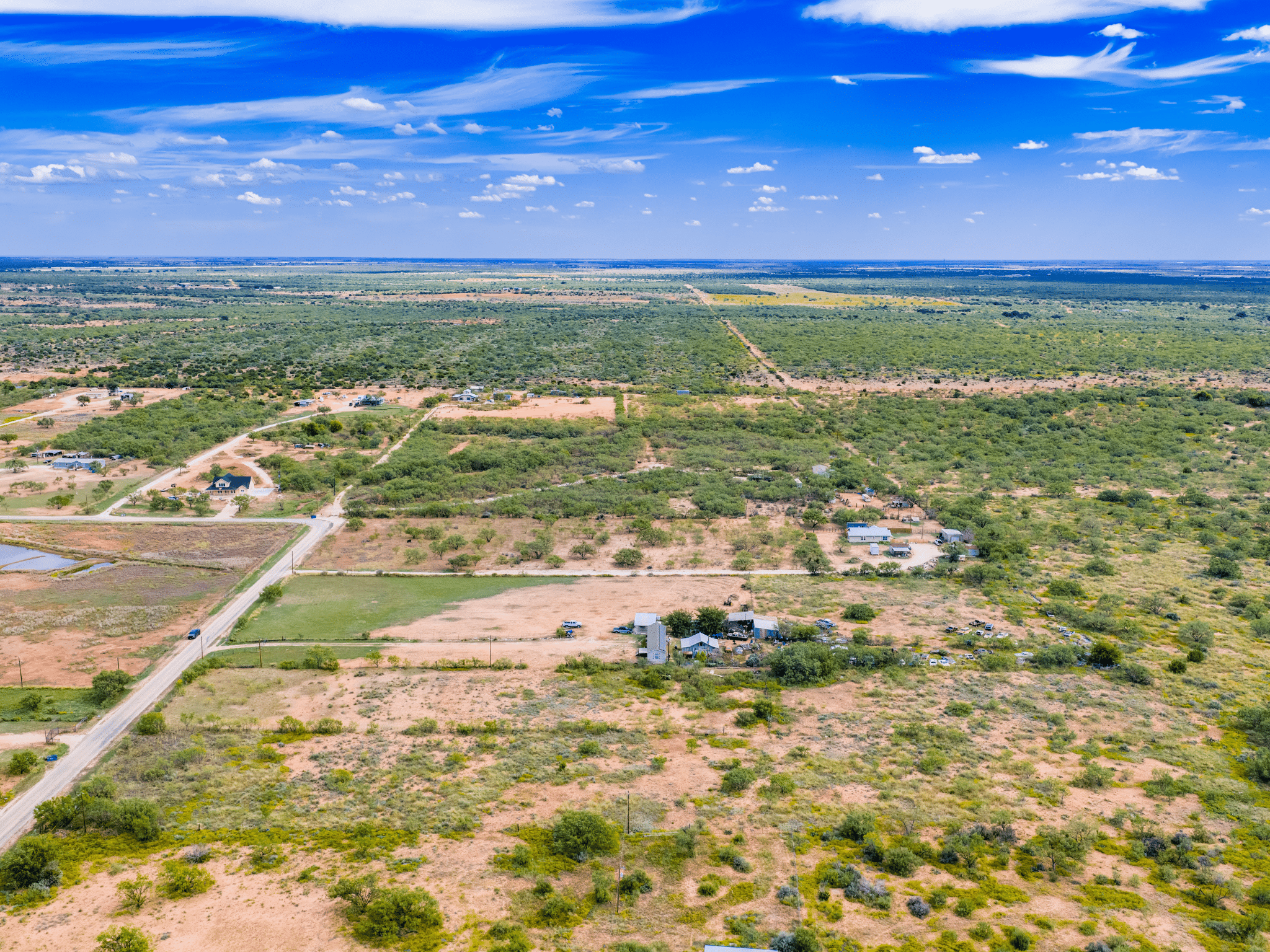
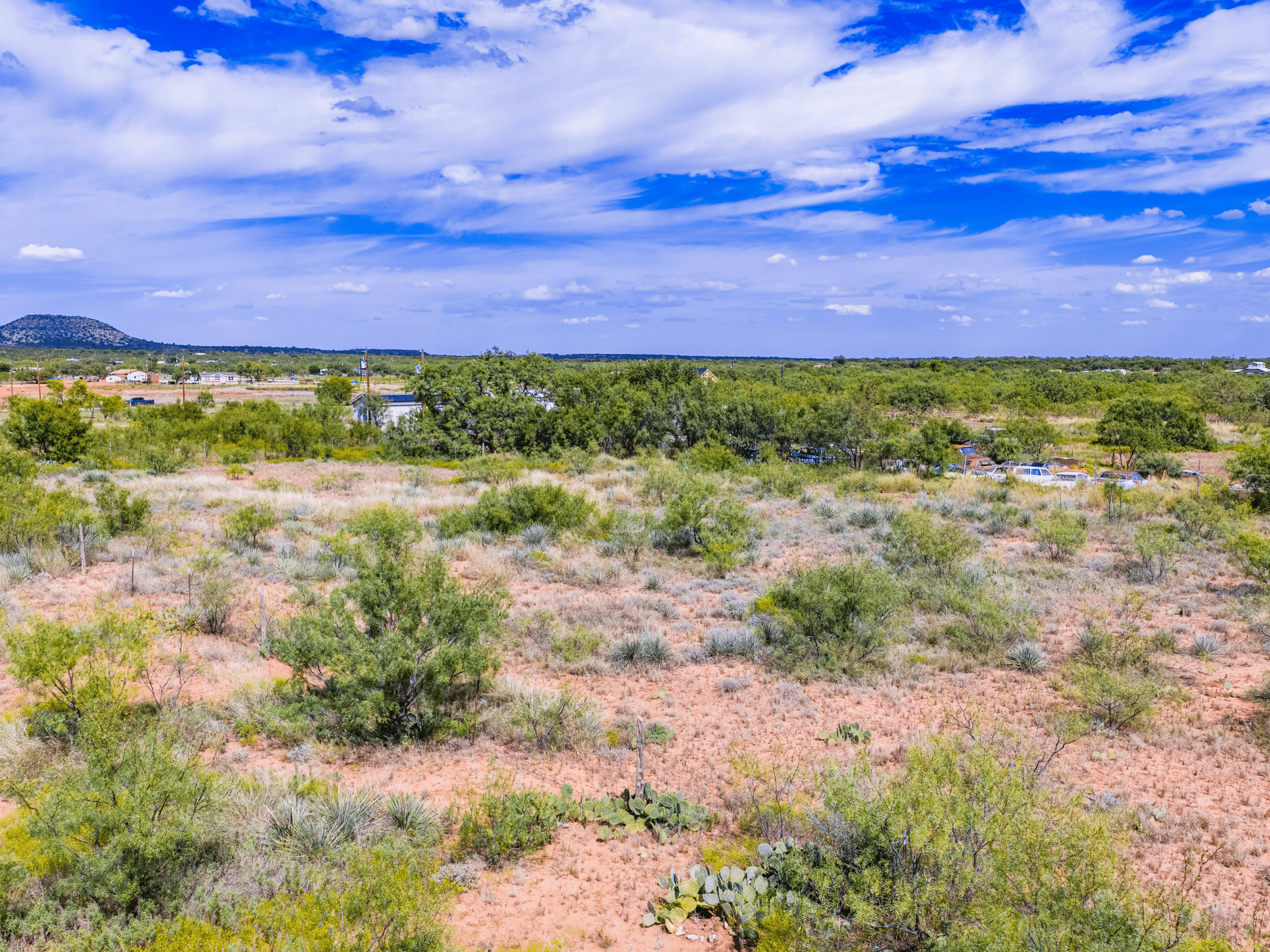
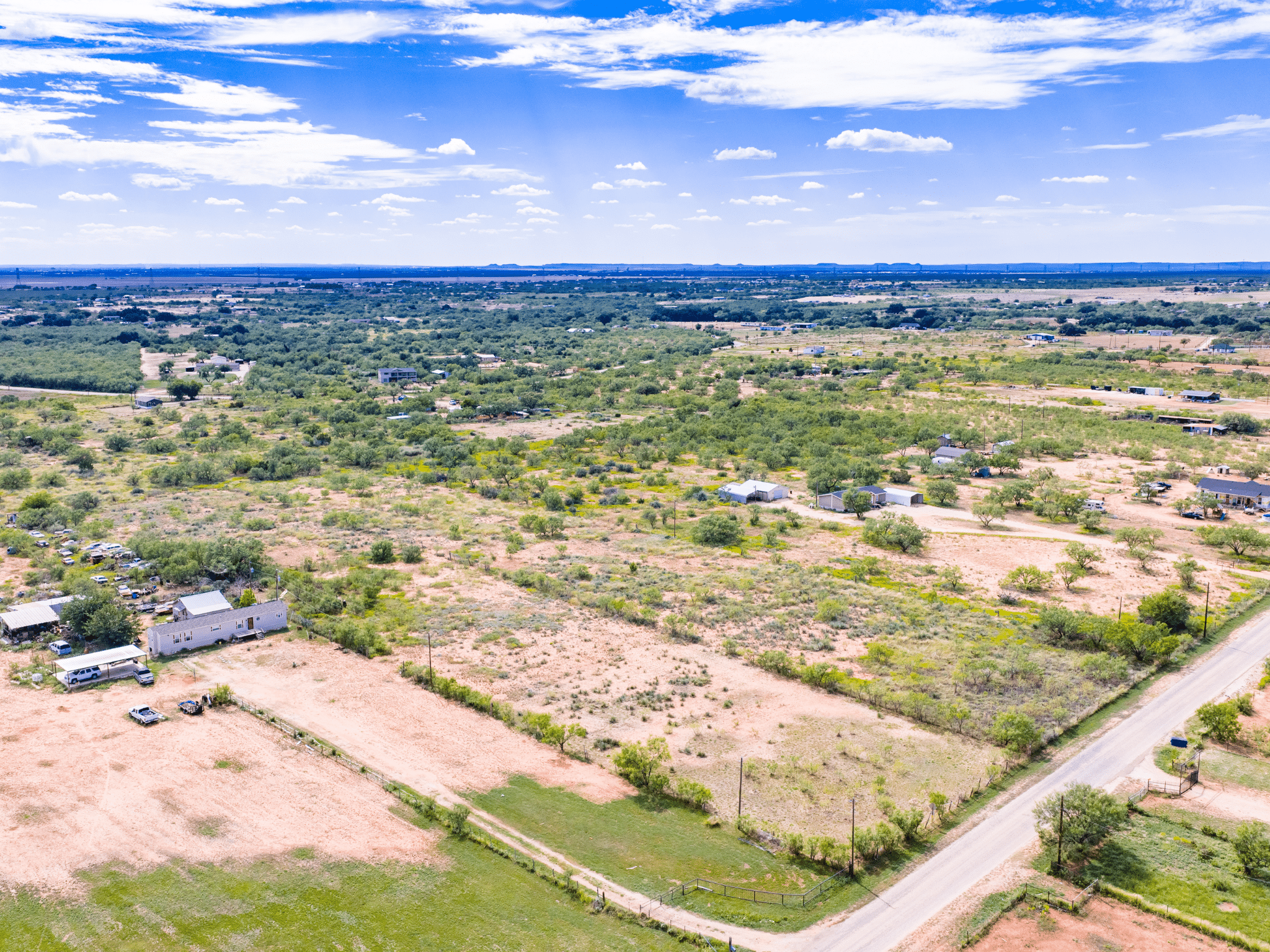
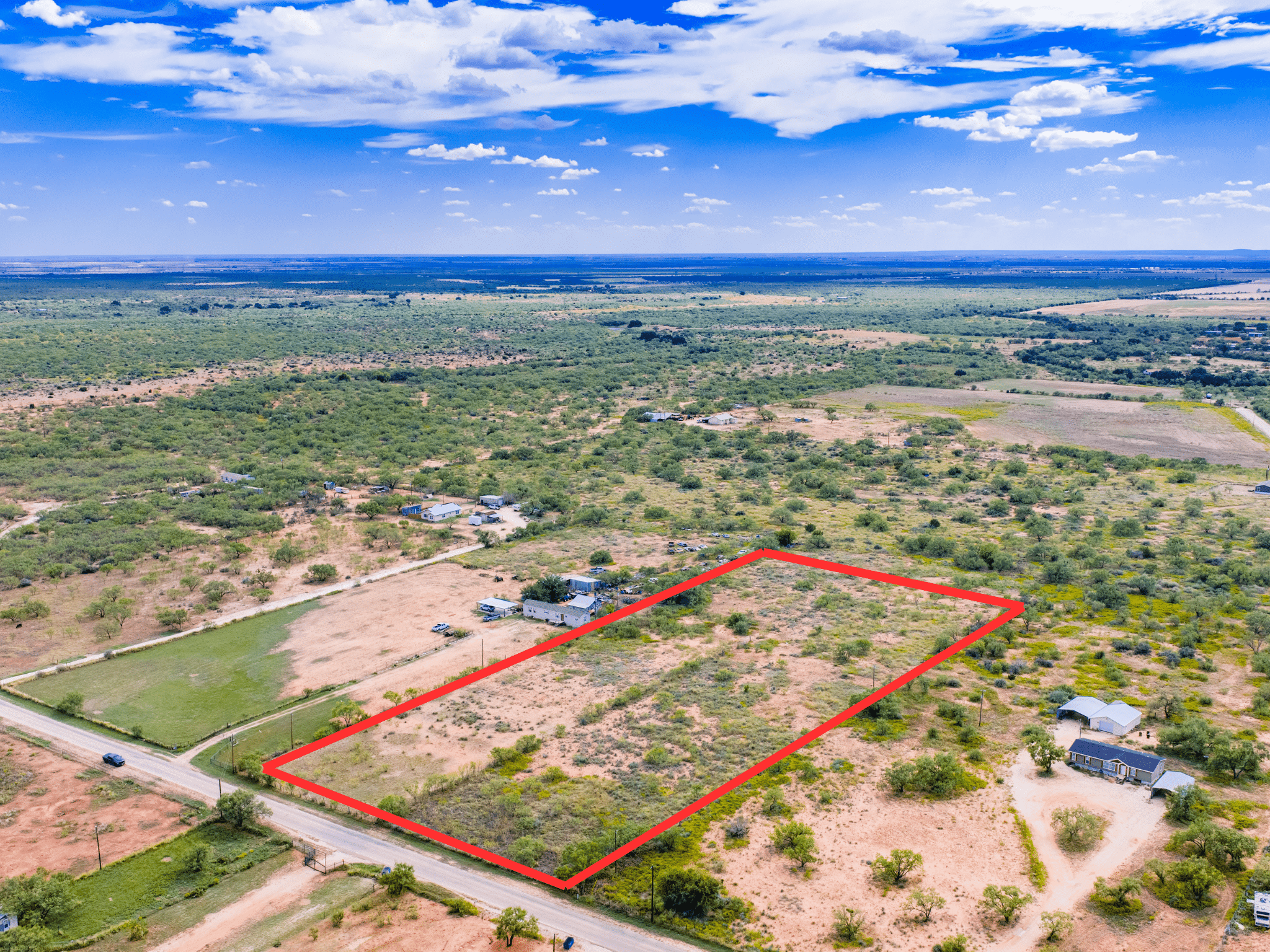
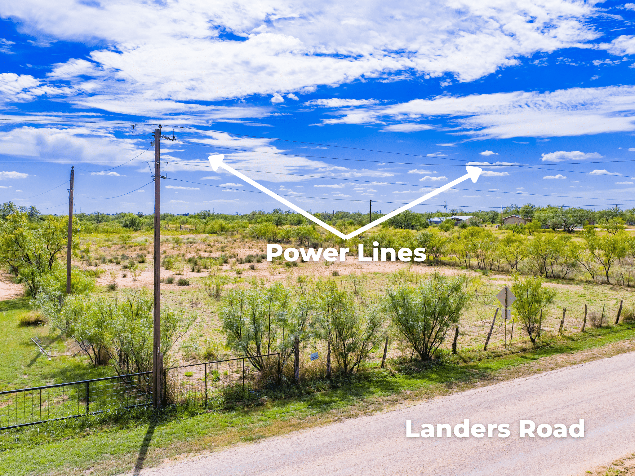
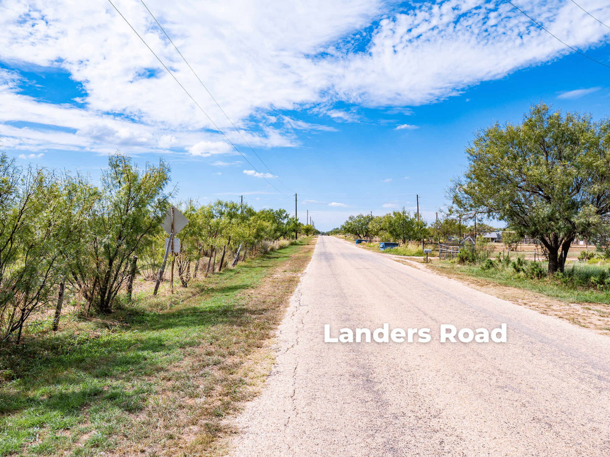
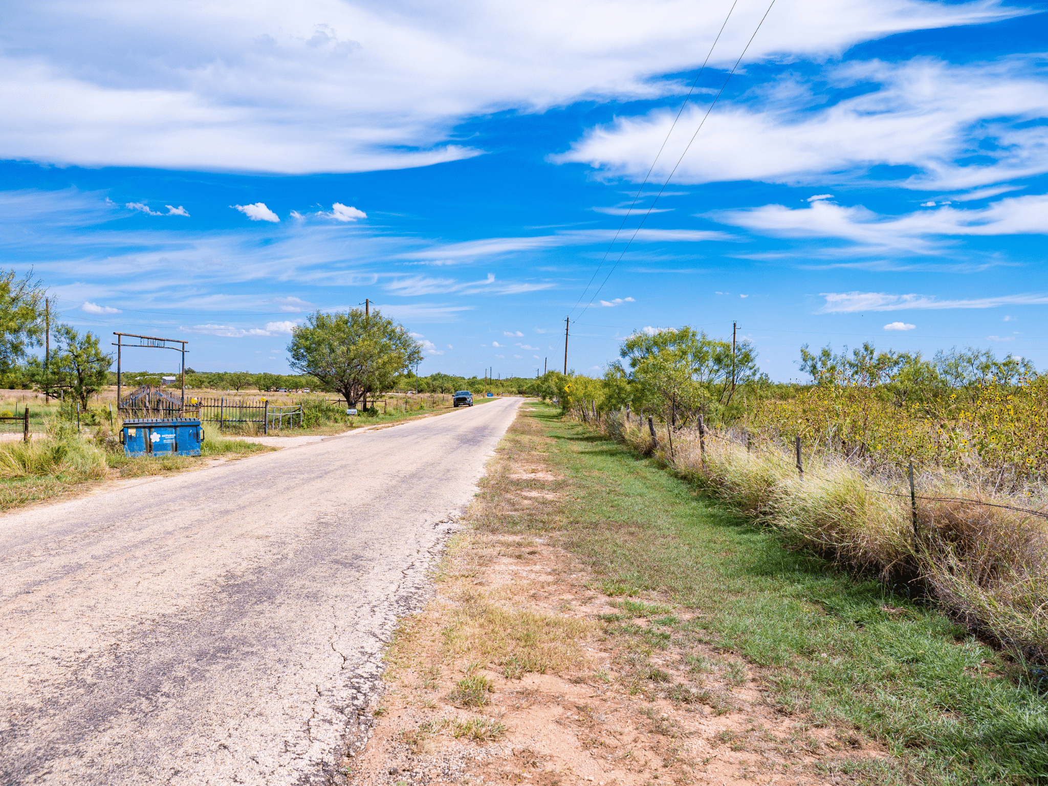
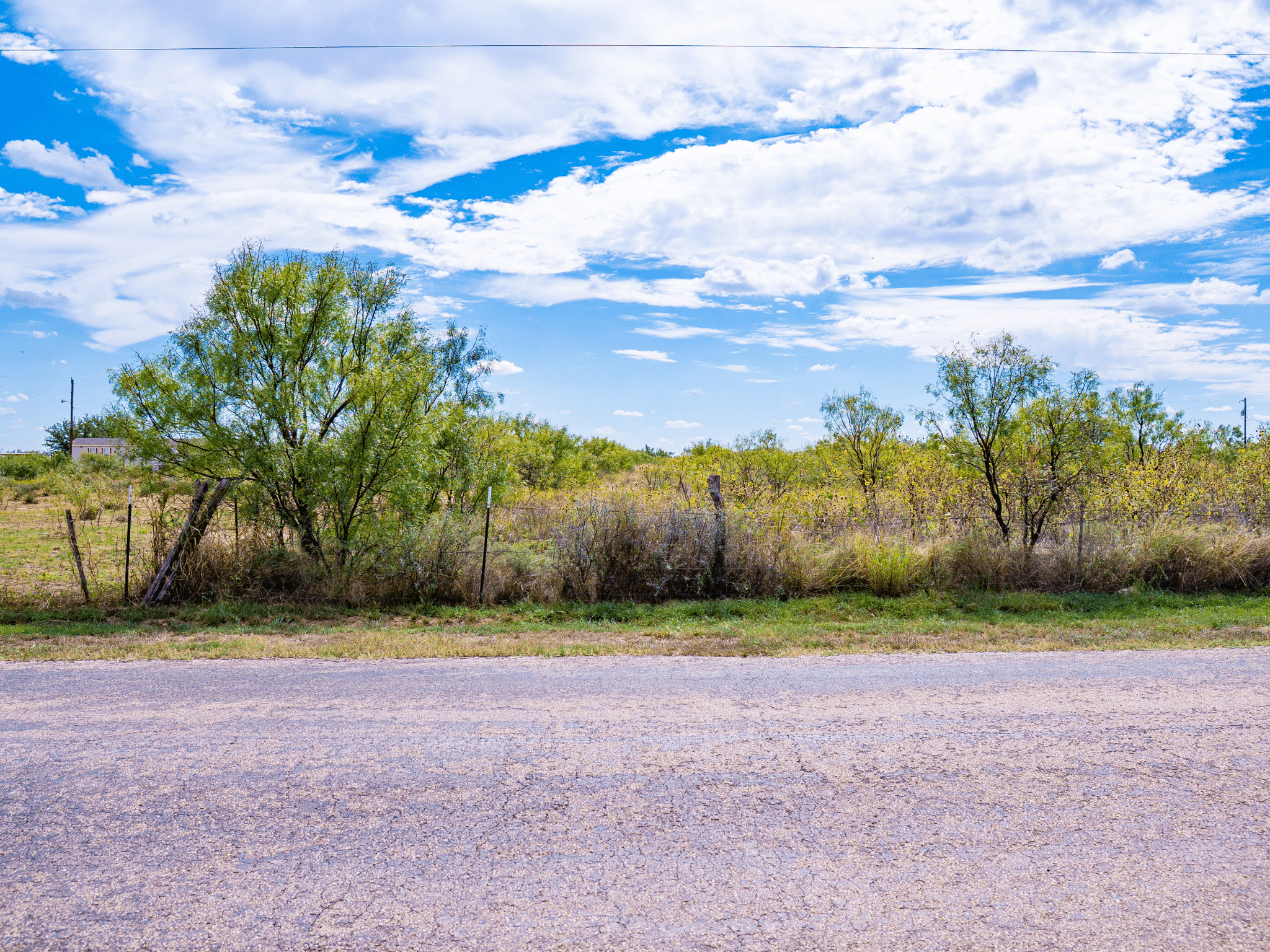
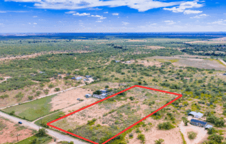
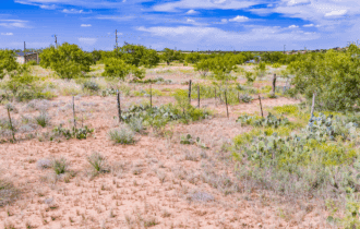
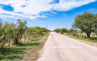
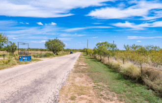
Five and a half acres of level West Texas ground in the Red Creek Subdivision, eleven miles east of San Angelo on paved road. This is the kind of lot that lets you do what you want—mobiles, barndominiums, tiny homes, RVs, even duplexes—with no HOA telling you otherwise. Power is available nearby through Concho Valley Electric, and city water runs to the area, so you can build on-grid or go solar and skip the bill.
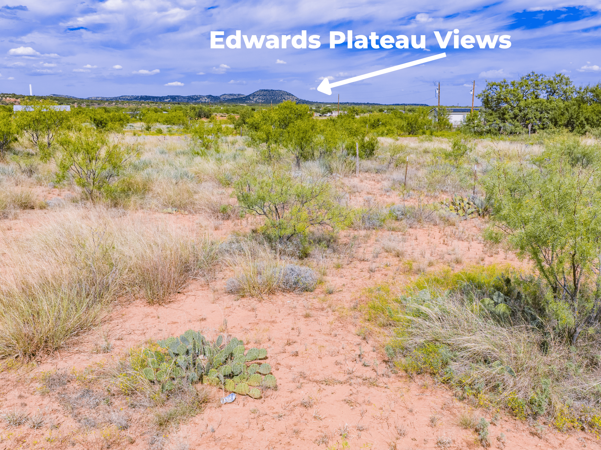
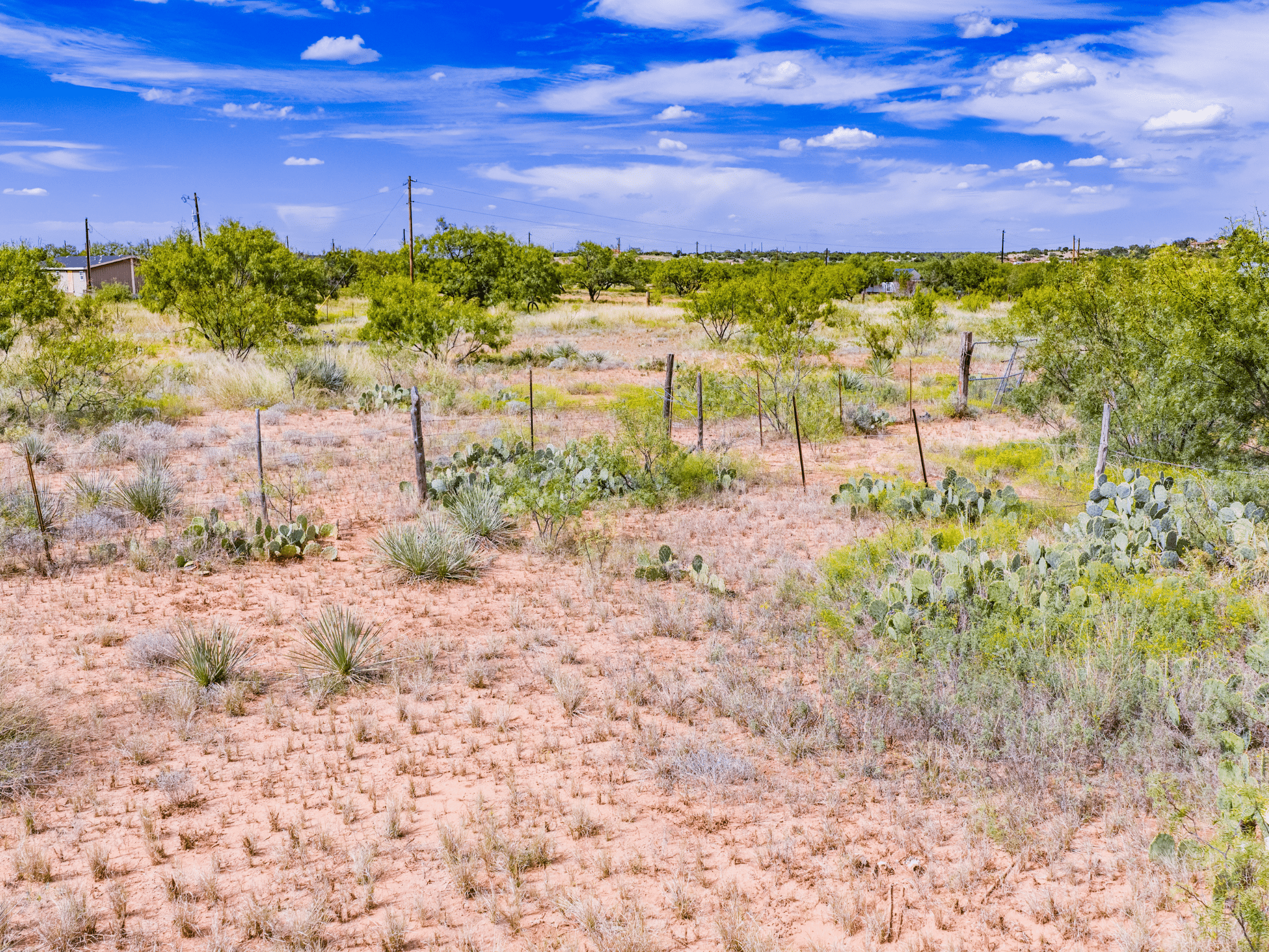
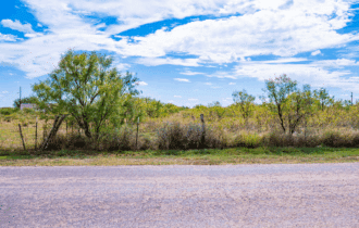
The terrain is flat and open, covered in native grasses with a few mesquite scattered around—classic Rolling Plains character without the rough country that makes building difficult. At 1,850 feet, you're high enough to catch a breeze and low enough to avoid the cedar breaks. Whitetail, turkey, and dove move through the surrounding ranches, and you're in Tom Green County's hunting corridor if you want to put out a feeder and glass the senderos on fall mornings.
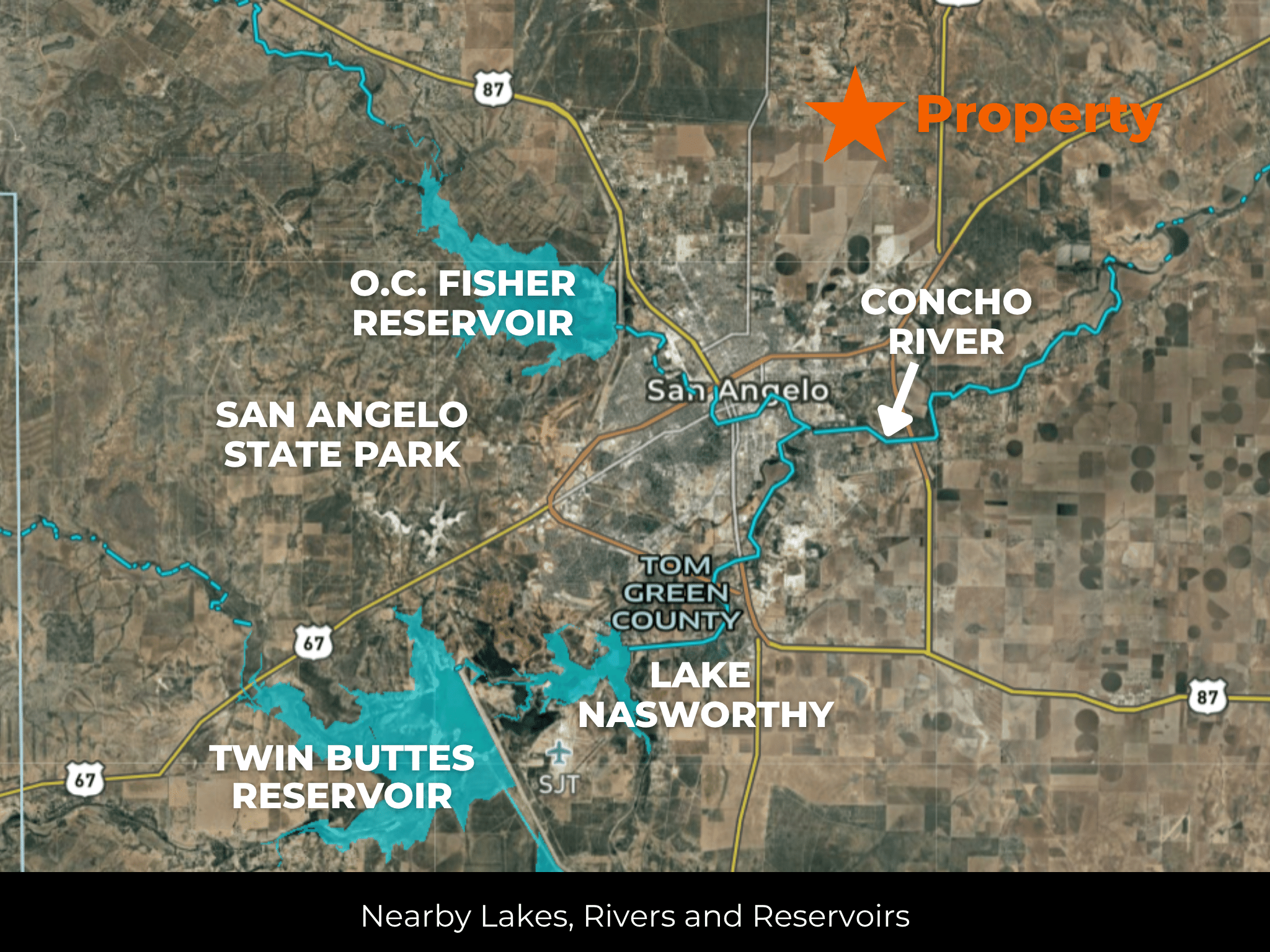
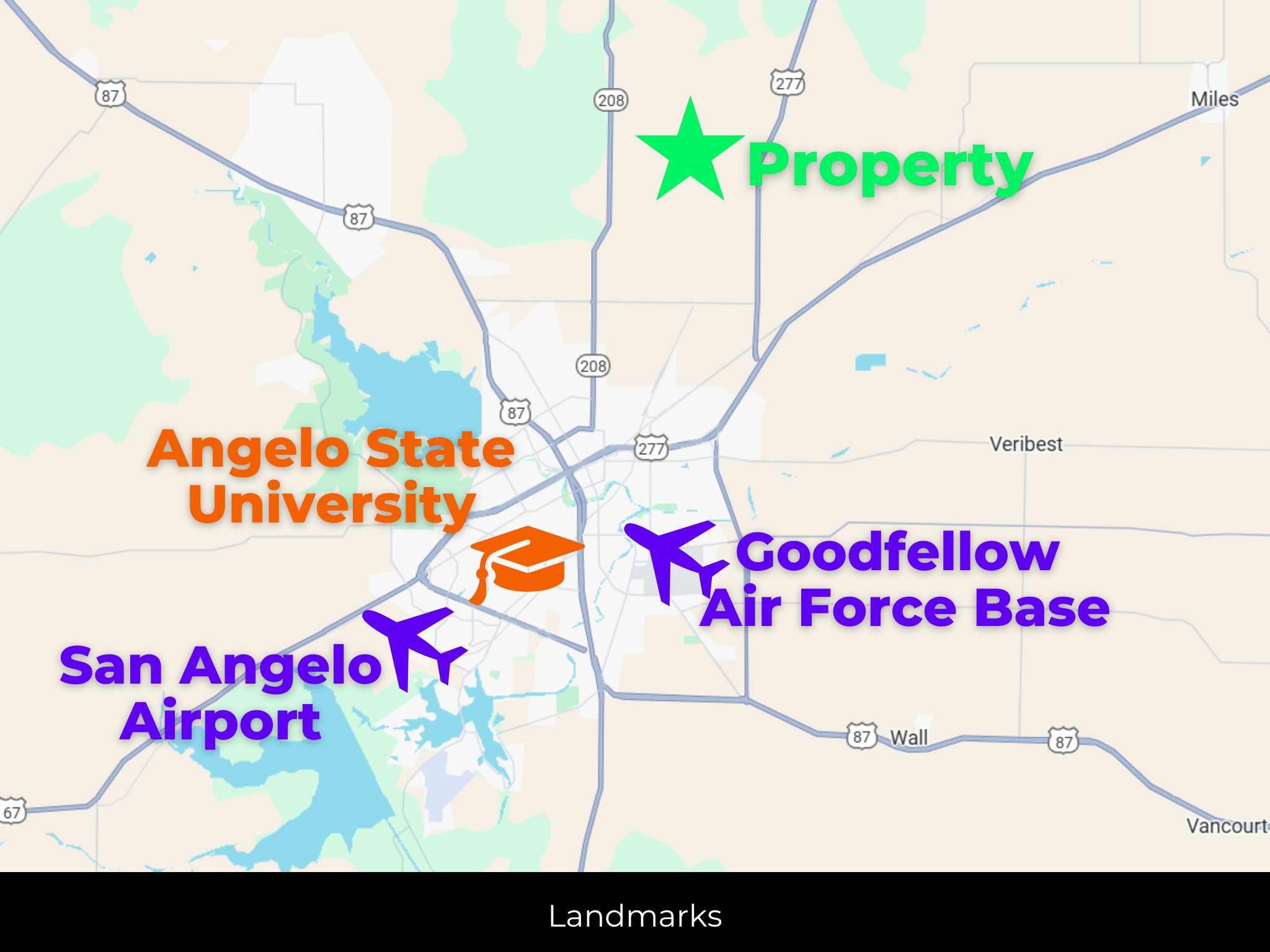
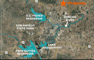
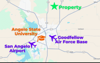
San Angelo is a quick fifteen-minute drive for groceries, healthcare, and whatever else you need. Lake Nasworthy is about twenty minutes south for bass, catfish, and summer weekends on the water. San Angelo State Park—7,677 acres of trails, camping, and public hunting—sits on the edge of town. Angelo State University is right there if you've got kids heading to college or you want access to the cultural side of a university town.
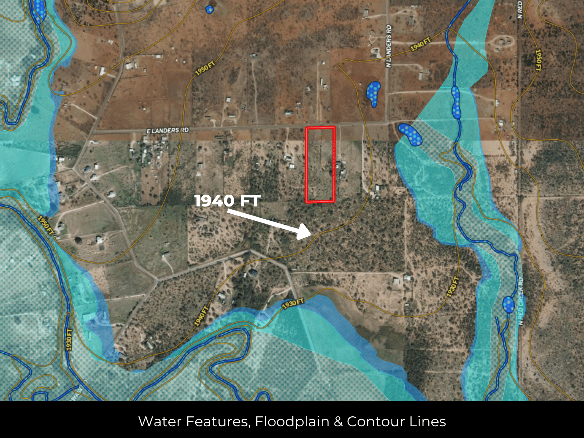
Survey on file. No floodplain. Annual taxes under $1,200. Warranty deed conveyance. This is a clean, simple lot for someone who wants space without complications—build your place, park your trailer, or hold it while San Angelo grows toward you. Call or text 855-833-5263 for details or to schedule a walk.
Quick Facts
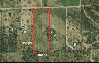
5.48 Acres, No HOA, Paved Road Access, Mobiles Allowed
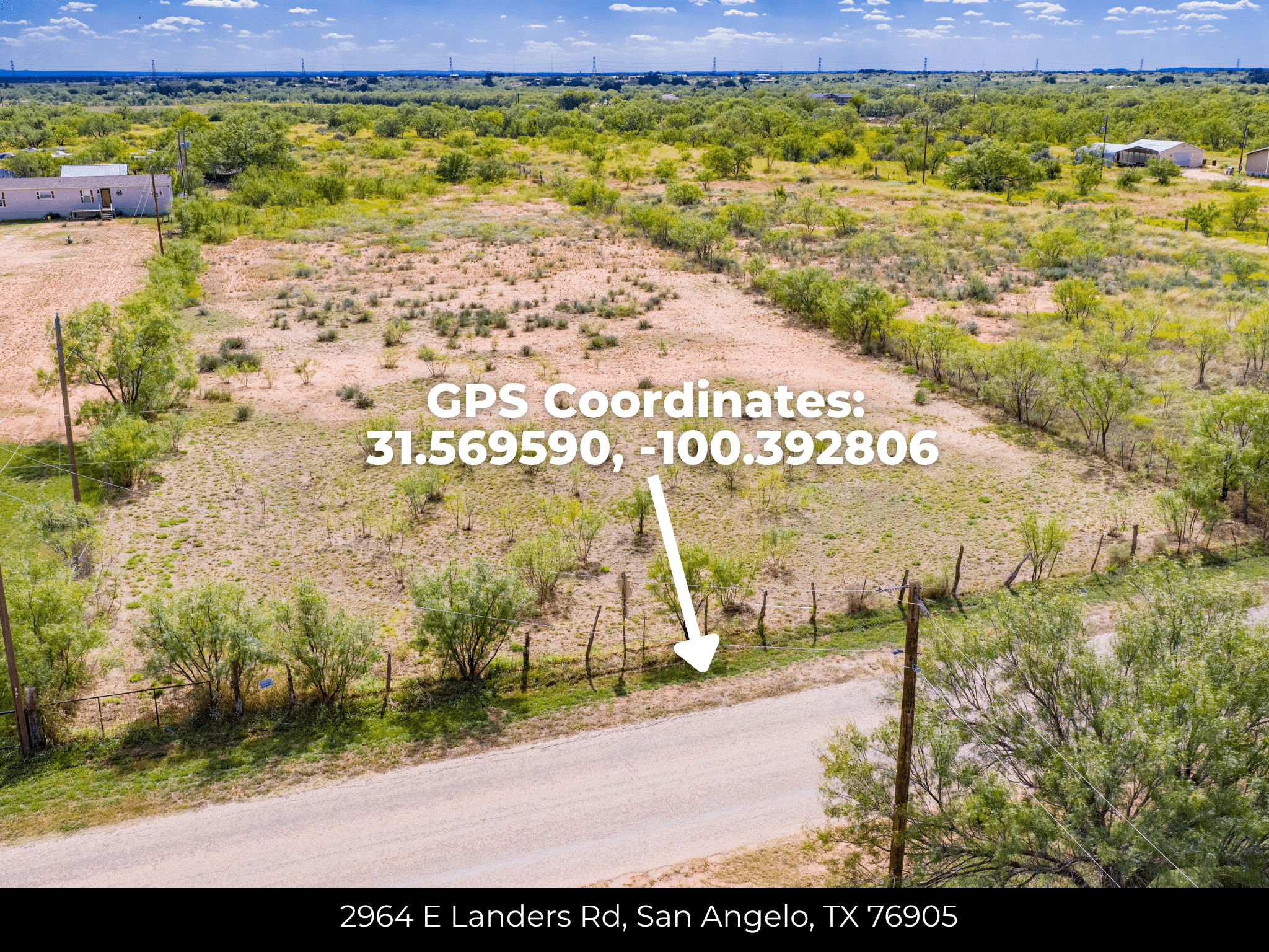
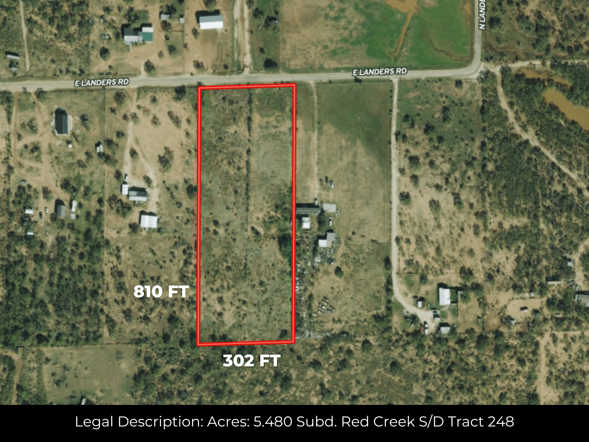
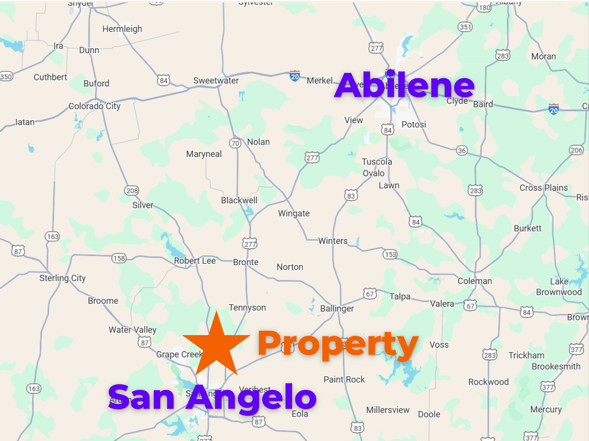
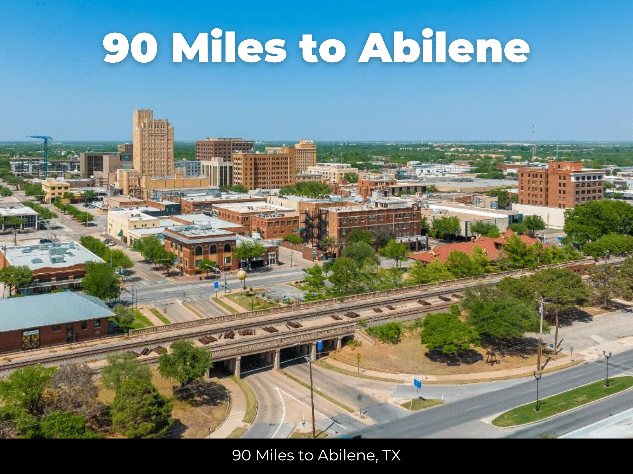
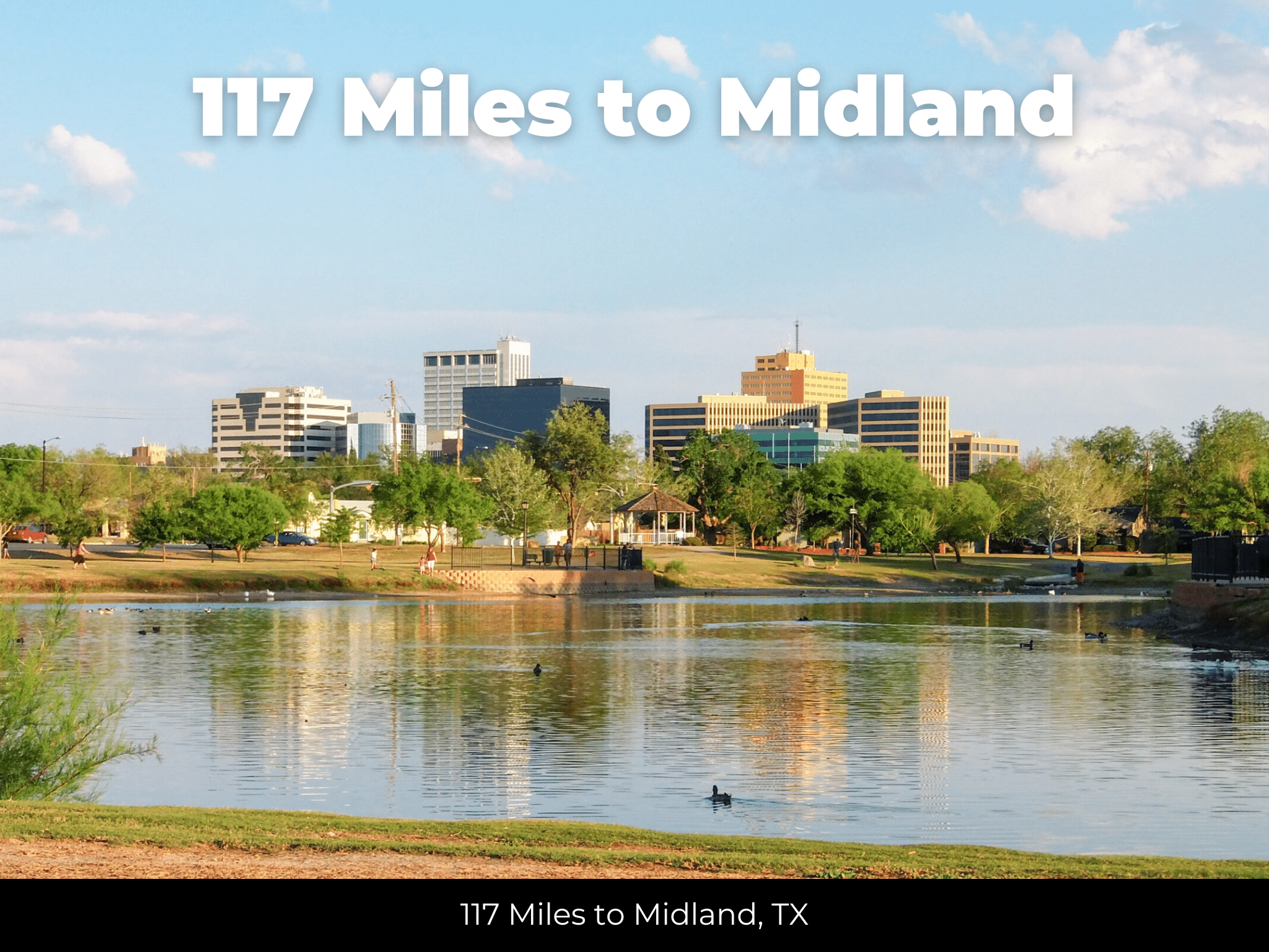
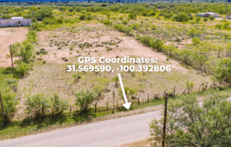
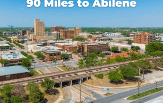
5.48 acres in Red Creek Subdivision, Tom Green County, TX—11 miles east of San Angelo. Level terrain, 810 x 302 dimensions, 1,850 ft elevation. Paved road access. Power available nearby (Concho Valley Electric); city water available. No HOA, no floodplain. Mobiles, barndominiums, tiny homes, RVs, duplexes, and camping all allowed. Survey on file. Annual taxes $1,189.42. Warranty deed. Whitetail, turkey, and dove in the area. San Angelo State Park (7,677 acres, 50 miles of trails, public hunting) is 15 minutes away. Lake Nasworthy 20 minutes south. Angelo State University in town. Abilene 90 miles; Midland 117 miles. GPS: 31.5696, -100.3931. APN: 55-64125-0248-000-00. Call or text 855-833-5263.
Visiting the Property
You are welcome to visit the property at your convenience and anytime while it's still available. However, we HIGHLY recommend checking-in with us prior to visiting the property in case the property has gone under contract or already sold.
The interactive map above is generated with MapRight. MapRight has free apps for Apple IOS and Android that can be used to track your location and route throughout a property and provide driving directions.
MapRight for Apple –> Download App.
MapRight for Android –> Download App.
To launch the interactive map on your device, 1) install the free MapRight app using one of the two links above for Apple or Android, and 2) click the “View Full Screen” link (see above) in the embedded map on the property listing page.
Property Information
Parcel Size
5.48 Acres
State
Texas
County
Tom Green
Nearest Cities
San Angelo
Parcel #
55-64125-0248-000-00
Address
2964 E Landers Rd, San Angelo, TX 76905
Legal Description
5.480 Subd: Red Creek S/D Tract: 248
Zip Code
76905
Annual Property Taxes
$1,189.42
Agricultural Tax Exemption
No
HOA
No
HOA per Year
None!
Survey Available
Yes
School District
San Angelo Independent School District
Liens and Back Taxes
None!
Source Deed
Sent for Filing.
Title Status
Free & Clear!
Outgoing Conveyance
Warranty Deed
Property Features
Acres
5.48
Dimension
810 x 302
County
Tom Green
Access
Road access
Power
Available nearby
Water
Available
Coordinates
31.5696, -100.3931
Elevation
1,850 ft
Terrain
Level
Floodplain
No
Duplexes
Yes
Mobiles
Yes
Tiny Homes
Yes
Barndominiums
Yes
RV's
Yes
Camping
Yes
Property Survey, HOA, & Additional Documents
Utilities
🔌 Power: Concho Valley Electric Cooperative
💧 Water: City of San Angelo Water Utilities
🚽 Sewer: City of San Angelo Water Utilities or Septic or alternative sewer system.
🗑️ Trash: City of San Angelo Residential Trash Collection
☎️ Phone: Cellular, VOIP (see internet below), and satellite phone through Iridium, Globalstar, or Inmarsat.
🌐 Internet: Satellite internet through Starlink, HughesNet, or ViaSat.
📺 Cable: Satellite cable through Dish or DirectTV.
Nearby Cities
- San Angelo, TX – 11 miles
- Abilene, TX – 90 miles
- Midland, TX – 117 miles
- Odessa, TX – 135 miles
Tom Green County Contacts
Tom Green County Assessor: Becky Robles – (325)-659-6529
Tom Green County Treasurer: Dianna Spieker – (325) 659-6520
Tom Green County Clerk: Christina “Liz” Ubando – (325)-659-6553
Tom Green County Zoning: City of San Angelo – Aaron Vannoy – (325)-657-4210
Tom Green County Health: Tom Green County Environmental Health Department – (325)-658-1038
Tom Green County CAD: Tom Green County Appraisal District – Tyler Johnson (Chief Appraiser) | (325)-658-5575
Tom Green County GIS: City of San Angelo GIS – Aaron Abilez | Phone: 325-657-4210
Tom Green County Website: https://www.tomgreencountytx.gov/page/homepage
Closing Costs and Fees
$299
Document Prep Fee
Buyer will pay a $299 document preparation fee, which includes all postage and county recording fees. Seller will warrant title to the property.
$0
In-House Closing Fee
There will be no additional fees or expenses for an in-house closing. We will close in 14 days or less. This is the fastest, easiest, and cheapest way to close.
$1,500+
Title Company Fees*
Title Company costs are typically 2-5% of the purchase price with a minimum fee of around $1,500. Many states have legislated, standard insurance rates and other fees vary by the title company.
* If Buyer elects to close through a third-party title company, Buyer will bear all closing costs and expenses, including Seller’s title policy and Seller's escrow fees. Closing through a title company typically takes 30-45 days, depending on the county, title company, and transaction activity in the area.
Driving Directions and GPS Coordinates
🚗 Driving Directions:
- Start in San Angelo heading east on US-67 N / Houston Harte Expy
- Take the exit for FM 380 / Arden Road (or the exit closest to Red Creek Subdivision – use exact plat location if known)
- Turn onto FM 380 or appropriate rural road leading into the Red Creek area (this may be Red Creek Road or another marked route – confirm with plat/survey)
- Follow local access roads to the parcel based on GPS (enter coordinates into GPS)
Google Map
If you click the blue Directions link below, 👇 you can get Google turn-by-turn directions to the property on any device. The map coordinates for the Google Map below are for the approximate center of the property and not the entrance, gate, or primary access point for the property. Google Maps may provide driving directions that require the use of private or abandoned roads or may require you to go through gates located on private property. Do not trespass on private property! Some properties will require a 4-wheel drive vehicle or may be inaccessible in certain weather conditions. Please don't get stuck or lost.
Additional Notes
As-Is and As-Available: This property is being sold property “as-is” and “as-available.” No representations as to fitness for a particular purpose have been made. No verbal claims or promises have been made. Please see our Terms of Service for more information.
Contract: After making your initial deposit, we will email you the purchase and sale agreement, which includes a warranty deed. Agreements are prepared manually and will be sent out Monday through Friday between 9 AM and 5 PM CST. Thank you for your patience.
No Monthly Payments: We are not offering seller financing on this property. This is an all-cash transaction. We are not offering a payment plan. If you would like to finance your purchase of the property, please contact a third-party lender prior to making your deposit. We will not sign a purchase and sale agreement that is contingent upon third-party financing without a pre-approval letter.
3% Buyer's Agent Commission: You are not required to have an agent or broker assist you with purchasing this property. However, if the Buyer does use an agent, and the Seller is made aware of this prior to an agreement on price or signed contract, the Seller will pay a 3% commission to the Buyer's licensed agent or broker.
Maps and GPS Coordinates: Maps and GPS coordinates are believed to be accurate, but accuracy is not guaranteed. The information contained in the maps should not be considered a “legal description,” and the maps and GPS coordinates are not a replacement for a survey. We have taken reasonable steps to ensure that parcel lines, maps, and coordinates are in fact accurate, but third-party geographical information system (GIS) providers, including information from the county, often contain errors and inaccuracies.