


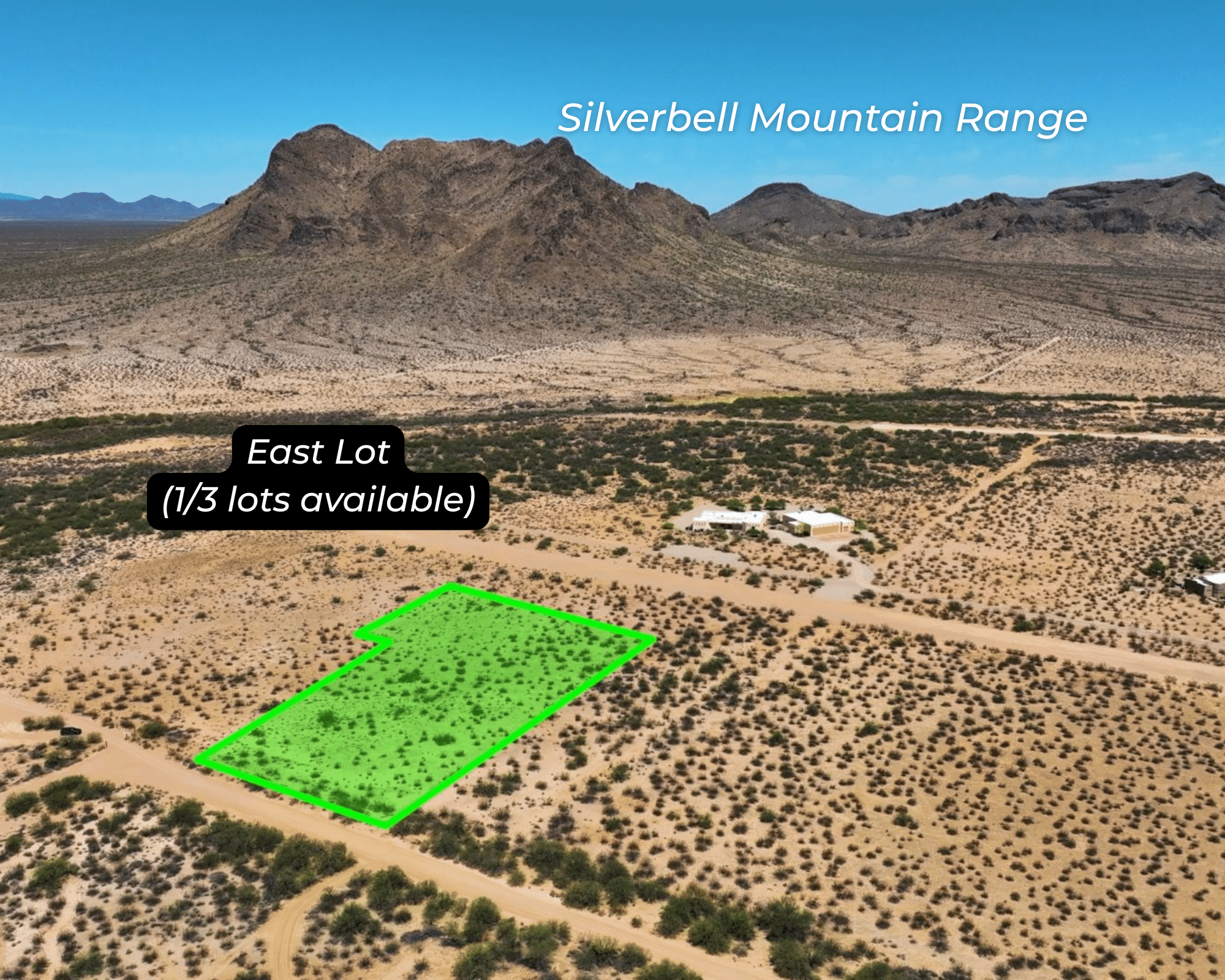
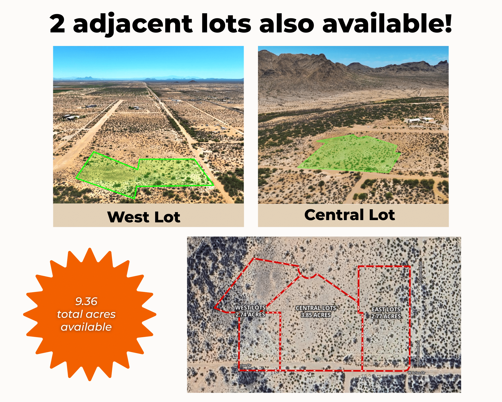


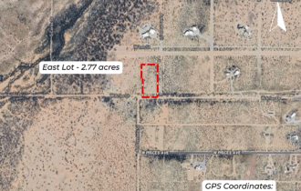


2.77 Acres of Peaceful Desert Escape Near Eloy
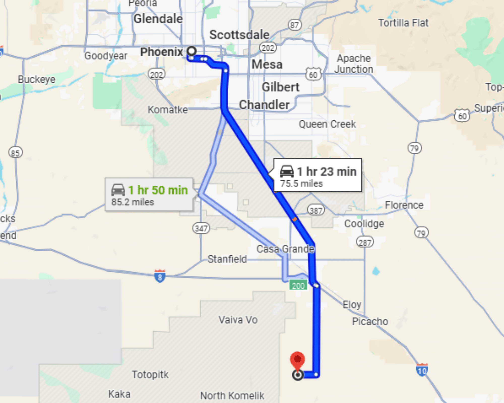
22 min (16 miles) from Arizona City, AZ
APN# 40937165 & 40937166
Payment
Payment Notes:
Warranty of Title: The property will be conveyed via a general warranty deed, guaranteeing you free and clear title to the property.
We accept Cash or 3rd party financing with a pre-approval letter.
We do not offer owner financing. No payment options are available for this property.
Paying a 3% Buyer's Agent Commission!
Property Description
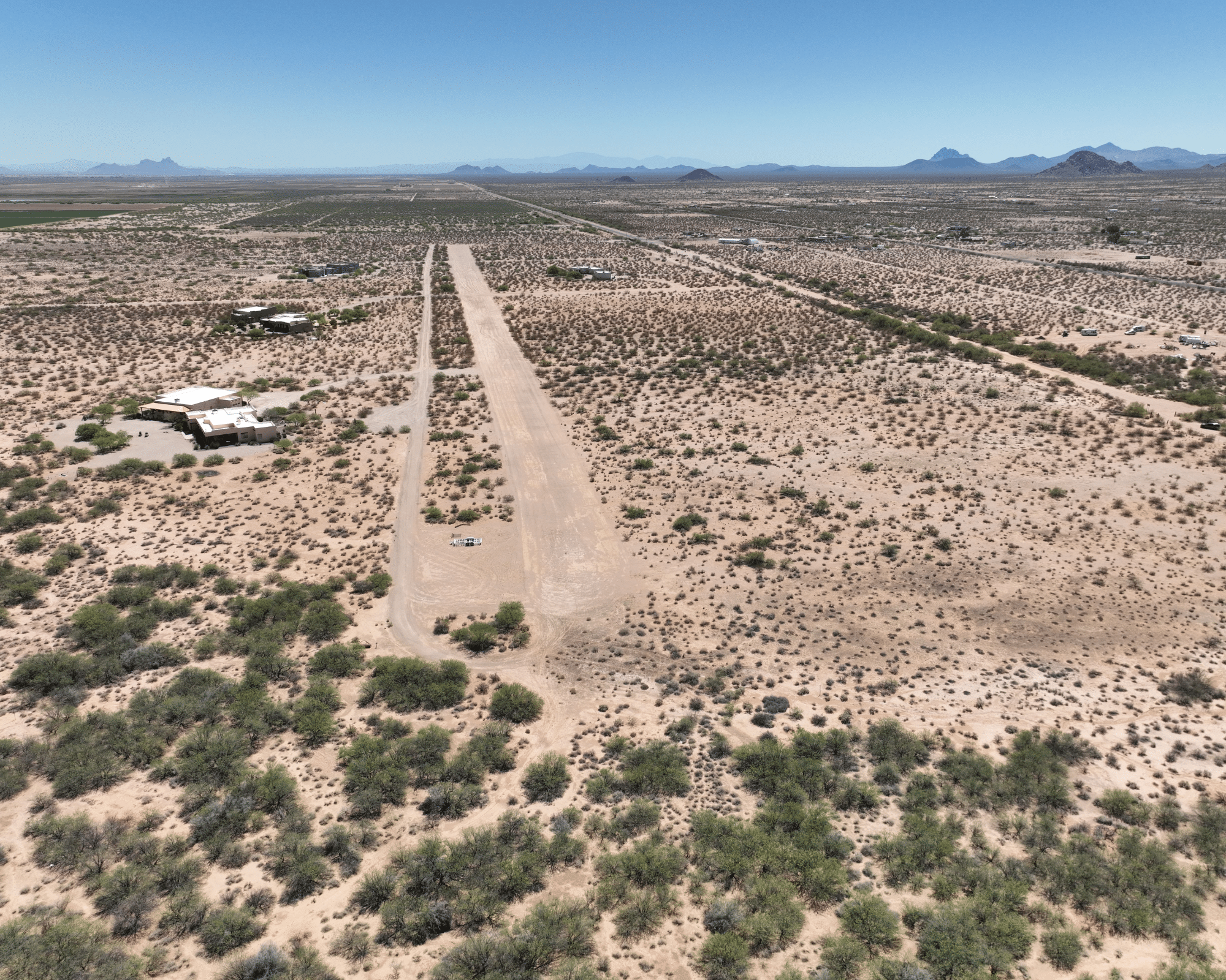
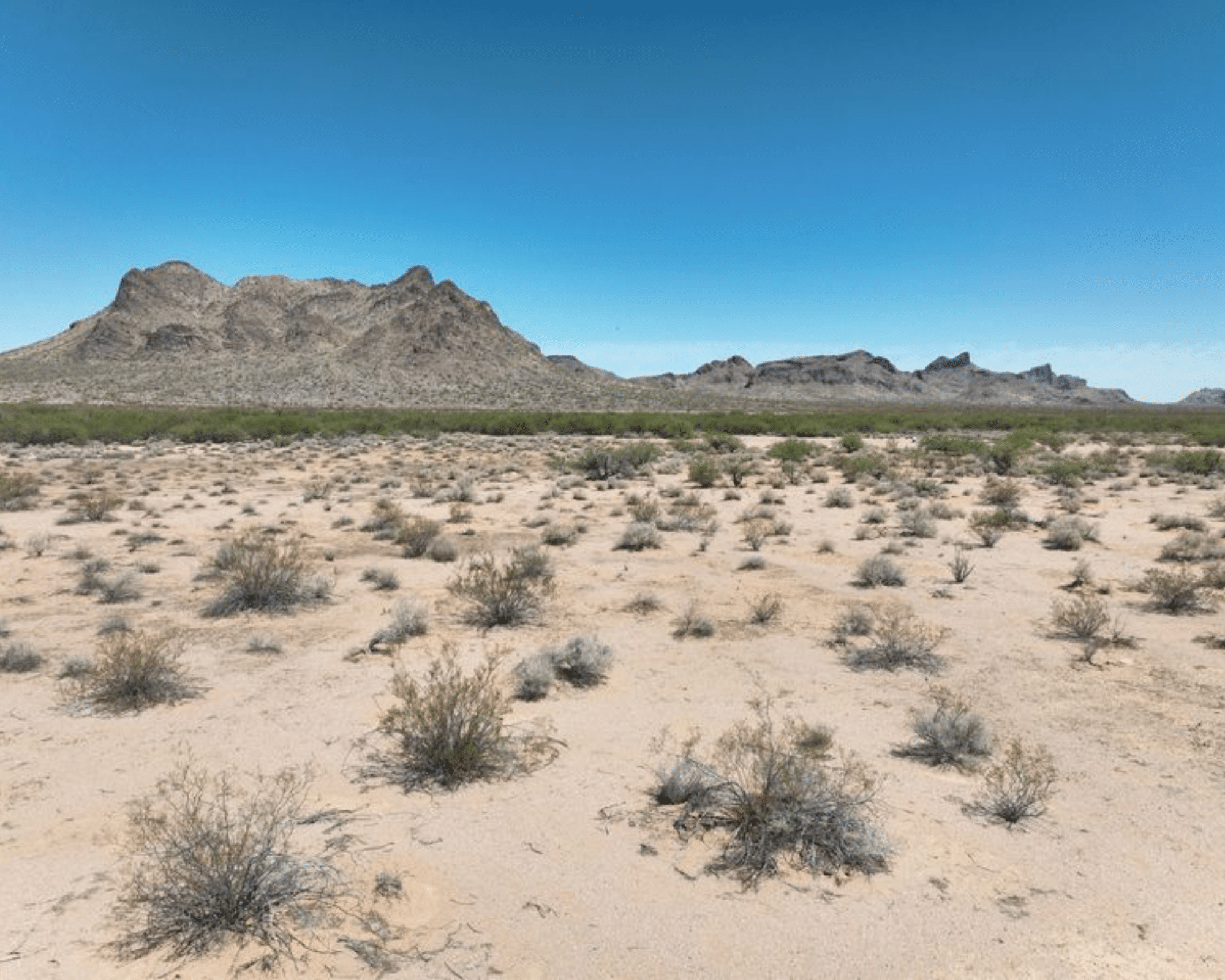
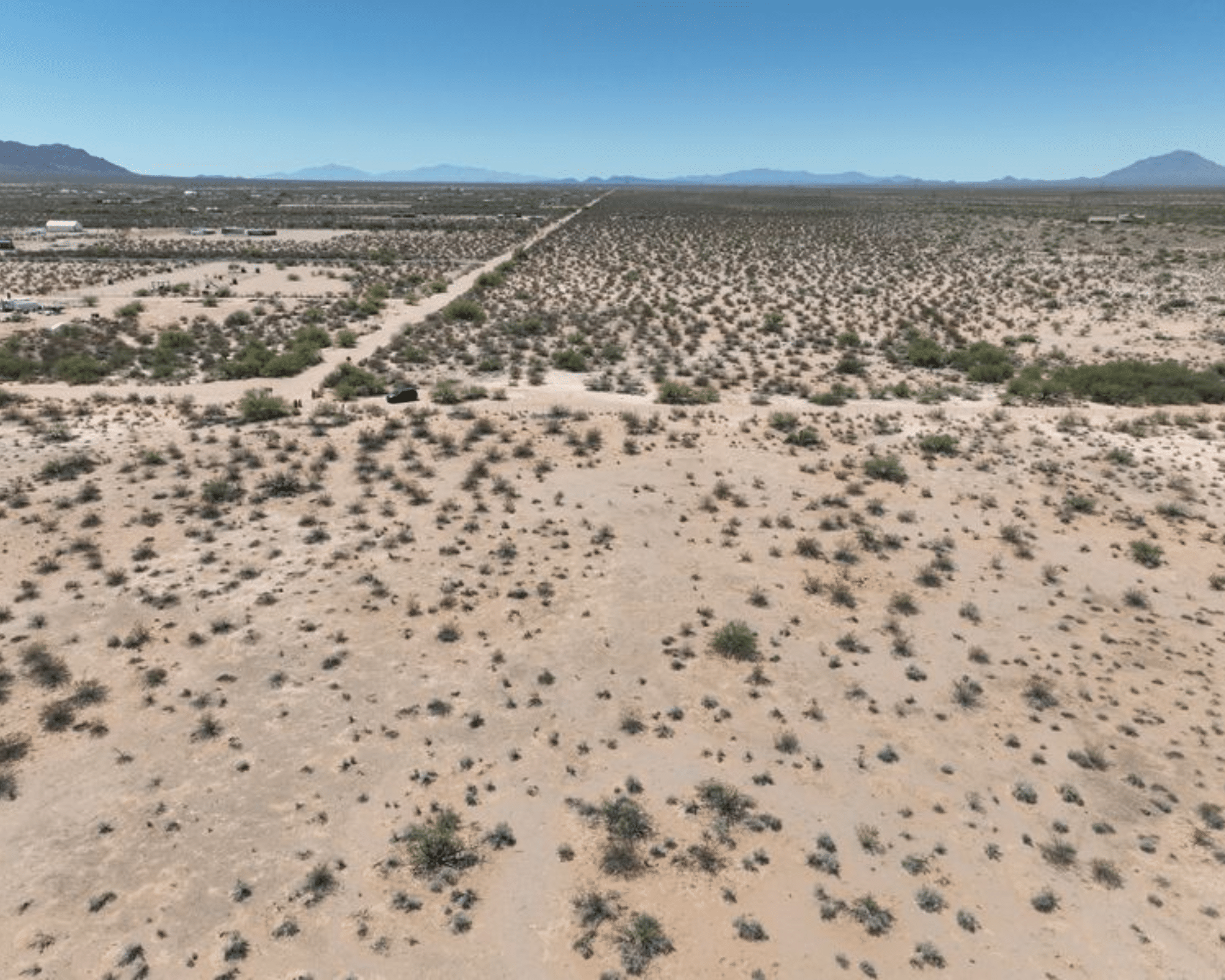
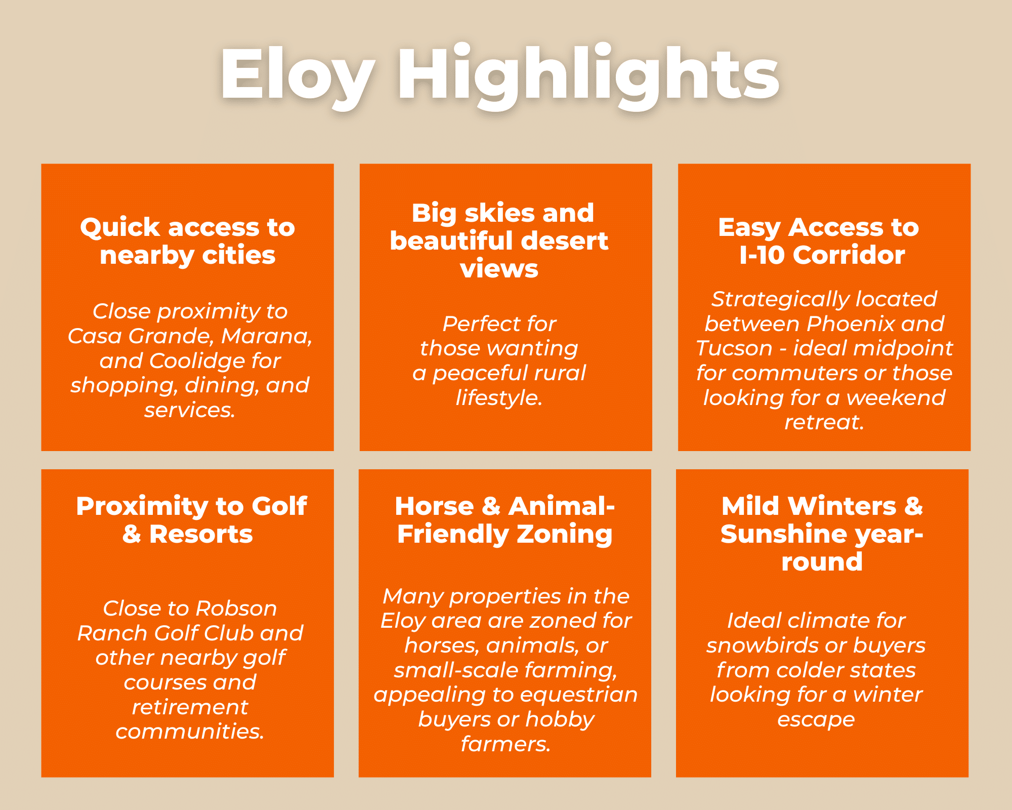
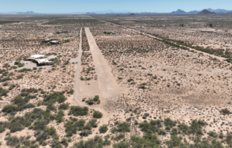
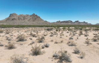
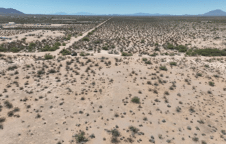
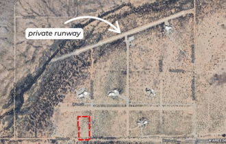
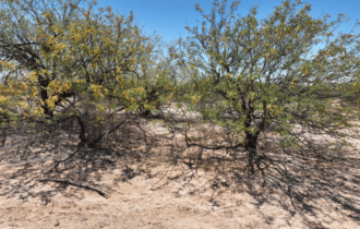
Discover a rare opportunity to own 2.77 acres in Flying Crown Ranch, an exclusive gated aviation community in the heart of rural Arizona. Surrounded by sweeping desert vistas and endless blue skies, this unique parcel offers the perfect blend of privacy, freedom, and connection—for those who live to fly or simply crave open space.
This flat, build-ready lot is your blank canvas to create the ultimate aviation retreat. With direct access to a privately maintained runway, you can taxi from your future home and hangar straight to the skies. Whether you're a weekend pilot, a full-time flyer, or a savvy investor, this is where your lifestyle takes off.
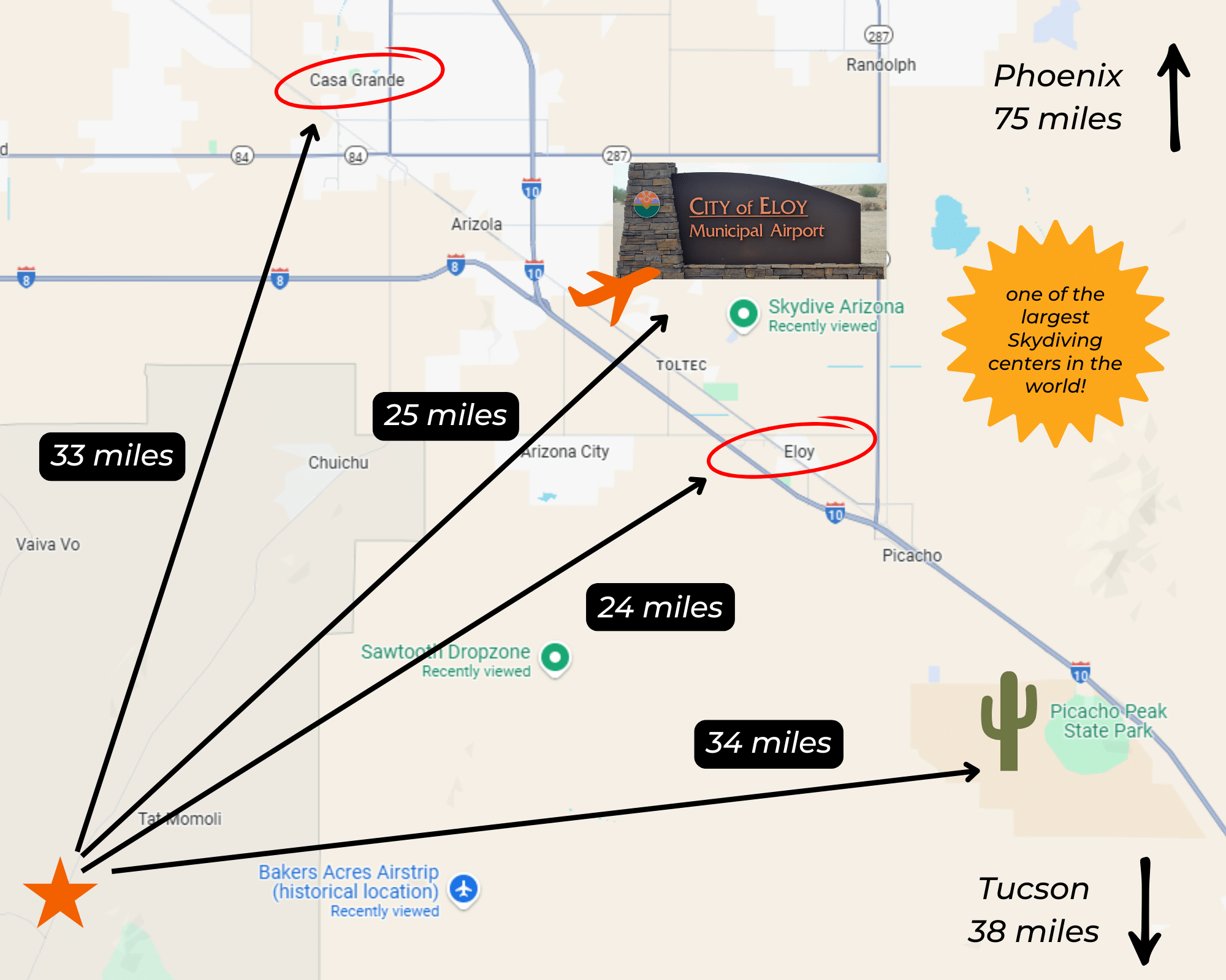
The community here isn’t just friendly—it’s united by a shared passion for aviation. You'll feel right at home among neighbors who value the same sense of independence and adventure. Located near the dynamic Sawtooth Airport and just a quick hop from Skydive Arizona, you're perfectly positioned to enjoy both serene desert living and high-adrenaline pursuits.
Here, the sky isn't the limit—it's just the beginning. Escape the ordinary and embrace a life elevated. Your runway to freedom starts at Flying Crown Ranch.
Visiting the Property
You are welcome to visit the property at your convenience and anytime while it's still available. However, we HIGHLY recommend checking-in with us prior to visiting the property in case the property has gone under contract or already sold.
The interactive map above is generated with MapRight. MapRight has free apps for Apple IOS and Android that can be used to track your location and route throughout a property and provide driving directions.
MapRight for Apple –> Download App.
MapRight for Android –> Download App.
To launch the interactive map on your device, 1) install the free MapRight app using one of the two links above for Apple or Android, and 2) click the “View Full Screen” link (see above) in the embedded map on the property listing page.
Property Information
Parcel Size
2.77 Acres
State
Arizona
County
Pinal
Nearest Cities
Eloy, AZ
Parcel #
40937165 & 40937166
Address
East Lots, Eloy, AZ, 85131
Legal Description
Silver Bell Estates #6 Lot 165 & Silver Bell Estates #6 Lot 166
Zip Code
85131
Annual Property Taxes
$83.18
Agricultural Tax Exemption
No
HOA
Yes
HOA per Year
$600
Survey Available
Plat Map
School District
Eloy School District
Liens and Back Taxes
None!
Source Deed
Sent for Filing.
Title Status
Free & Clear!
Outgoing Conveyance
Warranty Deed
Property Features
Acres
2.77
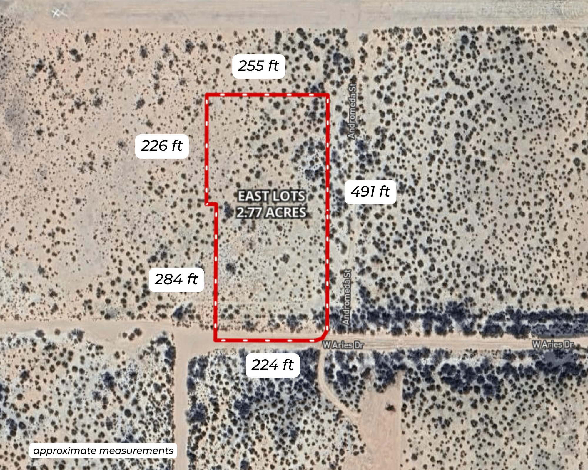
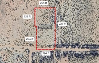
Dimension
510 feet x 255 feet x 491 feet x 224 feet
County
Pinal
Access
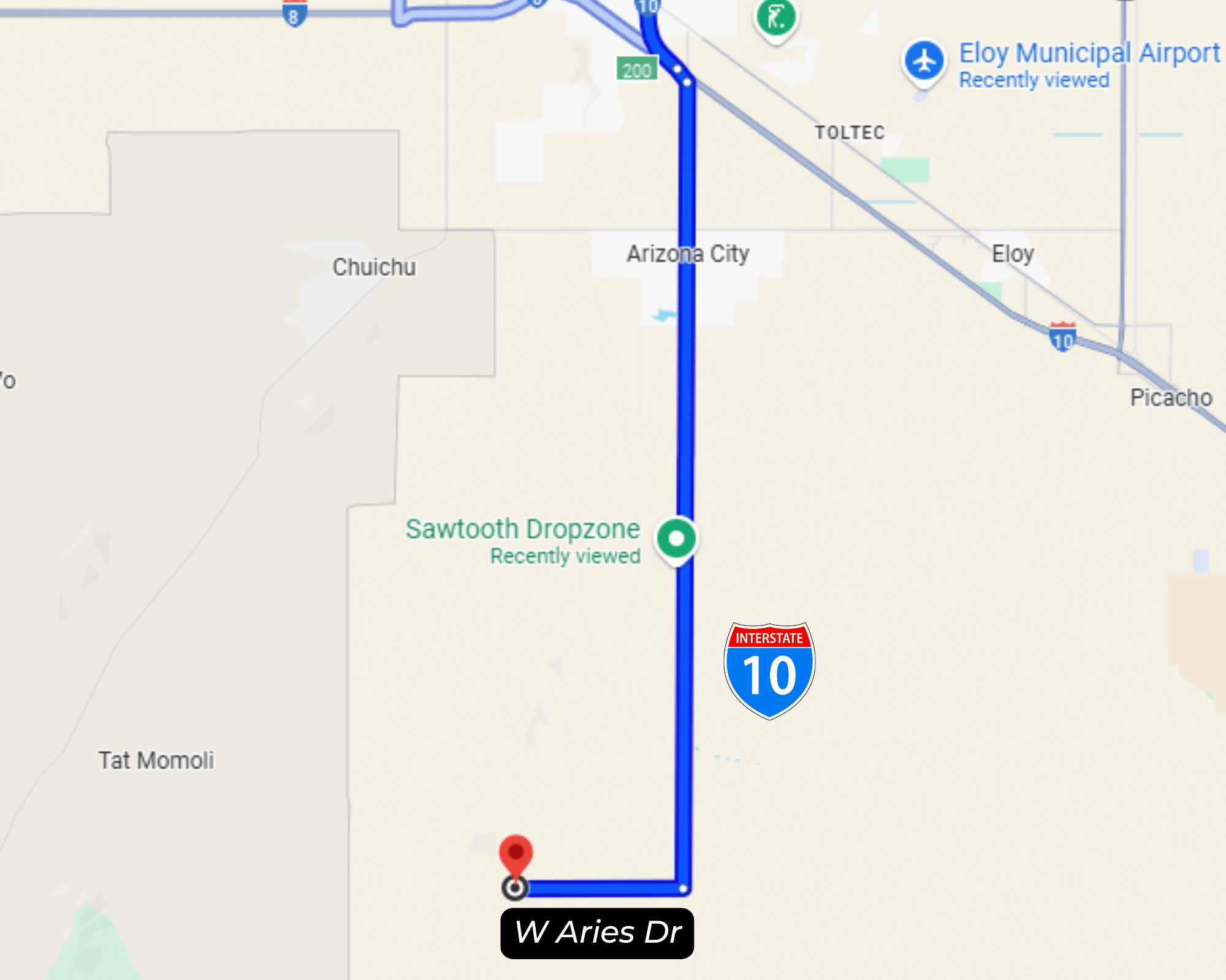
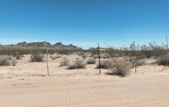
W. Aries Drive
Power
Available
Water
Available
Heating
Alternatives
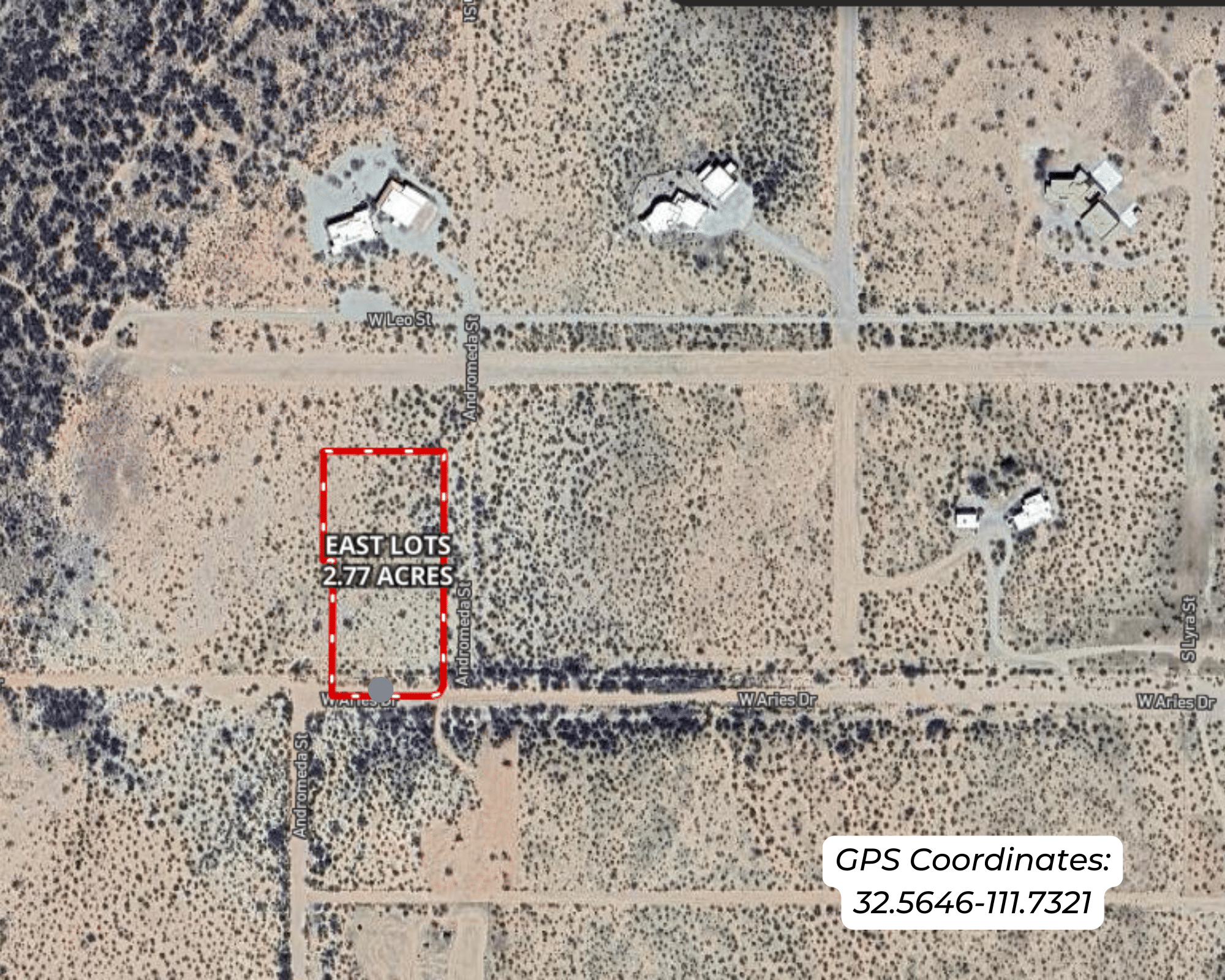
Coordinates
32.5646, -111.7341
Zoning
Vacant Land
Elevation
1,600 feet
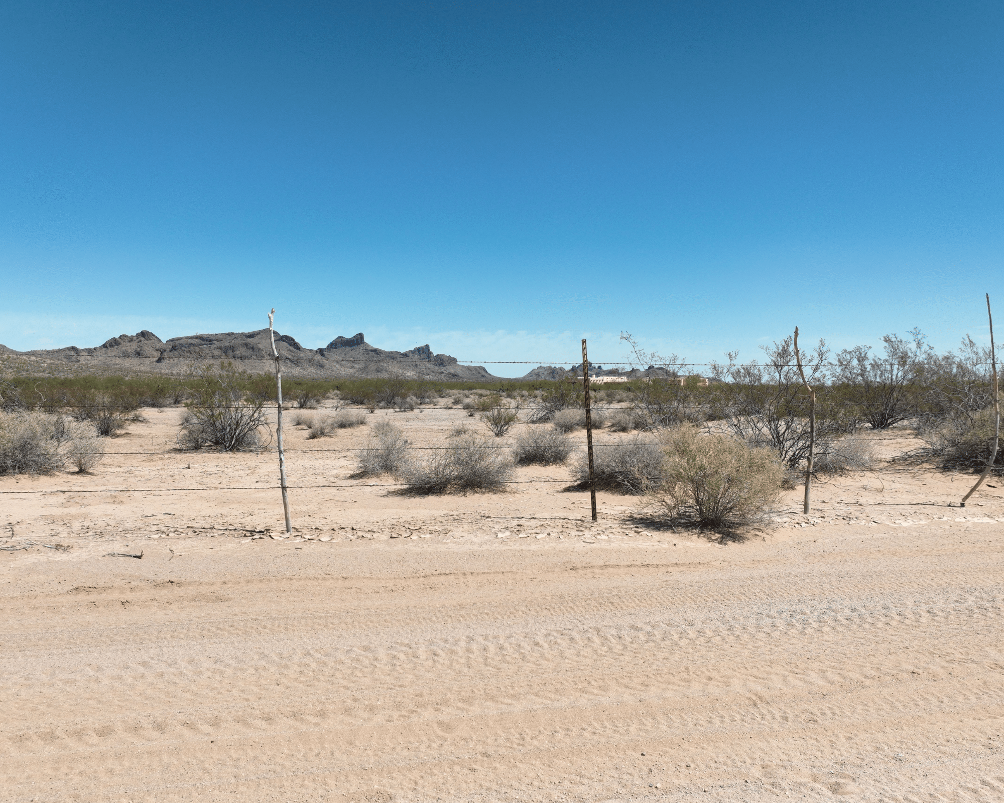
Terrain
Flat
Floodplain
No
Duplexes
No
Mobiles
No
Tiny Homes
No
Barndominiums
No
RV's
No
Camping
No
Property Survey, HOA, & Additional Documents
Utilities
🔌 Power: Arizona Public Service or Solar, wind, propane, or alternative energy source.
💧 Water: Silverbell Irrigation & Drainage or Water well, collection, hauling/delivery, or alternative.
🚽 Sewer: Septic or alternative sewer system.
☎️ Phone: Cellular, VOIP (see internet below), and satellite phone through Iridium, Globalstar, or Inmarsat.
🌐 Internet: MTE Communications, Airbeam, and satellite internet through Starlink, HughesNet, or ViaSat.
📺 Cable: Satellite cable through Dish or DirectTV.
County Contacts
Pinal County Assessor Douglas Wolf (520) 866-6361 (website)
Pinal County Treasurer Michael P. McCord (888) 431-1311 (website)
Pinal County Clerk Dana Lewis (520) 866-6830 (website)
Pinal County Zoning (520) 509-3555 (website)
Pinal County Health (866) 960-0633 (website)
Pinal County CAD (website)
Pinal County GIS (520) 509-3555 (website)
Closing Costs and Fees
$299
Document Prep Fee
Buyer will pay a $299 document preparation fee, which includes all postage and county recording fees. Seller will warrant title to the property.
$0
In-House Closing Fee
There will be no additional fees or expenses for an in-house closing. We will close in 14 days or less. This is the fastest, easiest, and cheapest way to close.
$1,500+
Title Company Fees*
Title Company costs are typically 2-5% of the purchase price with a minimum fee of around $1,500. Many states have legislated, standard insurance rates and other fees vary by the title company.
* If Buyer elects to close through a third-party title company, Buyer will bear all closing costs and expenses, including Seller’s title policy and Seller's escrow fees. Closing through a title company typically takes 30-45 days, depending on the county, title company, and transaction activity in the area.
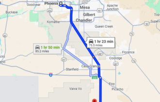
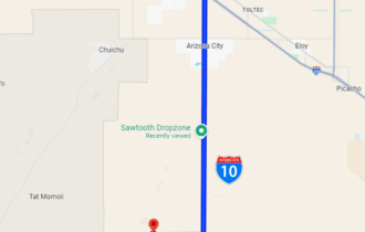
Driving Directions and GPS Coordinates
🚗 Driving Directions: Head south on N Main St toward W 6th St, Turn right onto W Frontier St, Turn left onto W Battaglia Rd, Turn left onto Sunland Gin Rd, Turn right onto W Aries Dr
📍 Center Point: 32.5646, -111.7341 (See embedded Google Map below 👇.)
Google Map
If you click the blue Directions link below, 👇 you can get Google turn-by-turn directions to the property on any device. The map coordinates for the Google Map below are for the approximate center of the property and not the entrance, gate, or primary access point for the property. Google Maps may provide driving directions that require the use of private or abandoned roads or may require you to go through gates located on private property. Do not trespass on private property! Some properties will require a 4-wheel drive vehicle or may be inaccessible in certain weather conditions. Please don't get stuck or lost.
Additional Notes
As-Is and As-Available: This property is being sold property “as-is” and “as-available.” No representations as to fitness for a particular purpose have been made. No verbal claims or promises have been made. Please see our Terms of Service for more information.
Contract: After making your initial deposit, we will email you the purchase and sale agreement, which includes a warranty deed. Agreements are prepared manually and will be sent out Monday through Friday between 9 AM and 5 PM CST. Thank you for your patience.
No Monthly Payments: We are not offering seller financing on this property. This is an all-cash transaction. We are not offering a payment plan. If you would like to finance your purchase of the property, please contact a third-party lender prior to making your deposit. We will not sign a purchase and sale agreement that is contingent upon third-party financing without a pre-approval letter.
3% Buyer's Agent Commission: You are not required to have an agent or broker assist you with purchasing this property. However, if the Buyer does use an agent, and the Seller is made aware of this prior to an agreement on price or signed contract, the Seller will pay a 3% commission to the Buyer's licensed agent or broker.
Maps and GPS Coordinates: Maps and GPS coordinates are believed to be accurate, but accuracy is not guaranteed. The information contained in the maps should not be considered a “legal description,” and the maps and GPS coordinates are not a replacement for a survey. We have taken reasonable steps to ensure that parcel lines, maps, and coordinates are in fact accurate, but third-party geographical information system (GIS) providers, including information from the county, often contain errors and inaccuracies.