


✈️ 9.36 Acres in Arizona Fly-In Community – Build Your Hangar, Land Your Plane 🌵
22 min (16 miles) from Arizona City, AZ APN# 40937162, 40937168, 40937167, 40937161, 40937169, 40937165 & 40937166
Payment
Payment Notes:
Warranty of Title: The property will be conveyed via a general warranty deed, guaranteeing you free and clear title to the property.
We accept Cash or 3rd party financing with a pre-approval letter.
We do not offer owner financing. No payment options are available for this property.
Paying a 3% Buyer's Agent Commission!
Property Description
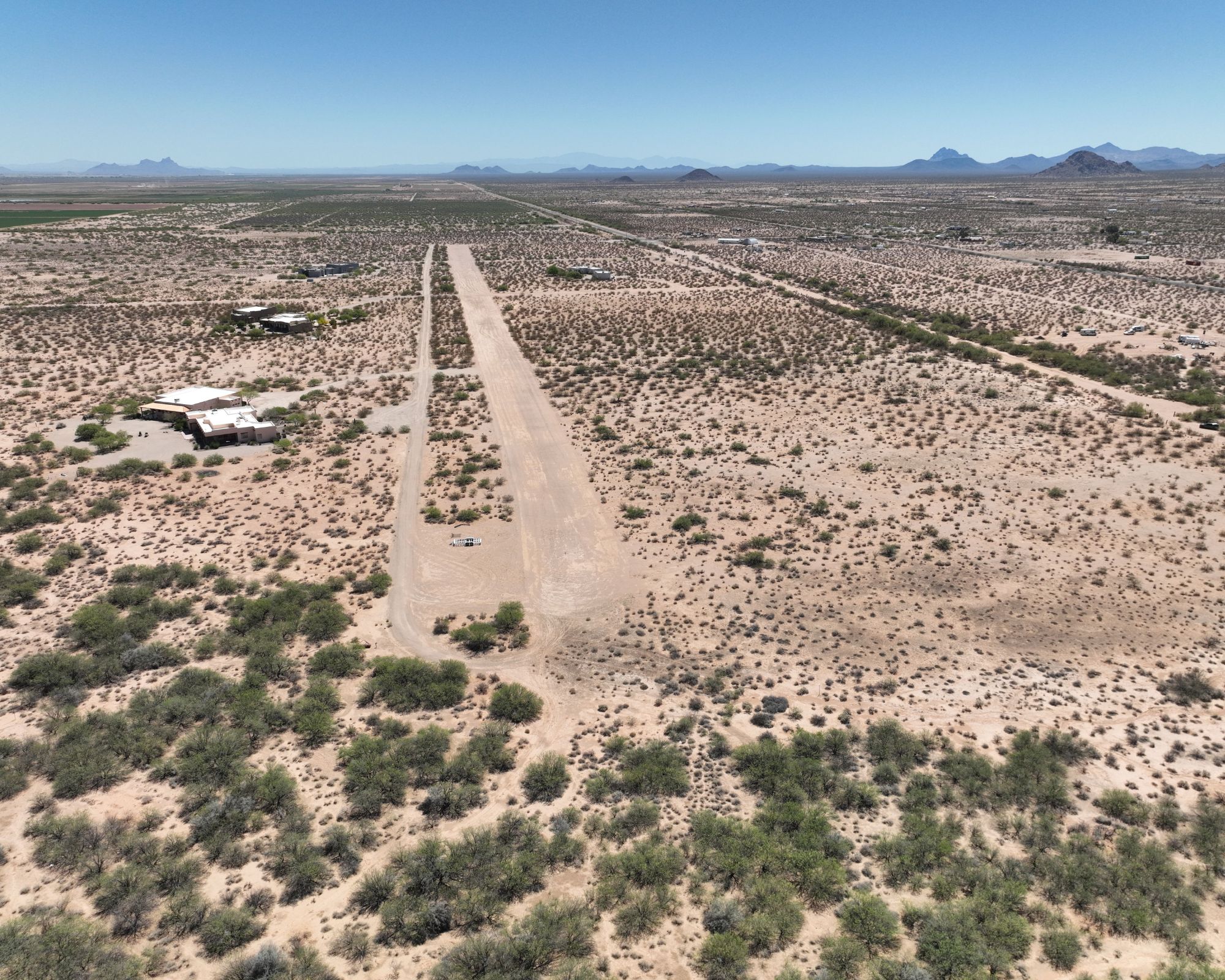
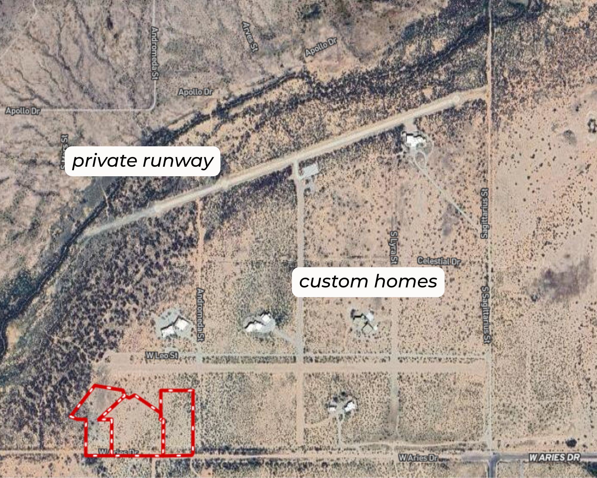
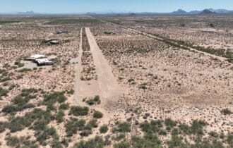
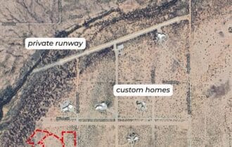
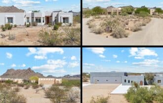
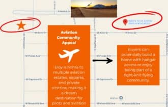
Taxi Home and Park in Your Own Hangar
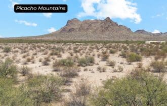
This is the kind of place pilots dream about—9.36 acres in a gated fly-in community where your runway is your driveway and your neighbors share your obsession with the sky.
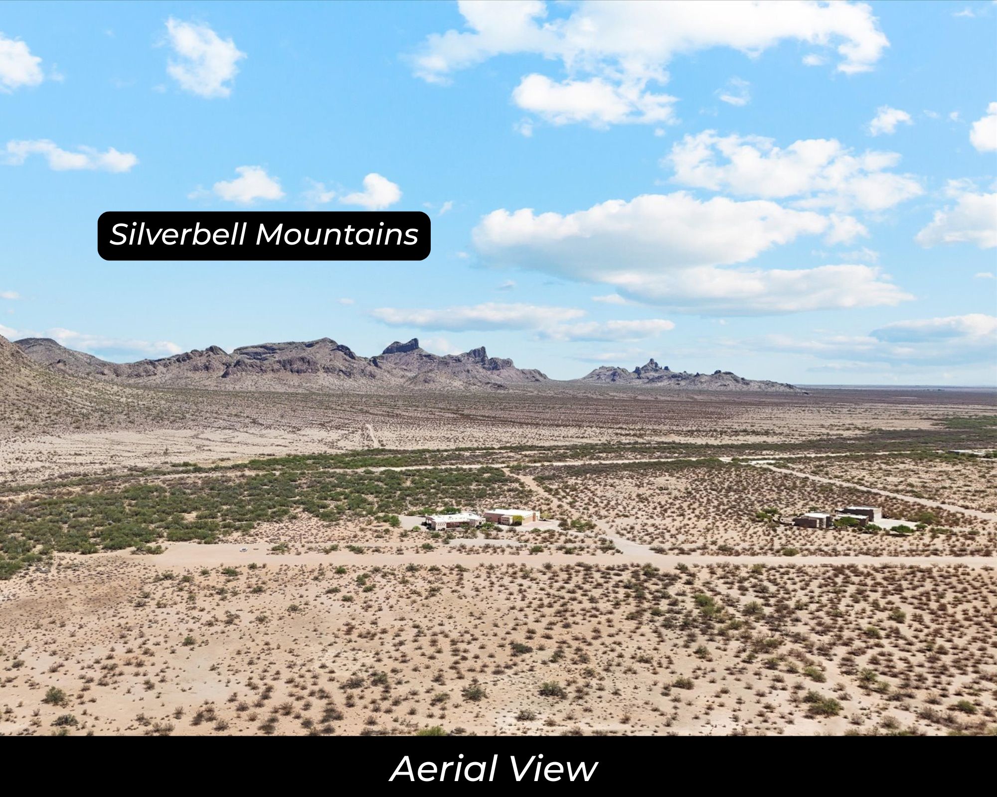
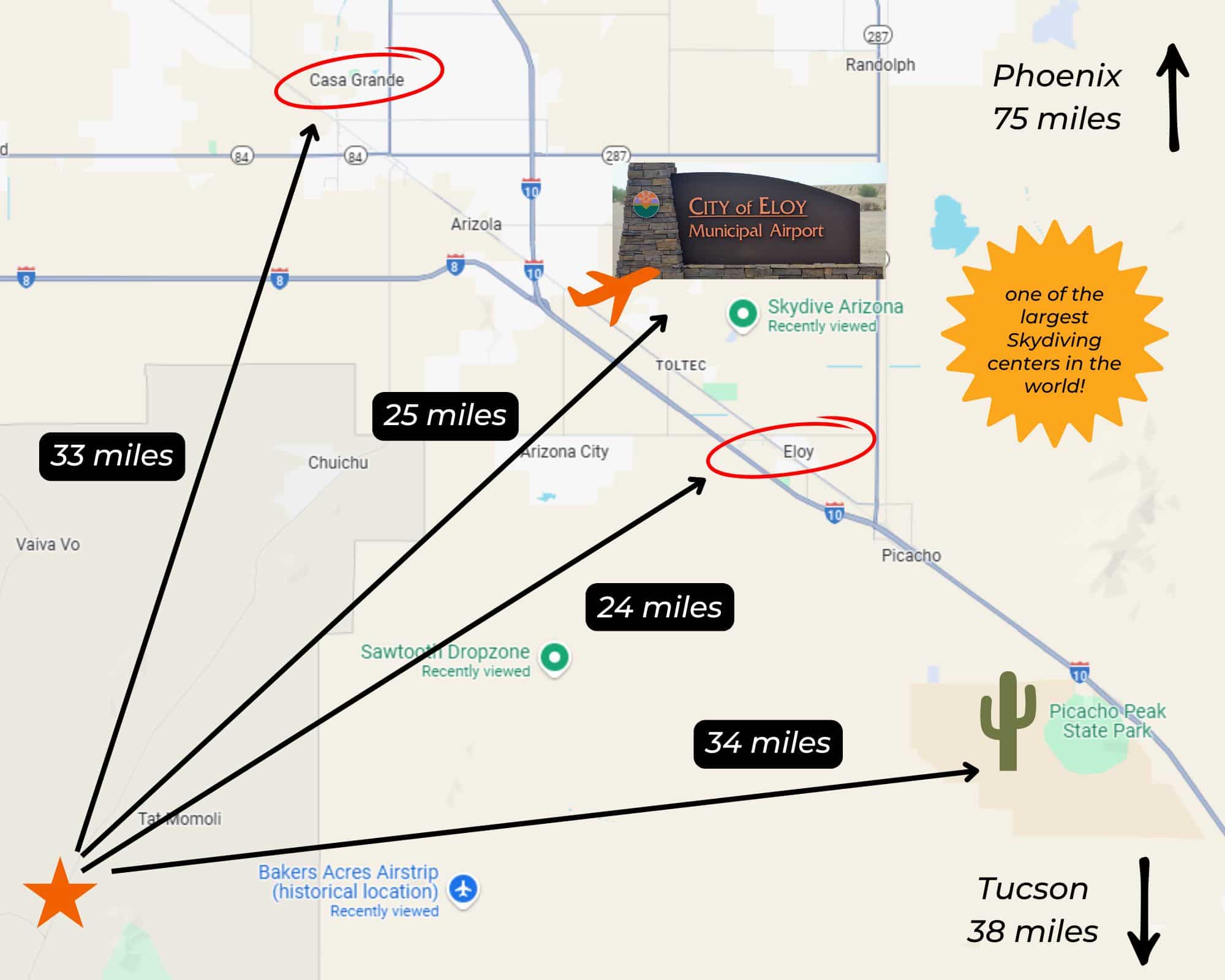
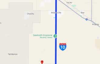
Flying Crown Ranch sits in the Sonoran Desert flats of Pinal County, Arizona, about 22 minutes from Arizona City and a short taxi from the community's private runway. Skydive Arizona operates right next door at Sawtooth Airport. This is a place built by pilots, for pilots, where hangars and homes share the same address.
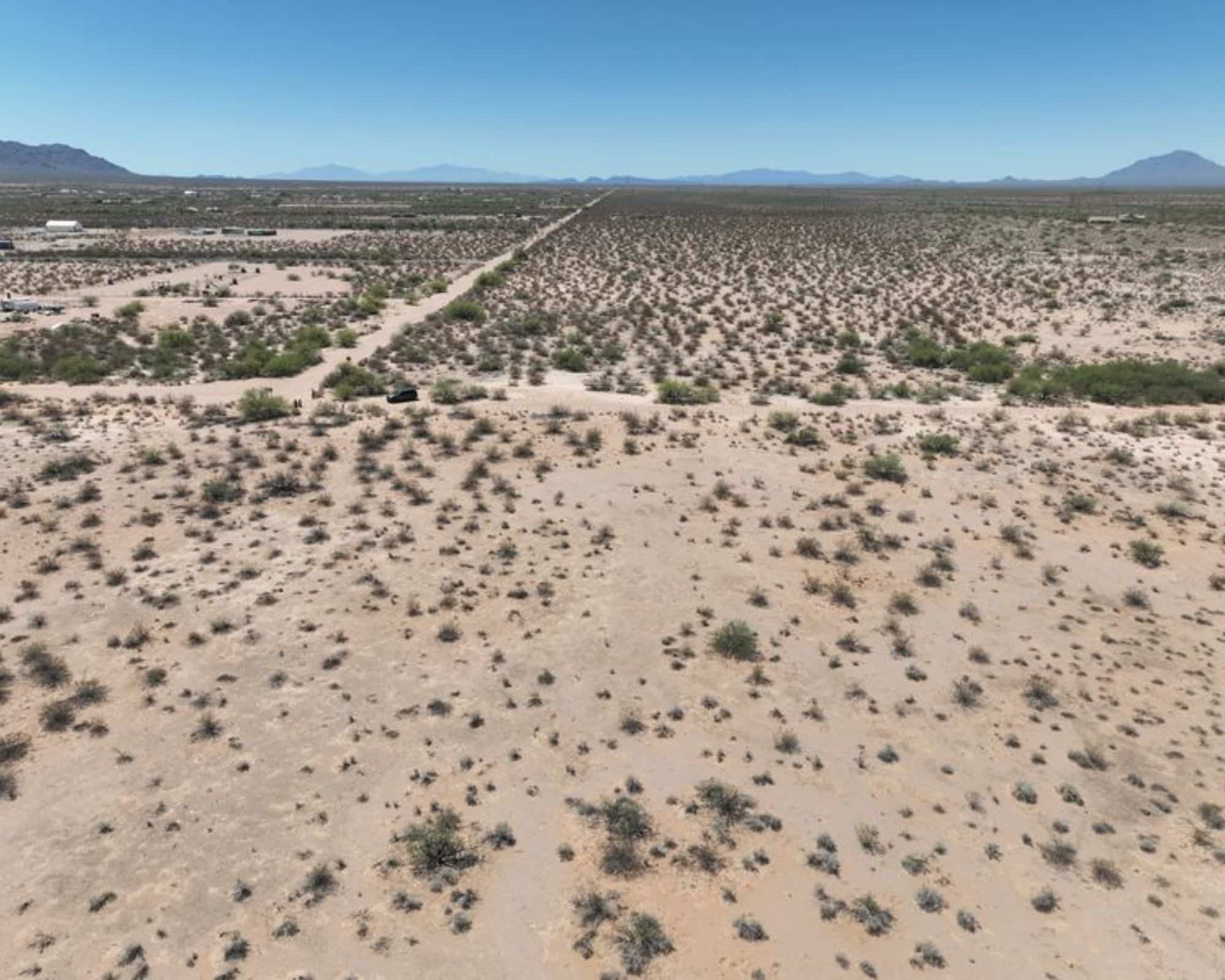
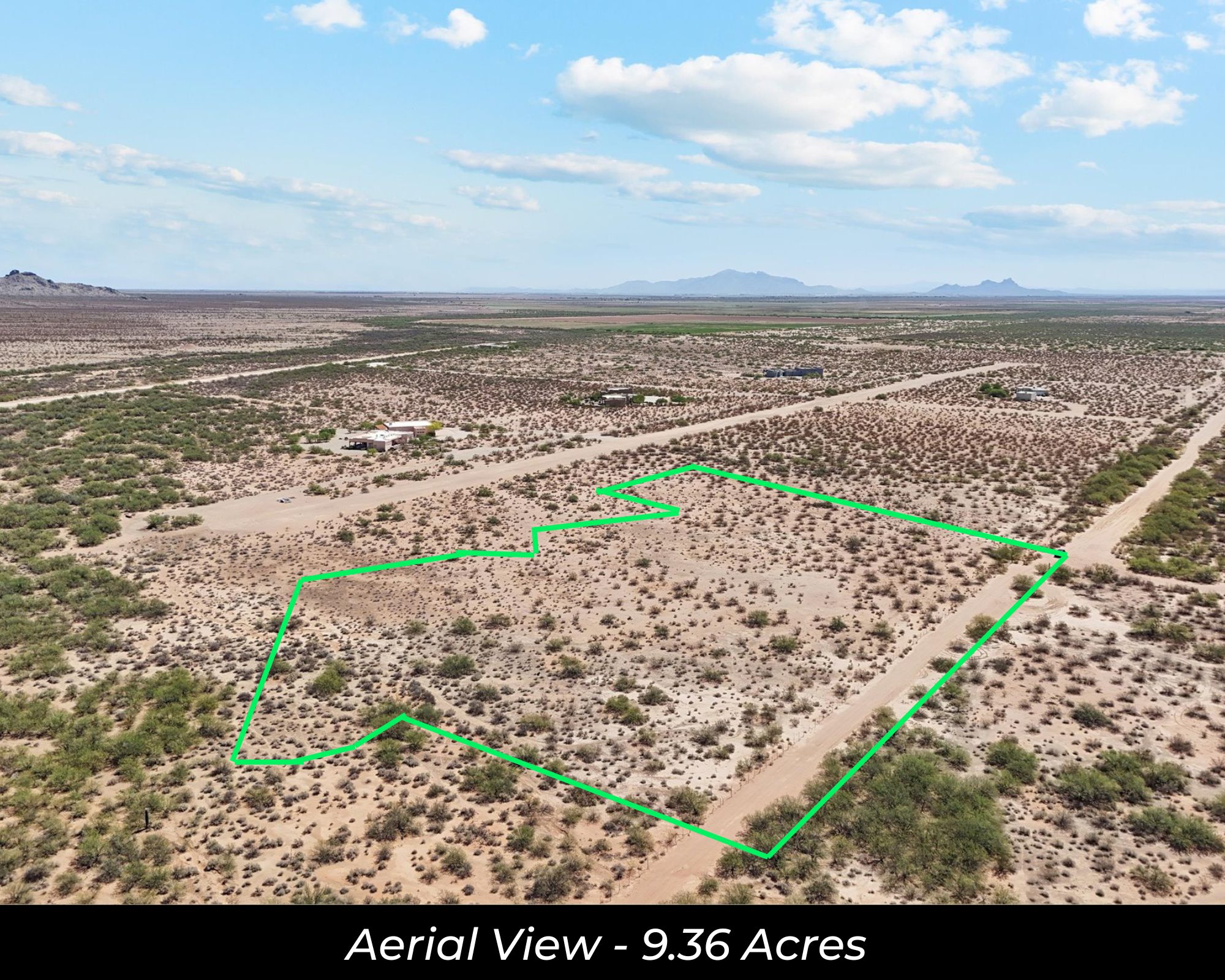
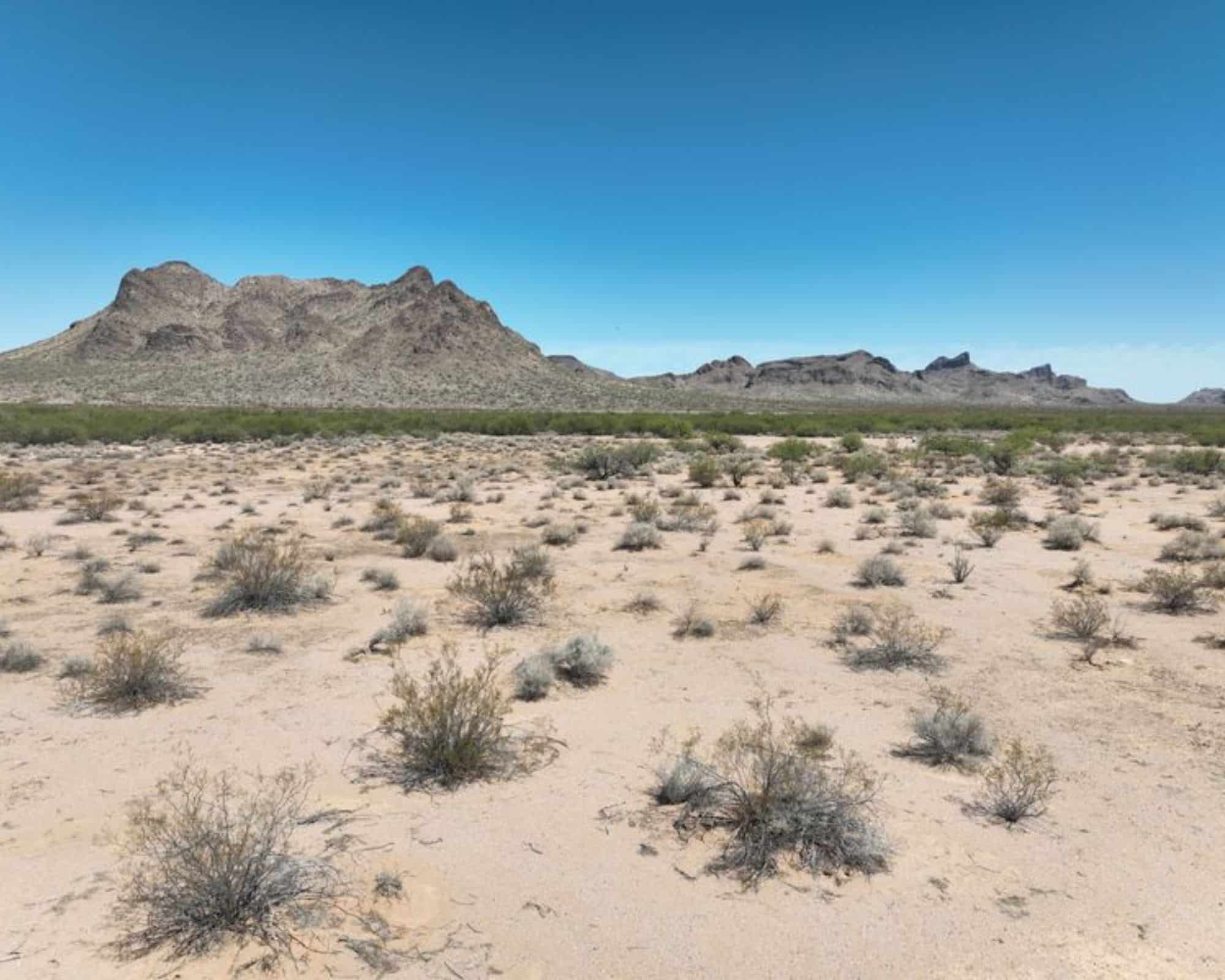
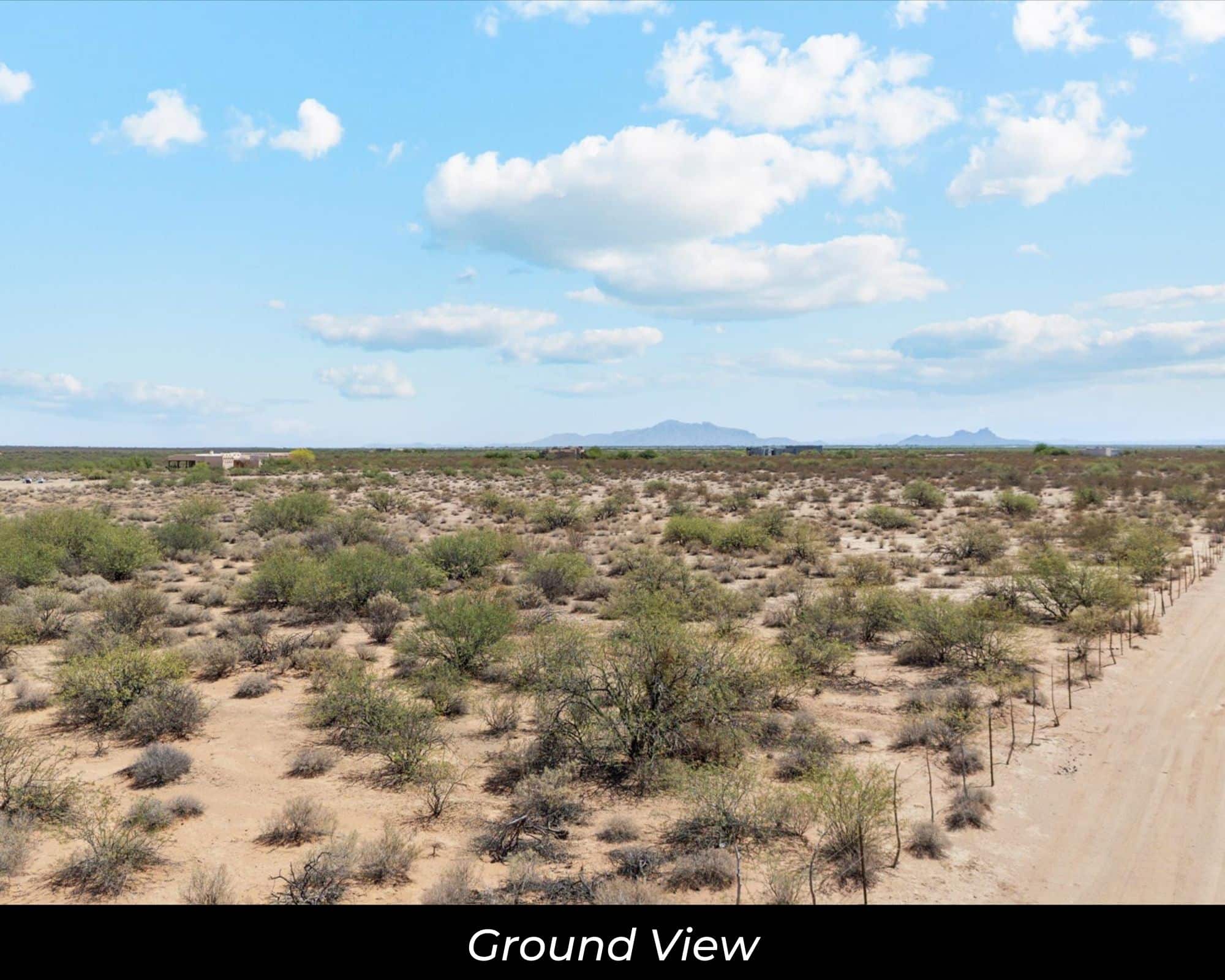
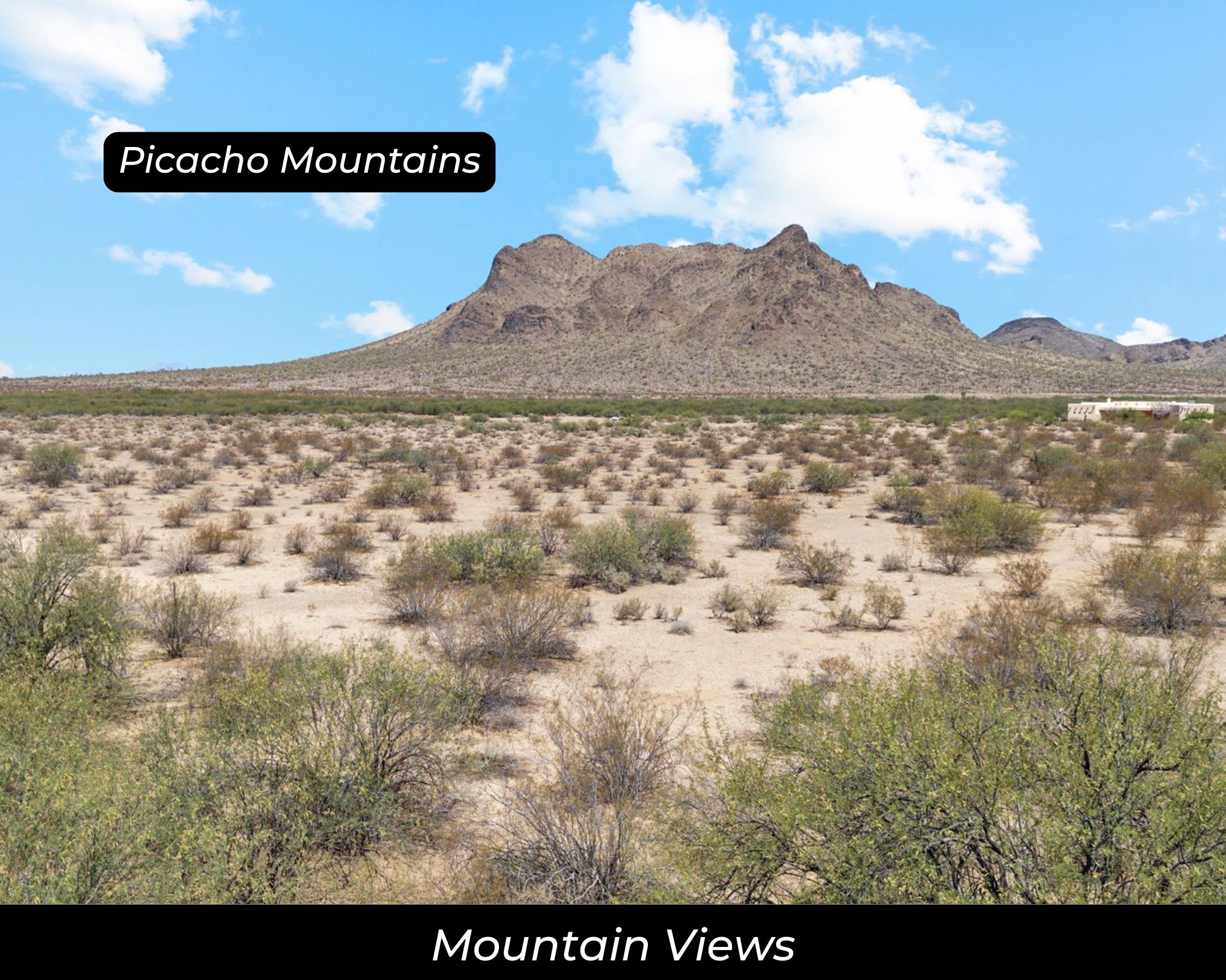
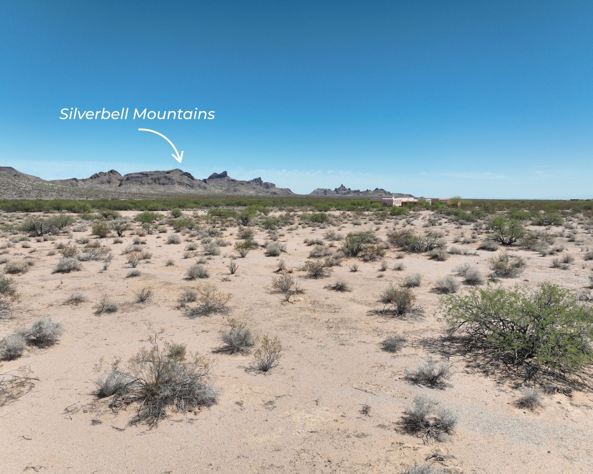
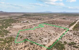
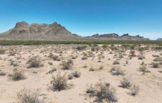
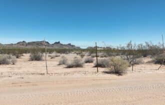
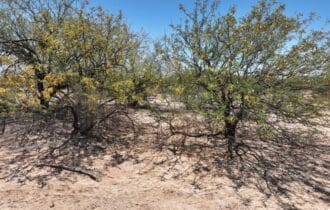
The offering consists of seven combined tax parcels totaling 9.36 acres, with dimensions of roughly 950 feet by 530 feet. The terrain is flat, level, and build-ready at 1,600 feet elevation. APS electric is available and water is provided by a private water company. Septic required. No floodplain. Mountain and desert views in every direction.
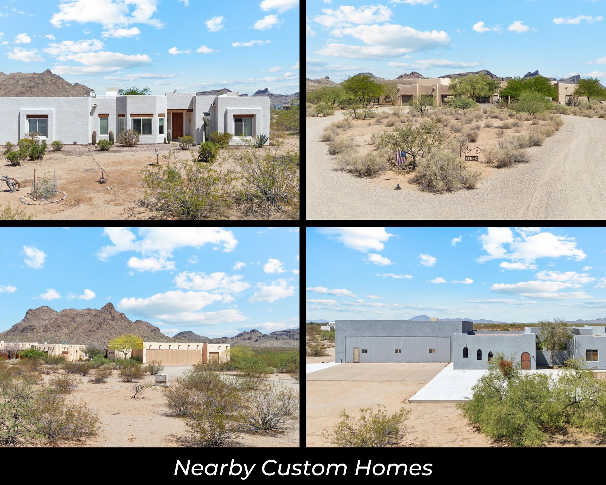
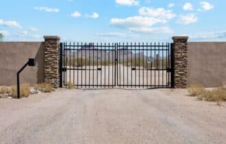
This is a deed-restricted aviation community. No mobiles, RVs, tiny homes, or camping. It's designed for site-built homes with private hangars—the kind of setup where you can roll out of bed, walk across the tarmac, and be wheels-up before most people finish their coffee.
The HOA runs $600 a year and keeps the runway maintained and the community gated. Annual taxes total approximately $665 across all parcels. Listing terms include cash and conventional financing. Conveyance is by warranty deed.
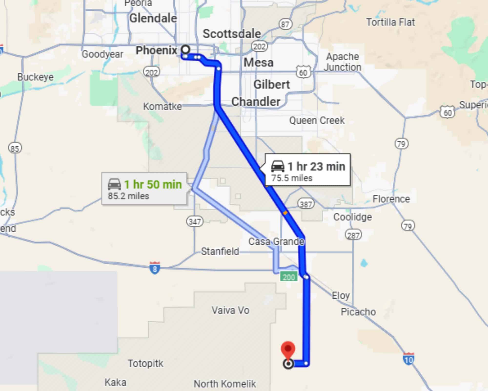
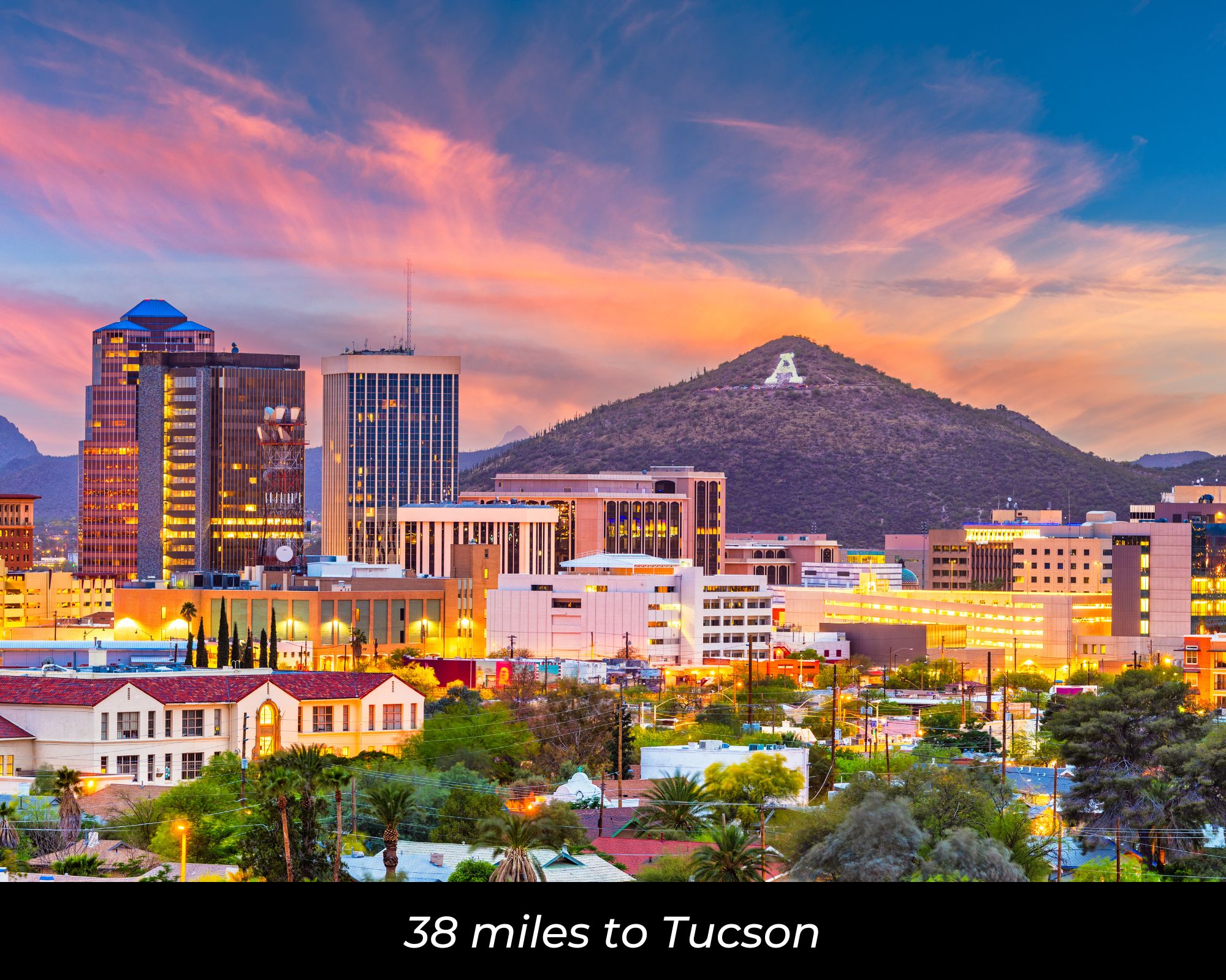
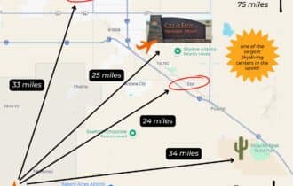
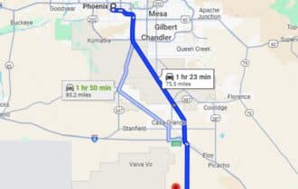
The Sonoran Desert delivers over 300 days of flying weather a year. Phoenix is about an hour north. Tucson is about an hour south. Arizona State University is about 70 miles north in Tempe, and the University of Arizona is about 80 miles south in Tucson. Picacho Peak State Park—famous for the westernmost Civil War battle—is about 20 minutes southeast. Out here, the sky is big, the air is clear, and nobody's going to complain about engine noise.
If you've spent years dreaming about a place where you can taxi home, this is it. Call or text 855-833-5263 to get the details or schedule a time to see it.
Quick Facts
9.36 Acres, Seven Parcels, Runway Access, Build-Ready
9.36 acres in Flying Crown Ranch, a gated fly-in community in Pinal County, AZ—about 22 minutes from Arizona City. Seven combined tax parcels sold together (approximately 950′ x 530′), providing flexibility for a custom home and private hangar with direct runway access. Flat, level terrain at 1,600′ elevation. APS electric available; water via private water company; septic required. No floodplain. Mountain and desert views. Deed-restricted aviation community—site-built homes and hangars only, no mobiles, RVs, tiny homes, or camping. HOA $600/year maintains runway and gate. Annual taxes approximately $665. Cash or conventional financing. Warranty deed. Sawtooth Airport and Skydive Arizona adjacent. Picacho Peak State Park 20 minutes southeast. Phoenix 1 hour north; Tucson 1 hour south. GPS: 32.5646, -111.7341. APNs: 40937162, 40937168, 40937167, 40937161, 40937169, 40937165, 40937166. MLS #6968059. Call or text 855-833-5263.
Property Video
Visiting the Property
You are welcome to visit the property at your convenience and anytime while it's still available. However, we HIGHLY recommend checking-in with us prior to visiting the property in case the property has gone under contract or already sold.
The interactive map above is generated with MapRight. MapRight has free apps for Apple IOS and Android that can be used to track your location and route throughout a property and provide driving directions.
MapRight for Apple –> Download App.
MapRight for Android –> Download App.
To launch the interactive map on your device, 1) install the free MapRight app using one of the two links above for Apple or Android, and 2) click the “View Full Screen” link (see above) in the embedded map on the property listing page.
Property Information
Parcel Size
9.36 Acres
State
Arizona
County
Pinal
Nearest Cities
Eloy, AZ
Parcel #
40937162, 40937168, 40937167, 40937161, 40937169, 40937165 & 40937166
Address
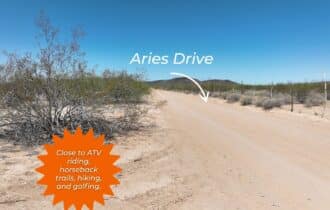
123 W Aries Dr, Eloy, AZ, 85131
Legal Description
Silver Bell Estates #6 Lot 161, Lot 162, Lot 165, Lot 166, Lot 167, Lot 168, Lot 169
Zip Code
85131
Annual Property Taxes
$83.18
Agricultural Tax Exemption
Yes or No
HOA
Yes
HOA per Year
$600
Survey Available
Plat Map
School District
Eloy School District
Liens and Back Taxes
None!
Source Deed
Sent for Filing.
Title Status
Free & Clear!
Outgoing Conveyance
Warranty Deed
Property Features
Acres
9.36
Dimension
950 feet x 530 feet
County
Pinal
Access
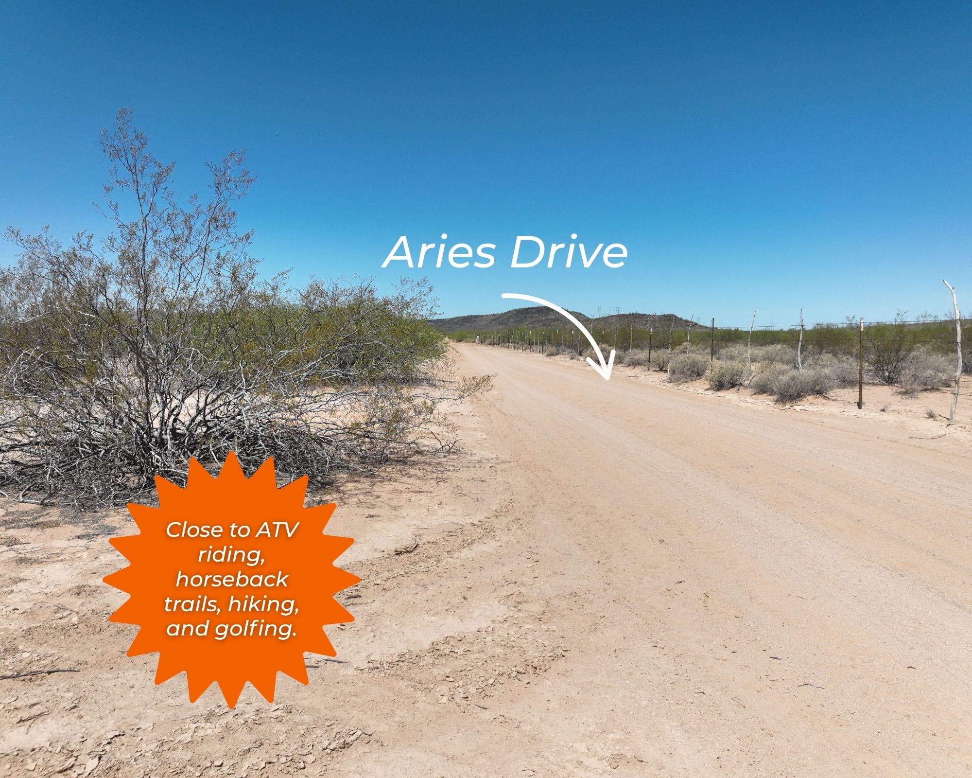
W. Aries Drive
Power
Available
Water
Available
Heating
Alternatives
Coordinates
32.5646, -111.7341
Zoning
Vacant Land
Elevation
1,600 feet
Terrain
Flat
Floodplain
No
Duplexes
No
Mobiles
No
Tiny Homes
No
Barndominiums
No
RV's
No
Camping
No
Property Survey, HOA, & Additional Documents
Utilities
🔌 Power: Arizona Public Service or Solar, wind, propane, or alternative energy source.
💧 Water: Silverbell Irrigation & Drainage or Water well, collection, hauling/delivery, or alternative.
🚽 Sewer: Septic or alternative sewer system.
☎️ Phone: Cellular, VOIP (see internet below), and satellite phone through Iridium, Globalstar, or Inmarsat.
🌐 Internet: MTE Communications, Airbeam, and satellite internet through Starlink, HughesNet, or ViaSat.
📺 Cable: Satellite cable through Dish or DirectTV.
County Contacts
Pinal County Assessor Douglas Wolf (520) 866-6361 (website)
Pinal County Treasurer Michael P. McCord (888) 431-1311 (website)
Pinal County Clerk Dana Lewis (520) 866-6830 (website)
Pinal County Zoning (520) 509-3555 (website)
Pinal County Health (866) 960-0633 (website)
Pinal County CAD (website)
Pinal County GIS (520) 509-3555 (website)
Closing Costs and Fees
$299
Document Prep Fee
Buyer will pay a $299 document preparation fee, which includes all postage and county recording fees. Seller will warrant title to the property.
$0
In-House Closing Fee
There will be no additional fees or expenses for an in-house closing. We will close in 14 days or less. This is the fastest, easiest, and cheapest way to close.
$1,500+
Title Company Fees*
Title Company costs are typically 2-5% of the purchase price with a minimum fee of around $1,500. Many states have legislated, standard insurance rates and other fees vary by the title company.
* If Buyer elects to close through a third-party title company, Buyer will bear all closing costs and expenses, including Seller’s title policy and Seller's escrow fees. Closing through a title company typically takes 30-45 days, depending on the county, title company, and transaction activity in the area.
Driving Directions and GPS Coordinates
🚗 Driving Directions: Head south on N Main St toward W 6th St, Turn right onto W Frontier St, Turn left onto W Battaglia Rd, Turn left onto Sunland Gin Rd, Turn right onto W Aries Dr
📍 Center Point: 32.5646, -111.7341 (See embedded Google Map below 👇.)
Google Map
If you click the blue Directions link below, 👇 you can get Google turn-by-turn directions to the property on any device. The map coordinates for the Google Map below are for the approximate center of the property and not the entrance, gate, or primary access point for the property. Google Maps may provide driving directions that require the use of private or abandoned roads or may require you to go through gates located on private property. Do not trespass on private property! Some properties will require a 4-wheel drive vehicle or may be inaccessible in certain weather conditions. Please don't get stuck or lost.
Additional Notes
As-Is and As-Available: This property is being sold property “as-is” and “as-available.” No representations as to fitness for a particular purpose have been made. No verbal claims or promises have been made. Please see our Terms of Service for more information.
Contract: After making your initial deposit, we will email you the purchase and sale agreement, which includes a warranty deed. Agreements are prepared manually and will be sent out Monday through Friday between 9 AM and 5 PM CST. Thank you for your patience.
No Monthly Payments: We are not offering seller financing on this property. This is an all-cash transaction. We are not offering a payment plan. If you would like to finance your purchase of the property, please contact a third-party lender prior to making your deposit. We will not sign a purchase and sale agreement that is contingent upon third-party financing without a pre-approval letter.
3% Buyer's Agent Commission: You are not required to have an agent or broker assist you with purchasing this property. However, if the Buyer does use an agent, and the Seller is made aware of this prior to an agreement on price or signed contract, the Seller will pay a 3% commission to the Buyer's licensed agent or broker.
Maps and GPS Coordinates: Maps and GPS coordinates are believed to be accurate, but accuracy is not guaranteed. The information contained in the maps should not be considered a “legal description,” and the maps and GPS coordinates are not a replacement for a survey. We have taken reasonable steps to ensure that parcel lines, maps, and coordinates are in fact accurate, but third-party geographical information system (GIS) providers, including information from the county, often contain errors and inaccuracies.