

35 Unrestricted Acres in Spanish Peaks Country – Mountain Views, No HOA, Huerfano County CO
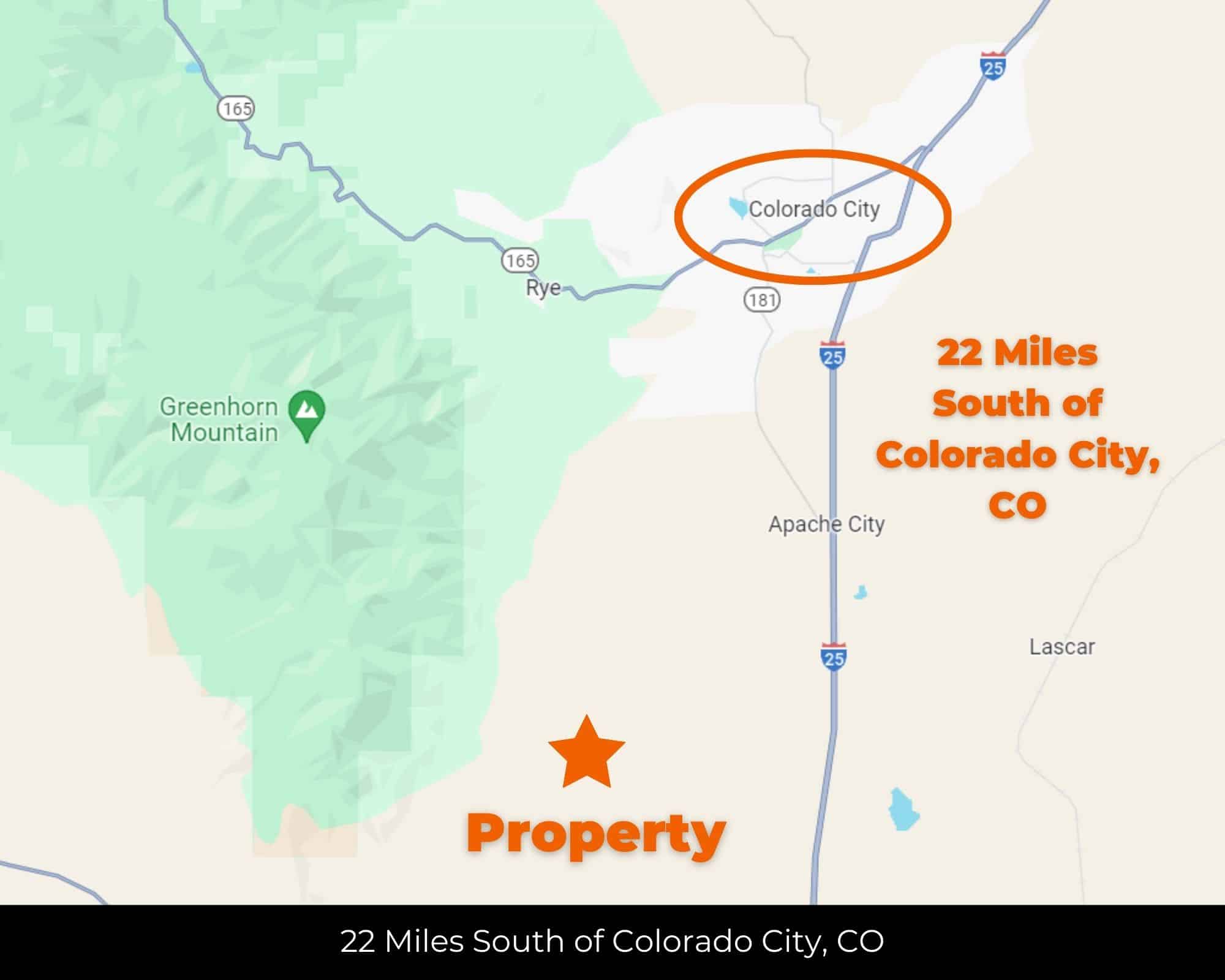
40 min (23.4 miles) to Walsenburg,CO APN# 4030536
Payment
Payment Notes:
Warranty of Title: The property will be conveyed via a general warranty deed, guaranteeing you free and clear title to the property.
We accept Cash or 3rd party financing with a pre-approval letter.
We do not offer owner financing. No payment options are available for this property.
Paying a 3% Buyer's Agent Commission!
Property Description
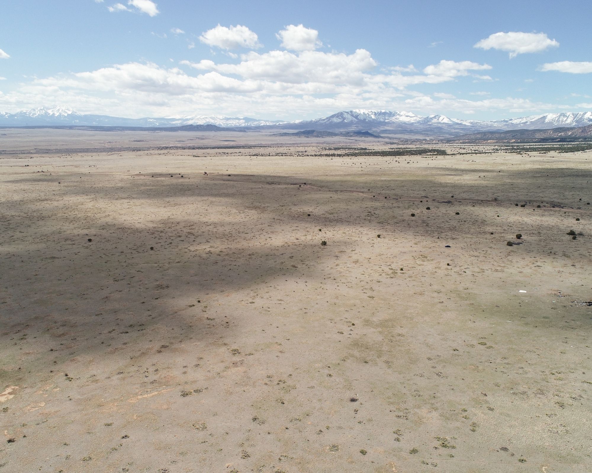
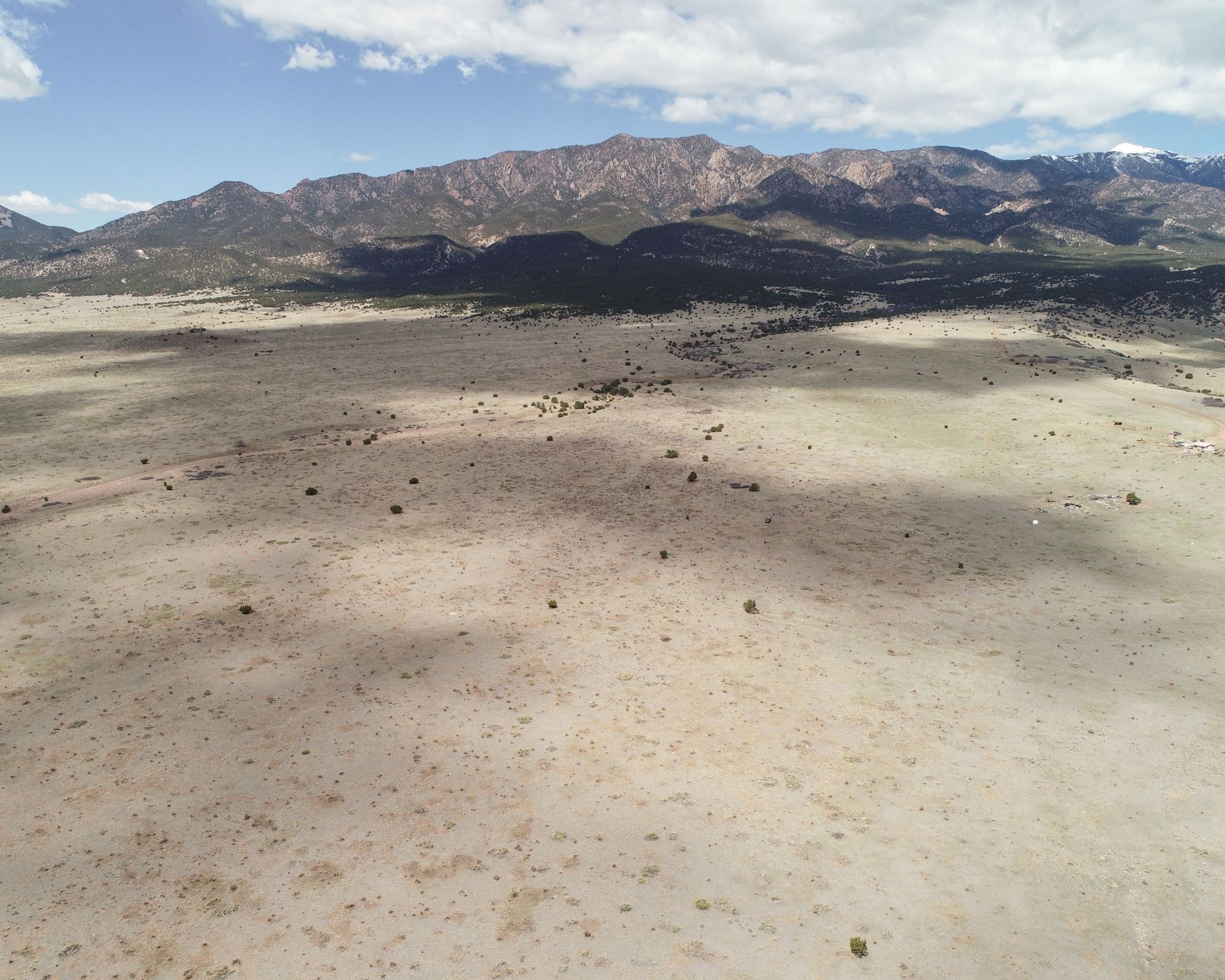
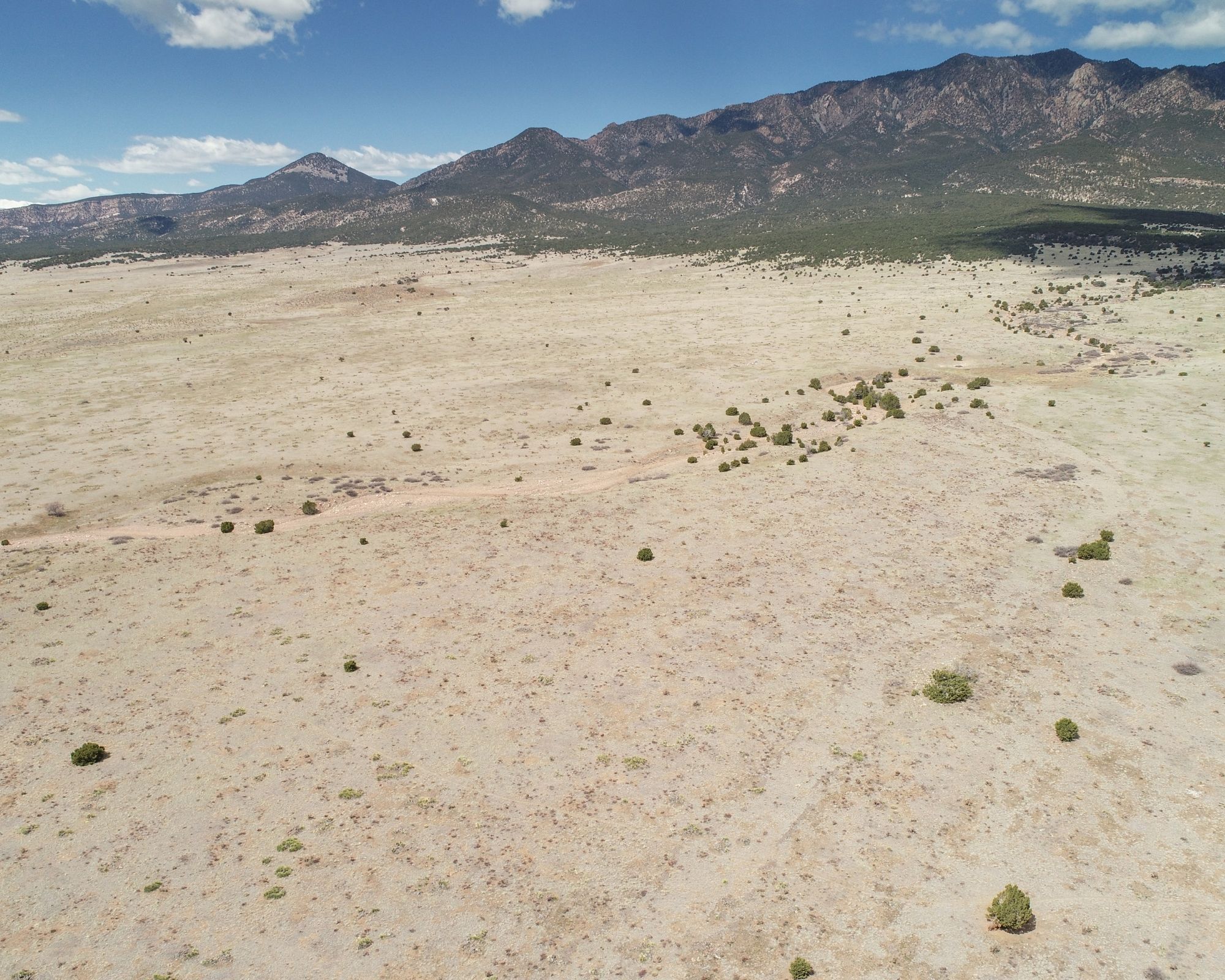
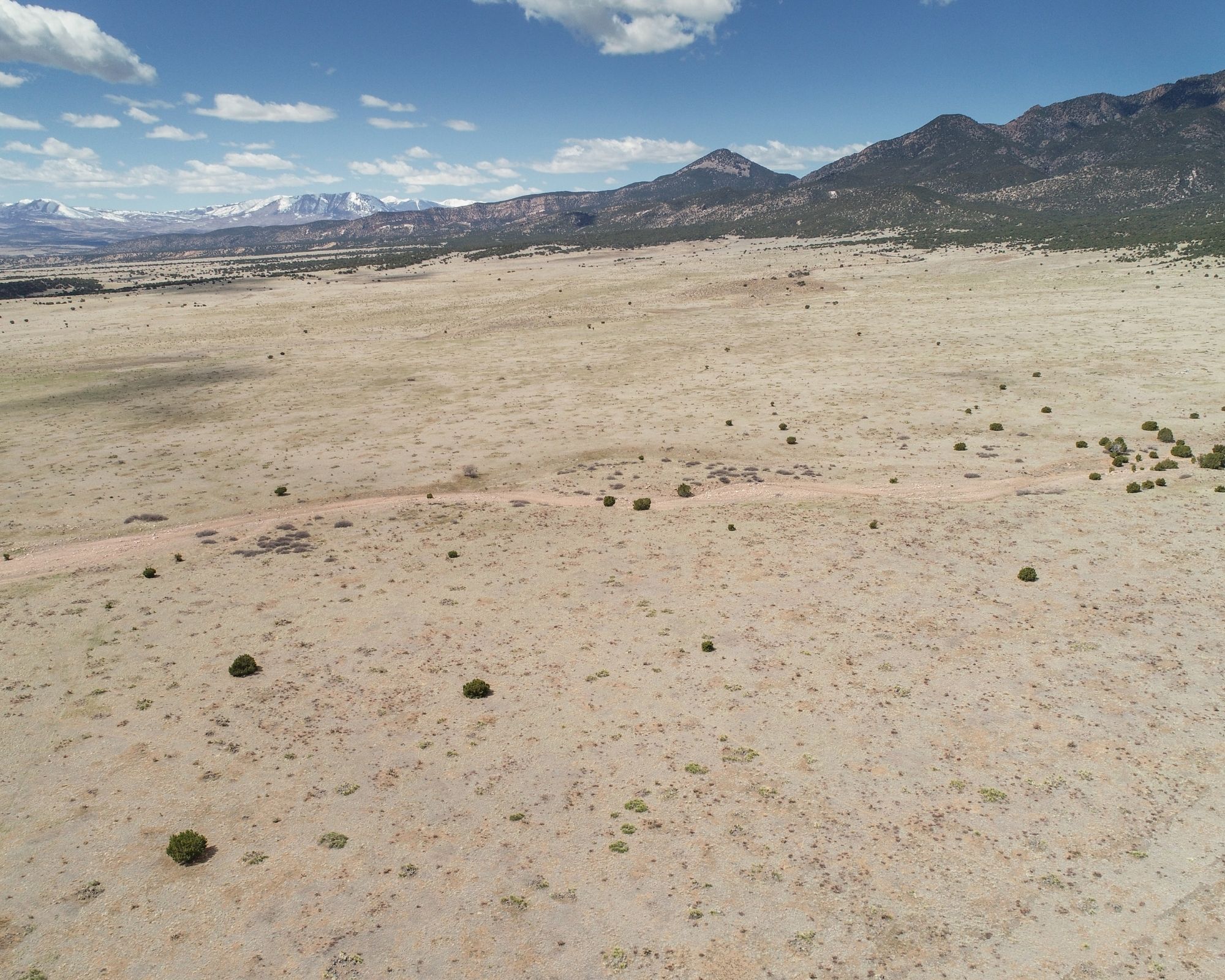
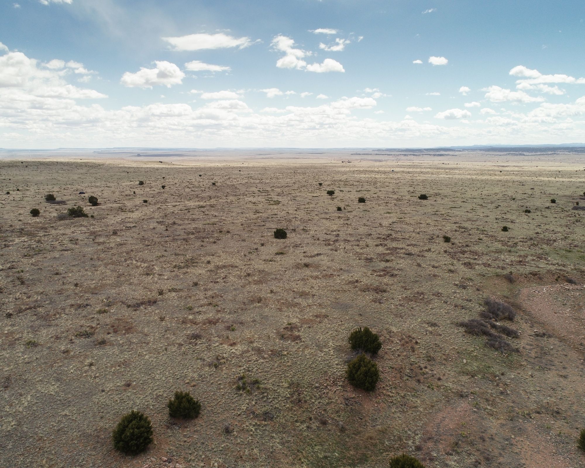
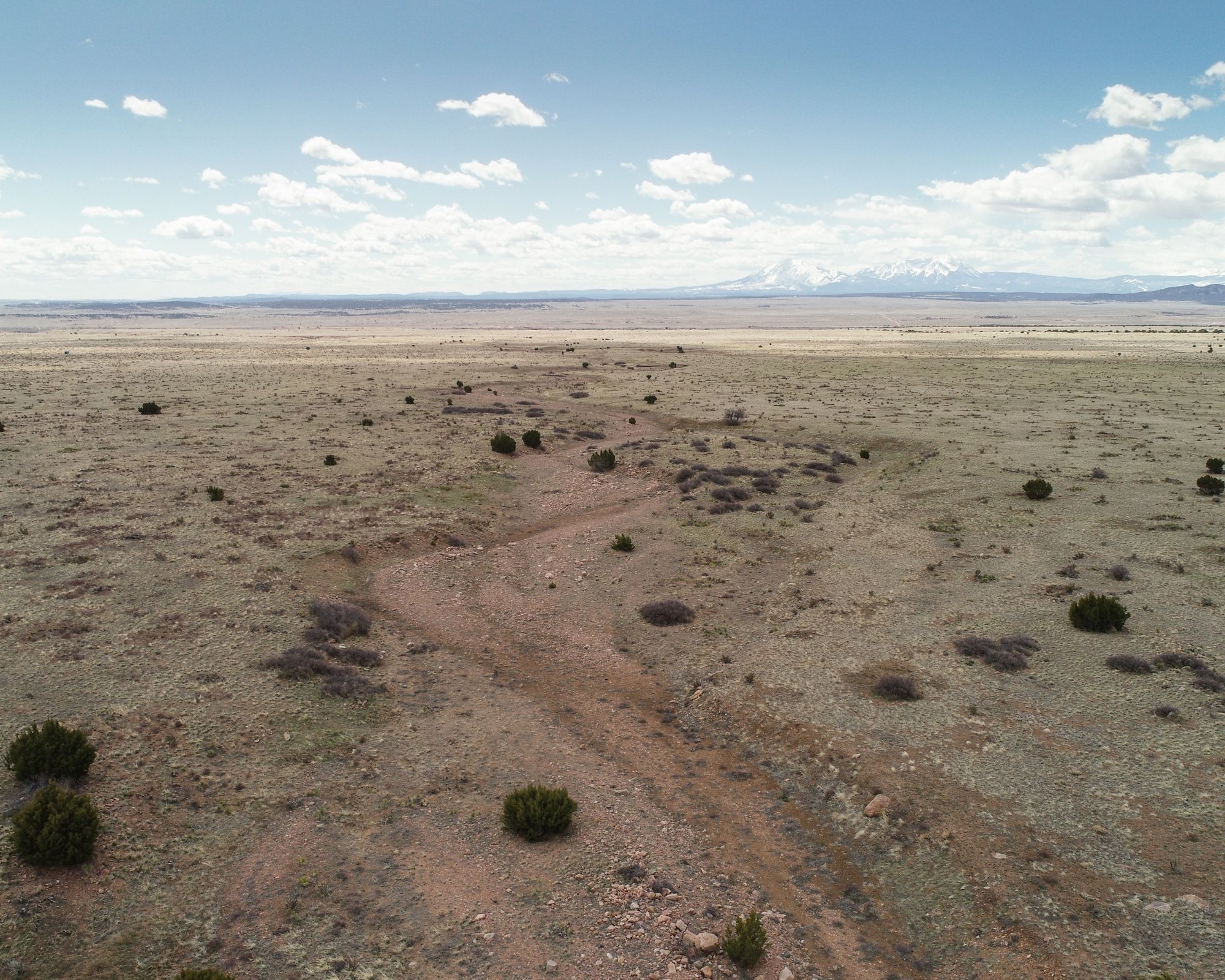
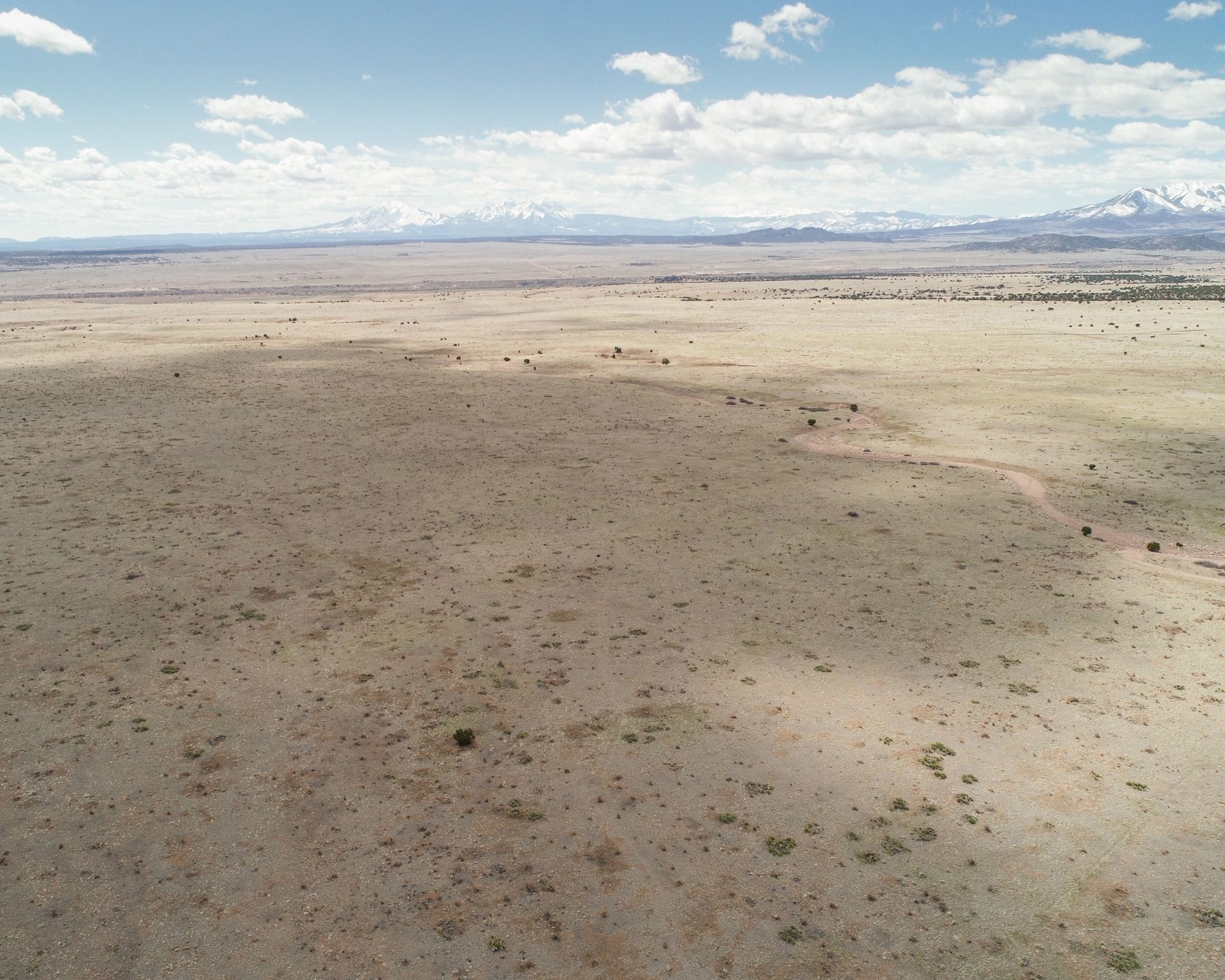
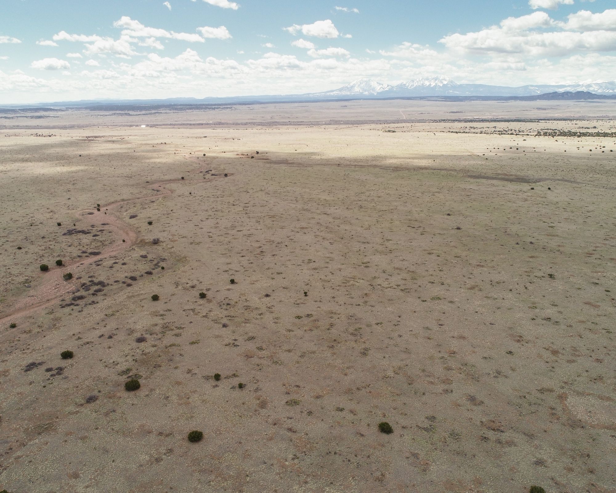
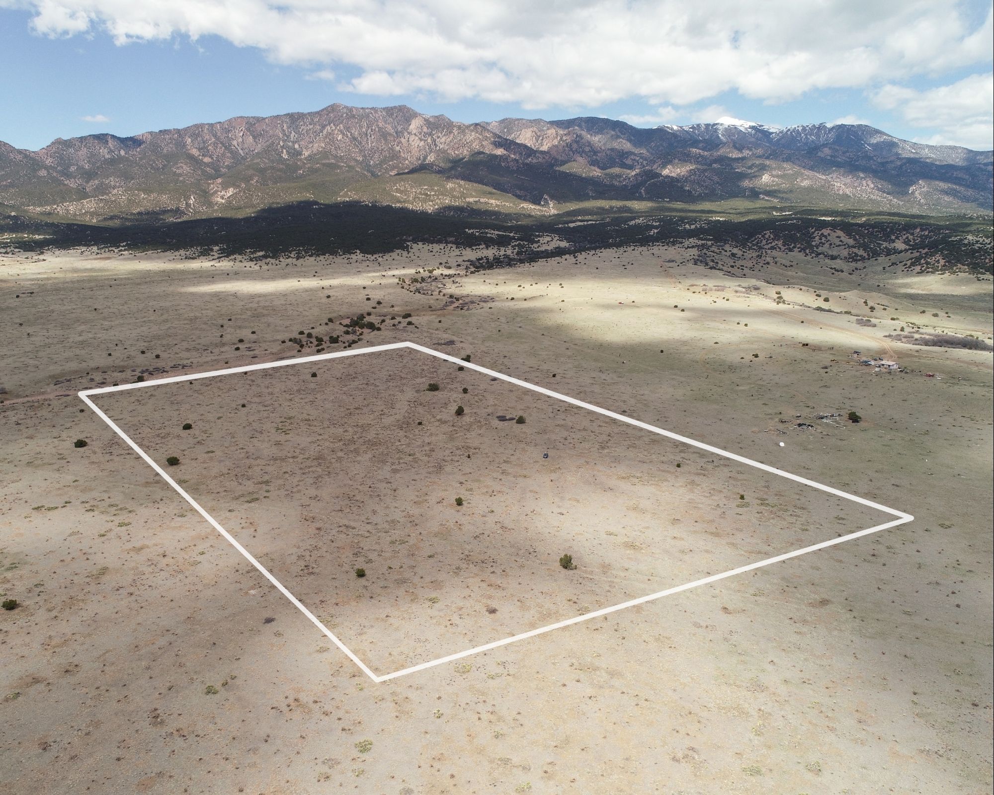
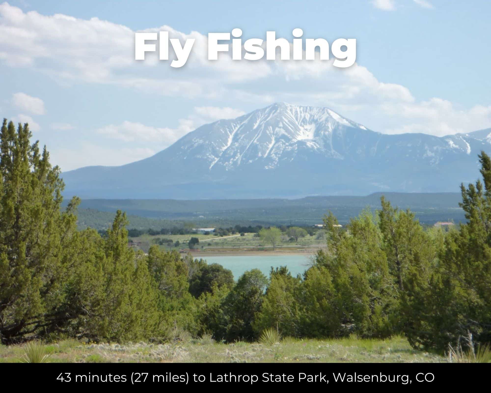
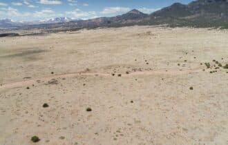
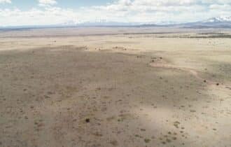
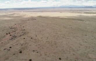
High Desert at the Foot of the Sangres
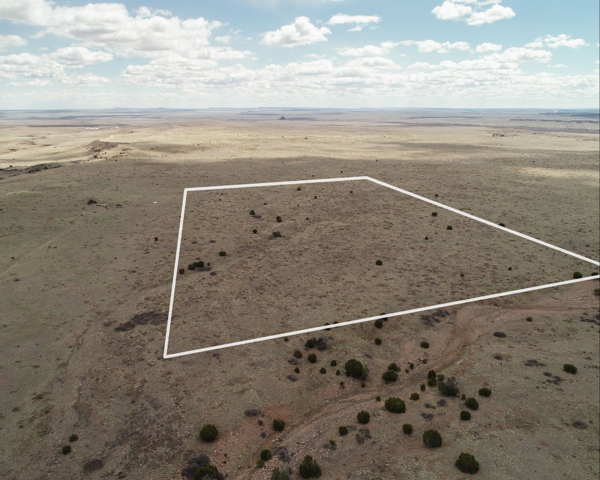
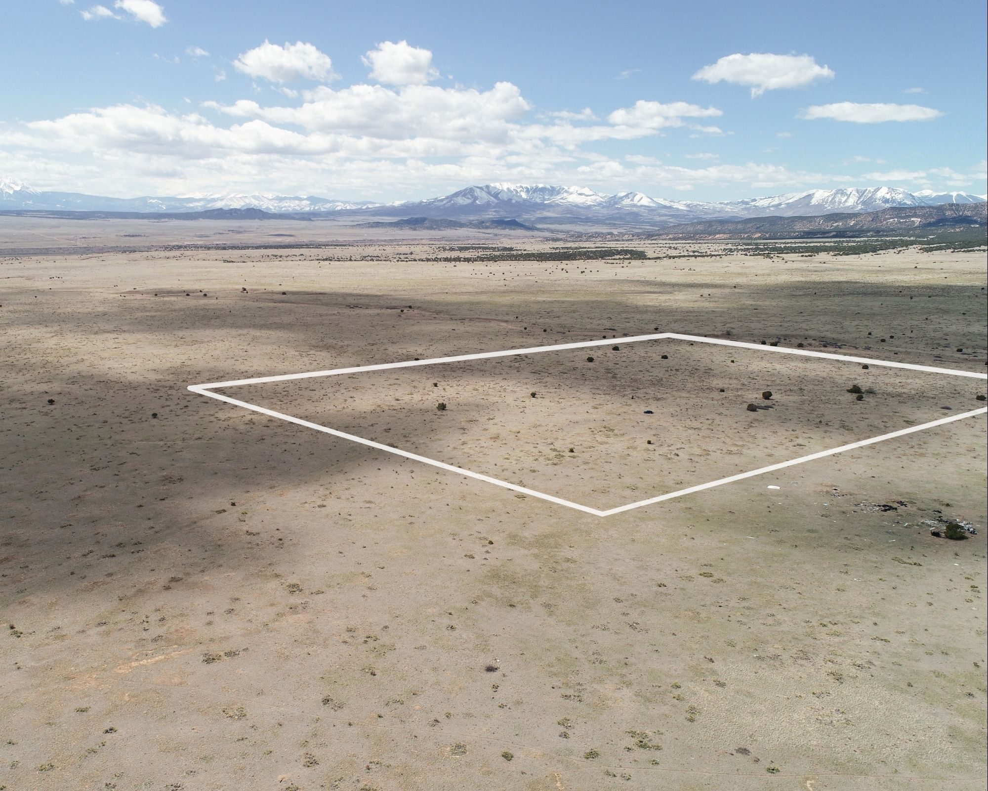
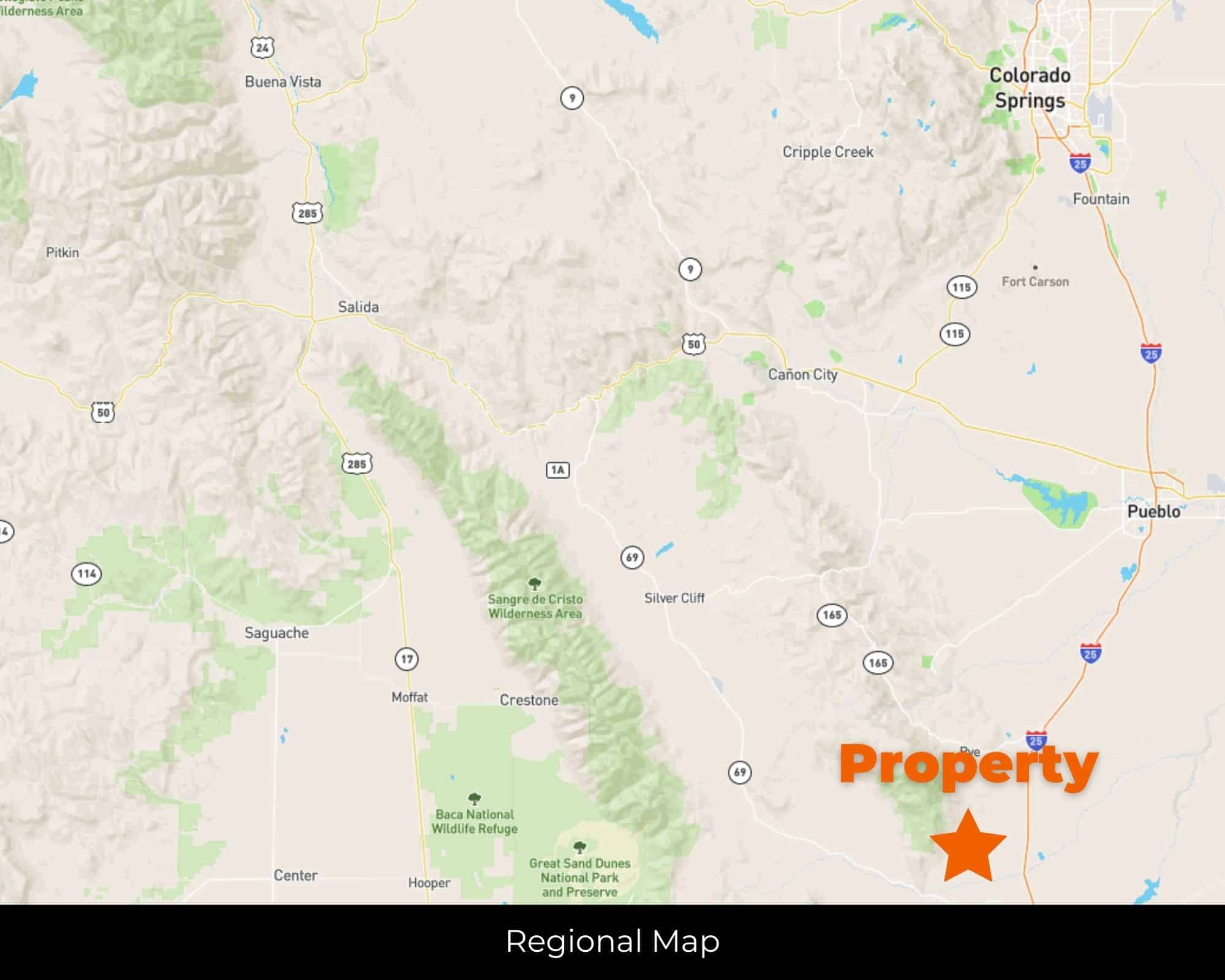
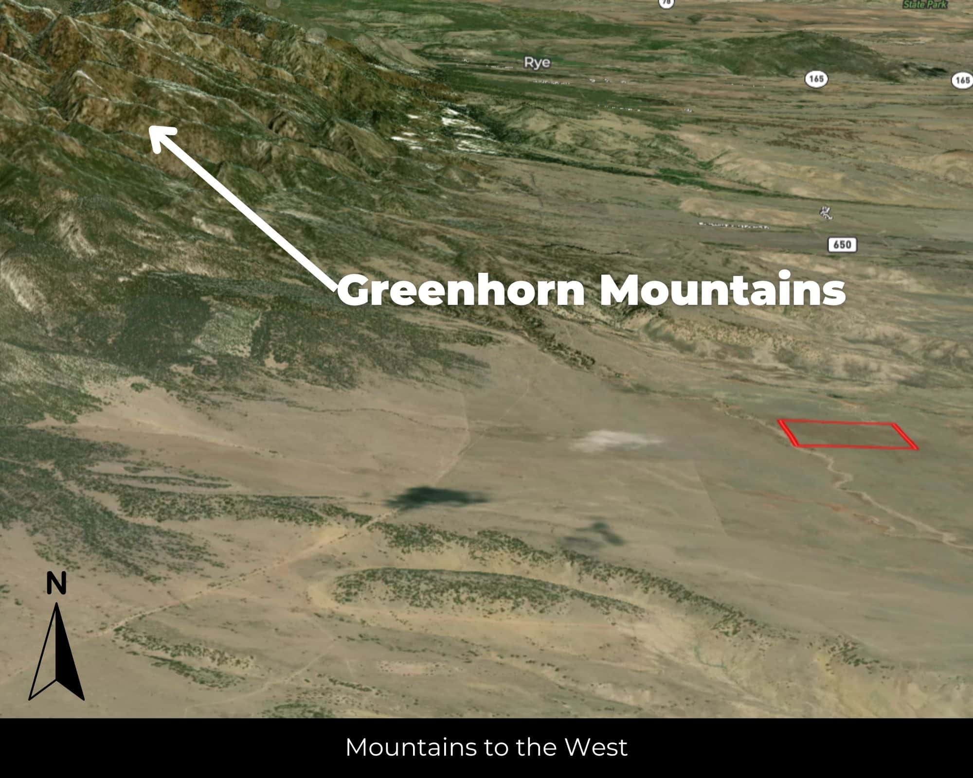
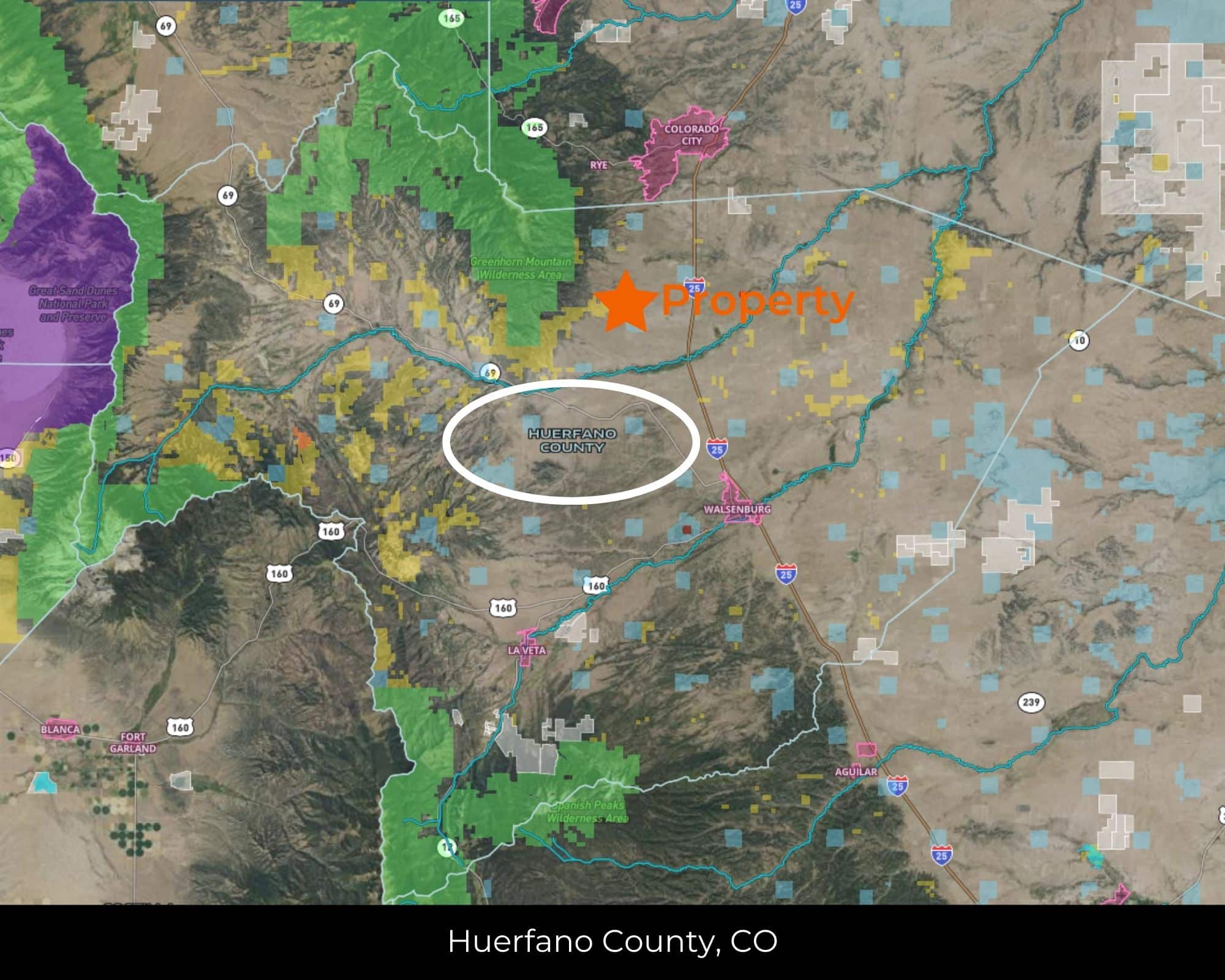
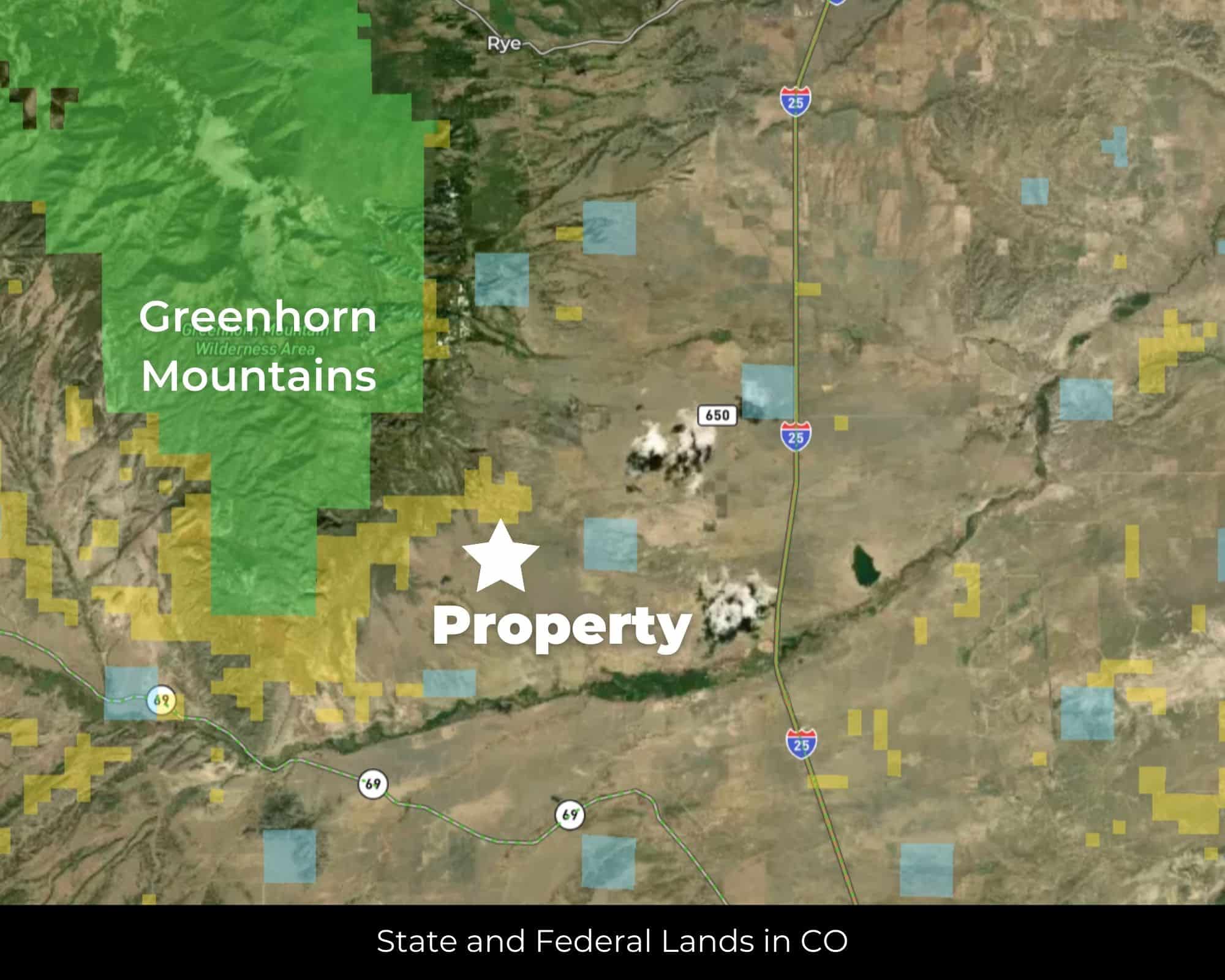
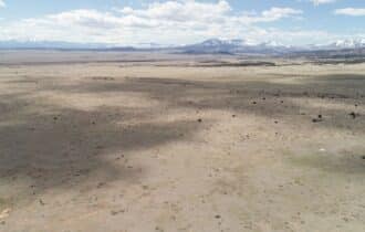
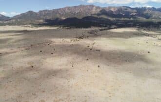
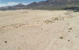
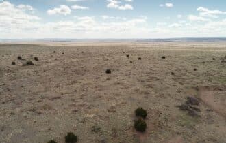
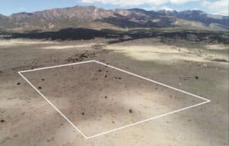
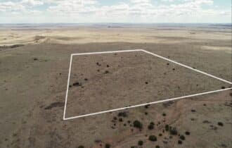
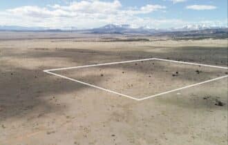
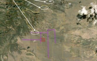
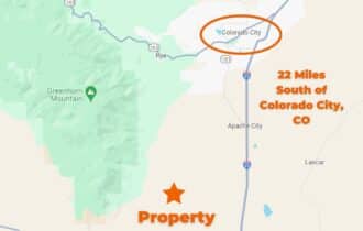
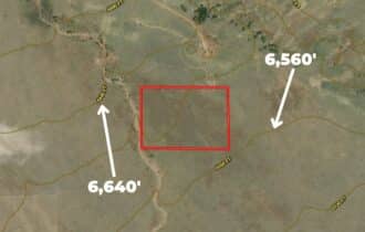
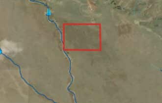
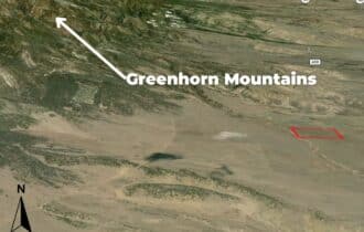
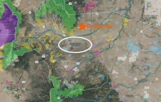
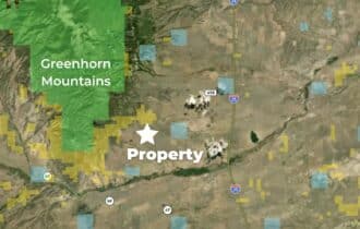
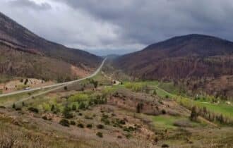
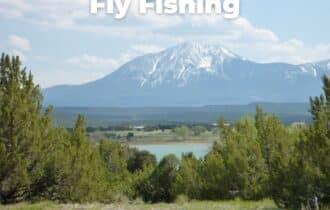
Thirty-five acres of open Colorado high country in southern Huerfano County, about 23 miles north of Walsenburg. The Spanish Peaks rise to the northwest—two 13,000-foot sentinels that have guided travelers through this country for centuries. From the property, you're looking at unobstructed views in every direction: mountains to the west, rolling high plains stretching east toward Kansas.
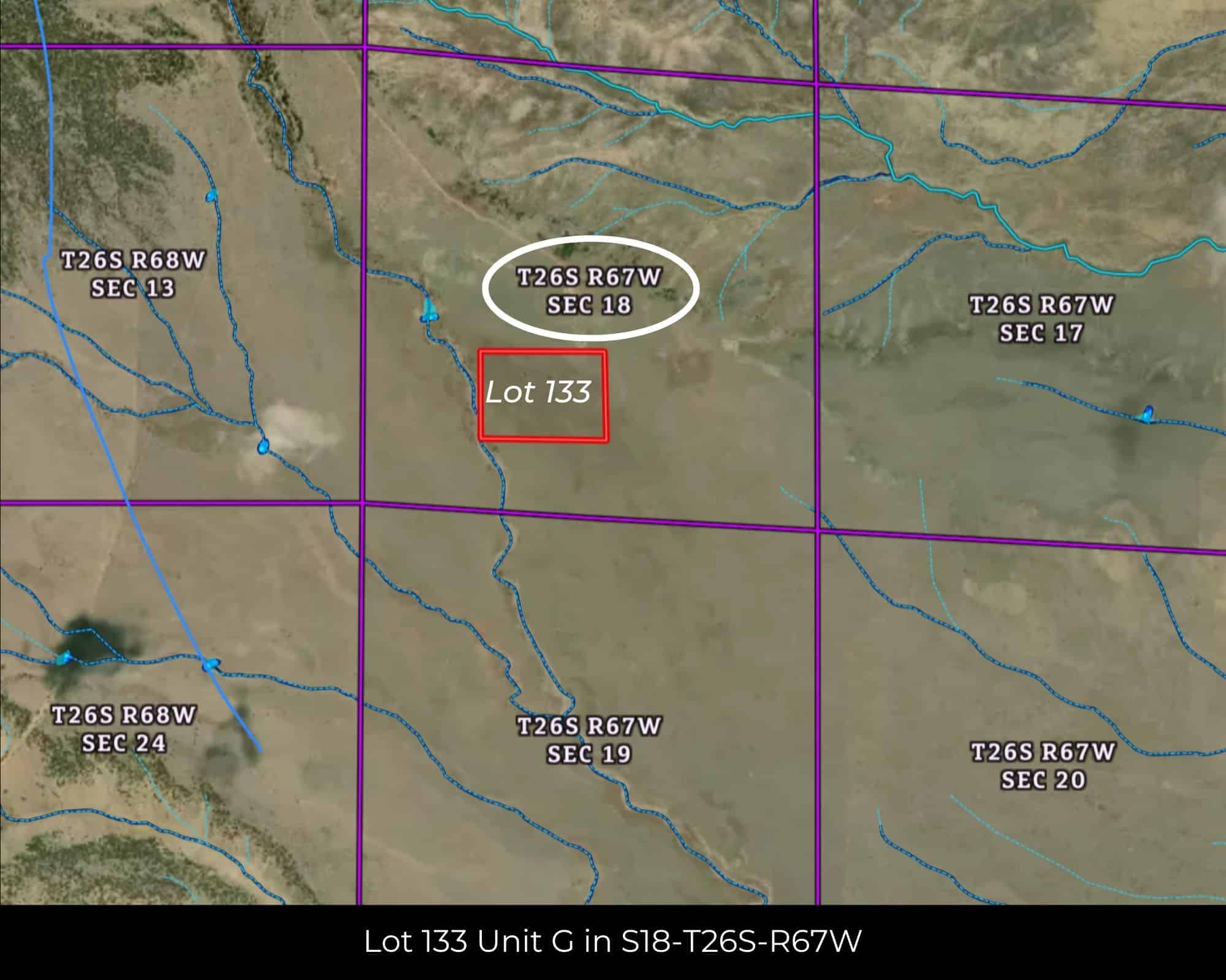
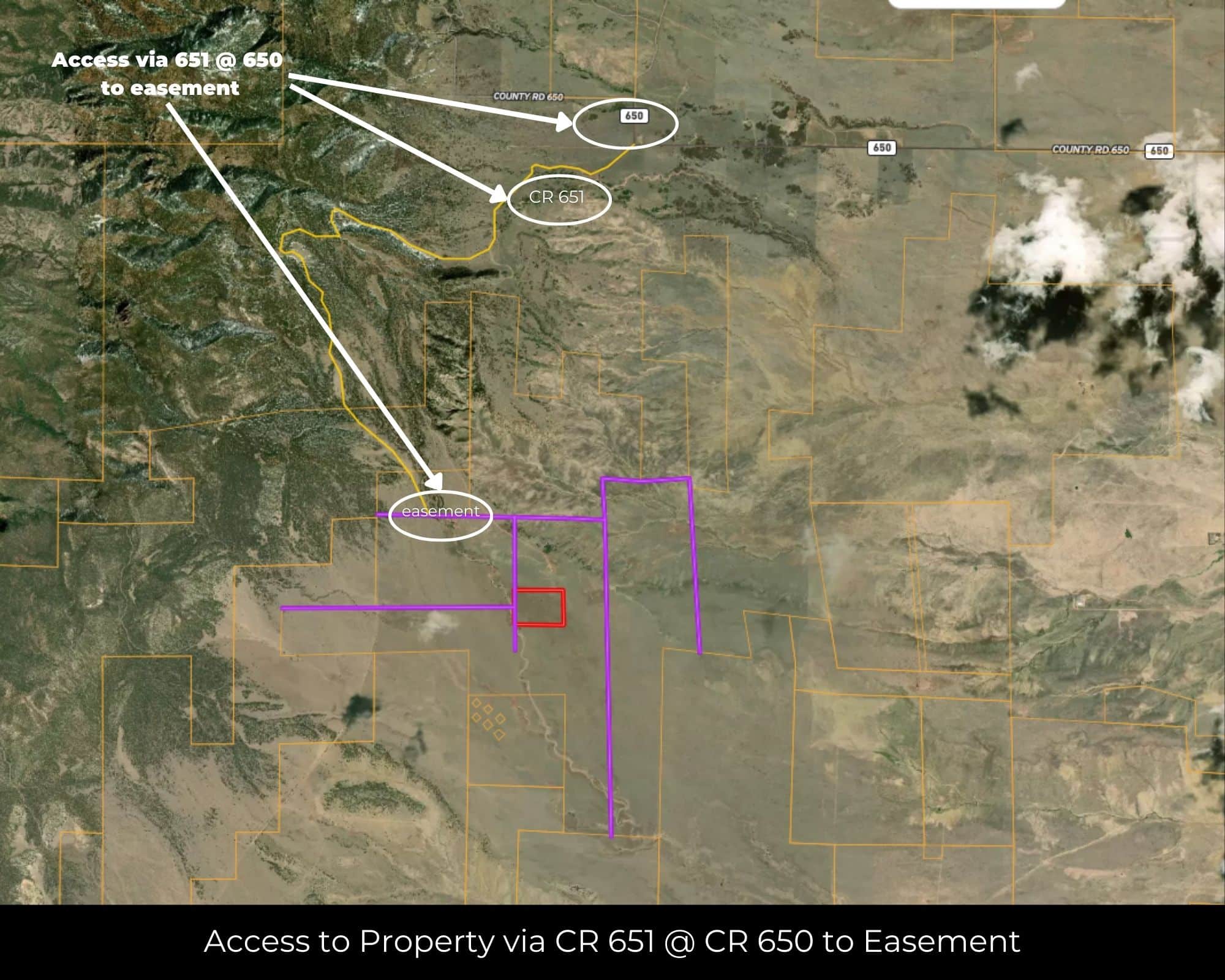
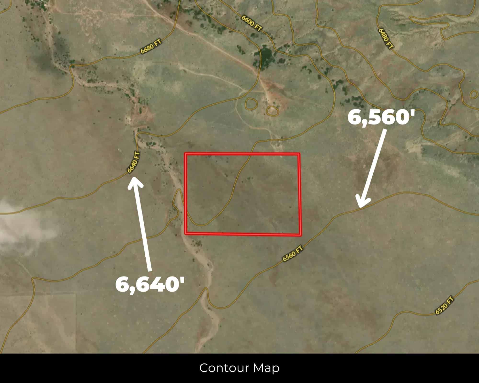
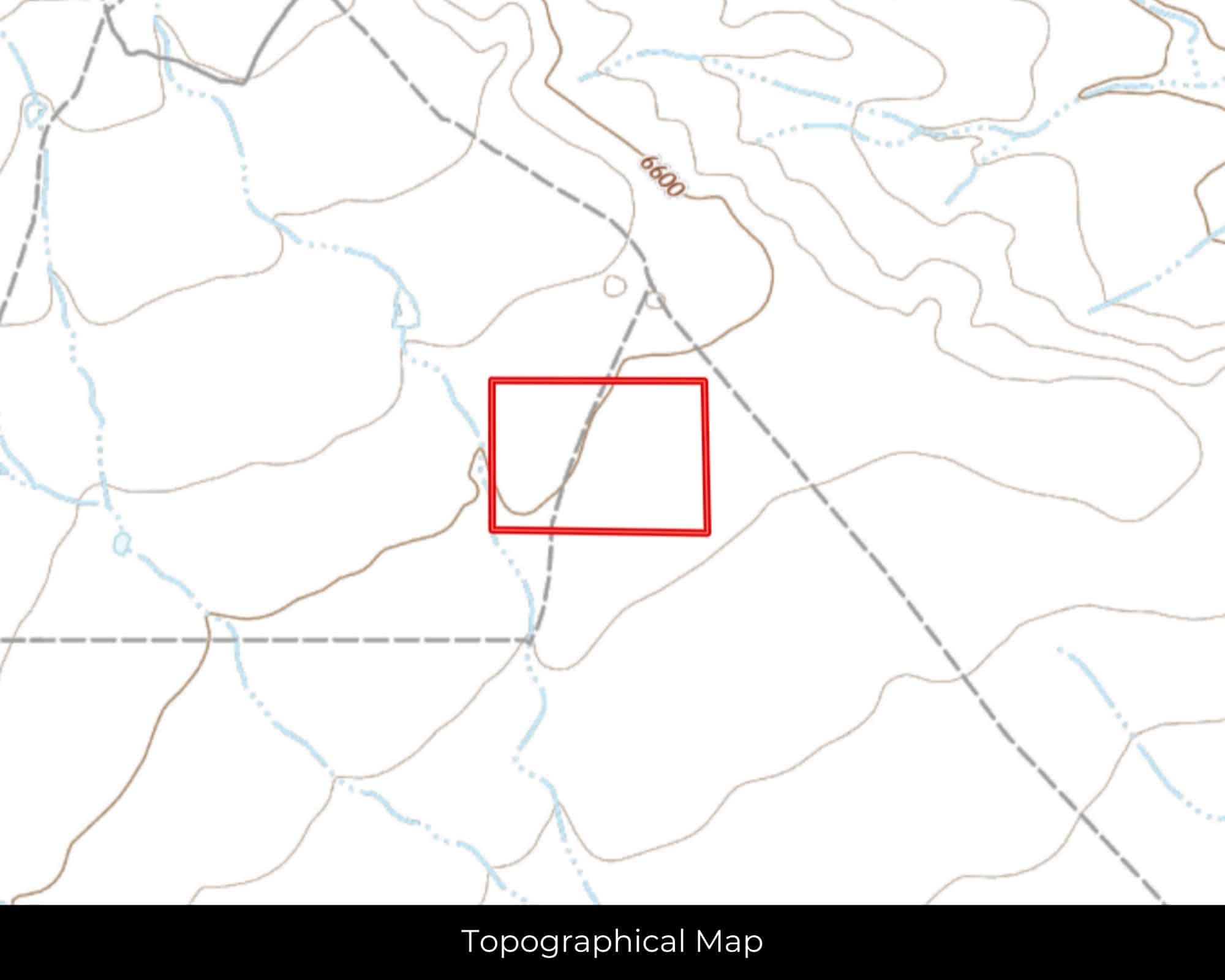
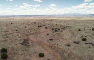
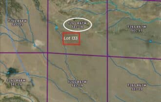
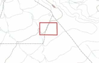
This is Lot 133 in Unit G of the CL&L Ranch subdivision, sitting at 6,600 feet on flat, native-grass terrain. Access is via dirt subdivision roads off CR 651—4WD or high-clearance vehicle encouraged. This is off-grid land; buyers should verify utility availability and conduct their own due diligence on power, water, and septic.
Huerfano County keeps zoning simple: mobiles, tiny homes, barndominiums, RVs, and camping are all permitted. No HOA. No deed restrictions telling you what you can or can't do with your own land. Put up a yurt, park an Airstream, run a few goats, or hold it while the Front Range keeps pushing south. Annual taxes are just $266.
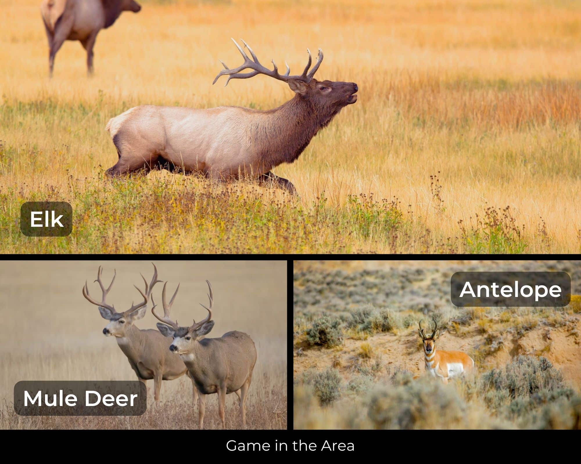
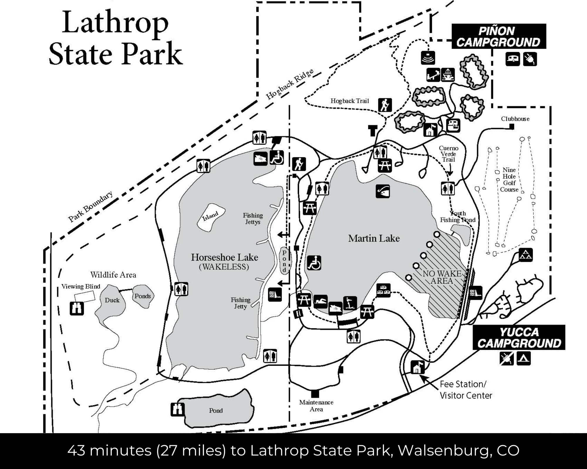
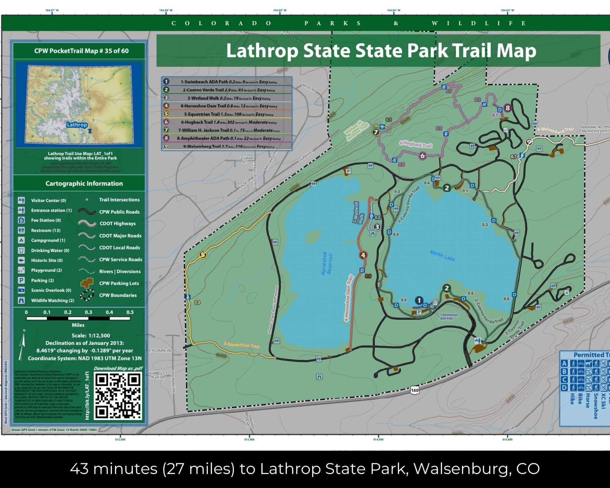
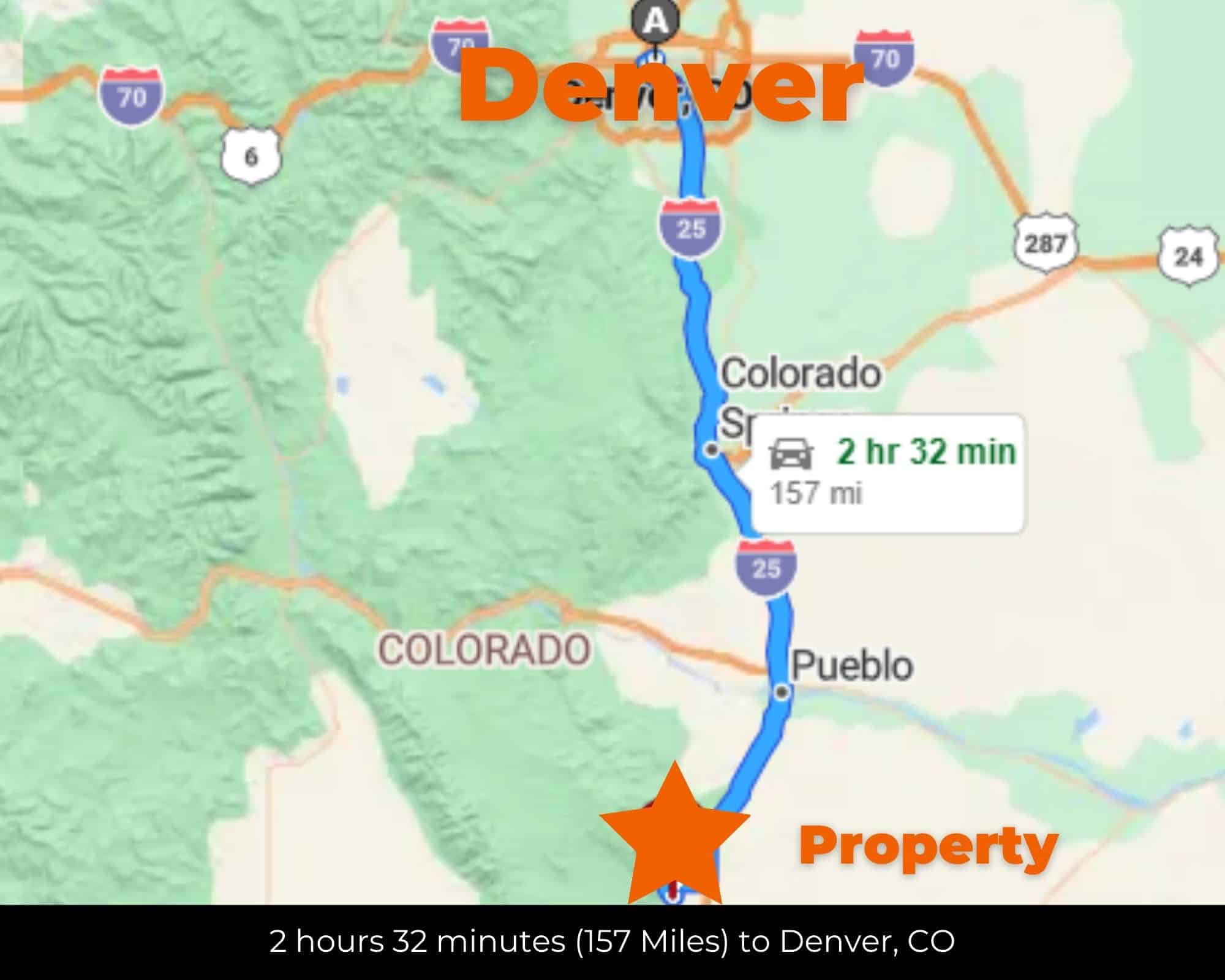
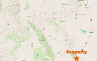
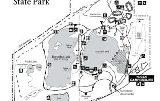
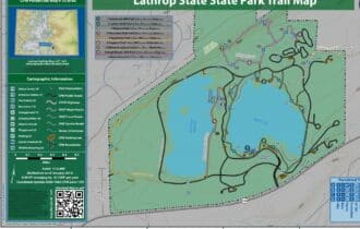
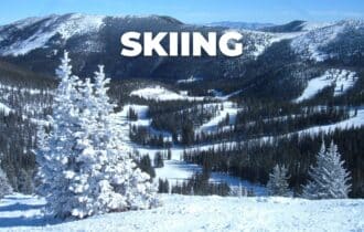
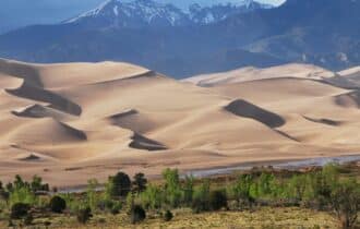
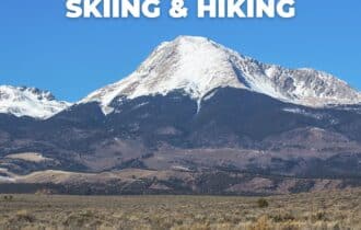
The region is big-sky country at its core—dry grasslands giving way to piñon-juniper foothills and the snow-capped Sangre de Cristos beyond. Lathrop State Park, Colorado's first state park, is about 45 minutes south near Walsenburg. Great Sand Dunes National Park is under two hours west. Pueblo is an hour north on I-25; Colorado Springs is 90 minutes. The Highway of Legends scenic byway—one of Colorado's most dramatic drives—winds through the Spanish Peaks just west of here.
At under $25,000, this is one of the most affordable parcels in the county. Lots like this move when people realize what unrestricted acreage with mountain views actually costs closer to Denver. Warranty deed. Free and clear title. Call or text 855-833-5263 to get the details.
Quick Facts
35 Acres, Spanish Peaks Views, No HOA, Off-Grid Ready
35 unrestricted acres in Huerfano County, CO—Lot 133, Unit G, CL&L Ranch. Flat, high-desert terrain at 6,600 ft with views of the Spanish Peaks to the northwest. Access via dirt subdivision roads off CR 651; 4WD or high-clearance vehicle encouraged. Off-grid land—buyers should verify utility availability and conduct due diligence on power, water, and septic. Zoning permits mobiles, tiny homes, barndominiums, RVs, and camping. No HOA, no deed restrictions. Annual taxes $266. One of the most affordable parcels in the county. Lathrop State Park 45 min; Great Sand Dunes National Park under 2 hrs; Pueblo 1 hr; Colorado Springs 90 min. Warranty deed, free and clear. GPS: 37.78392, -104.93185. APN: 4030536. Call or text 855-833-5263.
Visiting the Property
You are welcome to visit the property at your convenience and anytime while it's still available. However, we HIGHLY recommend checking-in with us prior to visiting the property in case the property has gone under contract or already sold.
The interactive map above is generated with MapRight. MapRight has free apps for Apple IOS and Android that can be used to track your location and route throughout a property and provide driving directions.
MapRight for Apple –> Download App.
MapRight for Android –> Download App.
To launch the interactive map on your device, 1) install the free MapRight app using one of the two links above for Apple or Android, and 2) click the “View Full Screen” link (see above) in the embedded map on the property listing page.
Property Information
Parcel Size
35 Acre
State
Colorado
County
Huerfano
Nearest Cities
Walsenburg ,CO
Parcel #
4030536
Address
00 CR 651 Walsenburg, CO, 81089
Legal Description
L 133, Unit G, Cl&Amp;L Ranch 361 66 362 277 744 835 363 37 211 383 964 965 385 008 559 584 372423
Zip Code
81089
Annual Property Taxes
$266.08
Ag Exemption
No
HOA
None
HOA per Year
None
Survey Available
None
School District
Huerfanio School District RE-1
Liens and Back Taxes
None!
Source Deed
Sent for Filing.
Title Status
Free & Clear!
Outgoing Conveyance
Warranty Deed
Property Features
Acres
35
Dimension
37.78 ft, X -104.93 ft.
County
Huerfano
Access
Dirt Road
Power
Available
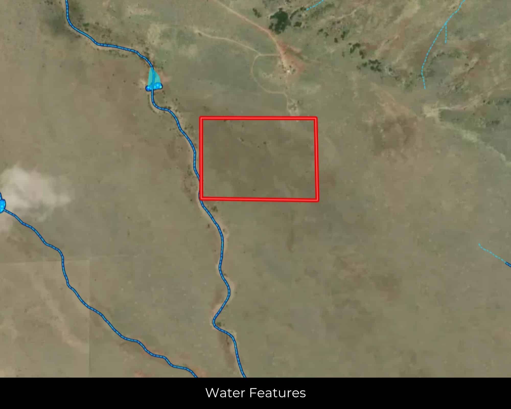
Water
Available
Coordinates
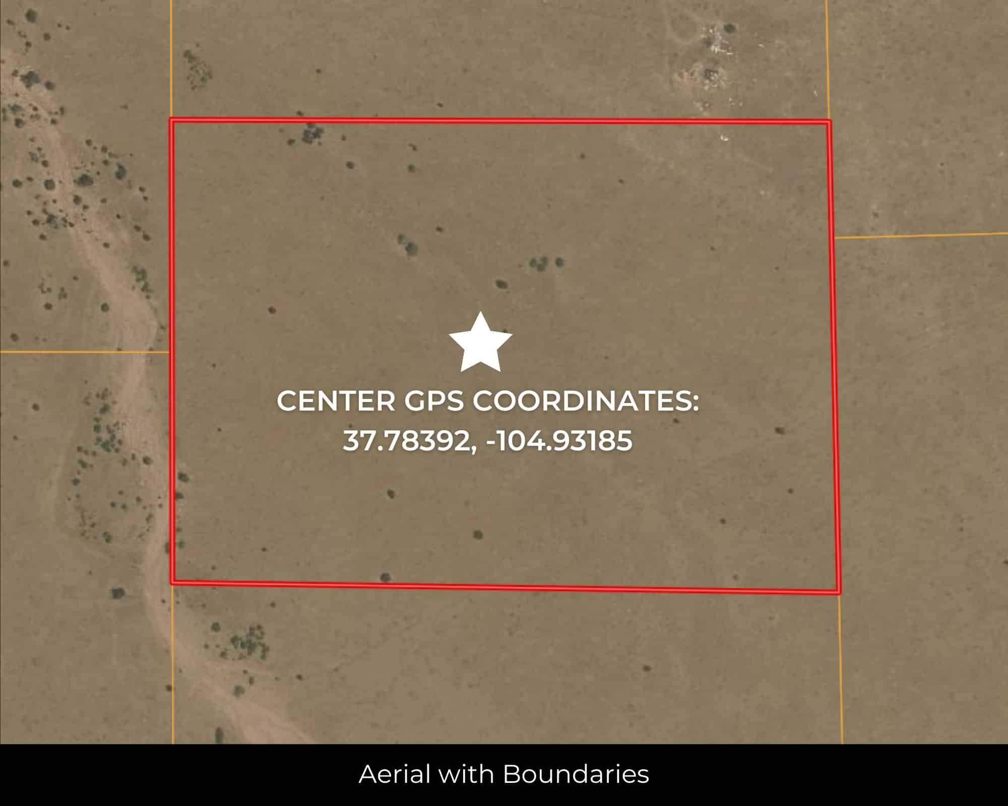
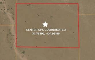
37.78392, -104.93185
Zoning
Vacant Lot
Elevation
6600 ft
Terrain
Flat
Floodplain
No
Duplexes
Yes
Mobiles
Yes
Tiny Homes
Yes
Barndominiums
Yes
RV's
Yes
Camping
Yes
Utilities
🔌 Power: San Isabel Electric Association
💧 Water: Walsenburg Utility Department (719-738-1048)
🚽 Sewer:Septic or alternative sewer system.
☎️ Phone: cellular, VOIP (see internet below), and satellite phone through Iridium, Globalstar, or Inmarsat.
🌐 Internet: satellite internet through Starlink, HughesNet, or ViaSat.
📺 Cable: satellite cable through Dish or DirectTV.
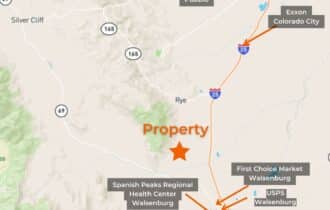
Nearby Cities, Conveniences, and Attractions
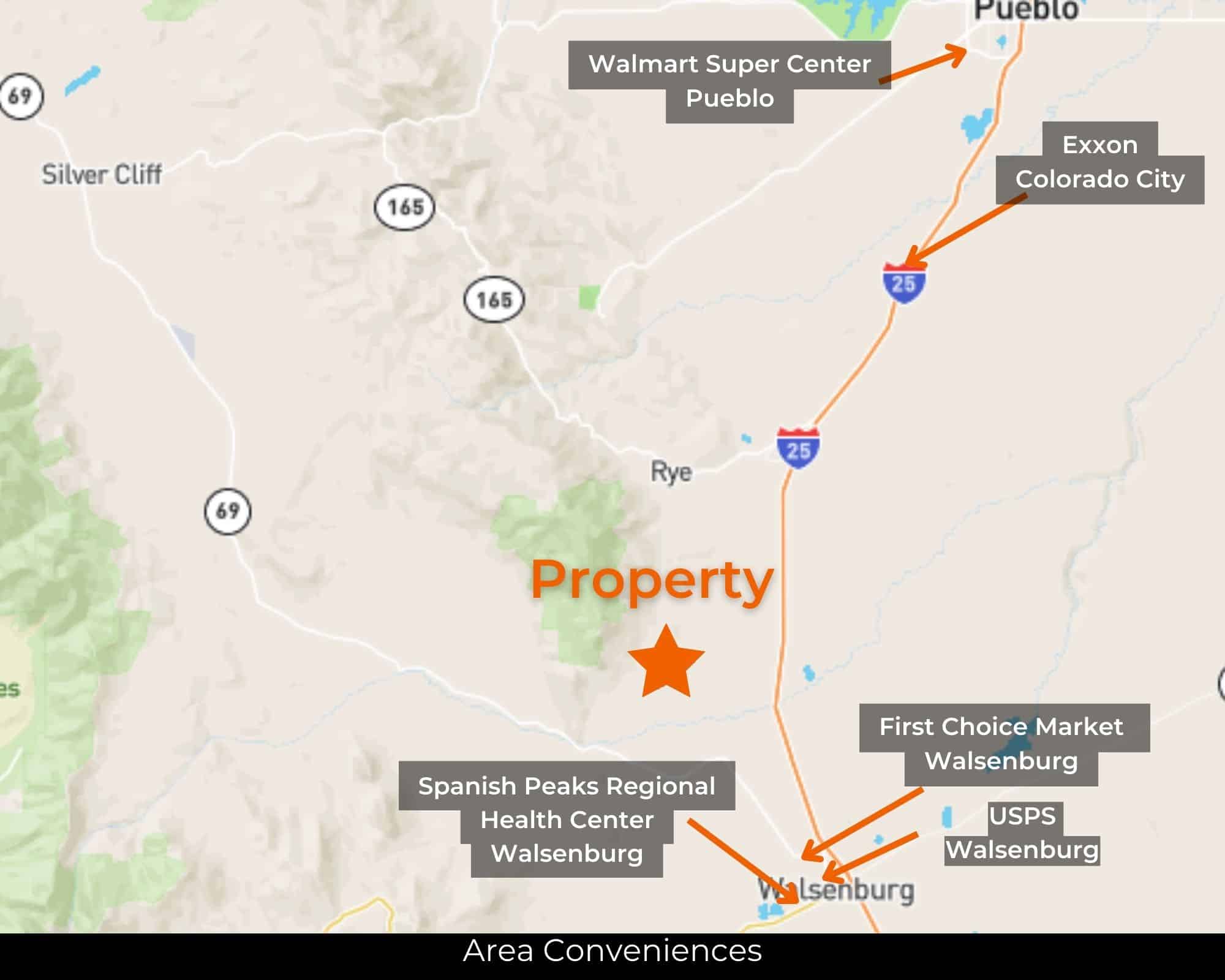
- 31 mins (19.6 miles) to Exxon, Colorado City (about)
- 34 min (22.4 miles) to First Choice Market, Walsenburg (about)
- 37 min (23.4 miles) to Walsenburg, CO (about)
- 39 mins (21.2 miles) to USPS, Rye (about)
- 44 min (26.8 miles) to Spanish Peaks Regional Medical Center, Walsenburg (about)
- 45 min (27.8 miles) to Lathrop State Park (about)
- 46 min (28.2 miles) to Walsenburg Golf Club (about)
- 51 min (41.4 miles) to Lowe's, Pueblo (about)
- 54 mins (43 miles) to Walmart, Pueblo (about)
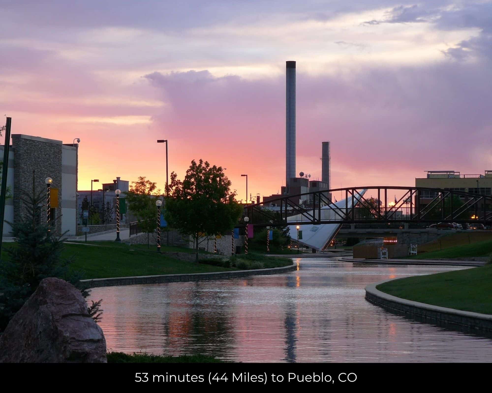
- 54 min (44.2 miles) to Pueblo, CO (about)
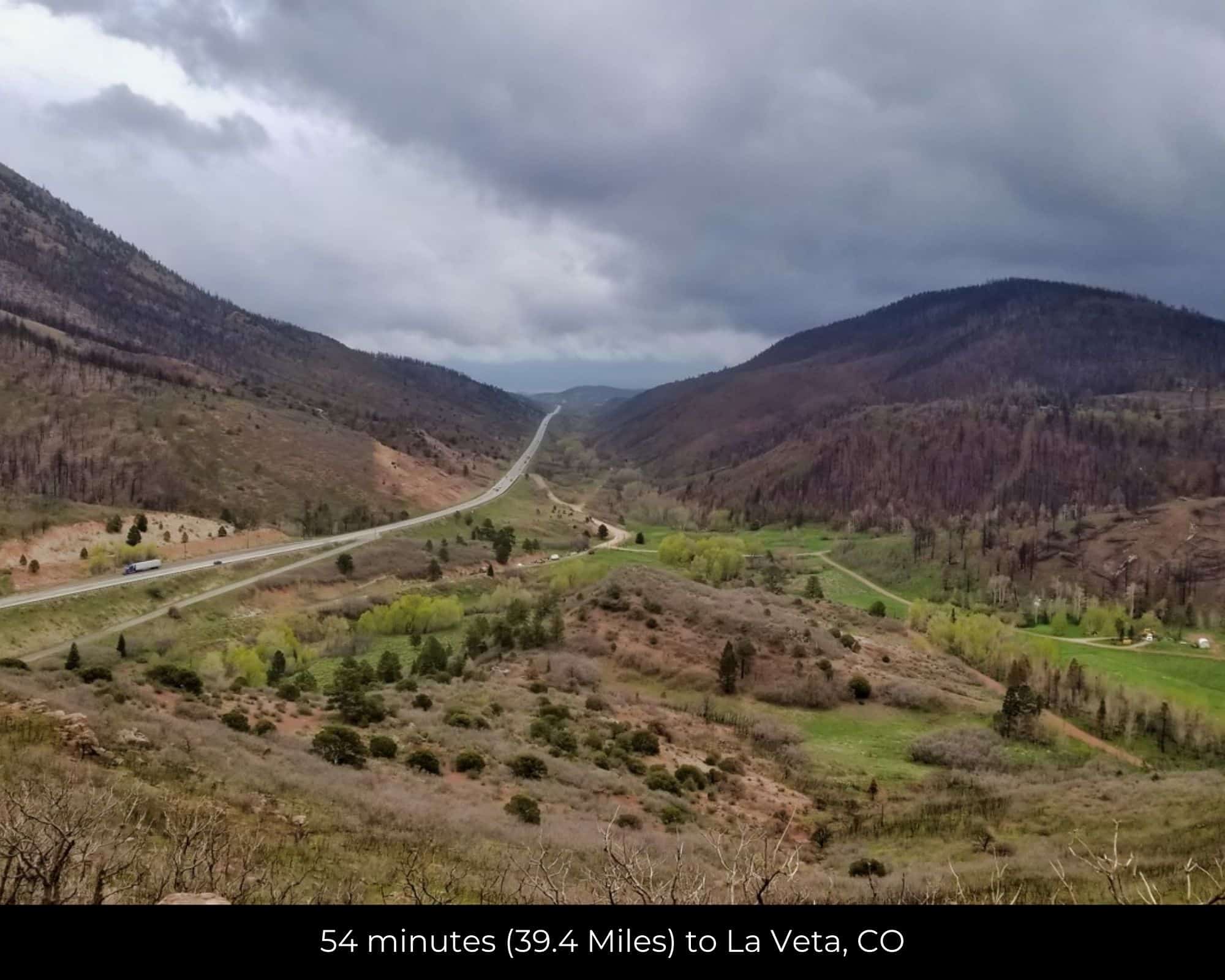
- 55 min (39.4 miles) to La Veta CO (about)
- 58 min (48.1 miles) to Tractor Supply CO, Pueblo (about)
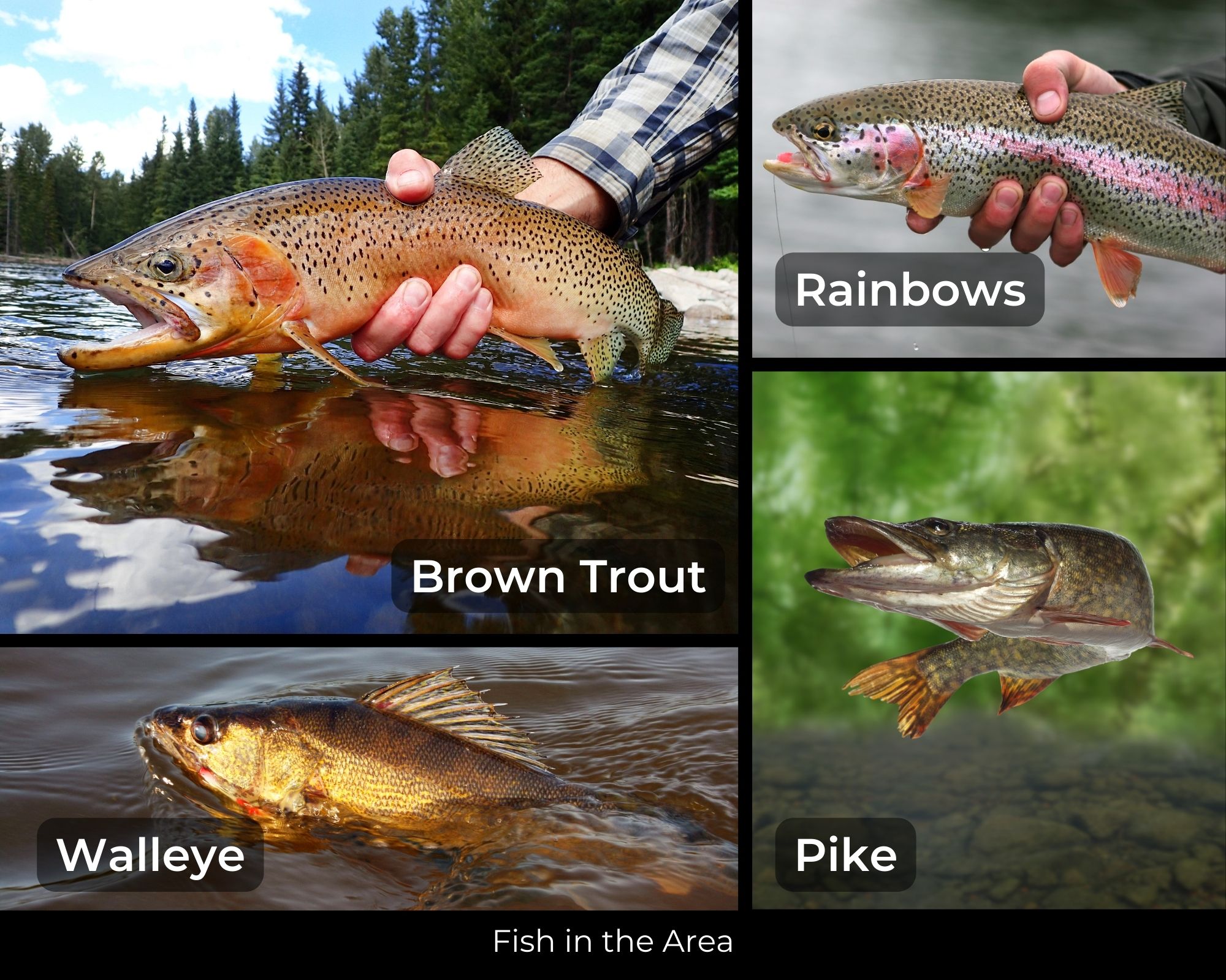
- 1 hr 5 min (33.2 miles) to Cuchara River (about)
- 1 hr 19 min (54.1 miles) to Cuchara Mountain Park (about)
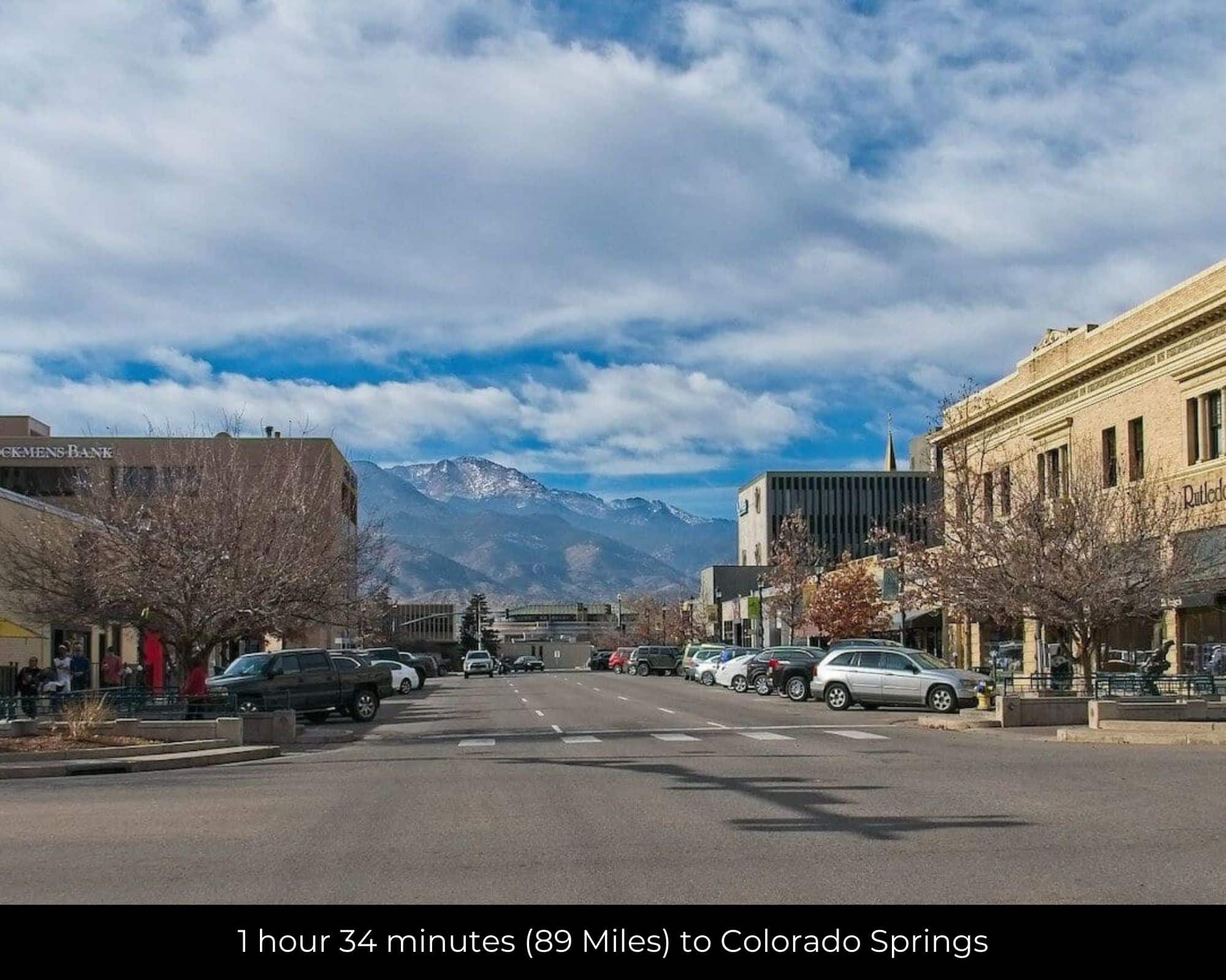
- 1 hr 33 min (86.3 miles) to Colorado Springs, CO (about)
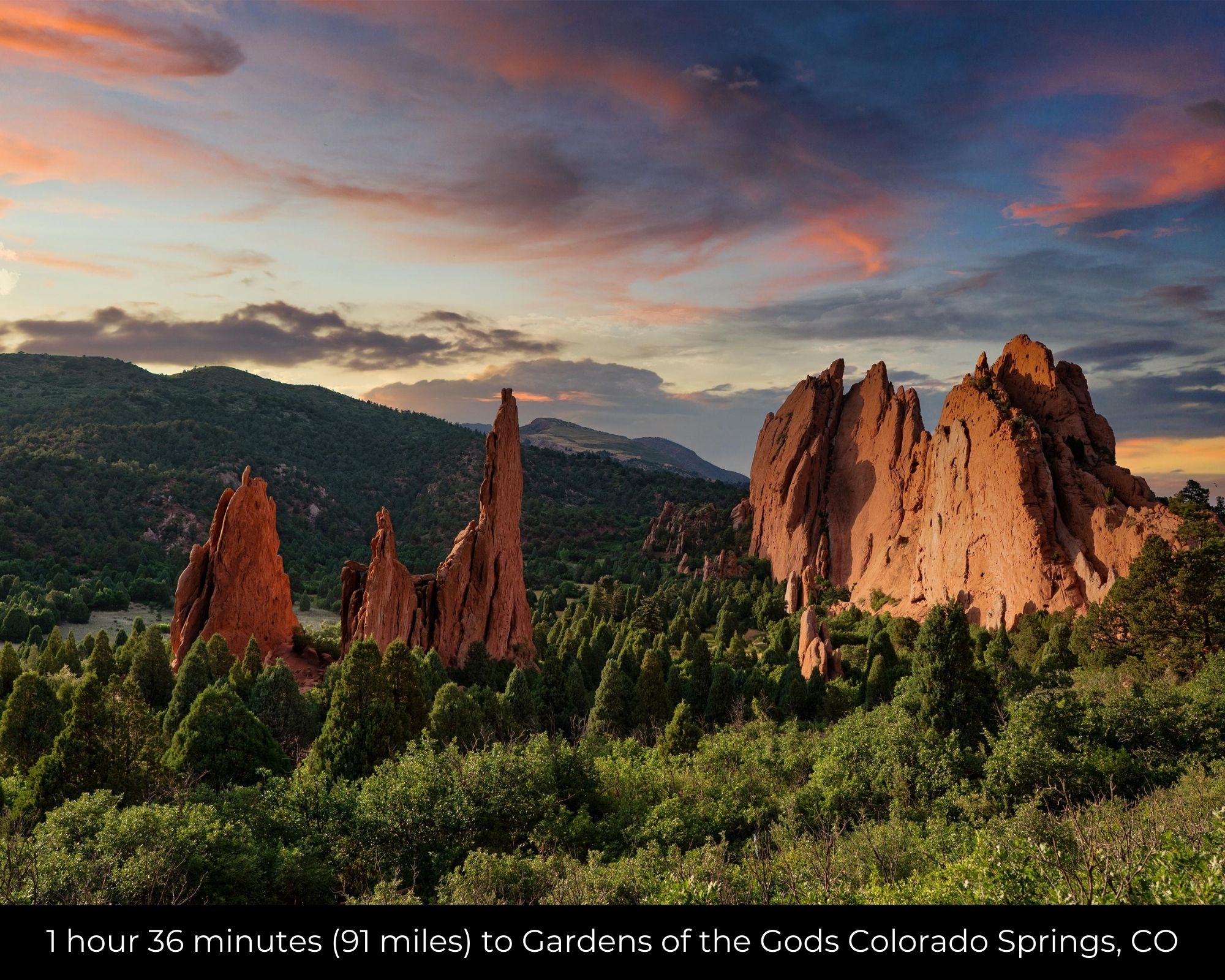
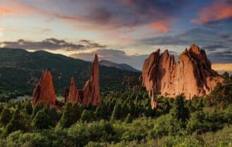
- 1 hr 42 min (90.1 miles) to Gardens of the Gods (about)
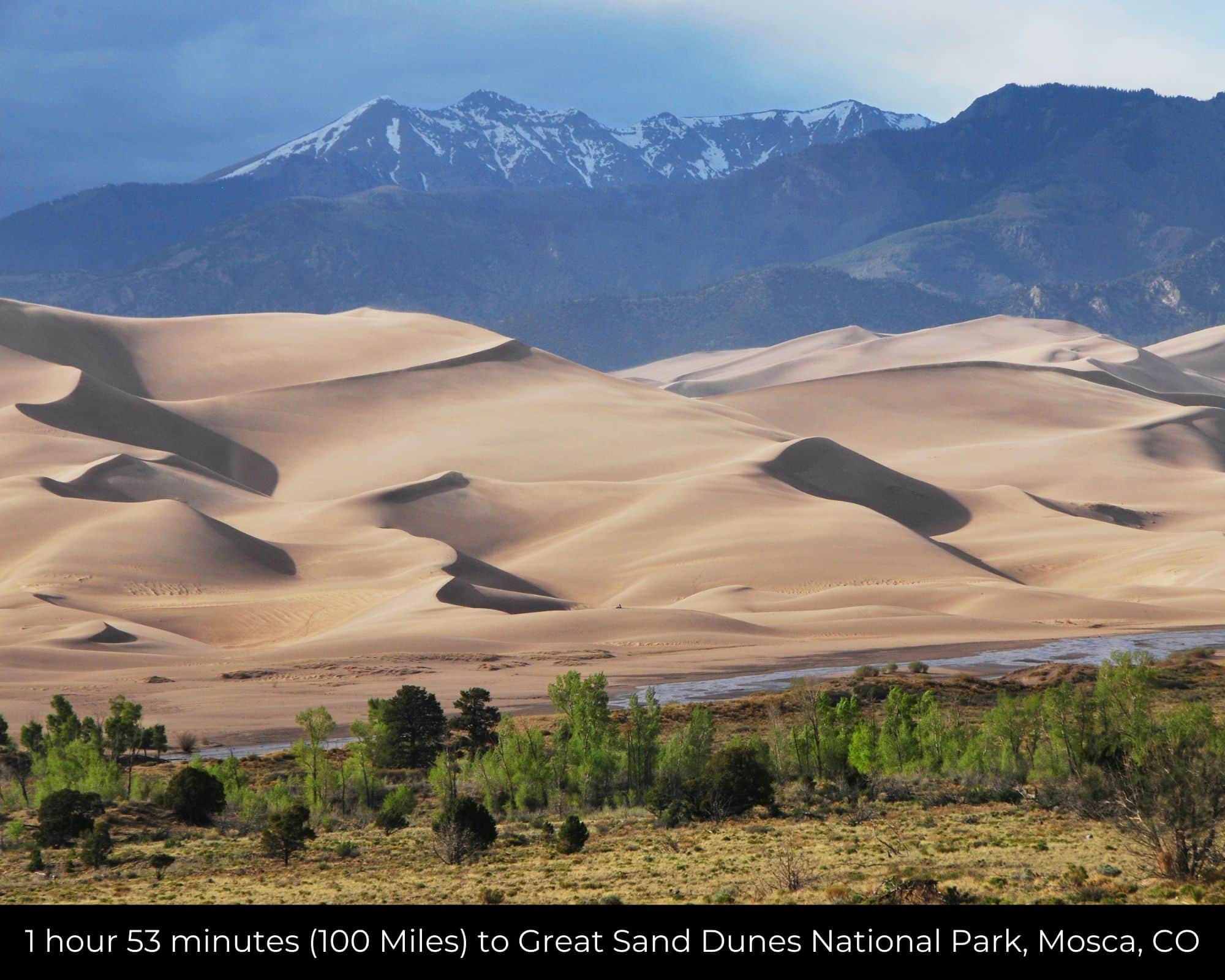
- 1 hr 50 min (96.8 miles) to Great Sand Dunes National Park & Preserve (about)
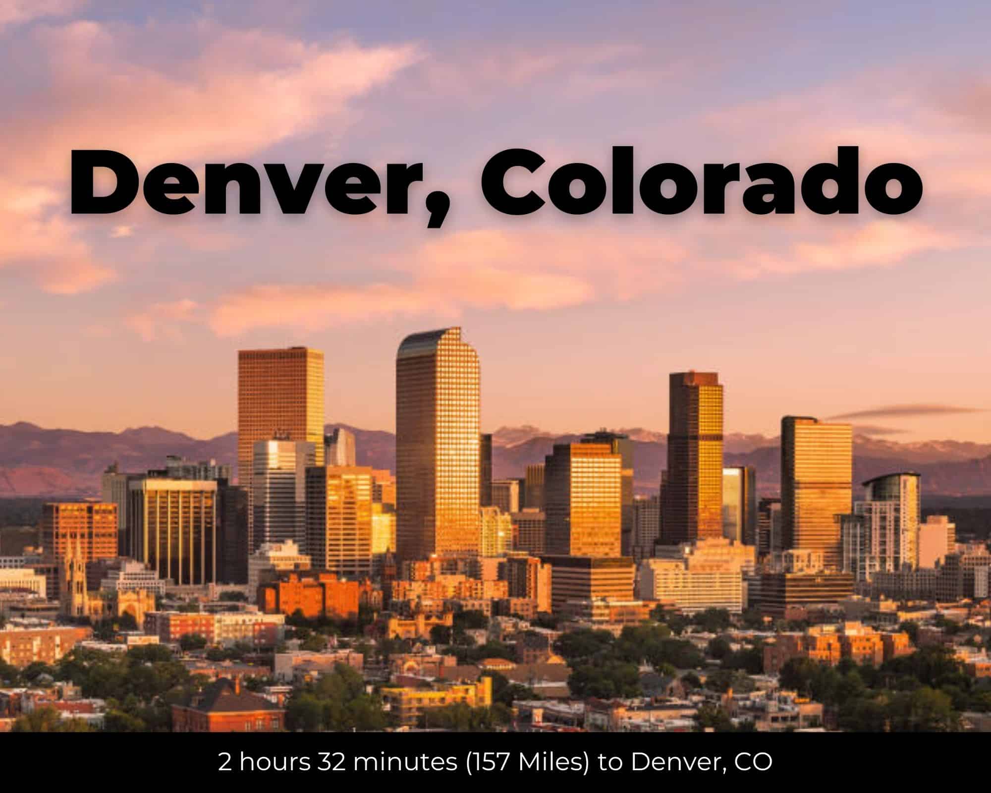
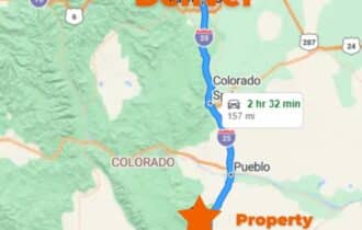
- 2 hr 41 min (157 miles) to Denver, CO (about)
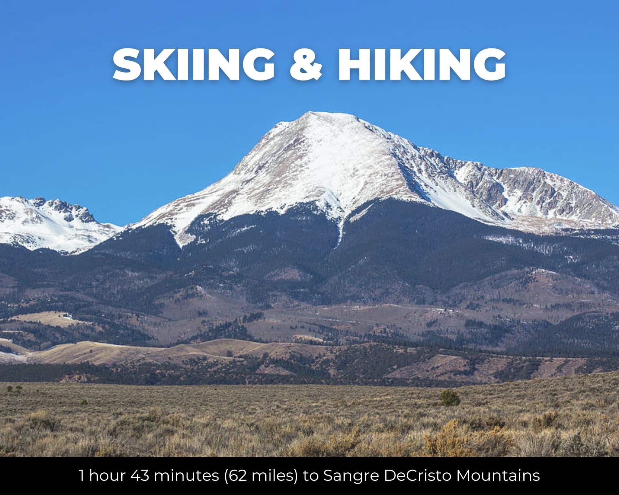
- 2 hr 50 min (146 miles) to Sangre de Cristo Wildnerness Area (about)
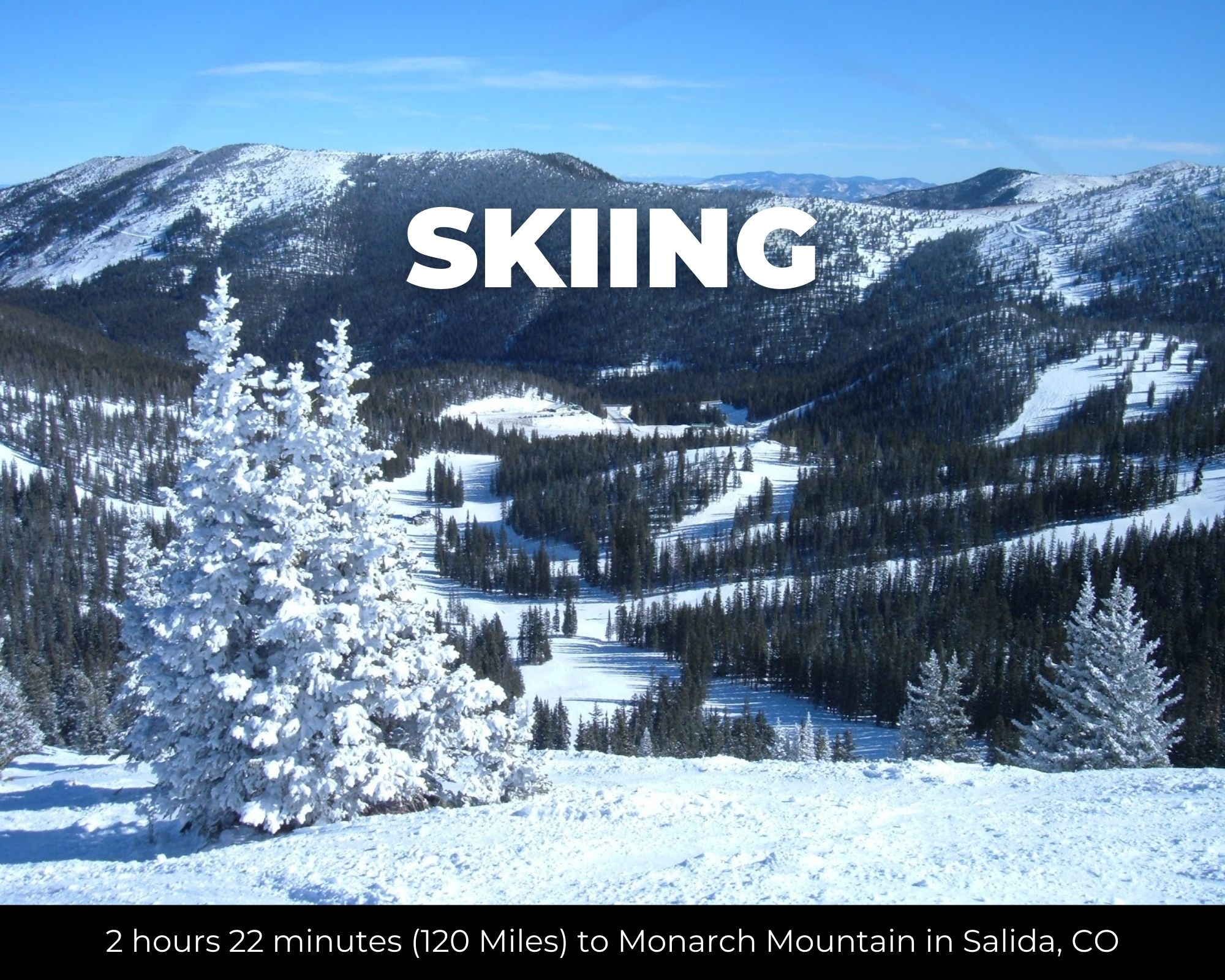
- 2 hr 53 min (140 miles) to Monarch Mountain (about)
- 3 hr 1 min (182 miles) to University of Colorado – Boulder (about)
- 3 hr 41 min (183 miles) to Gunnison, CO (about)
County Contacts
Huerfano County Assessor Elisha Meadows (719) 738-3000 ext 504. (website)
Huerfano County Treasurer Debra J. Reynolds (719) 738-3000 ext 505 (website)
Huerfano County Clerk Erica Vigil (719)-738-3000 Ext 503 (website)
Huerfano County Zoning Cheri Chamberlain 719-738-1220 (website)
Huerfano County CAD (website)
Huerfano County GIS (website)
Closing Costs and Fees
$299
Document Prep Fee
Buyer will pay a $299 document preparation fee, which includes all postage and county recording fees. Seller will warrant title to the property.
$0
In-House Closing Fee
There will be no additional fees or expenses for an in-house closing. We will close in 14 days or less. This is the fastest, easiest, and cheapest way to close.
$1,500+
Title Company Fees*
Title Company costs are typically 2-5% of the purchase price with a minimum fee of around $1,500. Many states have legislated, standard insurance rates and other fees vary by the title company.
* If Buyer elects to close through a third-party title company, Buyer will bear all closing costs and expenses, including Seller’s title policy and Seller's escrow fees. Closing through a title company typically takes 30-45 days, depending on the county, title company, and transaction activity in the area.
Driving Directions and GPS Coordinates
🚗 Driving Directions: Get on I-25 S from Co Rd 650 24 min (9.3 mi), Follow I-25 S to I-25BL S 10 min (11.7 mi), Continue straight to stay on I-25BL S
📍 Northwest Corner: 37.7859, -104.9343 (Google Map)
📍 Northeast Corner: 37.7859, -104.9295 (Google Map)
📍 Southeast Corner: 37.7833, -104.9294 (Google Map)
📍 Southwest Corner: 37.7833, -104.9343 (Google Map)
📍 Center Point: 37.78392, -104.93185 (See embedded Google Map below 👇.)
Google Map
If you click the blue Directions link below, 👇 you can get Google turn-by-turn directions to the property on any device. The map coordinates for the Google Map below are for the approximate center of the property and not the entrance, gate, or primary access point for the property. Google Maps may provide driving directions that require the use of private or abandoned roads or may require you to go through gates located on private property. Do not trespass on private property! Some properties will require a 4-wheel drive vehicle or may be inaccessible in certain weather conditions. Please don't get stuck or lost.
Additional Notes
As-Is and As-Available: This property is being sold property “as-is” and “as-available.” No representations as to fitness for a particular purpose have been made. No verbal claims or promises have been made. Please see our Terms of Service for more information.
Contract: After making your initial deposit, we will email you the purchase and sale agreement, which includes a warranty deed. Agreements are prepared manually and will be sent out Monday through Friday between 9 AM and 5 PM CST. Thank you for your patience.
No Monthly Payments: We are not offering seller financing on this property. This is an all-cash transaction. We are not offering a payment plan. If you would like to finance your purchase of the property, please contact a third-party lender prior to making your deposit. We will not sign a purchase and sale agreement that is contingent upon third-party financing without a pre-approval letter.
3% Buyer's Agent Commission: You are not required to have an agent or broker assist you with purchasing this property. However, if the Buyer does use an agent, and the Seller is made aware of this prior to an agreement on price or signed contract, the Seller will pay a 3% commission to the Buyer's licensed agent or broker.
Maps and GPS Coordinates: Maps and GPS coordinates are believed to be accurate, but accuracy is not guaranteed. The information contained in the maps should not be considered a “legal description,” and the maps and GPS coordinates are not a replacement for a survey. We have taken reasonable steps to ensure that parcel lines, maps, and coordinates are in fact accurate, but third-party geographical information system (GIS) providers, including information from the county, often contain errors and inaccuracies.